Runtime.80ab492fe3d778817936.js in Nevada
Trying to find the best in Nevada? Bivy has great hiking, biking, paddling, climbing, skiing, riding and more, with hand-curated trail maps, as well as detailed driving directions.
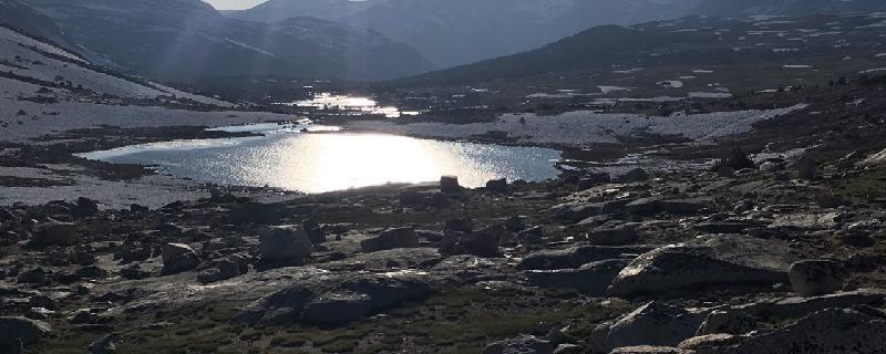
California, Inyo County
13 :09 hrs
10.9 mi
626.40283 ft
Extreme
Piute Pass Trail begins through a forest of lodgepole pine and aspens as it meanders alongside a creek. It passes several high alpine lakes glacially formed and encased in granite rock; this section of the trail is mostly exposed. At 7.8 miles the trail descends into an evergreen forest and ends at Hutchinson Meadow. There may be fallen or leaning trees on or near the trail due to high winds in December of 2011. This is intended to be an overnight trip; check with Inyo National Forest for required information.
California, Inyo County
32 :59 hrs
12.9 mi
2446.8066 ft
I
Mount Williamson Trail begins by following a creek and then making several switchbacks as it quickly gains elevation. The trail is a narrow path that meanders through a rugged landscape providing little to no shade on the trail. This trip is intended to be an overnight trip; at 8 miles is Ansel Camp. Fires are not permitted at the camp. The trail continues to climb through an exposed landscape and past a cluster of alpine lakes where there are plenty of excellent views of the surrounding area. The final ascent climbs up a steep rocky chute and over a steep, blocky headwall to the plateau and finally the summit. It is recommended to do this early in the season when the snow line is lower. During this time, you will encounter talus and scree. Also, crampons and ice axes are recommended for Shepherds Pass. Weather conditions during winter ascents make this significantly more difficult as stated by Harding in 1954. Difficulty Rating: Class 3
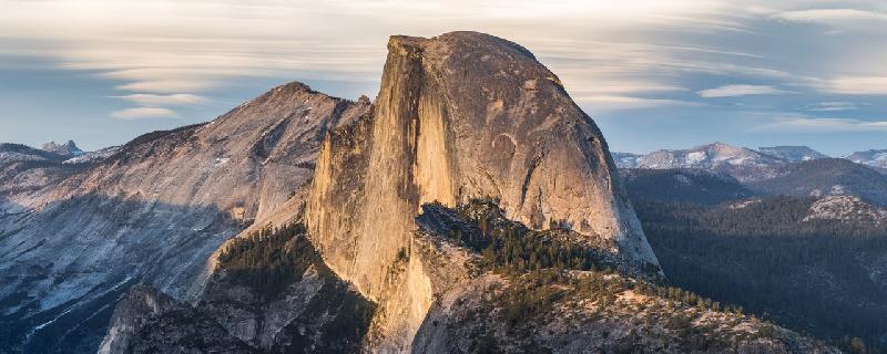
California, Mariposa County
10 :17 hrs
7.3 mi
1393.9924 ft
Extreme
The trail to Half Dome follows the Merced River until it flattens out at Little Yosemite Valley. The ascent has some steep sections and switchbacks including where Vernal Falls and Nevada Falls are at 2 miles and again at 3 miles; there are excellent views of Yosemite Falls at these points. Along the trail, there are three restrooms: Vernal Falls footbridge (2 miles), Emerald Pool (2 miles), Nevada Falls (3 miles), and Little Yosemite Valley (4 miles). Two sets of 400 foot long cable wires run up and down the final ascent to the summit. At the summit, views of Yosemite Valley and the High Seirra await. This is a long and difficult hike, make sure to be prepared. Check out the National Park Website for some tips.
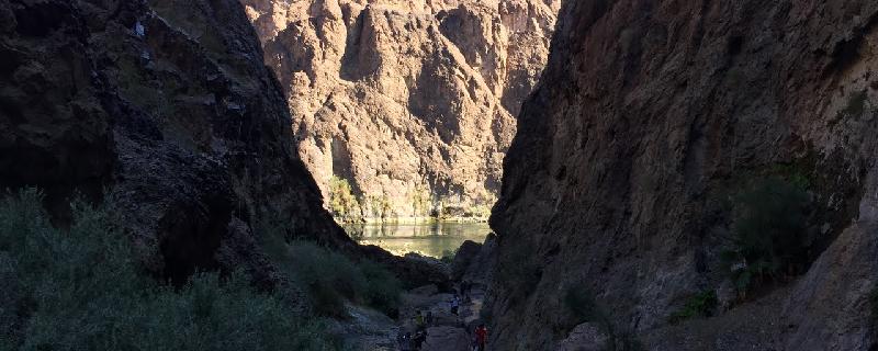
Nevada, Henderson
02 :37 hrs
2.5 mi
275.71368 ft
Hard
Travelling through Gold Strike Canyon south of Lake Mead, this trail will deposit you on the shore of the beautiful Colorado River a mile below the Hoover Dam (which cannot be seen from here due to a turn in the river). This canyon begins reasonably wide, but is narrow in some spots, and always incredibly beautiful. It is also teaming with wildlife, so be on the lookout for beautiful creatures which should be avoided.
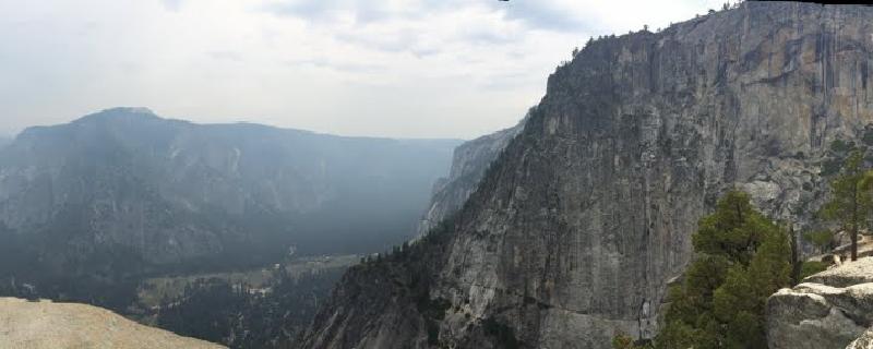
California, Mariposa County
04 :50 hrs
2.5 mi
815.92847 ft
Hard
Yosemite Falls is the tallest falls in North America at an impressive 2,425 feet. The trail to Yosemite Upper Falls has steep sections containing switchbacks. There are steep drop-offs to the east of the trail and therefore it is important to stay on trail; the trail is well maintained and this should not be an issue. In exposed sections there are metal railings in place to enhance trail safety. The vegetation along the trail consists of large shrubs and trees in some places, but it is mostly exposed which allows for excellent views of Yosemite Valley, Half Dome, and Yosemite Falls. A platform was constructed at the mouth of upper falls allowing for remarkable views that would otherwise not be seen.
Nevada, Esmeralda County
10 :48 hrs
3.9 mi
1008.4695 ft
I
Nevada’s highest point, Boundary Peak is a summit that few reach. At 13,140 feet, this is a strenuous journey that requires both strength and stamina to climb. We recommend the use of ski poles to reach the summit, but no other equipment is required. Though the trail is only 4 miles long, many who climb Boundary, which is the lowest of the White Mountain high peaks, make this a two-day trip and camp on the slopes leading up to the peak.
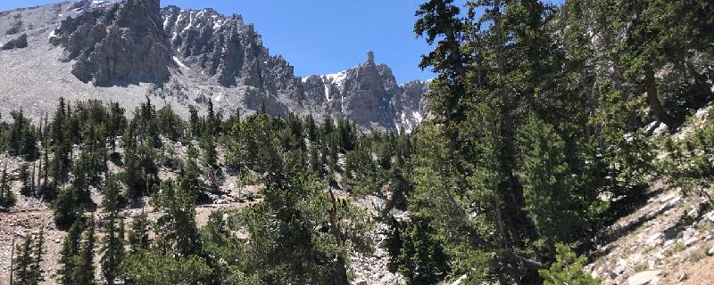
Nevada, White Pine County
02 :01 hrs
4 mi
153.97583 ft
Moderate
Hike to Bristlecone Forest and alpine lakes.
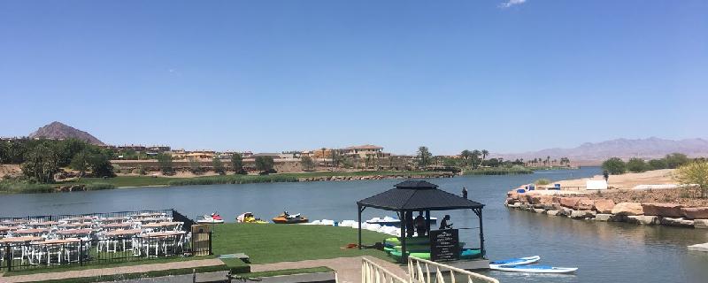
Nevada, Henderson
00 :29 hrs
1.1 mi
6.9079285 ft
I
Nice view of the lake and community. Doable with a paddle boat. Beware of the wind direction as that can significantly propel you or slow you down.
California, Inyo County
01 :44 hrs
3.7 mi
162.89795 ft
Moderate
Methuselah Trail meanders through a forest of ancient windswept Bristlecone Pines, one of the oldest living organisms on the planet. There is a visitor center near the trailhead with additional information about this resilient forest. There are excellent open views of the surrounding area where the trail begins to loop back to the trailhead. The trail is open year-round, however, the road to the trailhead may be closed during periods of high snow accumulation.
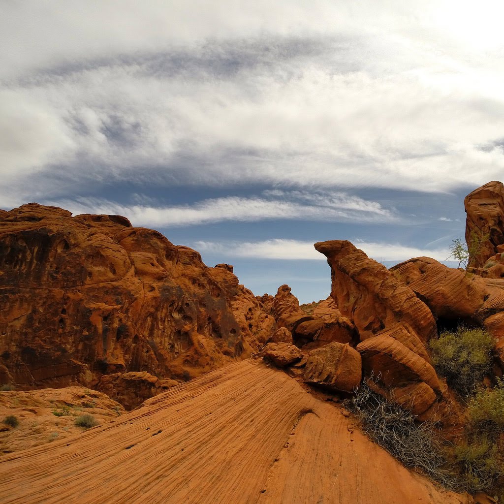
Nevada, Clark County
00 :12 hrs
0.5 mi
15.184204 ft
Easy
This is a very easy walk. It is kid and stroller friendly. This trail gives you a really nice view of the red rocks
See more adventures..
Explore complete list
Explore nearby adventures

