Best Backcountry Skiing in Nevada
Trying to find the best backcountry skiing in Nevada? Bivy has great hiking, biking, paddling, climbing, skiing, riding and more, with hand-curated trail maps, as well as detailed driving directions.
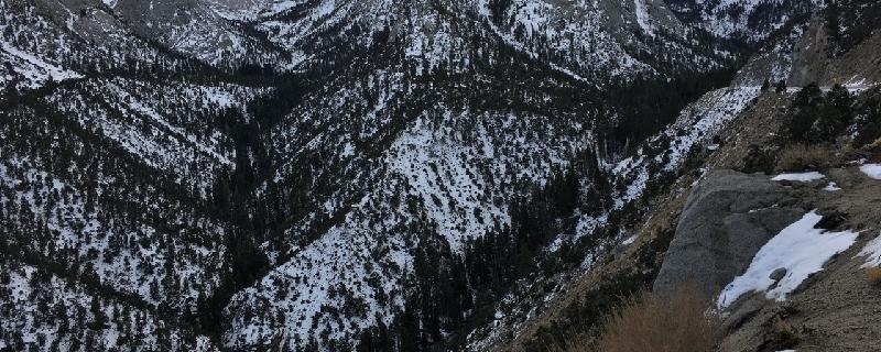
California, Inyo County
09 :46 hrs
4.3 mi
1862.4985 ft
S3
Mount Whitney is not only the highest peak in California, but the highest peak in the contiguous United States. The route steeply climbs alongside the North Fork of Pine Creek and passes three alpine lakes before reaching the base of a distinctive couloir on the northeast face, this is Mountaineers Route. It ascends through the couloir and traverses along the north face to the west ridge and finally the summit. Due to icy and exposed conditions beyond the notch at 14,200 feet, skiing this section of the couloir is too dangerous and not recommended. The plateau at the summit lacks snow and is usually left barren from exposure. This should be done as a multi-day trip with at least two overnights at Upper Boy Scout Lake (mile 2.5) or Iceberg Lake (mile 4). Contact Inyo National Forest for information on camping and permits required. Difficulty Rating: IV S3
California, Inyo County
13 :18 hrs
7.5 mi
1797.8474 ft
S4
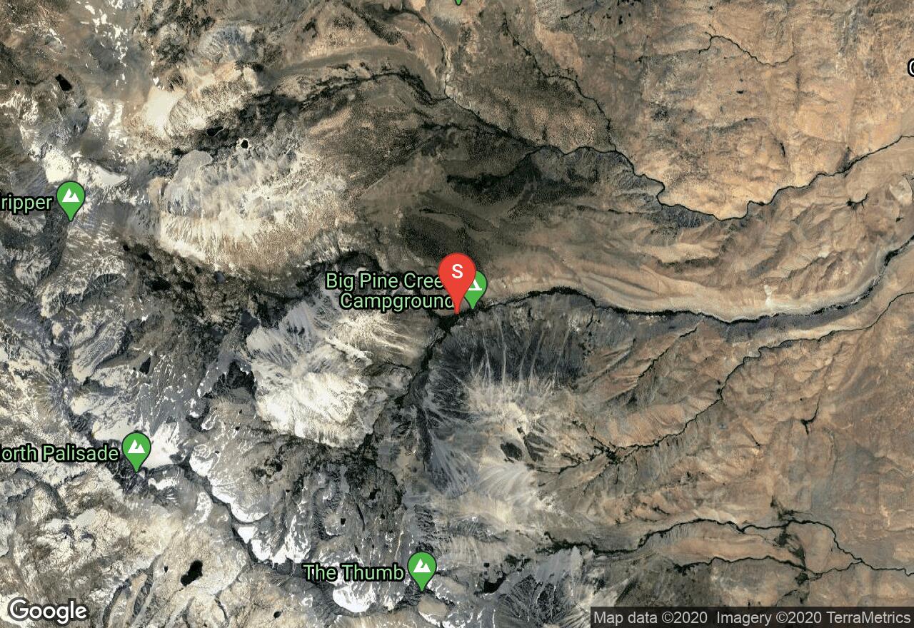
North Palisade is the fourth largest peak in California and a popular destination for avid backcountry skiers. From Glacier Lodge, you'll hike into an alpine valley and a more rugged terrain where you'll pass First, Second, and Third Lake all strung together by Big Pine Creek. Above Sam Mack Meadow you'll hike above tree line and skirt the edges of a small lake; this is a great spot for camp. Contact Kings Canyon National Park for information on camping and required permits. The final approach to the top of the U-Notch is challenging and requires advanced mountaineering skills; bring rope, crampons, and ice axes. Difficulty Rating: IV S4 A
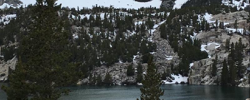
California, Inyo County
12 :09 hrs
5.1 mi
2418.4941 ft
S0
Mount Williamson is second to Mount Whitney in height and is compared in size to Mount Shasta. This is one of the more challenging tours. The peak is surrounded by steep walls and narrow canyons where Williamson Creek, Bairs Creek, and its tributaries flow. The route begins below snowline as it climbs along the canyon walls above the North fork of Bairs Creek avoiding the dense vegetation that grows below. It climbs in and out of gullies until it reaches the midway point where the canyon widens and open views of the cirque and plateau summit come into view. The final approach ascends up the cirque and through a couloir to the summit. For the descent, follow your ascent route back. This is intended to be a multi-day trip; contact Inyo National Forest for information on camping and permits required. Difficulty Rating: IV S5
California, Fresno County
16 :55 hrs
24.5 mi
2434.105 ft
S3-
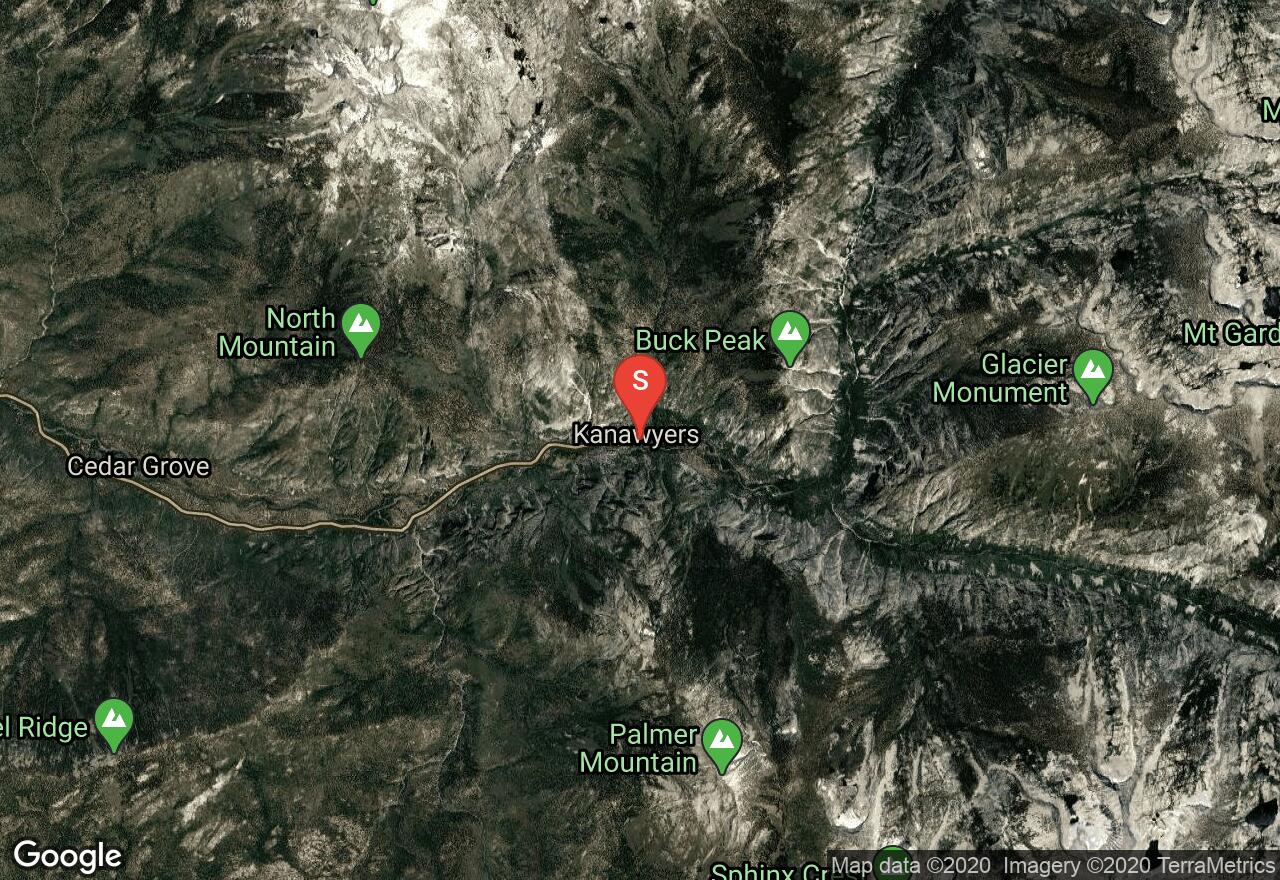
The steep and rugged slopes that comprise the dominant peak that is Mount Brewer are still distinguished from its neighboring peaks that also exceed 13,000 feet. This multi-day backcountry ski trip tours Sequoia and Kings National Park as it climbs through narrow canyons where the South Fork of Kings River and Sphinx Creek flow to an alpine lake basin above tree line. Beyond Sphinx Lakes the route climbs up and over a pass before making the final approach up a wide, steep gully to the summit. At the summit you'll find panoramic views of the impressive peaks and narrow canyons of Sequoia and Kings National Park. This can also be done as an out and back with a descent down the northwest face. This is intended to be a multi-day trip; contact the national park for information on camping and required permits. Difficulty Rating: IV S3
California, Inyo County
17 :06 hrs
24.6 mi
1834.9812 ft
S3
In the central Sierra Nevada's stands a group of steep, rugged peaks known as the Palisades. Among the four most prominent peaks is Mount Sill. This multi-day backcountry trip climbs from Glacier Lodge where it follows alongside Big Pine Creek into a valley and past a string of alpine lakes. The terrain becomes more rugged as you are shortly surrounded by steep rock walls and fewer evergreens. You'll pass several lake basins and climb up and over six saddles as you make your way to Mount Sill and loop back to the lodge. Although this is a long and strenuous tour, you will undoubtably be rewarded once you reach the summit of Mount Sill. From the top, its a 5,000 foot descent down a cirque and back to camp. This is intended to be a multi-day trip; the recommended midway spot to camp is at Glacier Creek Lake at mile 12 and at the base of Mount Sill. Contact Kings Canyon National Park for information on camping and required permits. Difficulty Rating: IV S3
California, Mammoth Lakes
20 :02 hrs
13.7 mi
1441.9202 ft
S3
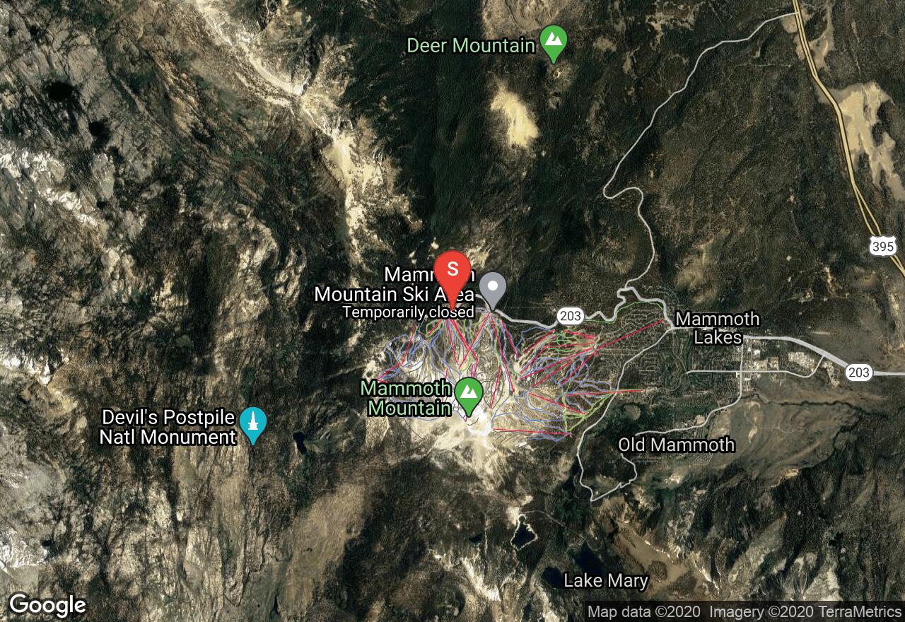
The prestigious Mount Ritter sits well above its neighboring Minarets and lies surrounded by glacial cirques, clear alpine lakes, lush meadows, and tumbling waterfalls. This prominent peak is a favorite backpacking trip and of course, a great winter touring trip. Minarets Road is left unplowed during winter months, therefore, the first stretch of this route follows roads to Agnew Meadow. From here you'll pass a string of alpine lakes as you ascend along the valley floor and a glacially polished and carved landscape. There is an excellent camping spot at one of the lake, Lake Ediza at mile 10. This marks the beginning of the most challenging stretch of the route. You'll steeply climb up and around the Minarets and over glacial cirques to the south ridge of Mount Ritter. Finally, you are rewarded with magnificent panoramic views of Yosemite and an excellent ski run back down the southeast glacier to Lake Ediza. Difficulty Rating: IV S3 A
California, Tulare County
05 :55 hrs
7.6 mi
1274.8804 ft
S3-
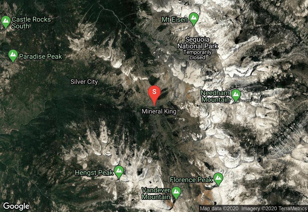
Sawtooth Peak is a jagged mountain with a string of lakes at its base, the Monarch Lakes, and Empire Mountain a mere 1.5 miles to the northwest. This rugged area is a popular destination for hikers and skiers alike. The route climbs alongside Sawtooth Creek through the valley to lower and upper Monarch Lakes where it ascends to Sawtooth Pass and travels along ridges to both summits. In winters Mineral King Road is closed until May. If you plan this trip before May, you must follow Mineral Kings Road from the closed gate to the start of this route adding approximately 12 miles one-way, but well worth the effort. This is intended to be a multi-day trip; contact Sequoia and Kings National Park for information on camping and permits required.
California, Inyo County
22 :41 hrs
15.7 mi
1495.6519 ft
S2+
This multi-day backcountry ski trip tours the remote and rugged terrain of northern Kings Canyon National Park with Mount Goddard as its primary destination. On this tour you'll pass through several high alpine lake basins and up and over two saddles before reaching Mount Goddard. Descend down the northwest slope and retrace the ascent route back to camp. This tour is long and challenging, but offers excellent ski terrain in addition to Mount Goddard, which is why it should be done as a multi-day trip. Contact Kings Canyon National Park for further information on camping and permits required. The route begins from highway 168 up to the point where the plows have cleared the road; it is not plowed beyond this point between winter and early spring. Difficulty Rating: IV S2+

California, Fresno County
18 :08 hrs
26.7 mi
2444.4502 ft
S4-
The steep and rugged slopes that comprise the dominant peak that is Mount Brewer are still distinguished from its neighboring peaks that also exceed 13,000 feet. This multi-day backcountry ski trip tours Sequoia and Kings National Park as it climbs through narrow canyons where the South Fork of Kings River and Sphinx Creek flow to an alpine lake basin above tree line. Beyond Sphinx Lakes the route climbs up and over a pass before making the final approach up a wide, steep gully to the summit. At the summit you'll find panoramic views of the impressive peaks and narrow canyons of Sequoia and Kings National Park. The descent route drops off the east face into a glacially carved valley and descends toward East Lake and Bubbs Creek. This is intended to be a multi-day trip; contact the national park for information on camping and required permits. Difficulty Rating: IV S4-
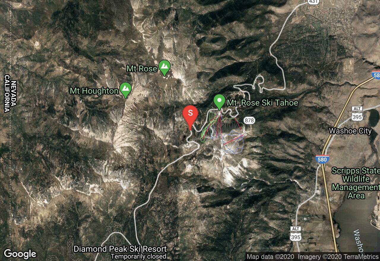
Nevada, Reno
02 :06 hrs
3.1 mi
369.27563 ft
S3-
I S3- This trail heads up a meandering path to Tamarack Peak, a lower point peak below Mt. Rose. This route will offer some of the best views of the surrounding mountains as well as the city of Reno, and an occasional glimpse of the Lake Tahoe area. Intermediate slopes offer the challenge on this shorter backcountry route.
See more adventures..
Explore complete list
Explore nearby adventures

