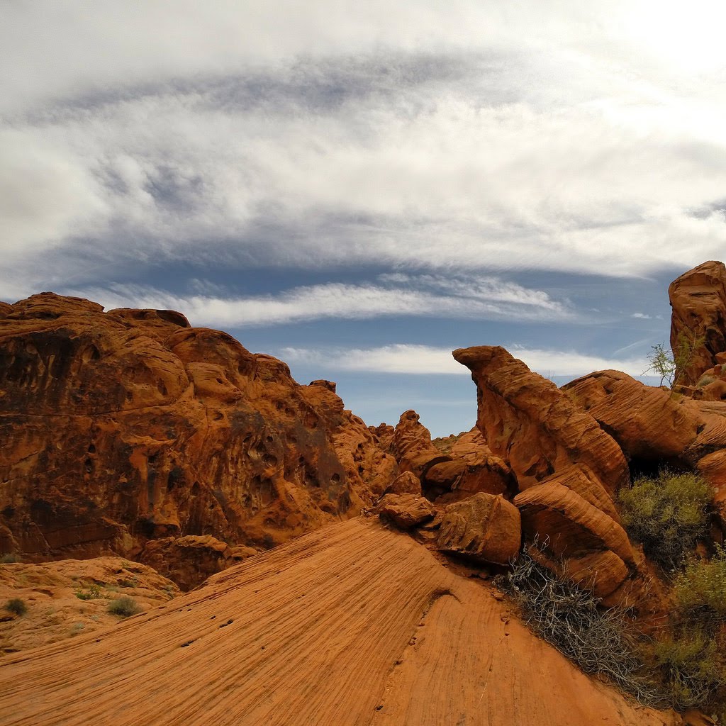
Best Waterways in Nevada
Trying to find the best waterways in Nevada? Bivy has great hiking, biking, paddling, climbing, skiing, riding and more, with hand-curated trail maps, as well as detailed driving directions.
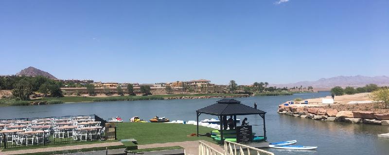
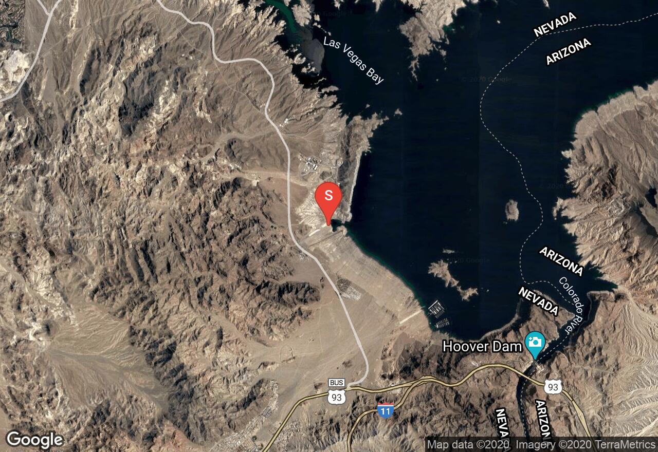
Nevada, Henderson
00 :29 hrs
1.1 mi
6.9079285 ft
I
Nice view of the lake and community. Doable with a paddle boat. Beware of the wind direction as that can significantly propel you or slow you down.
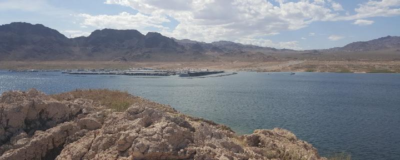
Nevada, Henderson
02 :03 hrs
4.8 mi
0.000061035156 ft
II
For an easy and fun water adventure in the Las Vegas area, consider the Boulder Island kayaking route. Leaving from the Hemenway Harbor, you’ll paddle to the very nearby Big Boulder, Little Boulder, and Rock Islands and explore their ever-changing coastlines (due to rising and falling reservoir water levels). Waves on Lake Mead can be a bit bigger than on smaller water bodies, upping the difficulty of cross-lake travel, but this is still a good adventure for novices.
Nevada, Henderson
02 :05 hrs
4.6 mi
8.264221 ft
II
If you’re looking for a water adventure but don’t feel up to the rigors of Lake Mead, this course in Lake Las Vegas is for you. Public access to the lake is found at a parking lot on the east side of the lake. Other access points can be found but may be limited by private ownership of launch spots. This is a popular spot, so be on the lookout for other boats, particularly larger and faster moving craft.
Nevada, Reno
00 :12 hrs
0.5 mi
0.77124023 ft
III
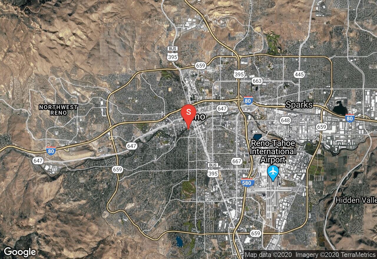
Surrounding Wingfield Park, the Truckee River Whitewater Park features 11 pools for kayak play, a kayak racing course, and annually hosts the Reno River Festival, a competitive kayaking event. The park is located in downtown Reno in walking distance from 24 resorts, so if you’re staying in Reno, passing through, or a local, access is quite easy. Rapids are rated at Class II to III.
California, Mariposa County
11 :19 hrs
28.7 mi
279.95358 ft
IV
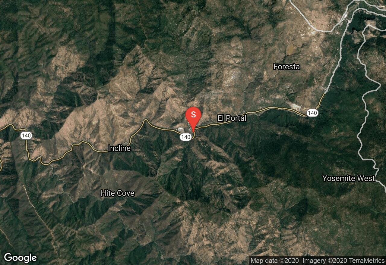
The headwaters for the Merced River originate from Mount Lyell of Yosemite National Park. It tumbles past Yosemite Dome creating the famous Vernal Falls and Nevada Falls before making its way to the valley floor and through a typical Sierra foothill canyon, this is where this trip begins. This run has a combination of Class III and IV rapids that eventually are broken up with a break just before Briceburg (mile 15). Briceburg is used as a take out/put in for a half day run. The trip explained here is intended to be a multi-day trip. The BLM has three designated camping areas: McCabe Flat campground at mile 17.5, Willow Placer campground at mile 18.8, and Railroad Flat campground at mile 20.2. Contact the BLM for further information on camping and required permits. At mile 22 just before the confluence with the North Fork of the Merced is a 30 foot waterfall, the North Fork Falls. Some have navigated the far left side and dodged the boulders, but most use the portage on the right. Here is a link to a map indicating rapids and put ins/take outs: http://www.merced-river.com/images/maps/rl-mer.jpg.
California, Tuolumne County
02 :30 hrs
7.8 mi
255.42902 ft
V
Cherry Creek run is one of the most challenging run in the US, making this the ultimate thrill ride for whitewater paddlers. Cherry Creek is a steep graded, swift moving tributary of the Tuolumne River originating from Yosemite Valley. On this trip you'll be dodging granite boulders, descending down five big drops, and riding long, continuous Class IV and V+ rapids known. At approximately mile 7 is the Class V drop Lumsden Falls which will require portaging.
California, Tulare County
06 :06 hrs
16.2 mi
623.83887 ft
V
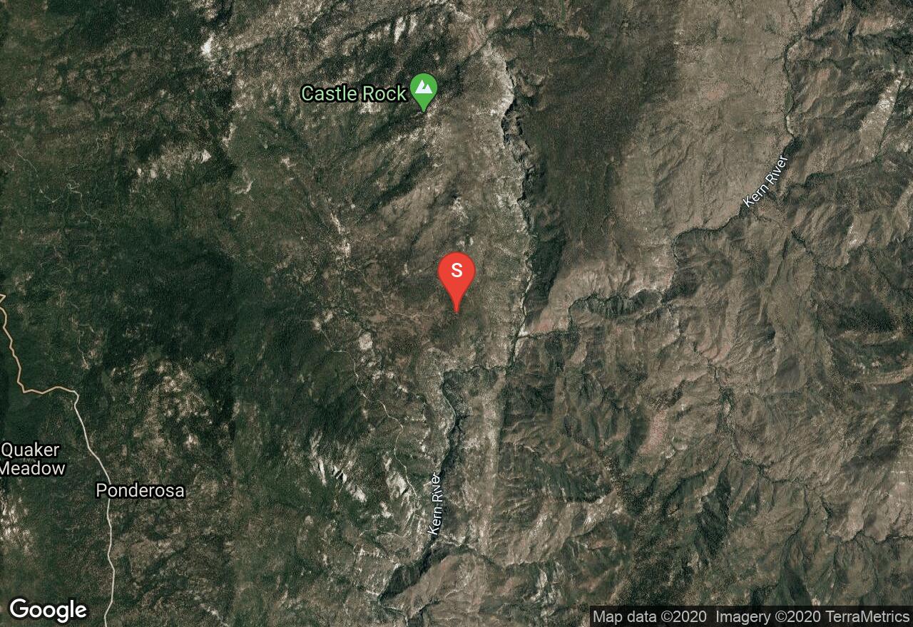
The Forks of the Kern River is an overnight whitewater run through Golden Trout Wilderness and Dome Land Wilderness. It bends past volcanic flows and into rocky canyon cliffs covered in a thin forest. What deters some from doing this run is the 1.7 mile hike to the put in. A mule service is available to transport gear and equipment; contact Golden Trout Wilderness Pack Trains. After only seconds of hitting the water you will face Class IV and V- rapids lasting until the take out site with some breaks in between. Some places of interest are Peppermint Falls (mile 9.5) where there's good camping and Dry Meadow Creek (mile 14.5) where you'll find granite water slides. At approximately mile 11.5 is the Class V rapid Vortex V. This should be portaged when the river is flowing below 1300 cfs. Just before the take out site is the most challenging rapid of this trip: Carson Falls, an 8 foot drop into a hole. A river permit is required for this trip; contact Sequoia National Forest for further information. Here is a link to a detailed map provided by Kern River Outfitters indicating places of interest and rapids: http://www.kernrafting.com/maps/forks-kern-river.html
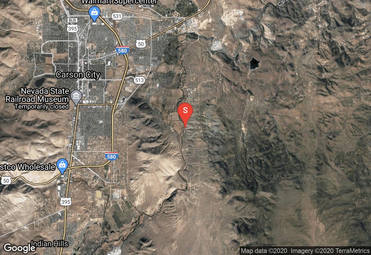
Nevada, Carson City
01 :47 hrs
3.6 mi
12.381958 ft
I
Recently established as an official aquatic recreation spot, the Carson River Aquatic trail in Carson City is a great place to get out on the water. The Trail is divided into two portions, the upper and the lower, the upper being a short Class I easy area, and the lower portion being a longer and more difficult Class III. Beware of high water from spring runoff.
Nevada, Henderson
08 :39 hrs
20.4 mi
0.000061035156 ft
III
Exploring the western arm of Lake Mead known as Las Vegas Bay, this is a great adventure for those who want to get away from the traffic of the more eastern sections of Lake Mead. Access this area from the Boulder Harbor boat launch and then head north. Other water craft will be present, including motorized craft, so be sure to watch out for these.
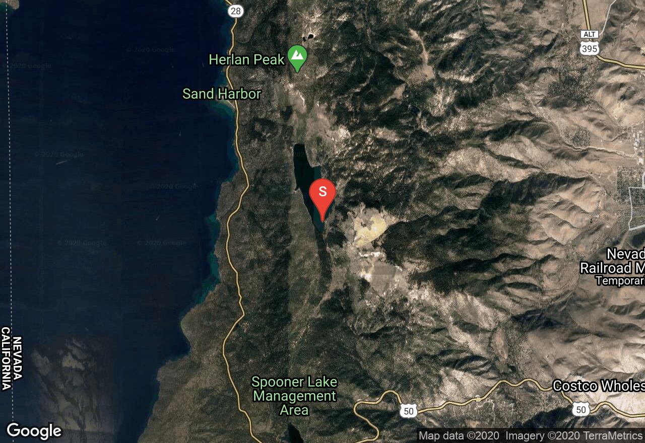
Nevada, Carson City
01 :37 hrs
3.8 mi
2.7834473 ft
I
Accessed from a small parking lot on the south end of the Lake, this is a great place to go if you want to get away from the busy Lake Tahoe crowd. The water here is slightly colder than Tahoe, and even can freeze over during the winter, but the surface is also calmer. This is a great place for beginners to learn and practice their techniques.
See more adventures..
Explore complete list
Explore nearby adventures

