Best Rock Climbing in Nevada
Trying to find the best rock climbing in Nevada? Bivy has great hiking, biking, paddling, climbing, skiing, riding and more, with hand-curated trail maps, as well as detailed driving directions.
California, Mono County
01 :20 hrs
1.3 mi
310.9746 ft
Various
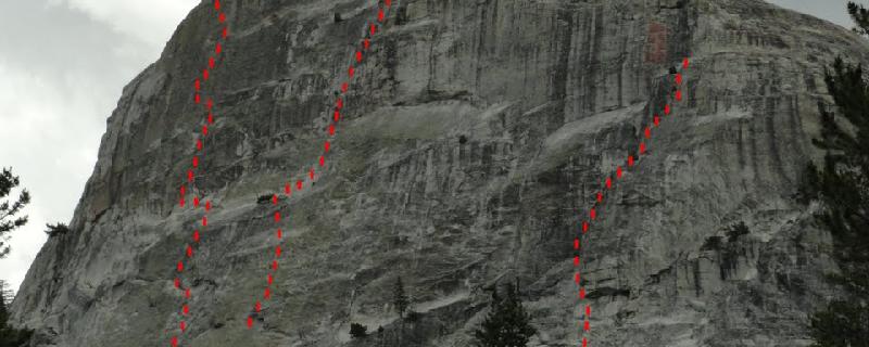
Located above McLeod Lake, Mammoth Crest is the prominent wide-ranging wall that can be seen from the town of Mammoth Lakes. Here you will find a quiet alpine wall that features routes ranging from 2-3 pitches. There are 6 different sections of this wall with “Sector 4” being located near the center of the formation. Approach from the Horseshoe Lake parking area, which is located within a deforested area where volcanic grasses have killed the trees. Follow Mammoth Pass Trail until reaching the trail junction. Take the trail that leads to McLeod Lake. After reaching the lake, skirt the outside of the lake to the south end. Hike up through the talus field to reach a small cliff band. From here head up and right to the base of the wall. To reach Sector 4, head southeast (left) along the base of the formation.
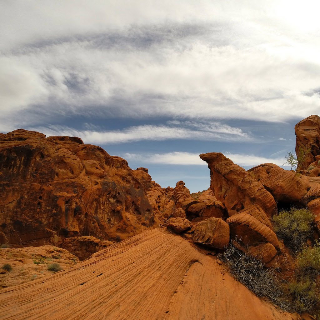
Nevada, Clark County
00 :21 hrs
0.5 mi
62.286743 ft
Various
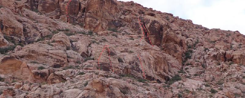
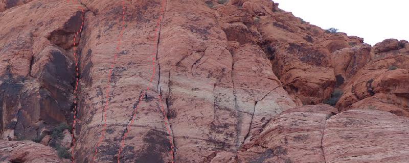
The Gallery is one of the more popular and classic walls in the second pullout of Calico in Red Rocks. It has at least 18 routes covering a wide range of difficulties. All of the routes are bolted. The Gift is one of the most classic routes on the wall. It's been in several climbing videos. Please pickup a human waste bag and dispose of it properly.
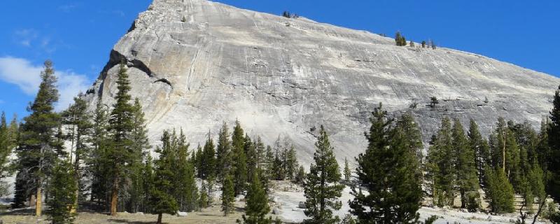
California, Tuolumne County
00 :09 hrs
0.1 mi
33.36548 ft
Various
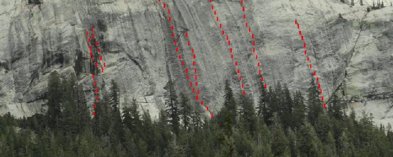
Lembert Dome is the prominent dome that dominates the eastern end of Tuolumne Meadows. It is located off Tioga Road, next to Dog Lake. If you are camping a wilderness permit is required and camping is prohibited within one mile of Tioga Road. The west face of the Dome offers mostly beginner routes with a couple difficult routes as well. Some of the classics are “The Water Cracks”, “Werner’s Wiggle”, “Truckin’ Drive” and “Rawl Drive”. The approach is easy and obvious from the parking lot.
California, Tuolumne County
00 :17 hrs
0.3 mi
61.756348 ft
Various
Lembert Dome is the obvious large dome just off Tioga Road in Tuolumne Meadows about 0.3 miles east of the Tuolumne Meadows Store. The North West offers steep multipitch routes, with the standout routes being “Northwest Books”, “Direct Northwest Face”, and “Crying Time Again”. Approach from the parking area on Stables Road.
California, Tuolumne County
00 :35 hrs
0.7 mi
111.84082 ft
Various
Located about a half mile south of “Medlicott Dome”, Dozier Dome offers the highest concentration of easier routes with quality slab, crack and knob climbing in Tuolumne Meadows. Dozier Dome can be seen from Hwy 120 as the lower formation located south of Medlicott Dome. Park along the shoulder of the road about 100 yards west of the paved pullout area for “Low Profile Dome”. Approach by following Cairns for 50 yards into the trees. Cross a major hiking trail as you continue to hike towards the slab. The main routes here “Erret by Bit”, “Holdless Horror”, “Tourette’s” and “Dumpster Evangelist” just to name a few.
California, Inyo County
00 :02 hrs
0.1 mi
3.149292 ft
Various
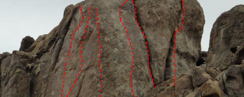
Alabama Dome is located within the Alabama Hills recreation area of the Eastern Sierra Nevada range, just outside of Lone Pine California. The Alabama Dome formation sits near the Arizona Dome off to the east side of Horseshoe Meadows Road and offers great rock with easy access. The stand out routes here are Blockade Runner, Dihedral Dance and gone With the Wind. Park along a small pullout area on the east side of Horseshoe Meadows Road and hike a short distance to the formation.

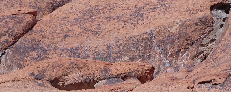
Nevada, Clark County
00 :24 hrs
0.5 mi
94.09448 ft
Various
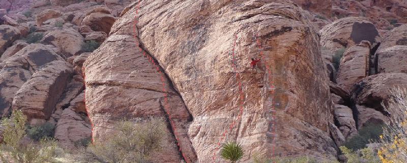
The Great Red Book Area is near the Second Calico Pullout of Red Rocks in Nevada. It sits high near the horizon to the east when looking from the parking lot. It's most known for the large dihedral holding The Great Red Book route. The are many sport and mixed routes on the large face to the right. It can get hot in the afternoon with a lot of sun exposure. Descend by continuing to the top of the rock feature and then hiking down the drainage to the left or west. Then traverse east. Some rappel off Ground-Up Vocabulary which requires a 60 m rope.
Nevada, Clark County
00 :15 hrs
0.2 mi
68.32251 ft
Various
Jabba the Hut is in the Calico Basin South area of Red Rocks. An easily accessible area with mostly moderate climbs and a few classics. It's divided among an upper tier, a lower tier, and Coco Crag. There is a meadow here where great care has been taken to keep people off. Please stay off.
Nevada, Clark County
00 :26 hrs
0.5 mi
110.08728 ft
Various
Riding Hood Wall sits west of Cannibal Boulder and Risk Brothers Roof in Calico Basin South of Red Rocks. A couple classic routes live there including Physical Graffiti. Most routes can be descended by rapping off west and downclimbing a bit.
Nevada, Clark County
00 :08 hrs
0.2 mi
27.008911 ft
Various
Cannibal Boulder is in the Calico Basin South area of Red Rocks. This huge boulder is easily reached with a short walk from the parking lot in the Calico Basin area. It has about 20 total routes on it ranging from easy 5.4s to difficult overhanging 5.12s on the south side.
See more adventures..
Explore complete list
Explore nearby adventures

