Best Mountaineering in Nevada
Trying to find the best mountaineering in Nevada? Bivy has great hiking, biking, paddling, climbing, skiing, riding and more, with hand-curated trail maps, as well as detailed driving directions.
California, Inyo County
32 :59 hrs
12.9 mi
2446.8066 ft
I
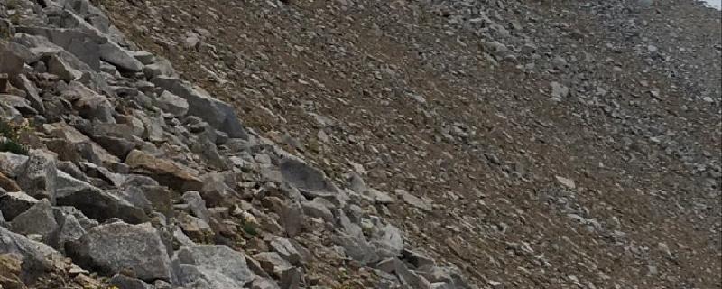
Mount Williamson Trail begins by following a creek and then making several switchbacks as it quickly gains elevation. The trail is a narrow path that meanders through a rugged landscape providing little to no shade on the trail. This trip is intended to be an overnight trip; at 8 miles is Ansel Camp. Fires are not permitted at the camp. The trail continues to climb through an exposed landscape and past a cluster of alpine lakes where there are plenty of excellent views of the surrounding area. The final ascent climbs up a steep rocky chute and over a steep, blocky headwall to the plateau and finally the summit. It is recommended to do this early in the season when the snow line is lower. During this time, you will encounter talus and scree. Also, crampons and ice axes are recommended for Shepherds Pass. Weather conditions during winter ascents make this significantly more difficult as stated by Harding in 1954. Difficulty Rating: Class 3
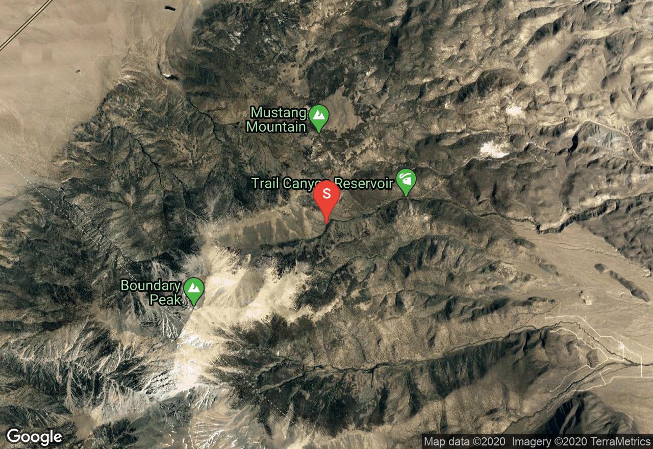
Nevada, Esmeralda County
10 :48 hrs
3.9 mi
1008.4695 ft
I
Nevada’s highest point, Boundary Peak is a summit that few reach. At 13,140 feet, this is a strenuous journey that requires both strength and stamina to climb. We recommend the use of ski poles to reach the summit, but no other equipment is required. Though the trail is only 4 miles long, many who climb Boundary, which is the lowest of the White Mountain high peaks, make this a two-day trip and camp on the slopes leading up to the peak.
California, Inyo County
11 :42 hrs
9.2 mi
2163.5361 ft
IV
The trail to the east arête and the east face of Split Mountain follows Red Mountain Creek Trail through a canyon and past Red Lake. This approach follows the arête to the right out the east central couloir. After a short warm up of some easy climbing, you will reach a steep wall and the beginning of the 5.9 rock climb to the top of the arête. You'll climb up and over large rock blocks and along a ridge crest no wider than 6 feet before reaching the second crux, a 5.8 rock climb. The final approach to the summit is an easy climb. This route contains sixteen plus pitches. It is recommended to do this as an overnight trip; contact Kings Canyon National Park for information on camping and permits required. This can be done year-round, but the most popular time to go is between June and October. Difficulty Rating: IV 5.9
California, Inyo County
20 :29 hrs
7.7 mi
1915.2798 ft
IV
North Palisade is amongst the more popular mountains for mountaineering. The U-Notch is a prominent feature between North Palisade and Polemonium Mountain and the most popular ascent route. The first ascent along this route was a solo completed by Norman Clyde in 1928. The trail to the north face and the U-Notch of North Palisade follows the North Fork of Big Pine Creek Trail as it passes several alpine lakes to Palisade Glacier. The route begins by climbing over or traversing around a bergschrund at the mouth of the couloir. Beyond the crevasse is between six and ten pitches of easy ice climbing. Ice screw belays are recommended, but not required. If you ascend on the edges of the gully, expect to place rock climbing gear. At the highest point of the notch, the route climbs up the near vertical south facing wall characterized by a crack system and a series of ledges. At the top of the long climb is a chimney to the left, this is the easiest route that climbs up the chimney and to the right over several more ledges. Contact Inyo National Forest for required camping permits. Difficulty Rating: IV 5.2
California, Inyo County
22 :04 hrs
8.4 mi
1813.8916 ft
IV
Middle Palisade shares the same ridge in which you will find seven of California's fourteeners, this is the Sierra Crest. The trail to the west face of Middle Palisade follows the South Fork of Big Pine Creek through a rugged canyon and over South Fork Pass where it then descends into a lakes basin and traverses over steep rock to the west face. The Smoke Buttress approach climbs eleven pitches up a steep buttress. The crux is at the tenth pitch where the route climbs a steep headwall. Once the buttress is completed, its Class 3 and 4 climbing up a couloir and along a ridge to the summit. Contact Inyo National Forest for required camping permits. There is much snow early in the year which requires the use of more gear and essentially more weight to carry. Can be climbed year-round, but the ideal time to go is between May through October. Difficulty Rating: IV 5.9 A1
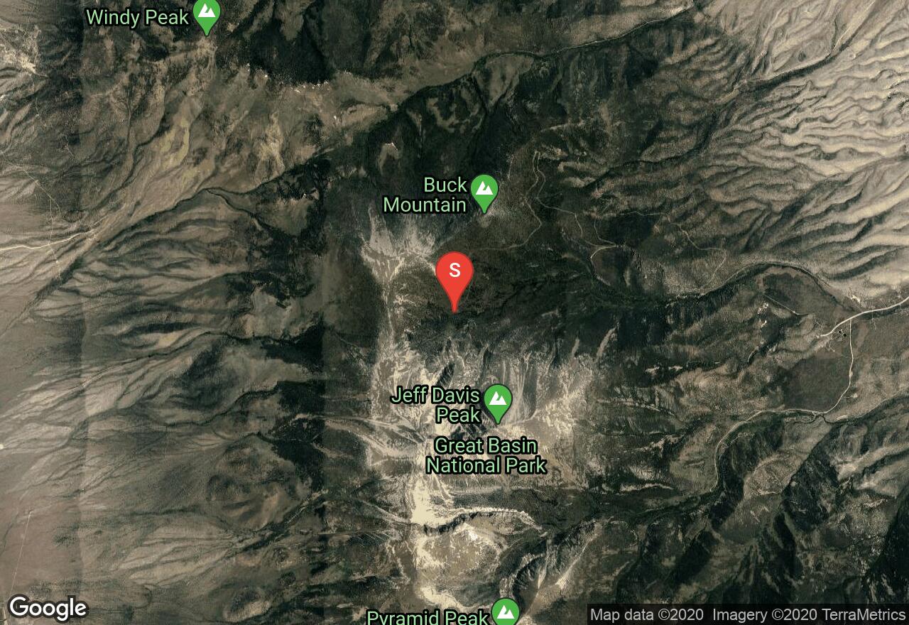
Nevada, White Pine County
10 :57 hrs
3.6 mi
928.15576 ft
I
There are a few different routes to summit Wheeler Peak. This route takes you over Jeff Davis peak and then saddles to Wheeler Peak, coming from the east rather than from the north. Of the different routes, this is definitely the most challenging. Many adventurers will then take the easier hiking trail back down the north side of Wheeler, rather than returning along the same route back over Jeff Davis peak. We recommend ski poles and rope for this summit.
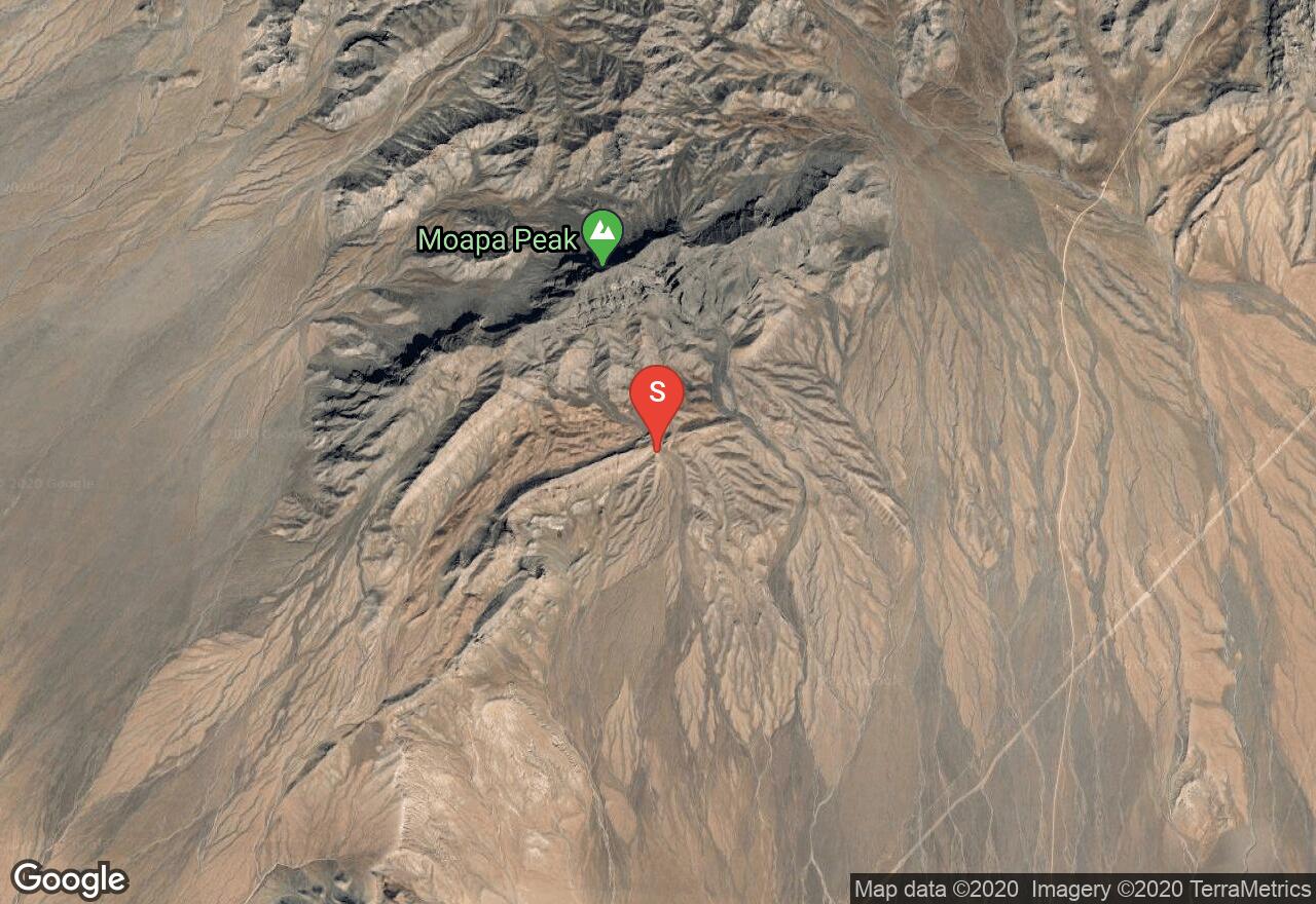
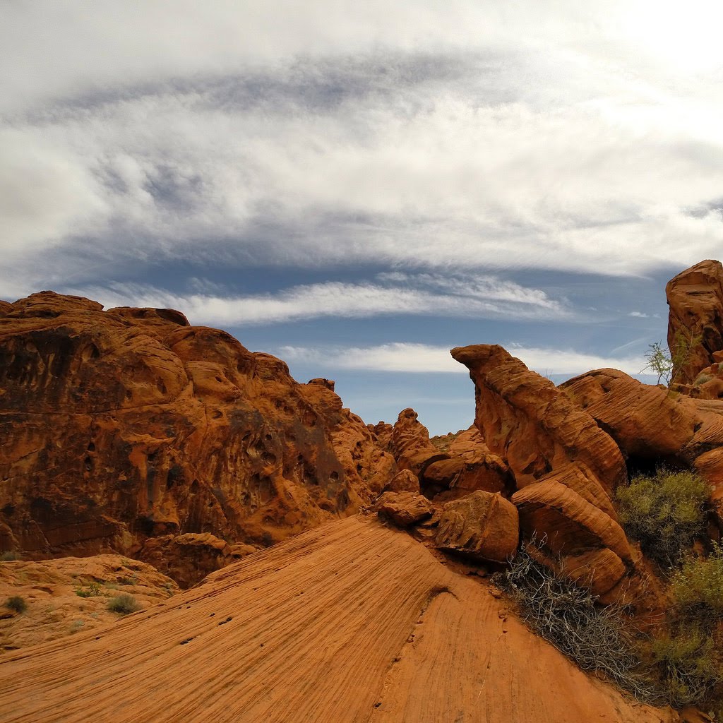
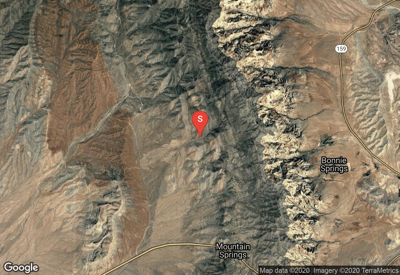
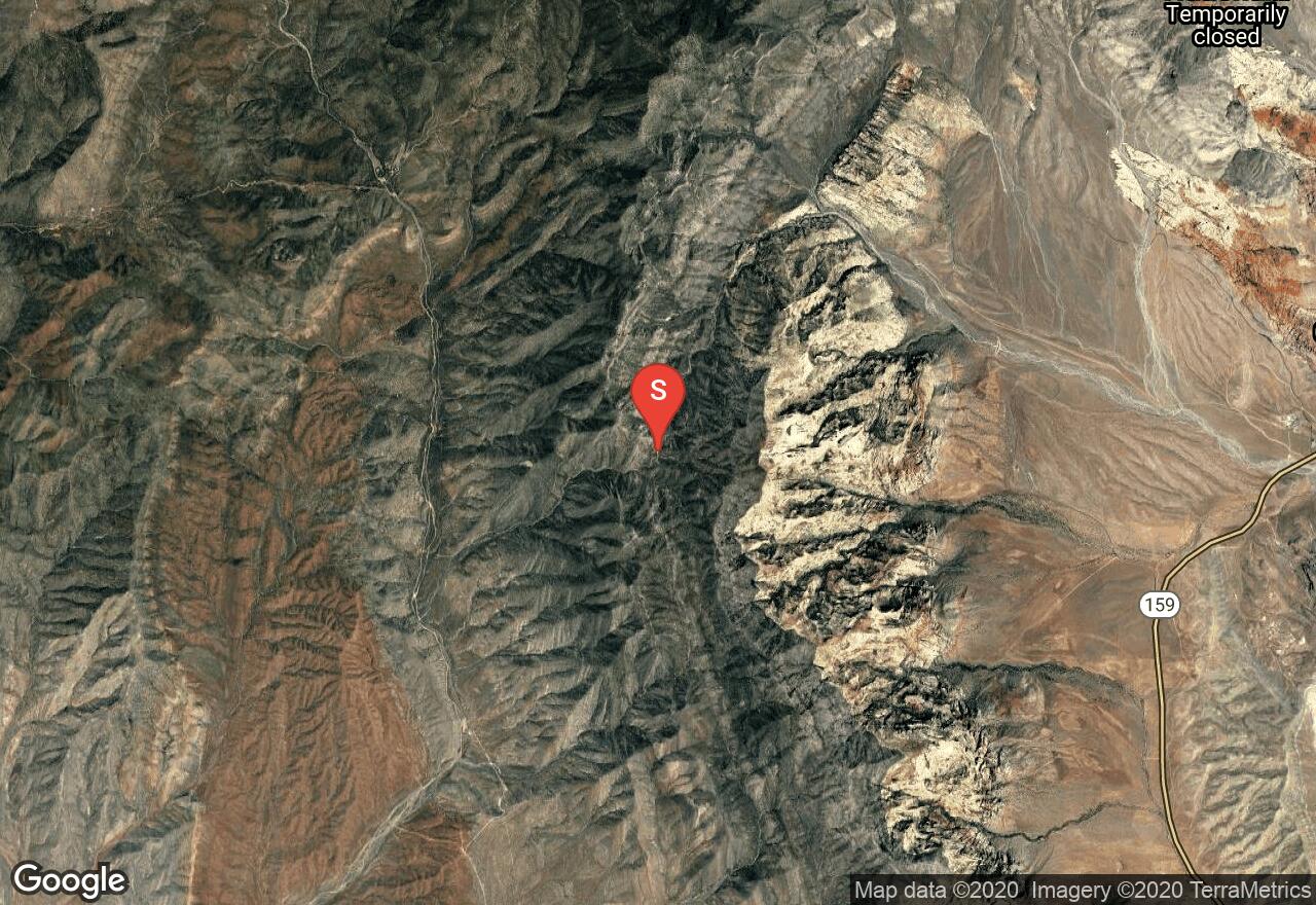
Nevada, Clark County
07 :39 hrs
3 mi
982.688 ft
I
Breathtaking views from the summit make this climb well-worth the effort. One section of class 3 climbing is the most difficult portion of the trail, so be ready with rope and ski poles, as well as a partner or three. The final approach is along a knife-edge ridge with dramatic drop-offs and spectacular vistas.
Nevada, Las Vegas
09 :03 hrs
4.8 mi
441.52075 ft
I
Well known as a premiere rock climbing destination, Rainbow Wall also offers a hiking/mountaineering route to the top, as well. Thie route will take you up to the top of a breathtaking sheer cliff overlooking Las Vegas and the wide open desert. Some class 2 terrain call for trekking poles, and rope is recommended.
Nevada, Esmeralda County
13 :01 hrs
4 mi
1358.3547 ft
I
Though Montgomery Peak is in California, the sole approach to the peak is from the Nevada side, an extension of the path to Nevada’s high point, Boundary Peak. The route is fairly-well travelled, and often signs of a “use trail” can be seen. Mostly, the path is class 1-2 terrain, with an optional section of class 3 climbing. The course from Boundary follows the ridgeline, providing spectacular views of both Nevada and California.
Nevada, North Las Vegas
06 :19 hrs
2.9 mi
260.93396 ft
I
YDS III. The destination for this route is not the highest point on the route, but it is definitely the most spectacular. With steep cliffs surrounding the path to the top, this is a perilous trail, but it’s not particularly difficult (class 3 climbing in some spots). If you climb this in summer months you won’t need anything more than ski poles and possibly some rope, but in winter months crampons are a must.
See more adventures..
Explore complete list
Explore nearby adventures

