Best SUV in Nevada
Trying to find the best SUV in Nevada? Bivy has great hiking, biking, paddling, climbing, skiing, riding and more, with hand-curated trail maps, as well as detailed driving directions.
Nevada, Nye County
01 :26 hrs
26.7 mi
1563.4609 ft
Unknown
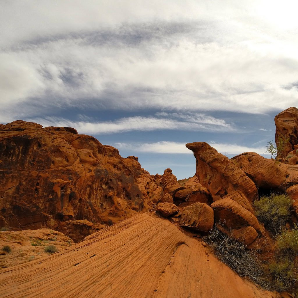
The route up Titus Canyon is one of the most popular in all of Death Valley National Park as it travels through a scenic canyon to multiple points of interest including a historic mining area and petroglyphs. The route follows a well-maintained gravel road that has no major obstacles. There are a few sections that are a little steep and narrow but the road is passable by most stock SUVs. The route is a one-way road that goes from east to west and because it is in the national park it is only open to street legal vehicles with a park pass. The route is open all year but is not recommended for the summer due to the excessive hot temperatures.
Nevada, San Bernardino County
04 :55 hrs
38.5 mi
1015.371 ft
Unknown
Mojave Road explores very remote and rugged terrain in historic and scenic Mojave National Preserve of southeast California. The eastern section of the road starts just on the east side of the California/Nevada border and heads west over a combination of rocky, sandy, rutted, and steep roadway. The ride is rated as moderate and is suitable for high-clearance 4x4 SUVs. Route-finding can be difficult so having a map, following cairns, and using GPS is recommended.

Nevada, Nye County
01 :25 hrs
26.8 mi
1563.903 ft
Unknown
This off-road trail is located in Death Valley National Park and is very popular. The road explores a super cool long canyon with rocky shelf roads, petroglyphs, and a ghost town. Most of the trail is graded but there is a 1.5-mile section where the road has only room for one vehicle and some larger rocks. A stock SUV with high clearance is recommended.

Nevada, Clark County
00 :18 hrs
1.6 mi
174.53204 ft
Unknown
This adventure is located an hour south of Las Vegas in a preserved ghost town called Nelson. The trail travels through a narrow rocky canyon with a mine and is a local favorite looking to test out a built rig. Expect two big waterfall climbs, the first one requires a locker but does have a bypass. The rock is sharp desert rock so good clearance is required. Flash floods can happen in this canyon so do not enter if there is any chance of rain.

Nevada, Lincoln County
06 :08 hrs
30 mi
723.328 ft
Unknown
This route follows a dirt-packed road to the ghost town of Delamar. There are tons of old mines and historical remnants. Wild horses and other wildlife are possible things you may see. You will travel through the Eight Mile Valley and then along the South Pahroc Mountains. The road gets a little rough in the wash and is also subject to flooding and washouts. Dispersed camping is allowed but there are no campgrounds with services.

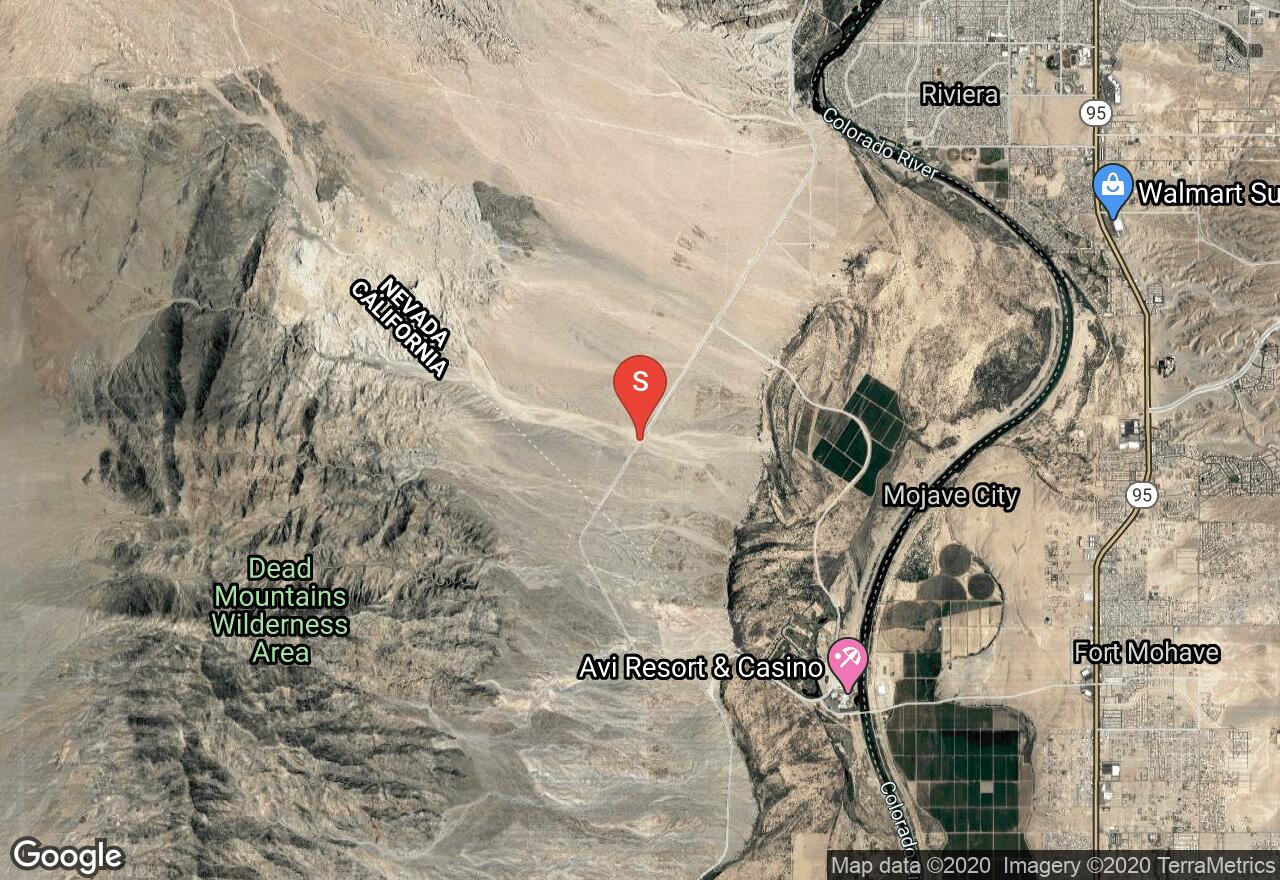
Nevada, Clark County
02 :17 hrs
12.1 mi
526.55896 ft
Unknown
This route begins just south of Boulder City and ends on the Colorado River. The trail surface is dirt, rock, and sand with some rocky sections and a sandy wash. During wet weather, the trail may become impassable. A lightly modified 4x4 is recommended. Be aware that cellphone service is not available so come prepared and travel in groups. Dispersed camping can be found along the trail.

Nevada, Lincoln County
03 :55 hrs
19.4 mi
1025.5621 ft
Unknown
Badger Spring and Tickaboo Mountain Trail is a spur off Badger Valley Loop. It is an easy trail for the most part that travels through a Joshua tree forest that has some interesting rock formations. There are several small creek beds and washes. During the winter months, you can expect snow as you climb in elevation. Dispersed camping is plentiful in the area.

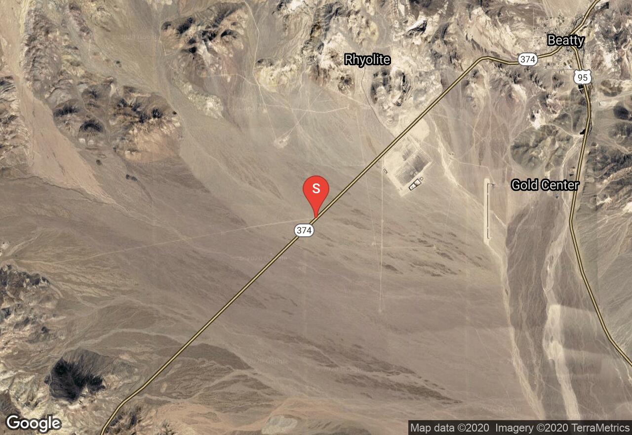
Nevada, Nye County
02 :41 hrs
13.5 mi
685.4019 ft
Unknown
Secret Pass is a remote trail with unique geologic formations, active and abandoned mining. Most of the trail is a hard-packed rock with exposed small boulders and you will cross several shallow washes. There are spur trails off the main road for more exploration. Flash flooding is possible so be sure to check weather conditions. The views are awesome and there is a good chance to see some wild burros.

Nevada, Clark County
01 :02 hrs
10.8 mi
207.84003 ft
Unknown
Flat Top Mesa travels along the edge of vertical cliffs through the wide-open desert. The trail surface is sand and dirt along a narrow ledge. High clearance is required for the narrow ledge hill climb at the beginning and end of the route. There are some blind washouts and deep ruts. Do not travel this route during wet weather. Dispersed camping and hiking opportunities are found along the way.

Nevada, Clark County
03 :08 hrs
16.3 mi
605.80597 ft
Unknown
Christmas Tree Pass is a fun enjoyable drive through the desert, with the name actually coming from all of the Christmas decorations that line the trail. There is dispersed camping with some very accessible campsites along the way. While this is a very easy gravel road to follow, be sure to watch out for small hidden ruts and washouts especially after rainstorms. This route is very scenic and you will find some amazing petroglyphs as well.
See more adventures..
Explore complete list
Explore nearby adventures

