Best Snowshoeing in Nevada
Trying to find the best snowshoeing in Nevada? Bivy has great hiking, biking, paddling, climbing, skiing, riding and more, with hand-curated trail maps, as well as detailed driving directions.
California, Mariposa County
06 :00 hrs
9.9 mi
174.51636 ft
Expert
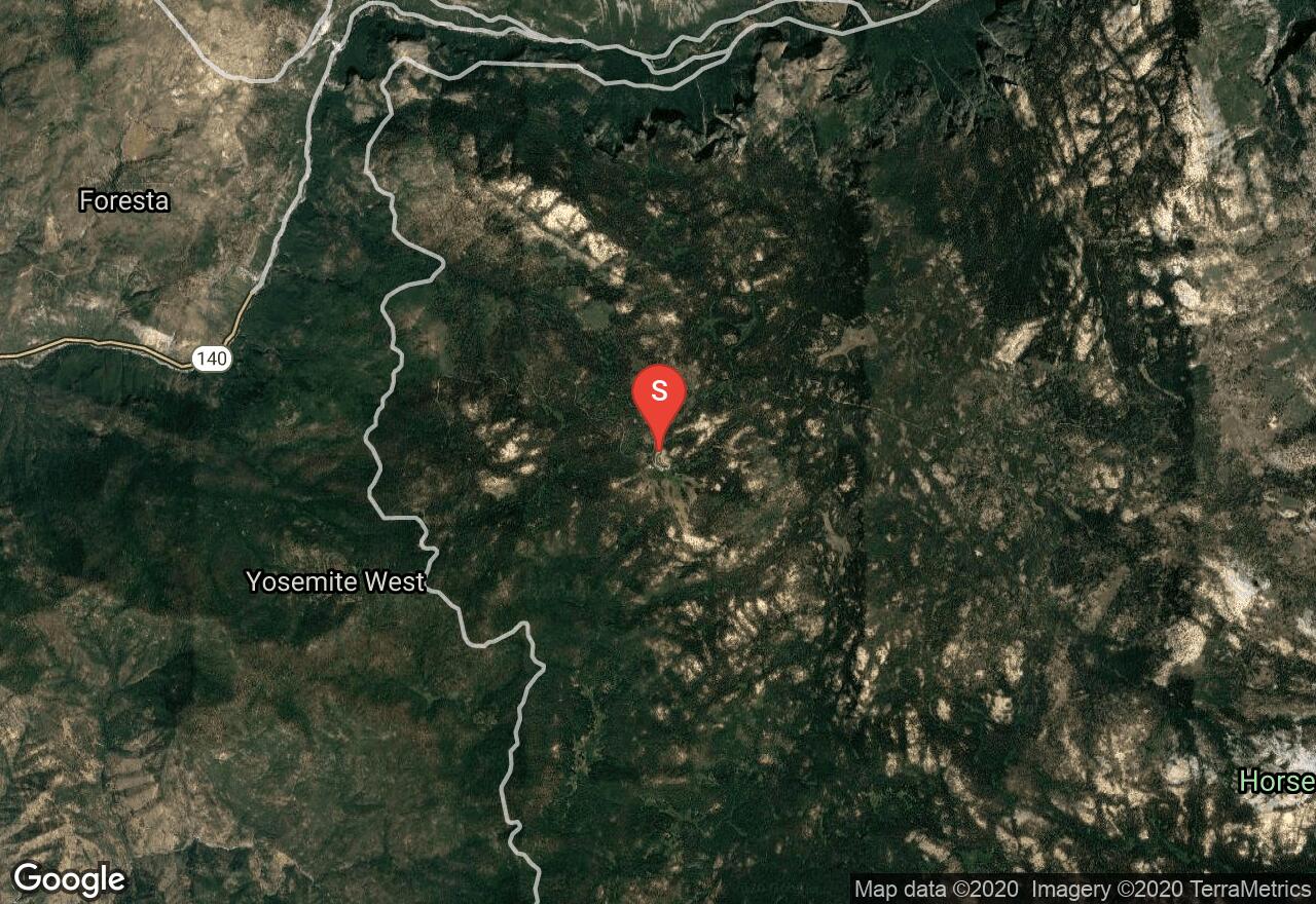
Located in Yosemite National Park, Dewey Point can be accessed year-round, however, some of the park roads are only open seasonally. This trail begins from Badger Pass, beyond this point the road is closed during winter months. The trail meanders through open meadows and between a forest of red firs and tall lodgepole pines. At the exposed rock point, Dewey Point, you will find amazing panoramic views of Yosemite Valley including El Capitan across the way. Be cautious of the steep drop offs at the point. This trail is not recommended for beginner skiers. Check with Yosemite National Park for up to date information on snow conditions and road closures.
California, Mammoth Lakes
04 :34 hrs
2.4 mi
300.30737 ft
Hard
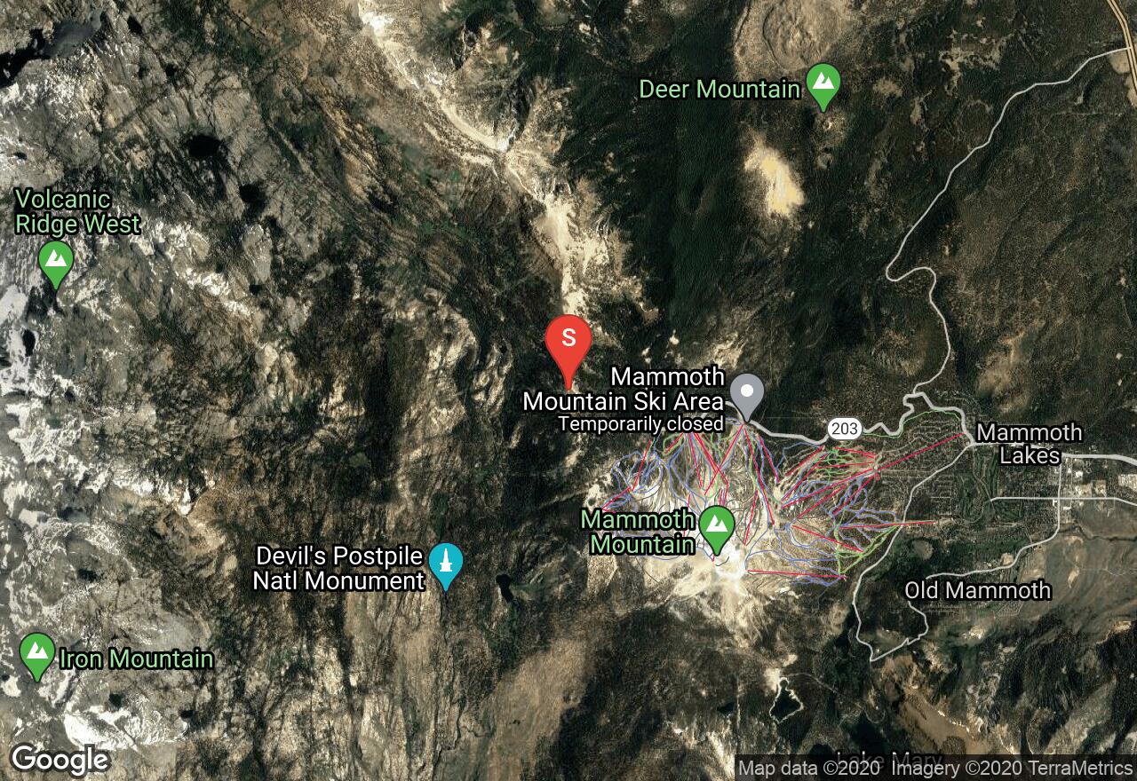
The trail along San Joaquin Ridge to Deadman Pass follows a dirt road as it wander along an exposed ridge with only few clusters of red firs, whitebark pines, and lodgepole pines. The trail is surrounded by panoramic views of the high sierras which include the Minarets, Mount Clyde, Mount Ritter, and Banner Peak. This trail can be snowshoed as late as April and even May; check with Ansel Adams Wilderness for more information about snowpack.
California, Mono County
12 :21 hrs
6.1 mi
1001.75024 ft
Extreme
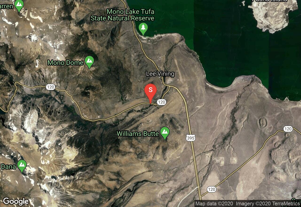
Located in the small town of Lee Vining, Mono Dome Trail is a gently graded climb along a well marked road that weaves through aspen groves, pines, pinyon pines, and firs. The trail crosses and follows alongside a creek where the road eventually disappears and its a cross country trek through a rocky, open, and steep terrain to Mono Dome. There are spectacular views from the dome of Mono Lake, Mount Dana, and Mount Gibbs. The slope grade beyond the creek is steep and not recommended for cross-country skiers.
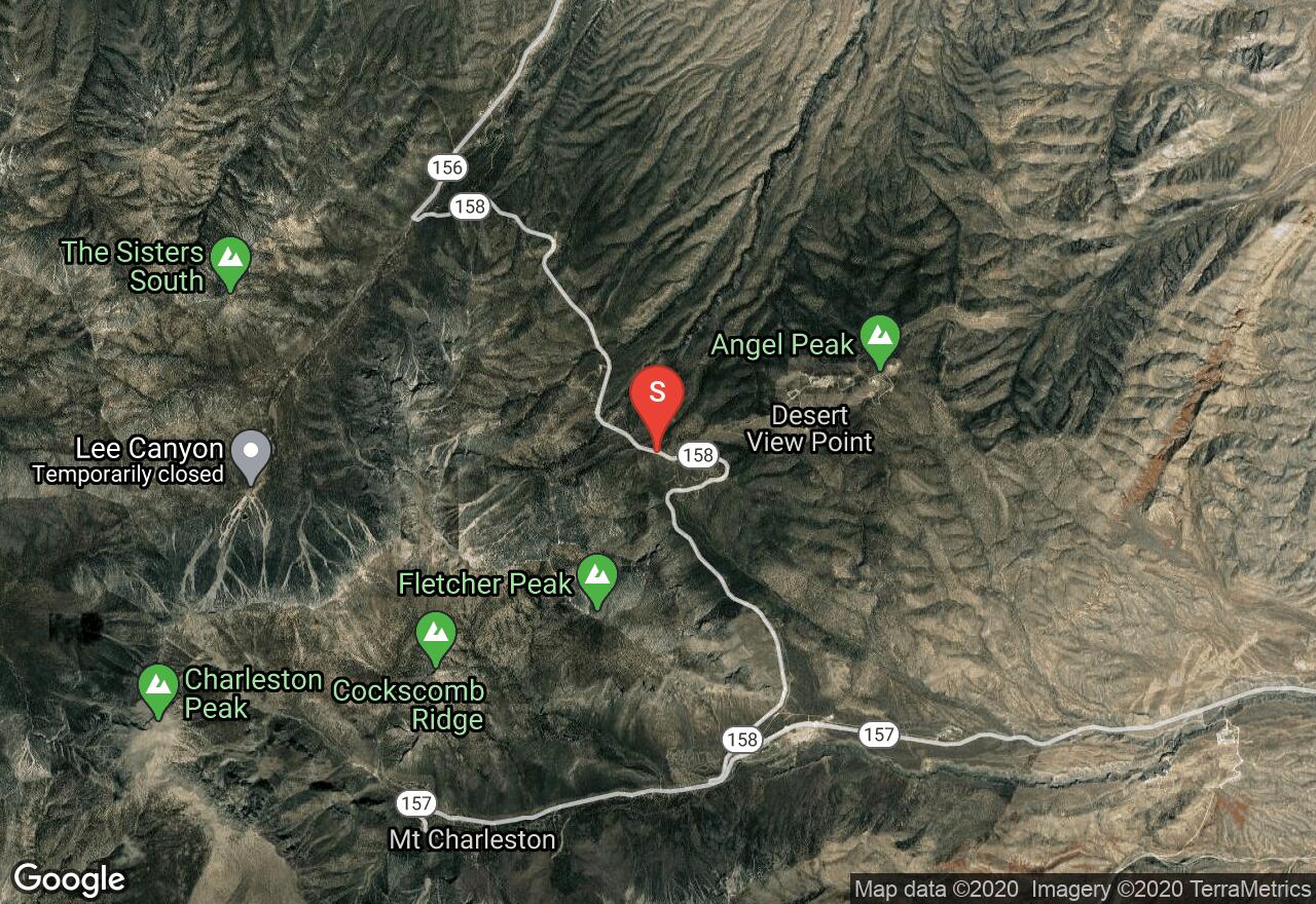
Nevada, Clark County
06 :11 hrs
2.5 mi
557.468 ft
Hard
Popular among adventurers of Southern Nevada, this is a rarity in the southern desert. This is primarily a snowshoeing route in the Mt. Charleston area. It's not abnormal to find large groups of enthusiasts making this trek together, in part because so few of these types of adventures can be found in the area. This is a rigorous adventure with an average slope of about 20% and stretches above 40% slope.
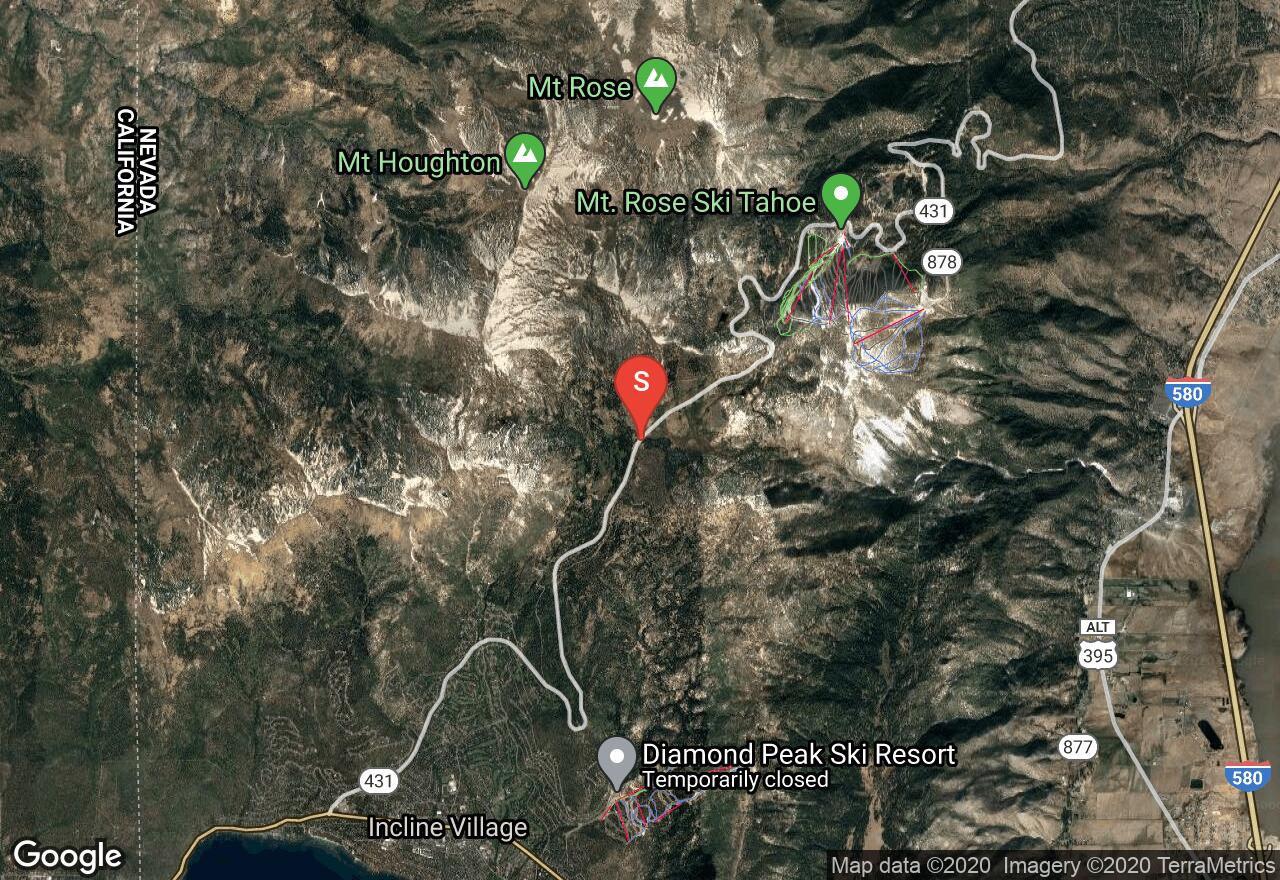
Nevada, Reno
02 :20 hrs
1.3 mi
153.073 ft
Moderate
One of very few routes that is a dedicated snowshoeing path, this route up to Chickadee Ridge is a favorite among snowshoers. This is a short path with few obstacles and lots of trees. The route starts out on a slight decline, but the stretch to the ridge is a tough 17% with some sections as steep as 35%, so be prepared to do a little climbing!
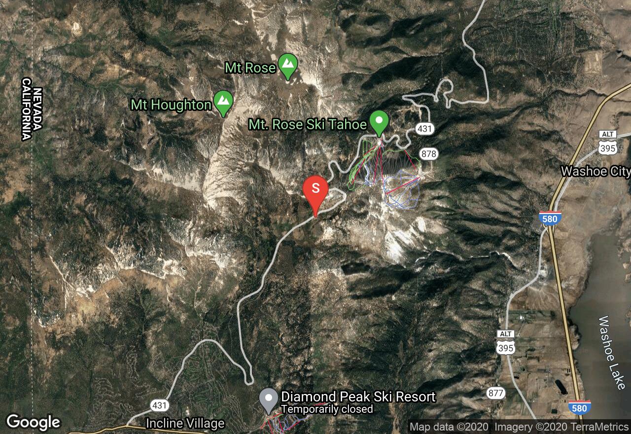
Nevada, Reno
00 :47 hrs
1.3 mi
13.560059 ft
Easy
Making its way around the Tahoe Meadows, this path is a constructed trail that gives information on local flora and fauna as you make your way through the meadow. With very little change in elevation, this is a great place to bring younger adventurers for a day in the wild.
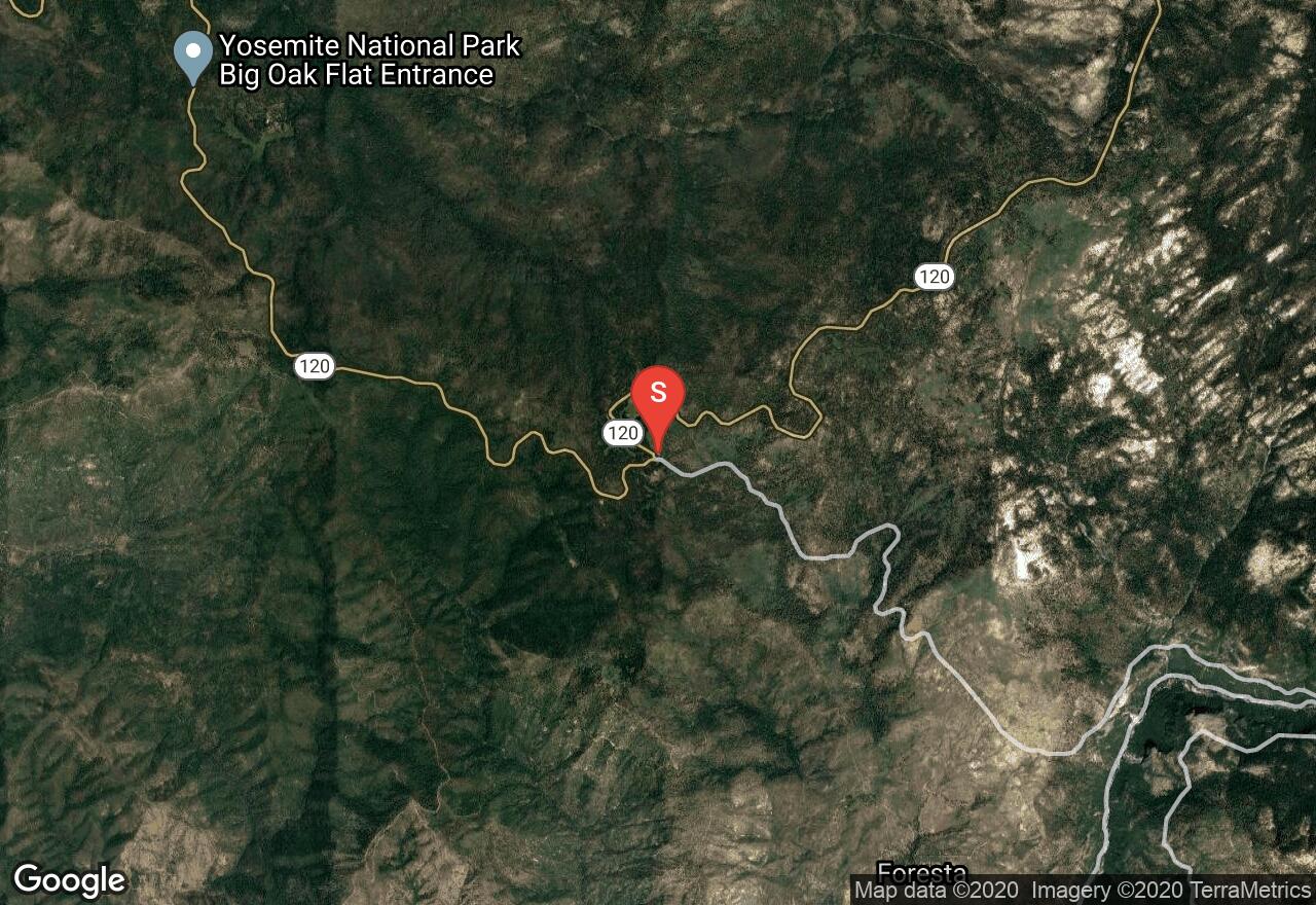
California, Mariposa County
01 :54 hrs
3.4 mi
34.20227 ft
Moderate
Located in Yosemite National Park, Crane Flats Loop winds through open meadows and forests as it makes a loop around Crane Flat Campground. Winter road closures are typical in Yosemite National Park, check with the park on the most up to date information on road closures.
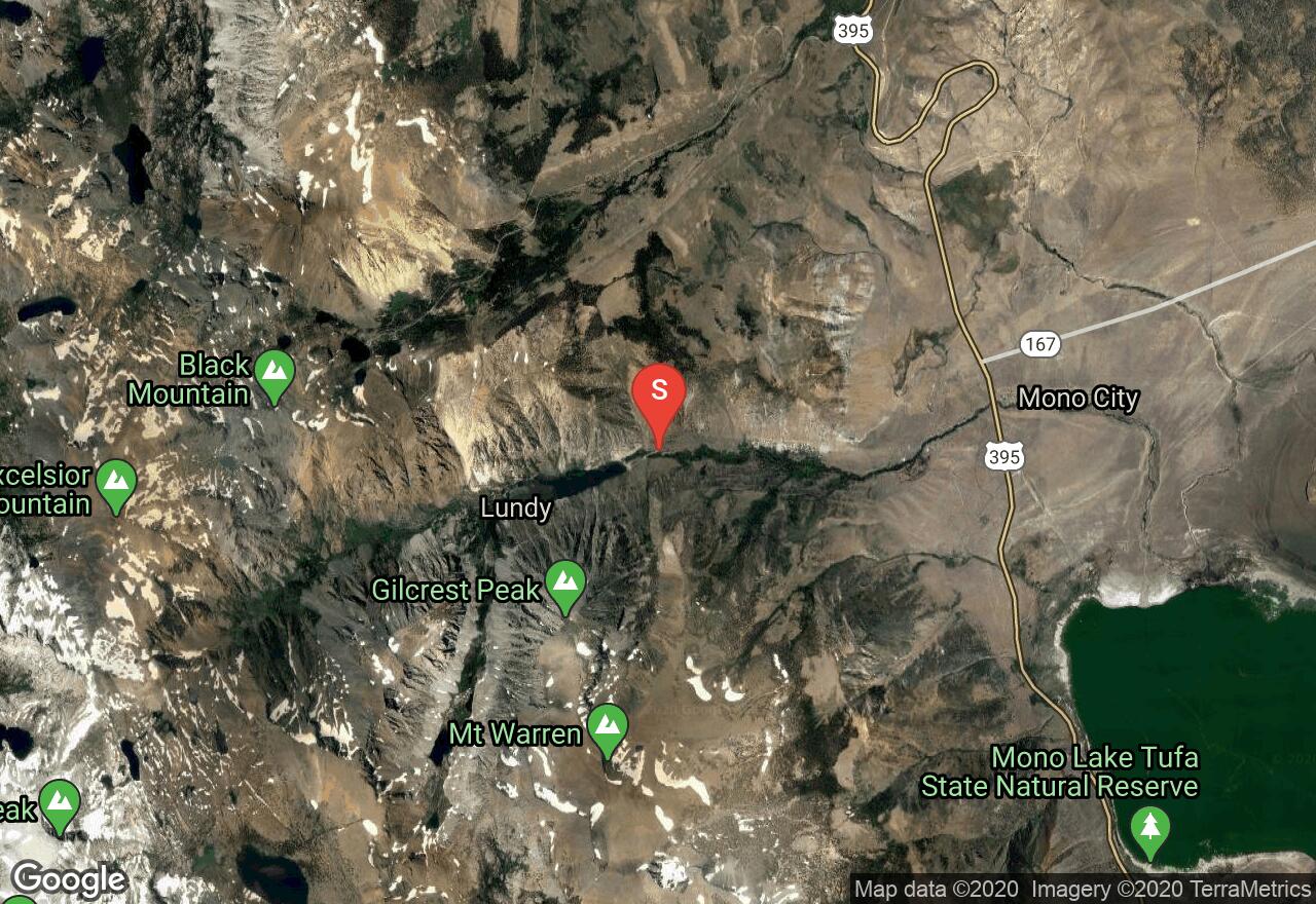
California, Mono County
08 :33 hrs
4.5 mi
668.6804 ft
Expert
Beginning from Lundy Lake, the trail to Oneida Lake skirts the outer edges of Lundy Lake while following an old dirt mining road through a an aspen grove and brush. Soon the trail veers left and ascends through a pine forest and between rugged rocky mountains and ridges where three lakes are stringed together by South Fork Mill Creek: Blue Lake, Crystal Lake, and Oneida Lake. The trail crosses the creek at 2.3 miles. Check with Toiyable and Inyo National Forest for avalanche danger information.
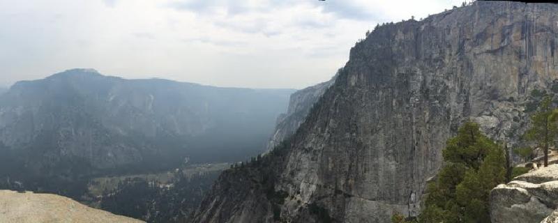
California, Mariposa County
04 :50 hrs
2.5 mi
815.92847 ft
Hard
Yosemite Falls is the tallest falls in North America at an impressive 2,425 feet. The trail to Yosemite Upper Falls has steep sections containing switchbacks. There are steep drop-offs to the east of the trail and therefore it is important to stay on trail; the trail is well maintained and this should not be an issue. In exposed sections there are metal railings in place to enhance trail safety. The vegetation along the trail consists of large shrubs and trees in some places, but it is mostly exposed which allows for excellent views of Yosemite Valley, Half Dome, and Yosemite Falls. A platform was constructed at the mouth of upper falls allowing for remarkable views that would otherwise not be seen.
Nevada, Mount Charleston
01 :49 hrs
1.1 mi
293.64282 ft
Moderate
Among relatively few trails in Southern Nevada, Mary Jane Falls trail culminates in its destination at a beautiful waterfall (less water in summer months). Picturesque in nature, this hike is a favorite of local hikers because the temperature tends to be below that of the surrounding desert. With some fairly steep passages, this is not a trail for beginners.
See more adventures..
Explore complete list
Explore nearby adventures

