Best Road Biking in North Carolina
Trying to find the best road biking in North Carolina? Bivy has great hiking, biking, paddling, climbing, skiing, riding and more, with hand-curated trail maps, as well as detailed driving directions.
North Carolina, Dare County
04 :49 hrs
48.1 mi
1.8647802 ft
Expert
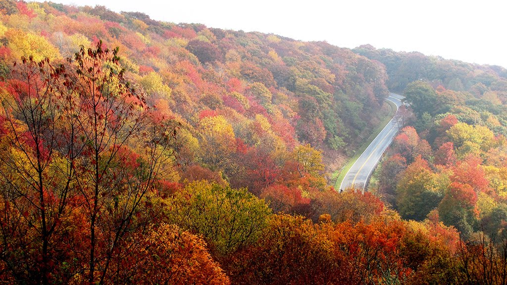
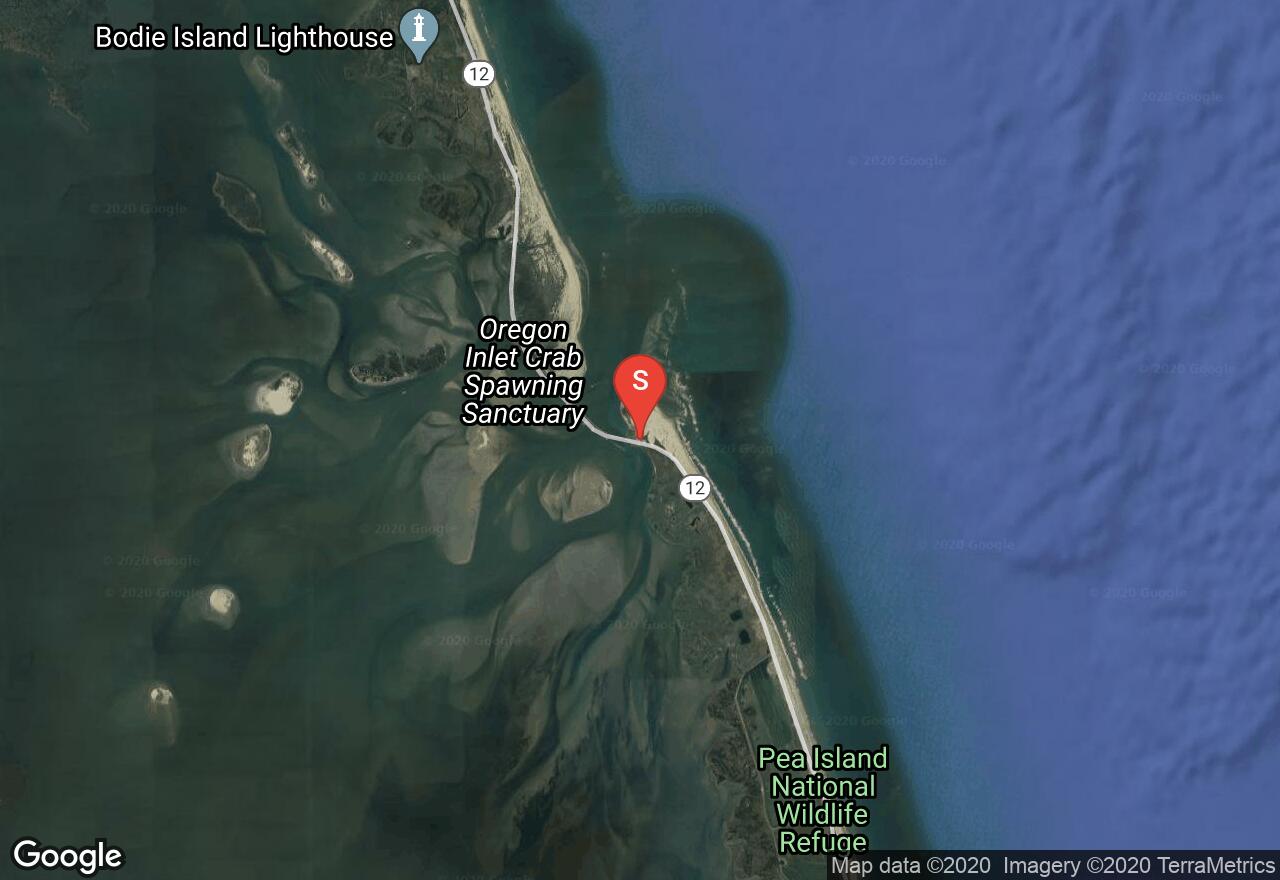
This one-way ride begins at Nags Head and follows Cape Hatteras National Park Road south along the coast to the tip of the cape on Hatteras Island. Most of the ride is along quiet coastlines with only sections of beach towns to ride through. The route mainly has the ocean to one side and the Pamlico Sound to the other. The ride heads south until the very end of the ride when it follows the road west until it ends. For a great view of the lighthouse, just follow a side road south when the road turns west.
North Carolina, Jackson County
01 :52 hrs
9.6 mi
155.55756 ft
Moderate
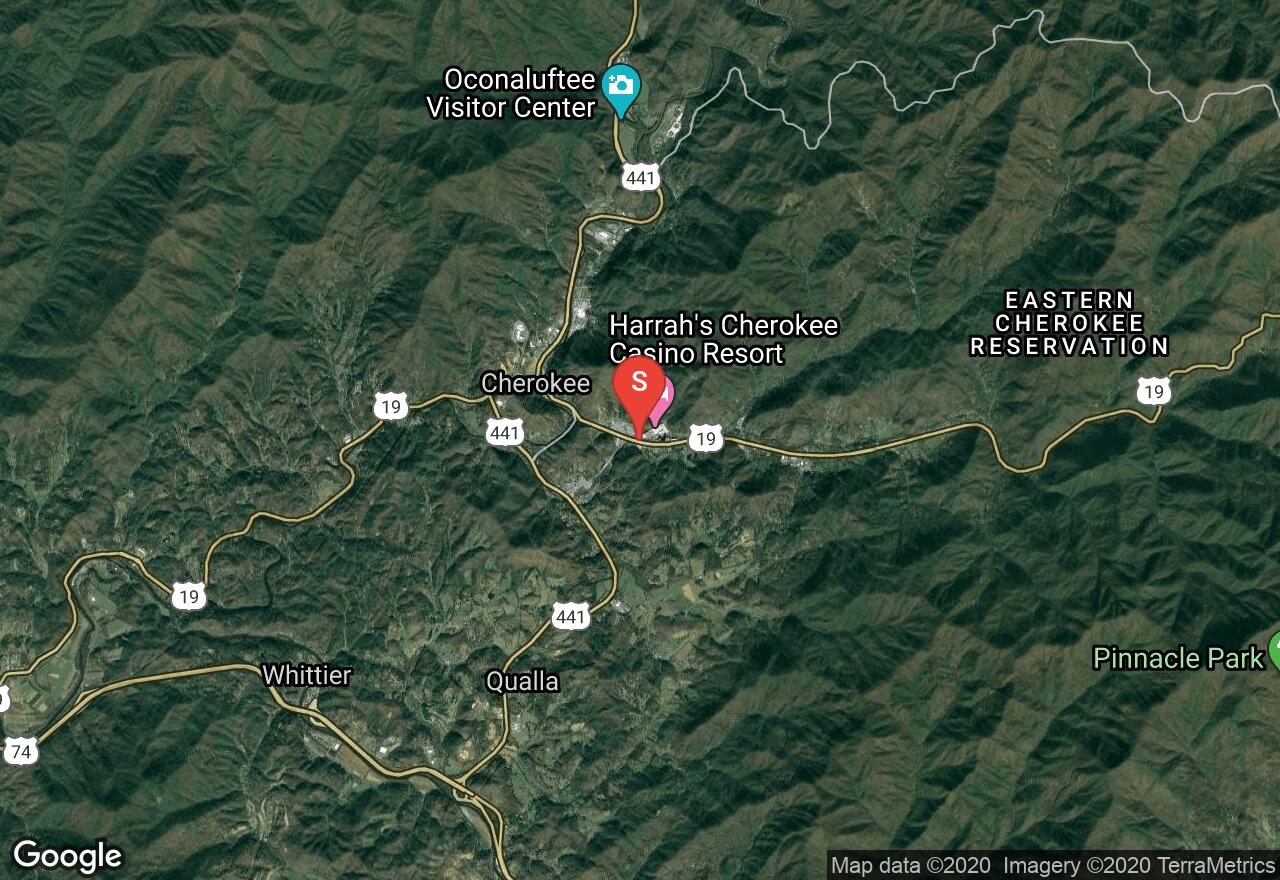
This ride begins in beautiful Cherokee and leads into Great Smoky Mountain National Park on an out-and-back route through a gorgeous valley. The ride is a climb alongside the Oconaluftee River on Highway 441. The return is a nice downhill and gives you an opportunity to enjoy the scenery back into town.
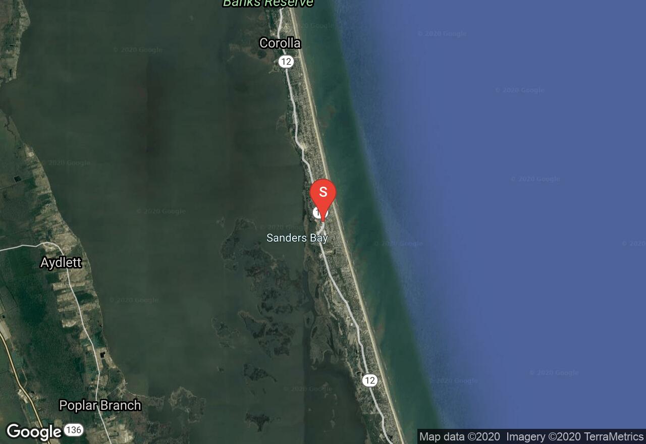
North Carolina, Southern Shores
01 :53 hrs
9.4 mi
5.62385 ft
Moderate
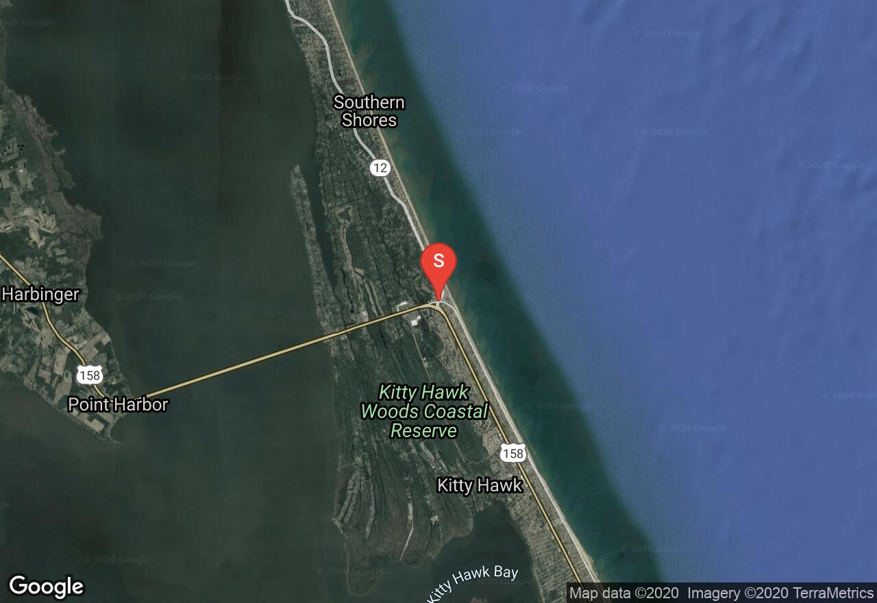
Following North Carolina 12 on the northern Outer Banks, this ride begins in the city of Duck and ride north to Sanderling Resort and then back the same route. The traffic can be busy along this stretch, but the shoulders and sidewalks along here are bike friendly. There are mainly views of the Currituck Sound along the ride, but most side roads on the ocean side can be taken for views of the surf and beach houses. If you're interested in more mileage, you can continue north to Corolla where the road ends at the beach.
North Carolina, Currituck County
00 :57 hrs
4.8 mi
2.2941618 ft
Easy
Beginning at where the Corolla Bike Path begins, this is an out and back route all the way to the ocean. The route follows the bike path from beginning to end and then joins Corolla Blvd and then Ocean Trail until it ends at the sand. Gorgeous and flat ride along the peninsula.
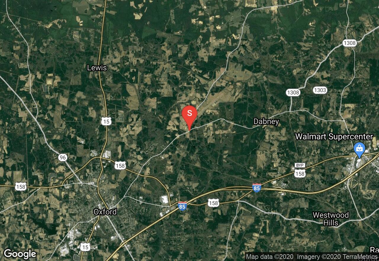
North Carolina, Granville County
07 :49 hrs
78.6 mi
77.58041 ft
Extreme
This ride encircles the beautiful Kerr Lake in northern North Carolina and southern Virginia. The route follows lightly used roads along hilly countrysides spotted with small towns and farms. This is a very peaceful ride with low traffic, around this 50,000-acre, man-made lake. The lake is situated in the northeast corner of the Piedmont region with forest-lined shores. The ride crosses the lake at Clarksville and then again at Kerr Dam.
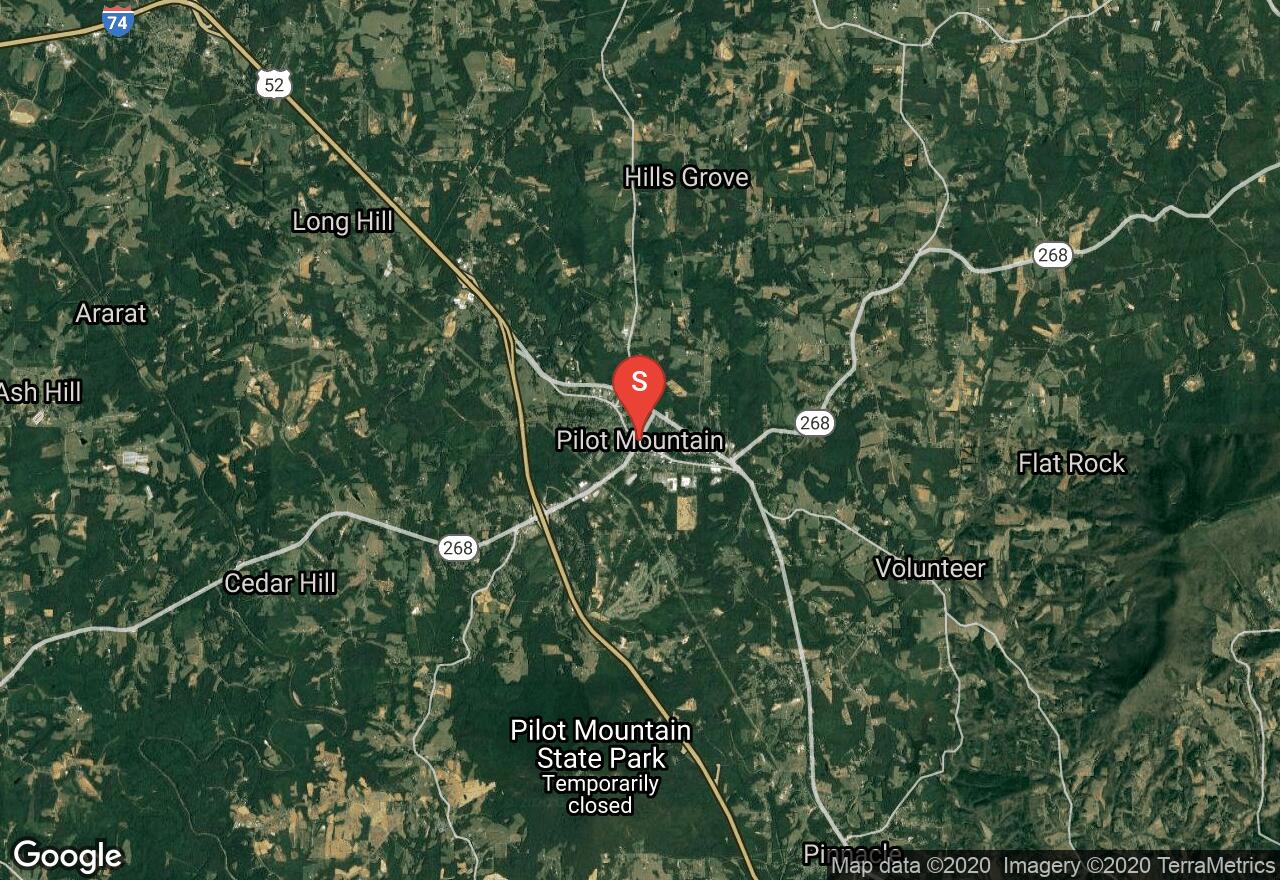
North Carolina, Pilot Mountain
04 :27 hrs
45.3 mi
140.59329 ft
Expert
This ride is a challenge, but has amazing views of the mountains and valleys from Pilot Mountain, around Sauratown Mountain and then through Hanging Rock State Park. There are some sections that are very remote with no services, but there is the town of Danbury near Hanging Rock to rest. The route has many steep, but short hills and they also offer the great views and some fun descents.
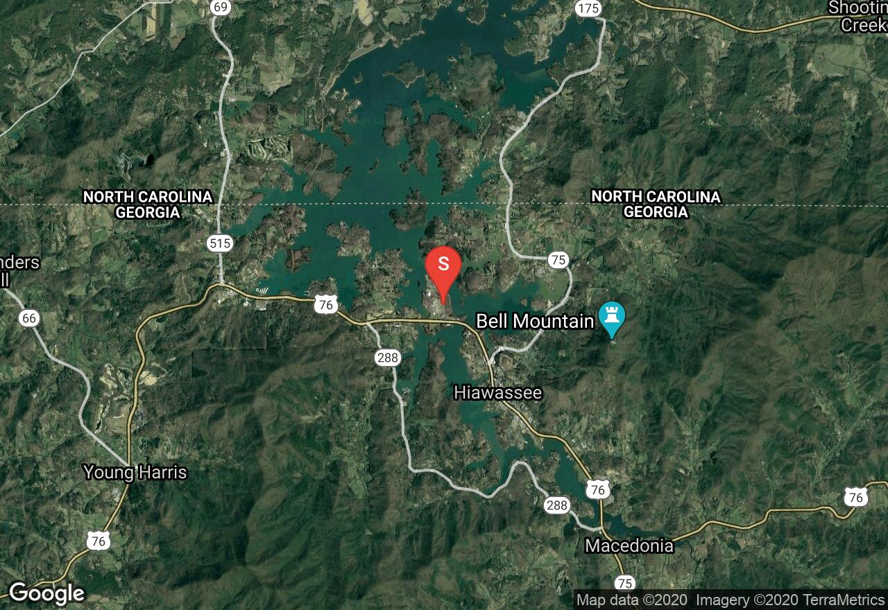
Georgia, Towns County
03 :31 hrs
36.2 mi
336.7282 ft
Hard
This scenic ride takes you around Georgia’s highest mountain, Brasstown Bald on a strenuous rolling mountain course. There are some fairly tough sections on this route, but the spectacular mountain scenery payoff is worth it. Be apprised that there is an option for a 12-mile loop if you take highway 288 near Macedonia.
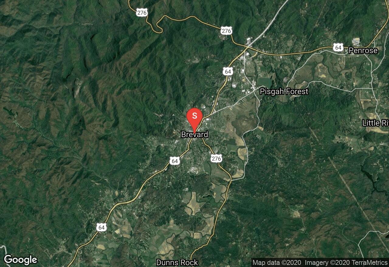
North Carolina, Brevard
04 :03 hrs
40.5 mi
100.5365 ft
Expert
Along most of this route is the beautiful French Broad River as it cuts through a scenic valley. The ride is not overly difficult and has great views of the mountains as it goes along pastures on country roads. The route leaves from Brevard and goes through Henderson and Transylvania counties along the river.
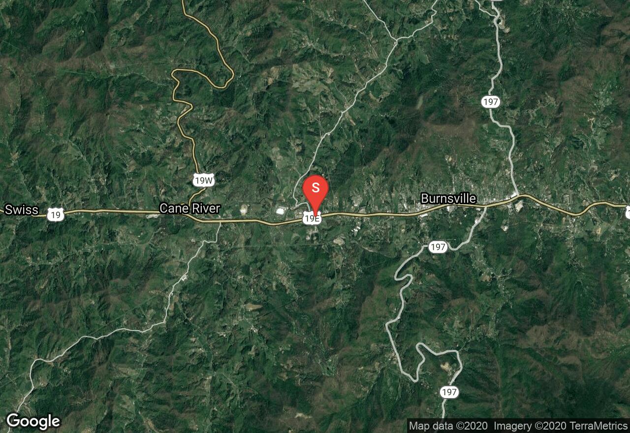
North Carolina, Yancey County
03 :44 hrs
37.4 mi
179.8667 ft
Hard
Right in the heart of the Blue Ridge, this ride is gorgeous and challenging through the river canyons of Jack's Creek and then Toe River in Yancey County. The route has very little traffic, making the sounds of the rivers and the wildlife a perfect soundtrack. The ride begins as it goes next to fields and then along Jack's Creek until it intersects with Toe River. For the remainder of the ride, the road cuts through the valley made by the river and next to railroad tracks for a section. This is a large loop ride with little to no services along the way.
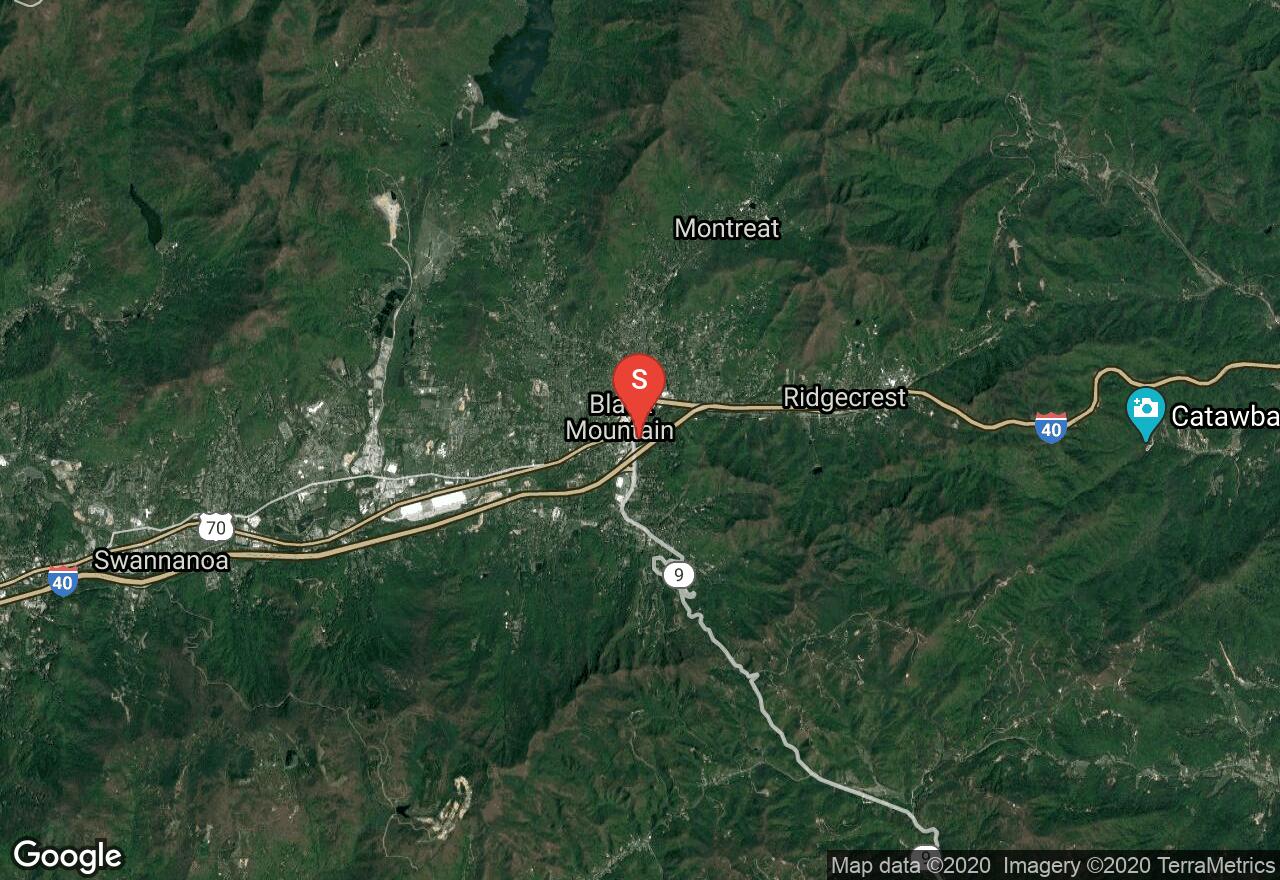
North Carolina, Black Mountain
01 :25 hrs
7.7 mi
309.4454 ft
Moderate
A gorgeous ride through Pisgah National Forest, this route follows the Old NC 10/Highway 70 route through the Royal Gorge. As the ride follows the old highway, the first section parallels I-40 and is still used by automobiles. When the old highway meets the Royal Gorge, it turns into what is now Point Lookout Trail where cars are no longer allowed. The trail is paved and cuts above the gorge for amazing views. The turnaround point for this route is at Old Fort Picnic Area. This is an out-and-back route that is mostly downhill there and thus a climb to return. You can easily start from the picnic area for a climb first and a downhill back.
See more adventures..
Explore complete list
Explore nearby adventures

