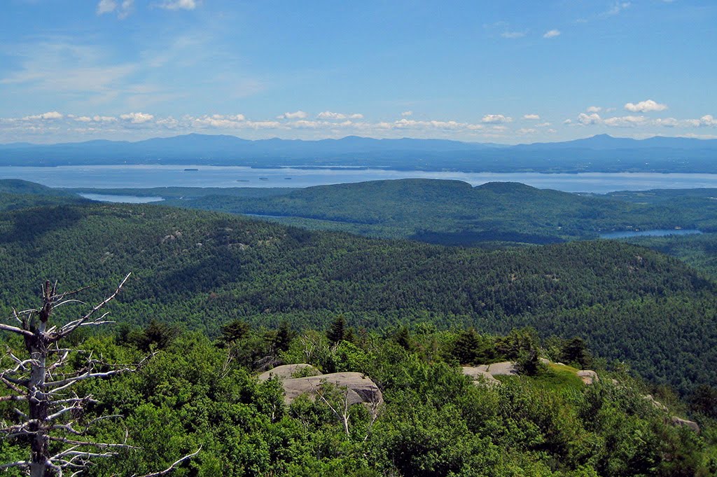
Best Climbing in Vermont
Trying to find the best climbing in Vermont? Bivy has great hiking, biking, paddling, climbing, skiing, riding and more, with hand-curated trail maps, as well as detailed driving directions.
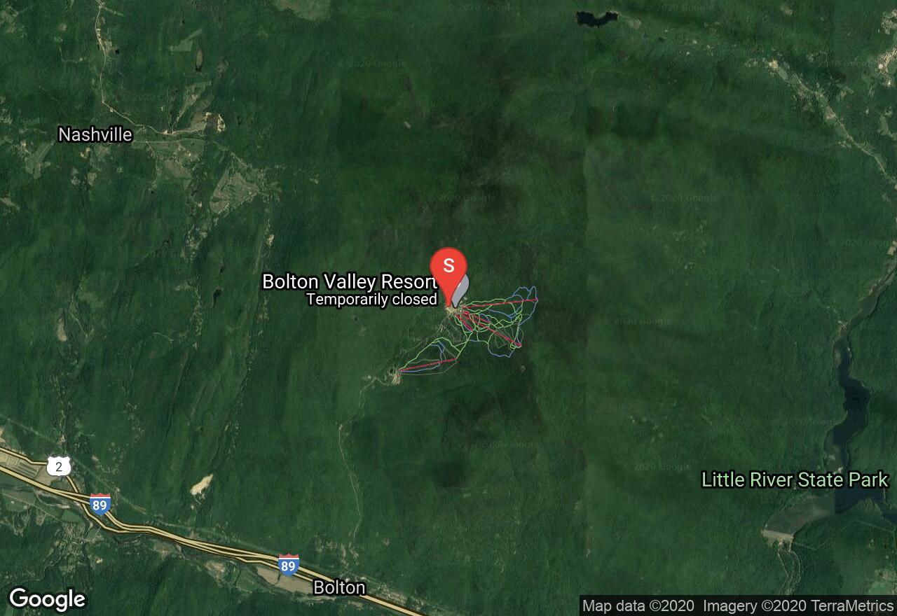
Vermont, Chittenden County
02 :47 hrs
5.8 mi
756.2539 ft
S2
The Bolton Trapp Tour is one of the most popular sections of the longer, 300-mile Catamount Trail, and is also the most challenging section. This scenic tour begins from the Bolton Valley Nordic Center and crosses over the shoulder of Bolton Mountain and descends into Nebraska Valley ending at the Trapp Family Lodge. Park at the Bolton Valley Ski Area parking lot to begin. Park a vehicle at the TRapp Family Lodge if you arranged a parking agreement from the owners, otherwise have a vehicle parked at a small plowed pullout area near the lodge. You must purchase a cross-country ski ticket from the Bolton Valley Nordic Center where the trail begins before starting your tour.
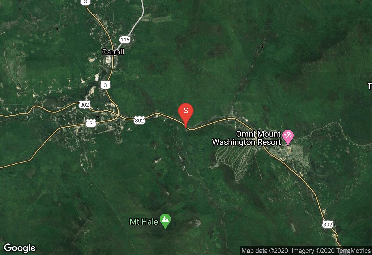
New Hampshire, Coös County
08 :52 hrs
19 mi
405.0631 ft
S2+
This classic north to south traverse through the Pemigewasset Wilderness is classic long-distance backcountry ski tour in New England. Begin from the plowed parking lot on the north side of the Zealand Campground. The terrain is moderate, and travels through wilderness areas along old logging railroads. Enjoy the serenity of the the wilderness as you follow rivers and pass waterfalls enroute to reaching your destination at the Lincoln Woods Trailhead/Visitor Center. To begin, ski along on the unplowed Zealand Road (shown here), or take the Spruce Goose Trail to reach Zealand Trail. After reaching Zealand Trail, it is another 2.7 miles to the AMC Zealand Falls Hut. From the hut, continue south to Thoreau Falls Trail. Connect to the Wilderness Trail that links into the Pemi East Side Trail leading to your destination.
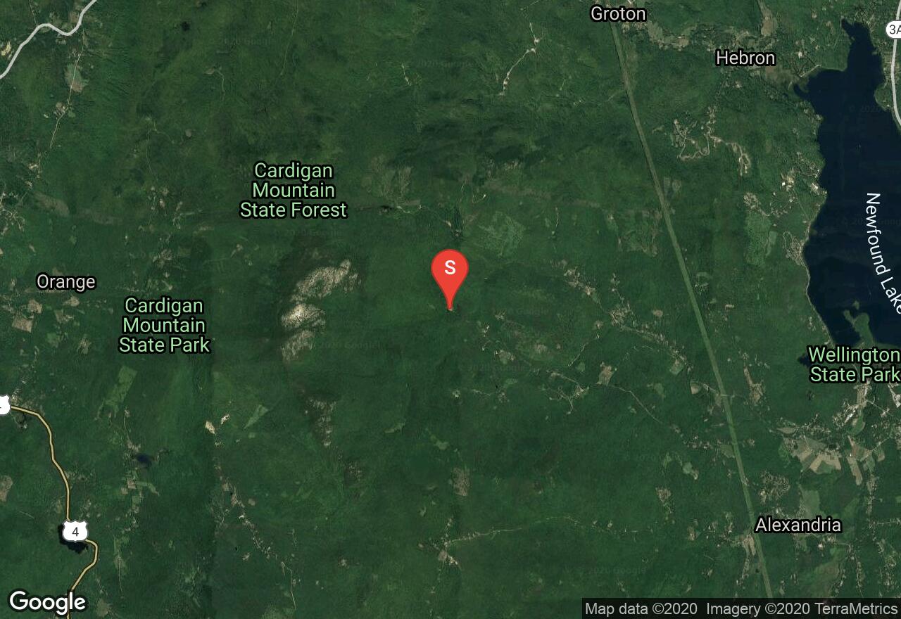
New Hampshire, Grafton County
02 :34 hrs
4.6 mi
518.45996 ft
S2+
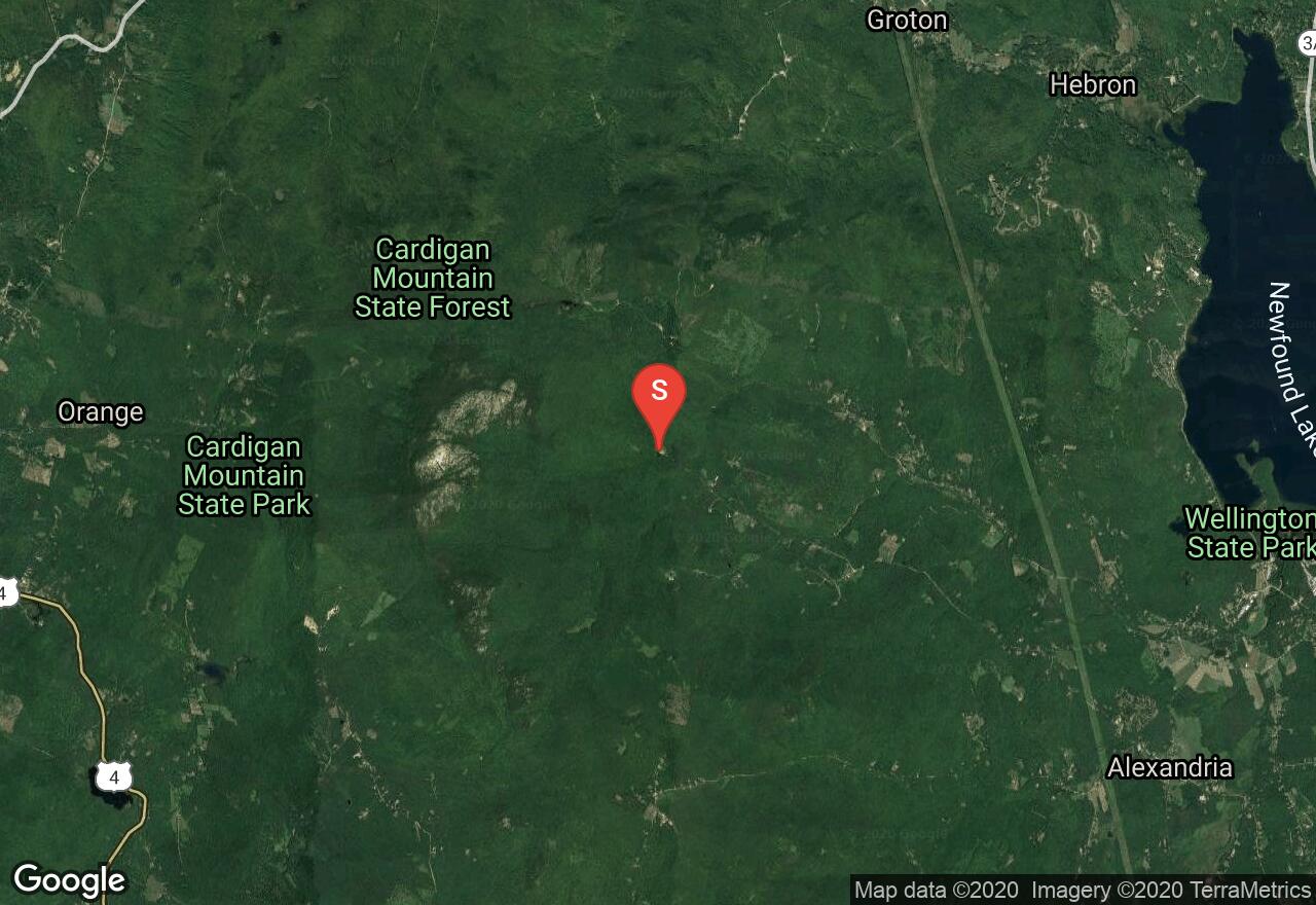
Located on the east side of the Cardigan summit ridge, this classic route descends down to Appalachian Mountain Club’s Cardigan Lodge. Drive to the end of Shem valley Road and park at the Cardigan Lodge. From the lodge begin on Holt Trail, after reaching the “grand Junction”, continue straight ahead to merge onto the Alexandria Trail. From PJ Ledge, continue to ascend to the summit via Clark Trail. Depending on snow levels, the summit cone may or may not be skiable and may require crampons to reach the true summit. Descend via Clark Trail to meet up with Alexandria Trail which offers lots of turns down sustained and steeper terrain. After reach the Grand Junction on your descent, you can either finish back to the lodge via the Holt Trail, (continue straight), or turn right onto the unmarked but well established Kimball Trail which is marked with blue blazes. After an easy ascent to a clearing upon a knoll, the Kimball Trail heads east through a softwood forest ending back at the lodge.
New Hampshire, Grafton County
02 :37 hrs
4.7 mi
516.74194 ft
S2+
Mount Cardigan Via Duke's and Alexandria Ski Trail Located on the east side of the Cardigan summit ridge, this classic route descends down to Appalachian Mountain Club’s Cardigan Lodge. Drive to the end of Shem valley Road and park at the Cardigan Lodge. From the lodge begin on the Manning Trail. From the top of the pasture connect with Duke’s trail and continue to ascend to it’s end on open snowfields back to the Manning Trail. Some skiers opt to start their run from here and follow ascents tracks back down. Others decide to continue their ascent to the Firescrew summit via the Manning Trail following the yellow blazes. From the summit enjoy great views before following your ascents tracks back down to the lodge. For those looking for a longer tour, continue via Mowglis trail to the true summit of Mount Cardigan. From here, descend via Clark Trail to meet up with Alexandria Trail which offers lots of turns down sustained and steeper terrain. Link into the Holt Trail to make it back to the lodge.
Vermont, Orleans County
04 :06 hrs
3.6 mi
382.68353 ft
S2+
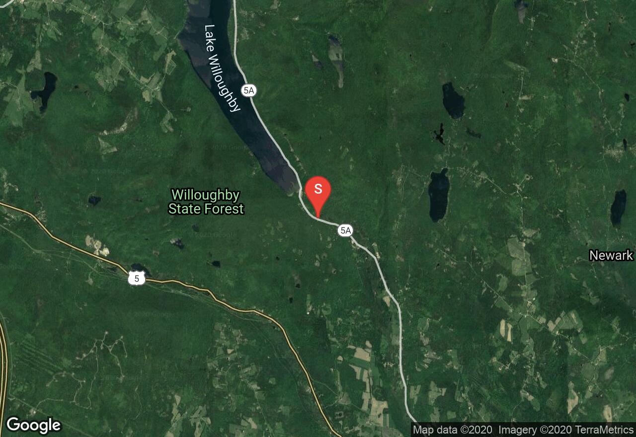
This route to the top of Mount Hor offers moderate terrain with multiple vista points, all of which are unique and offer impressive views of the surrounding wilderness. Begin from the parking area on VT 5A and ski on the wide CCC Road which is usually groomed. Ascend the terrain for about 200ft before rounding a right hand bend at the junction and head west. Enjoy the vistas as you make your way to the Willoughby State Forest sign at 1.8 miles. Head right and link onto Herbert Hawkes trail following blue blazes. After reaching the next junction, you have two options, head south to the southern summit of Mount Hor, or head north (right) to the North Lookout which offers views of Bruke Mountain and the stunning views of the ice cliffs pouring over Mount Pisgah. To return, follow your tracks back to VT 5A.
Vermont, Windsor County
03 :00 hrs
6.1 mi
194.54224 ft
S2+
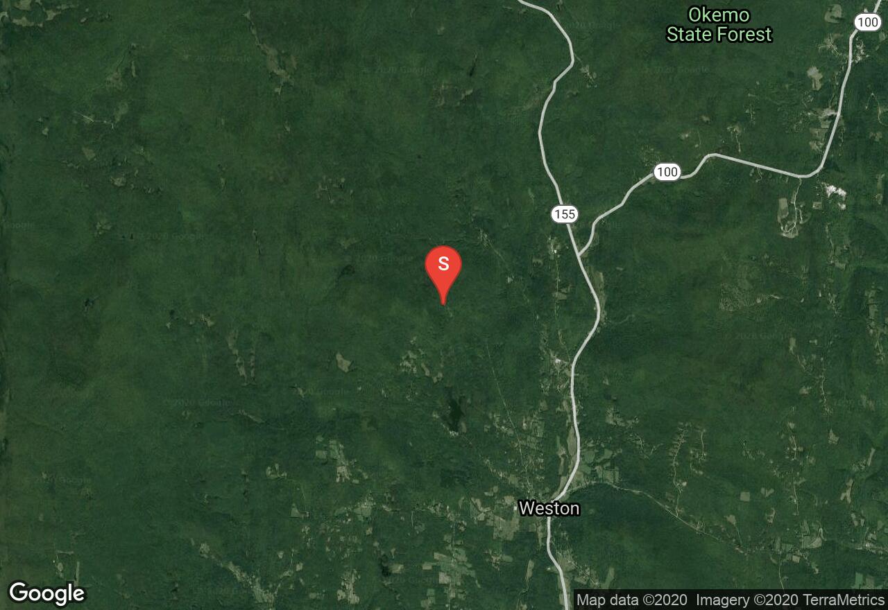
Located within the Green Mountain National Forest the Root Beer Bridge Trail offers a long moderate descent after a short but steep uphill. Begin from the parking area along Moses Pond Road and ski along the unplowed road which doubles as a snowmobile trail. From the three-way intersection follow the Root Beer Bridge Trail loop clockwise (shown here), or counter clockwise (harder option with more uphill). For the uphill section of this trail, good wax and some solid herringbone skills will get to the top after which you get to enjoy the moderate descent. After finishing the loop, follow your tracks back along the unplowed road/snowmobile trail back to your vehicle.

New Hampshire, Grafton County
02 :39 hrs
1.9 mi
489.93274 ft
S2+
Located on the east side of the Cardigan summit ridge, this classic route descends down to Appalachian Mountain Club’s Cardigan Lodge. Drive to the end of Shem valley Road and parka t the Cardigan Lodge. From the lodge begin on the Manning Trail. From the top of the pasture connect with Duke’s trail and continue to ascend to it’s end on open snowfields at the Manning Trail. Some skiers opt to start their run from here and follow ascents tracks back down. Other decide to continue their ascent to the Firescrew summit via the Manning Trail following the yellow blazes. From the summit enjoy great views before following your ascents tracks back down to the lodge. The descent features a long traverse with lots of room to carve some turns.
Vermont, Addison County
01 :43 hrs
4.1 mi
169.72168 ft
S2+
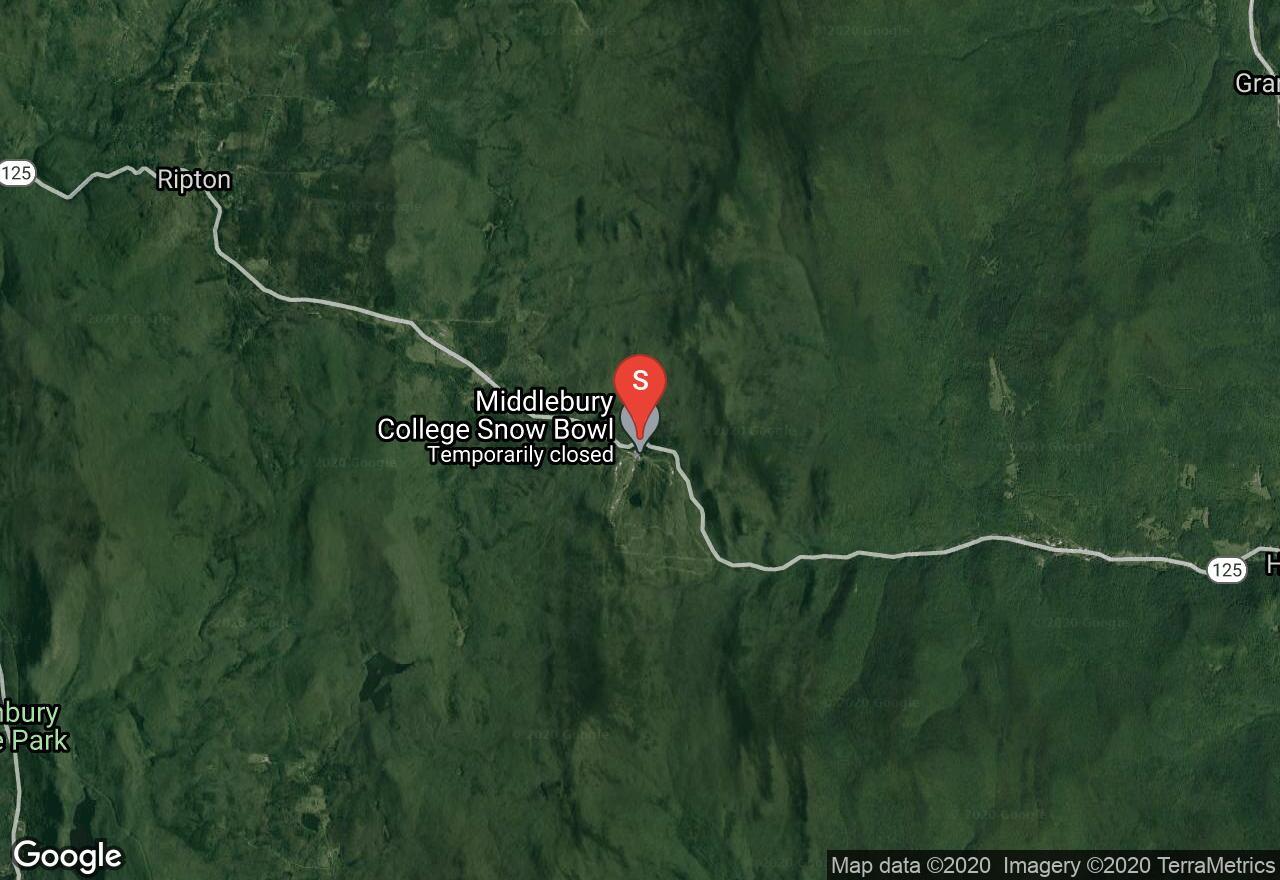
This backcourntry ski route begins at Middlebury College Snow Bowl and travels through mixed forest terrain with gentle downhill descents ending near the Rikert Ski Touring Center. The trail is maintained by the U.S. Forest Service. The trailhead begins directly opposite from the Middlebury Snow Bowl with a clearly visible sign marking the trail. There are the occasional blue blazes to mark the route, but overall these are unneeded as the trail itself is wide enough to follow and usually has regular traffic to mark the trail. At about 2 miles after traversing and descending slightly the trail crosses over the boundary of the Breadloaf Wilderness and links into the Burnt Hill Trail to the left. Follow this trail to the end at the unplowed road (FR59). This is a one-way route.
New Hampshire, Grafton County
06 :16 hrs
5.8 mi
290.229 ft
S2
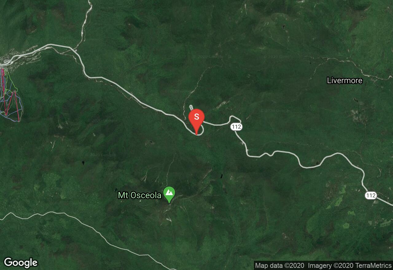
Begin this tour of the Greeley ponds and the Kancamagus Brook Ski Trail 4.7 miles east of the Lincoln Woods Visitor Center at a small parking area. Follow the Greeley Ponds Ski trail on the right and continue to the intersection of the Greeley Ponds hiking Trail which comes in from the left. After reaching the Upper Greeley Pond, either ski across the frozen pond or follow the trail on the west side and continue to the Lower Greeley Pond. Descend down a old logging road to reach the junction of Kancamagus Brook Ski Trail. Head left and ascend 1,000 feet in 3.2 miles along an old logging road through the forest. Towards the top, the trail levels and meanders through some wetlands. Enjoy views of Mount Tripyramid before following your ascent tracks back to the trailhead.
Vermont, Orleans County
00 :38 hrs
3 mi
682.62585 ft
S4-
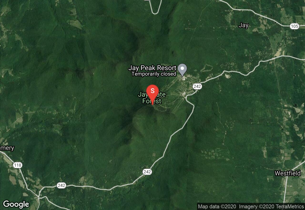
This popular backcountry powder run descends off the steep east face of Big Jay Mountain. Park at the Jay Peak Ski Resort and purchase a lift-ticket to reach the top of Jay Peak. From here cross the ridge over to Big Jay and descend the steep flanks. Cut to the right before reaching the stream on the valley floor. Make your way through the thick tree/brush forest until finding one of the many logging roads that spit you out onto VT 242. There is a small pullout along VT 242 to park your shuttle vehicle. If you do not want to purchase a lift-ticket, you have the option of hiking in from the pullout along VT 242.
See more adventures..
Explore complete list
Explore nearby adventures

