Best Rafting in Vermont
Trying to find the best rafting in Vermont? Bivy has great hiking, biking, paddling, climbing, skiing, riding and more, with hand-curated trail maps, as well as detailed driving directions.
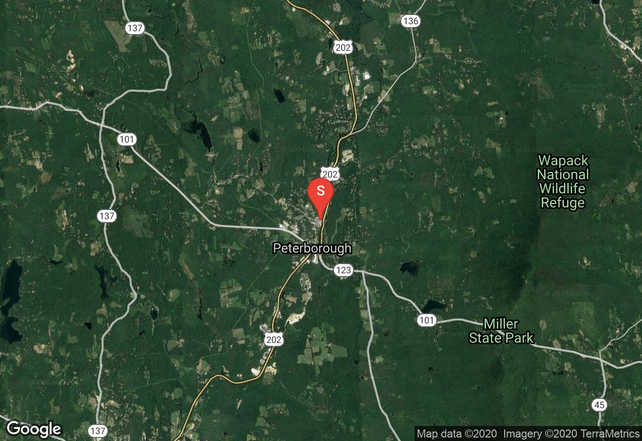
New Hampshire, Peterborough
03 :54 hrs
9.3 mi
15.003143 ft
I
This is nice paddle beginning in Peterborough; it wanders out of town into suburban and then pastoral settings ending at Powder Mill Pond. This stretch is almost always navigable and has a good blend of flat, quick and whitewater that makes it accessible for most. There is a portage along the way but it is a short one encountered at the outlet of the Contoocook Reservoir at about mile 1.8.
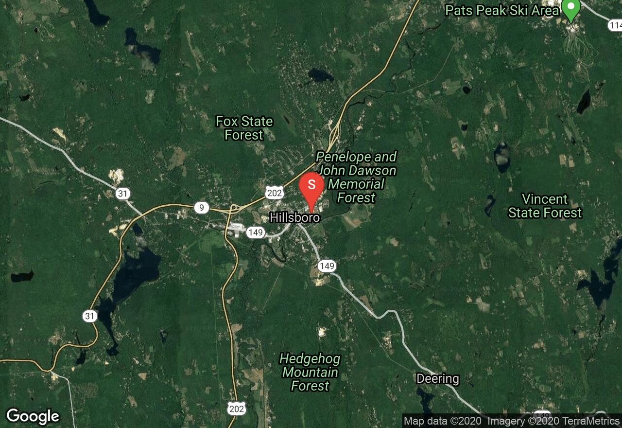
New Hampshire, Hillsborough
02 :51 hrs
7.1 mi
47.70008 ft
IV
This section of the Contoocook is among the more popular bits of whitewater in New England due to its challenging rapids and reliable flows. This outing is not for the beginner; there are many class III/IV rapids that must be scouted before attempting them; the GPS track provided does not imply a suggested course down river. Along with the challenge this float is enjoyable due to the natural condition of the riverbanks and surrounding woodlands.
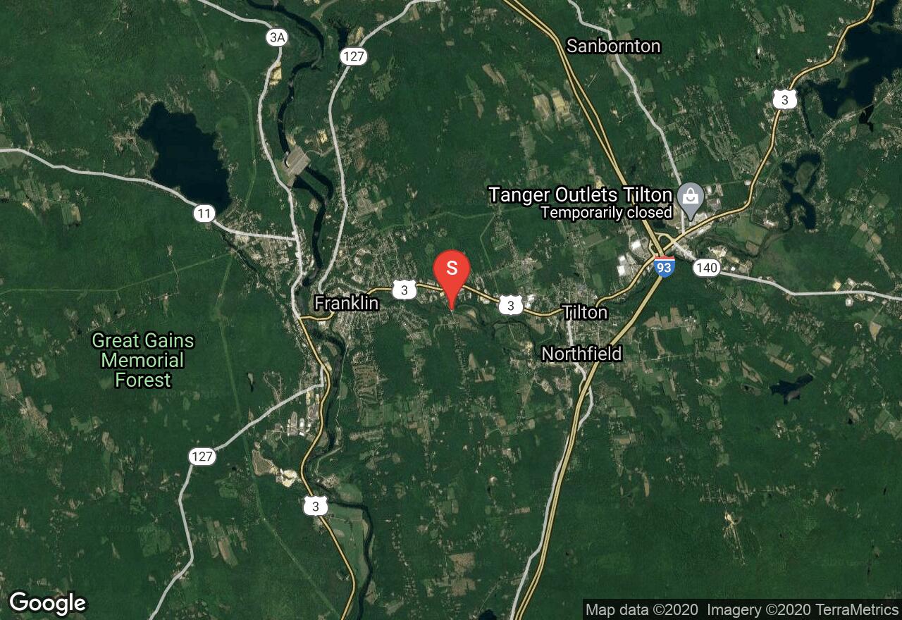
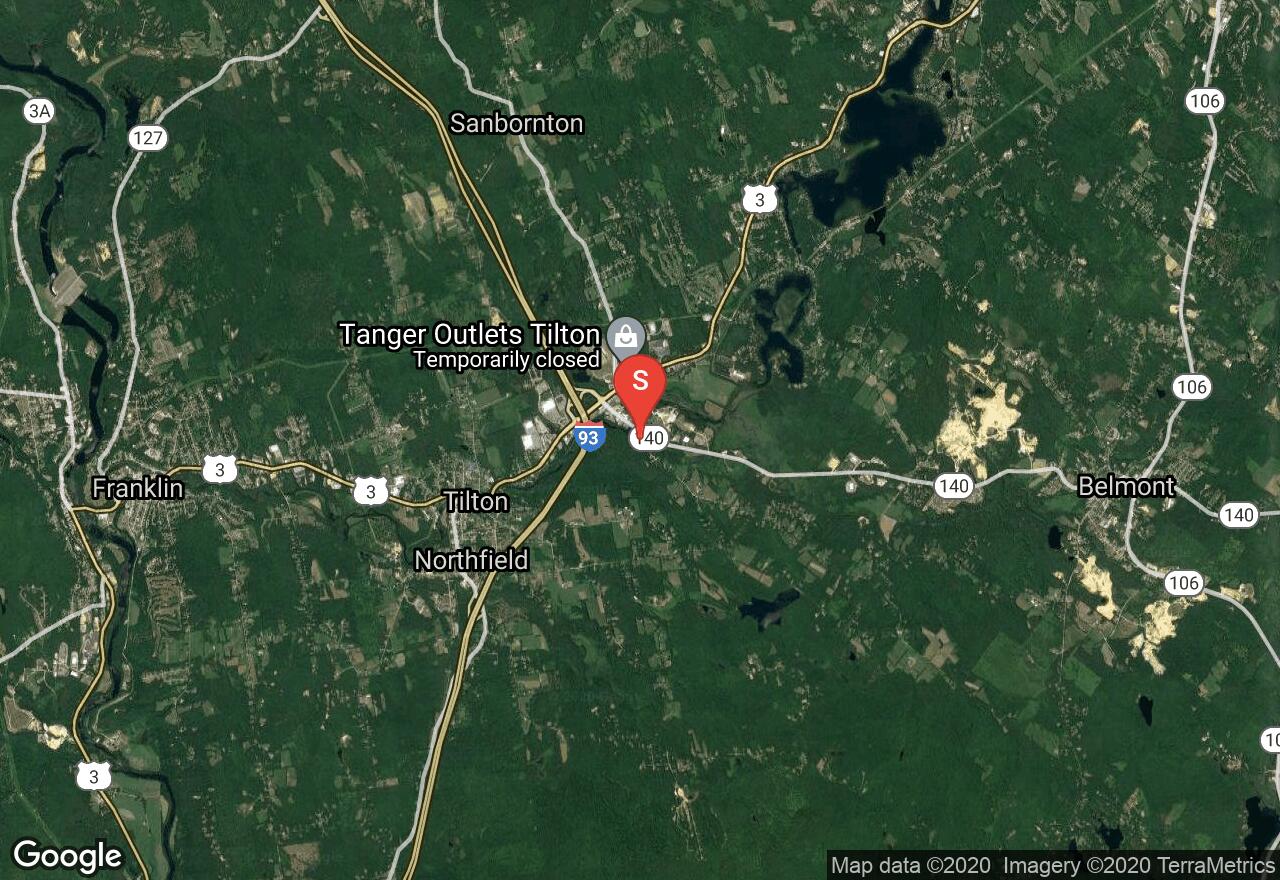
New Hampshire, Northfield
00 :27 hrs
1.3 mi
28.10131 ft
IV
This short, challenging stretch or whitewater and bounces over seven or eight rapids that range from class III to class IV depending on river flows. The surroundings of this paddle are scenic with heavily wooded banks on both sides punctuated by old dam and factory ruins. This float is of the degree of difficulty that you really should scout it before running; you can accomplish this from the Winnipesaukee River Trail that parallels the left bank. Also be aware that the GPS track provided is not intended to imply a suggested course down river.
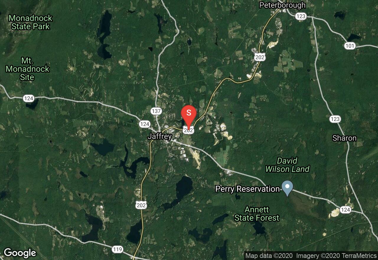
New Hampshire, Jaffrey
02 :28 hrs
6.4 mi
73.999985 ft
II
This river journey, well suited for the novice begins just below Cheshire Pond in Jaffrey and wanders through woodlands and lightly developed suburban areas. To avoid a nasty gorge that contains class IV rapids when it is runnable a long portage (quarter mile) is made at about mile 2 of the journey. There is another shorter portage at Noone on the Contoocook Reservoir.
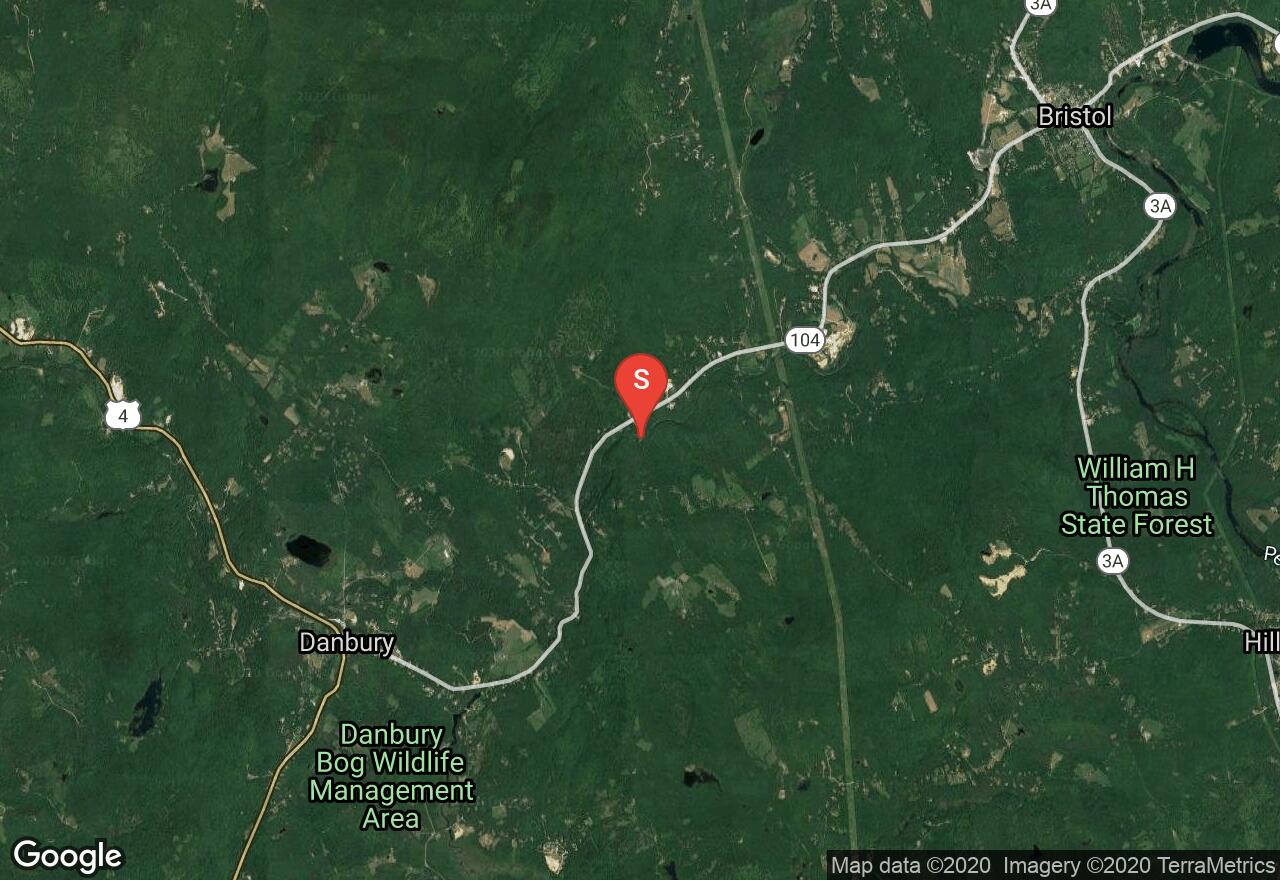
New Hampshire, Alexandria
00 :36 hrs
1.8 mi
46.986313 ft
IV
This stretch of river is certainly not for the novice but provides a few miles of class III/IV whitewater for the skilled boater. You should definitely scout this run before the descent and keep in mind that the GPS track provided does not imply the suggested course down river. Along with the challenge this adventure is also enjoyable due to the natural state of the banks and surroundings.
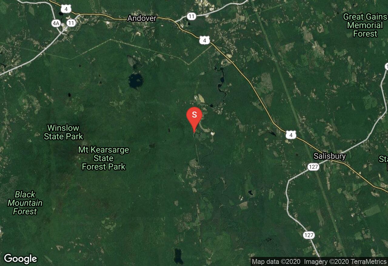
New Hampshire, Salisbury
01 :53 hrs
4.5 mi
13.799988 ft
I
This is a scenic route; this section of the Blackwater River wanders through wooded swamps in the largely undeveloped countryside of central New Hampshire. Although the current is slow, downed trees in and over the river do present a hazard. Timing for this paddle is important as enjoying it becomes difficult in low water and dangerous in highwater; late spring and falls with wet weather are usual ideal.
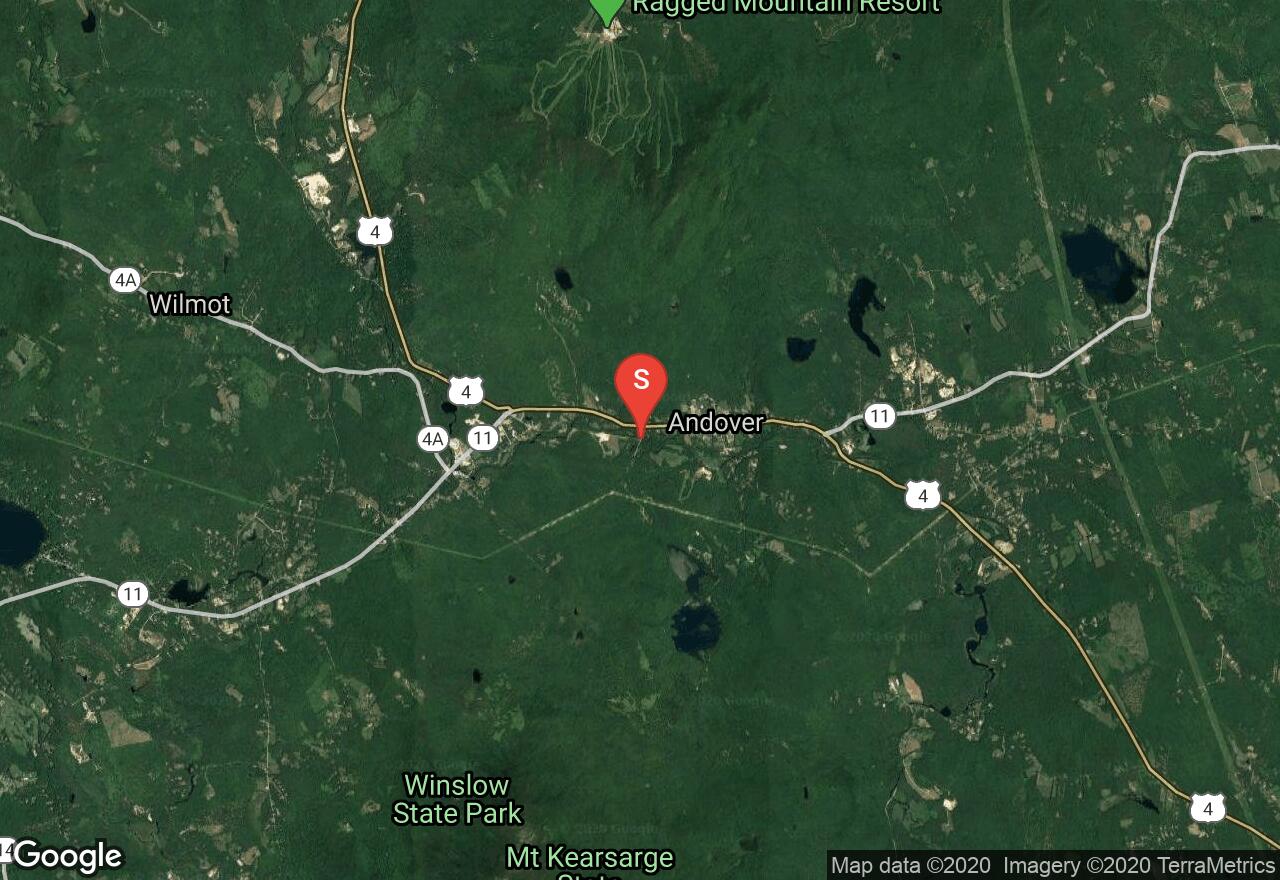
New Hampshire, Andover
03 :11 hrs
7.5 mi
8.350174 ft
I
This paddle takes you from the covered bridge in Andover through New England woodlands and wetlands. Eventually the river winds into a slack water know as The Bay and some paddling will be required. There is a short minor rapid at the end of The Bay and then the take-out will be on the left. It is imperative that the take out is made as there is a dangerous class IV rapid beginning at the bridge just beyond.
New Hampshire, Northfield
00 :55 hrs
2.2 mi
11.222595 ft
II
This short section of the Winnipesaukee River begins at the edge of Northfield and takes out just above the dam in town. The reliable flow in this bit of river makes it a good place to take beginners. The left bank exists in a fairly natural state with dense woods covering the bank. The right bank is considerably more developed.
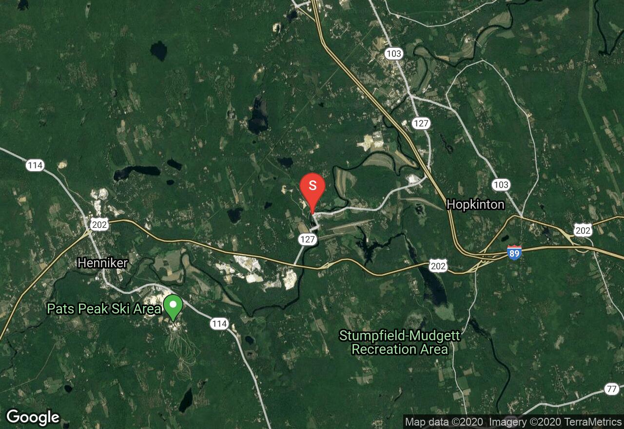
New Hampshire, Hopkinton
06 :47 hrs
16 mi
9.97551 ft
I
This long stretch of lazy river begins near the covered bridge in Rowley and wanders through farmlands and woodlands. There is a short portage in Contoocook that utilizes the Contoocook Covered Railroad Bridge. Beyond Contoocook the river travels through yet more farmland with long stretches of wooded banks. The take-out is an excellent roadside access off of Island Road.
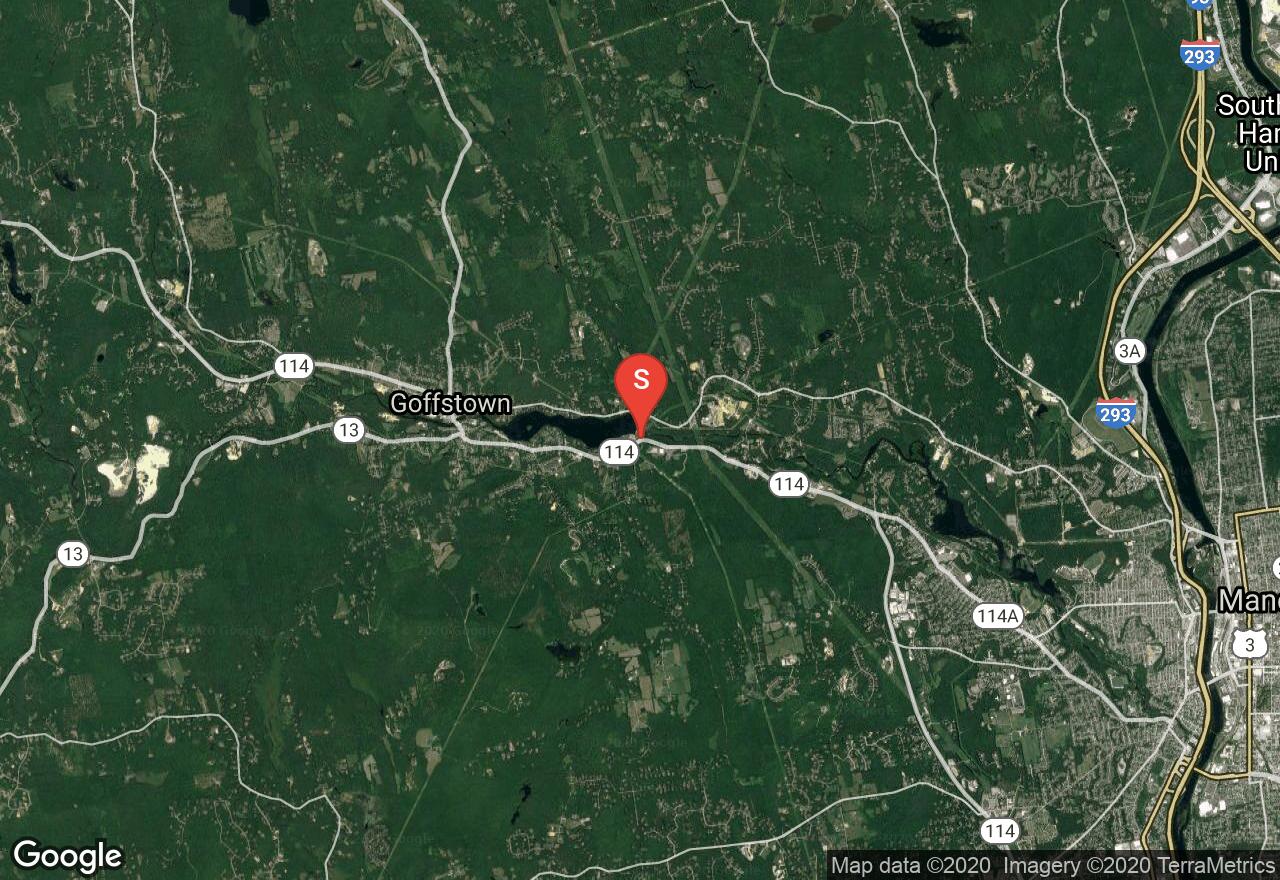
New Hampshire, Goffstown
03 :05 hrs
7.6 mi
52.503937 ft
III
This run begins in the riffle below Glen Lake Dam and starts right in with some class II rapids. Intermittent rapids continue until the Henry Bridge Road. You encounter a long section of slack water near Pinardville follow by a portage around a dam on the river left. There is another minor rapid before reaching the Merrimack River were you’ll find a take out on the left bank under the Queen City Avenue Bridge. Follow the River Walkway Recreation path to roadway access.
See more adventures..
Explore complete list
Explore nearby adventures

