Best Crosscountry Skiing in Vermont
Trying to find the best crosscountry skiing in Vermont? Bivy has great hiking, biking, paddling, climbing, skiing, riding and more, with hand-curated trail maps, as well as detailed driving directions.
Vermont, Washington County
01 :42 hrs
3.5 mi
60.452118 ft
Moderate
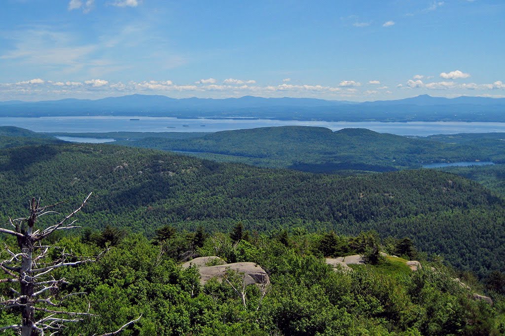
Woods, rolling hills, fields & views
Vermont, Washington County
01 :37 hrs
1.2 mi
94.78717 ft
Moderate
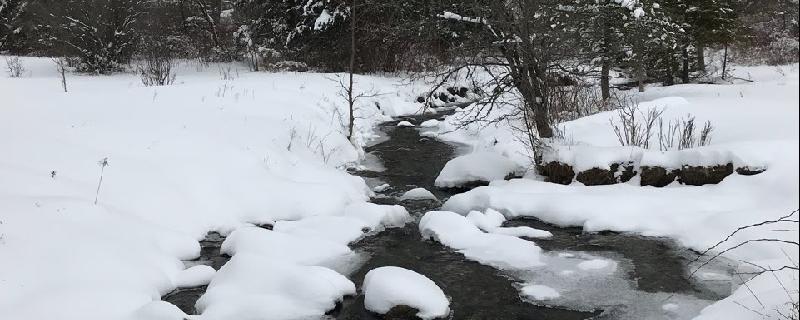
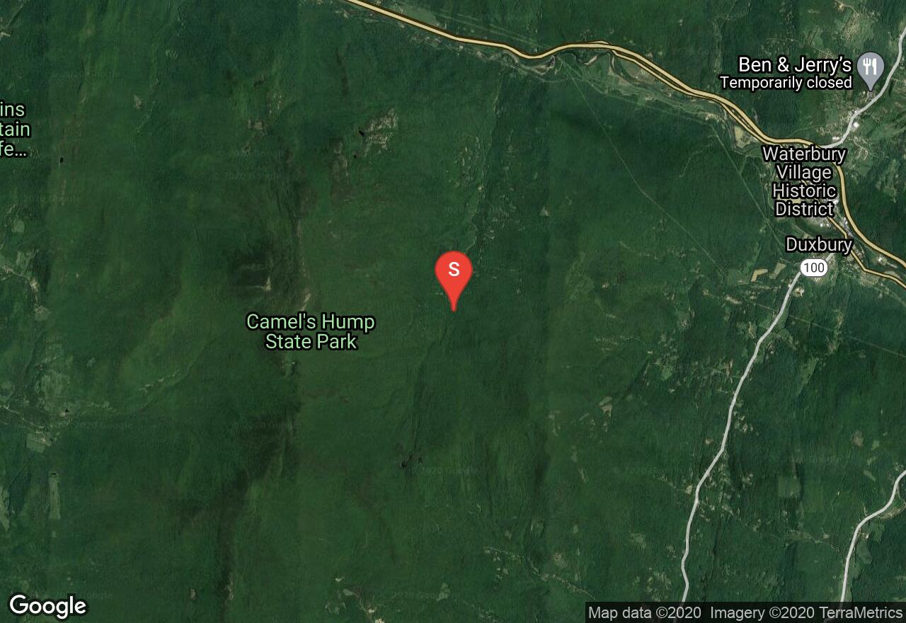
Beginning on the Camel’s Hump View Trail, follow the easy going and wide trail through the woods. You will quickly intersect with the Ridley Crossing Ski Trail. This route is sandwiched between Ridley and Sinnott Brooks and offers a pleasant winter setting with good skiing.
New Hampshire, Waterville Valley
01 :37 hrs
3.3 mi
94.28952 ft
Hard
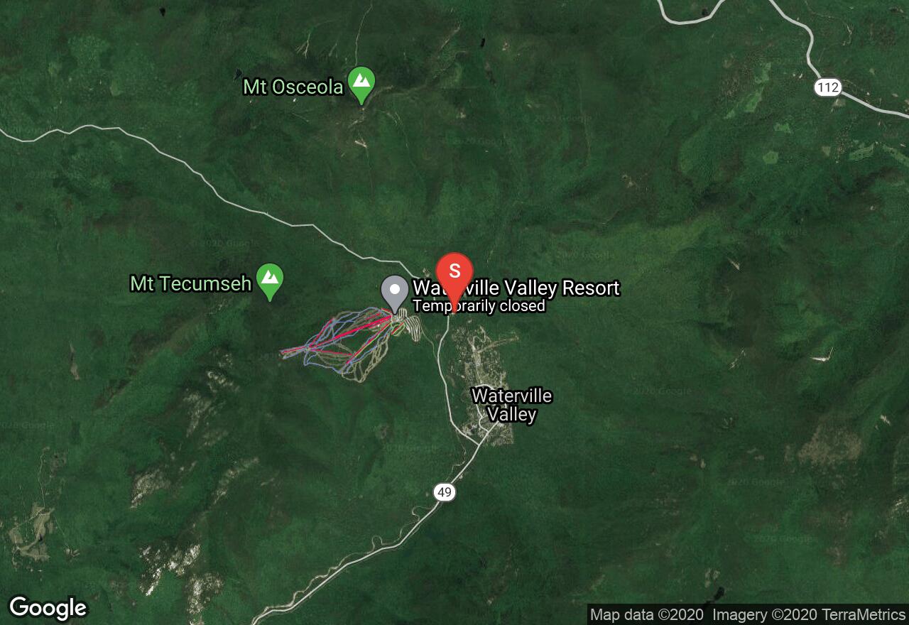
This loop in the Waterville Valley trail system offers classic double track and a skating lane in the dense woodland setting of the White Mountains. This route has a moderate climb and a quick rolling descent. The nearby Waterville Valley Nordic Center has trail passes for the area as well as rentals and lessons.
Vermont, Windham County
04 :16 hrs
3.7 mi
138.35724 ft
Moderate
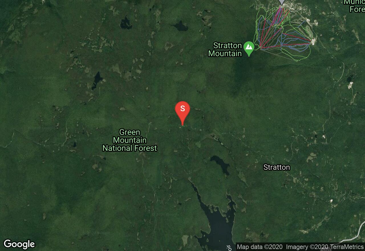
Enjoy the southern end of the Green Mountain National Forest with this ski tour to Stratton Pond. Navigate moderate terrain enroute to Stratton Pond beginning at the parking area on the north side of Stratton Arlington Road. Make your way up the road a short distance to Catamount Trail. Follow this trail as it merges onto the main Stratton Pond Trail. To return from Stratton Pond, follow your tracks back to your vehicle.
Vermont, Bennington County
04 :25 hrs
4.6 mi
108.01572 ft
Easy
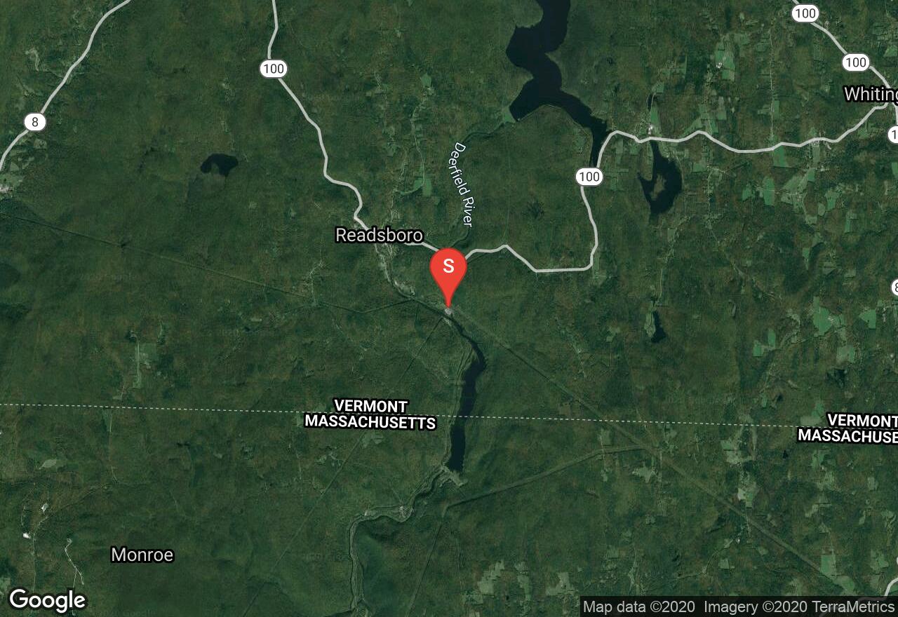
The Catamount Trail stretches the length of Vermont and is enjoyed by the public for skiing and snowshoeing during the winter months. It is divided into 31 sections crossing through the Green Mountain National Forest, Vermont State Land and some private land (that has granted trail-use permission). Beginning near the border of Massachusetts at the Harriman Station, this section is one of the easiest sections to ski. It is all flat with the exception of one short steep climb near the end that can be walked. This can be done as one-way with shuttle or out-n-back.
New Hampshire, Grafton County
03 :35 hrs
3.4 mi
134.37698 ft
Easy
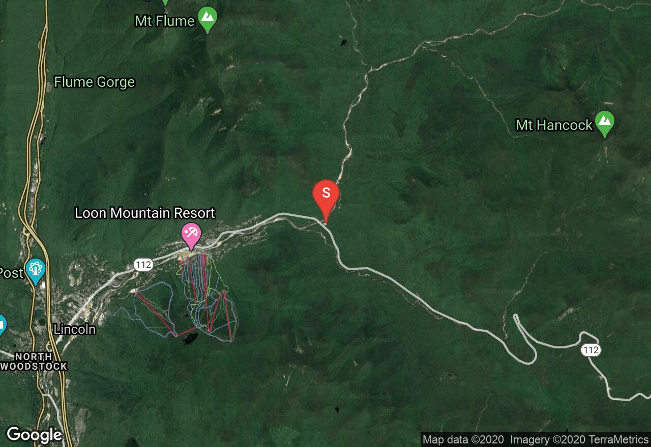
Great for beginner cross-country skiers, the Lincoln Woods Trail leads into the Pemigewasset wilderness from the Lincoln Woods Trailhead/Lincoln Woods Visitor Center parking lot. Begin by skiing across the suspension bridge and turn right onto the Lincoln Woods Trail. Enjoy mostly flat terrain on a wide trail that was once a logging railroad path. Before the trail crosses the Franconia Brook, turn left onto the Black Pond Trail. Follow your tracks back to the trailhead. If a longer tour is desired, other route options exist from the same trailhead.
Vermont, Lamoille County
01 :04 hrs
2.2 mi
43.753876 ft
Moderate
Wiessner Woods is a popular destination for winter and summer activities. Deer, Fox, partridge, thrush, owls, falcons, moose and even bear are possible wildlife you may see. There are several trails that branch off the main trail, giving you options to shorten or lengthen your adventure. All routes are signed by colors. This route follows the Sugarhouse loop.
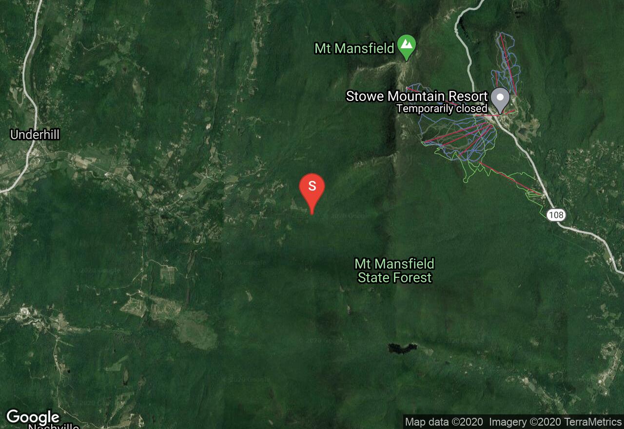
Vermont, Chittenden County
03 :28 hrs
5 mi
443.04288 ft
Hard
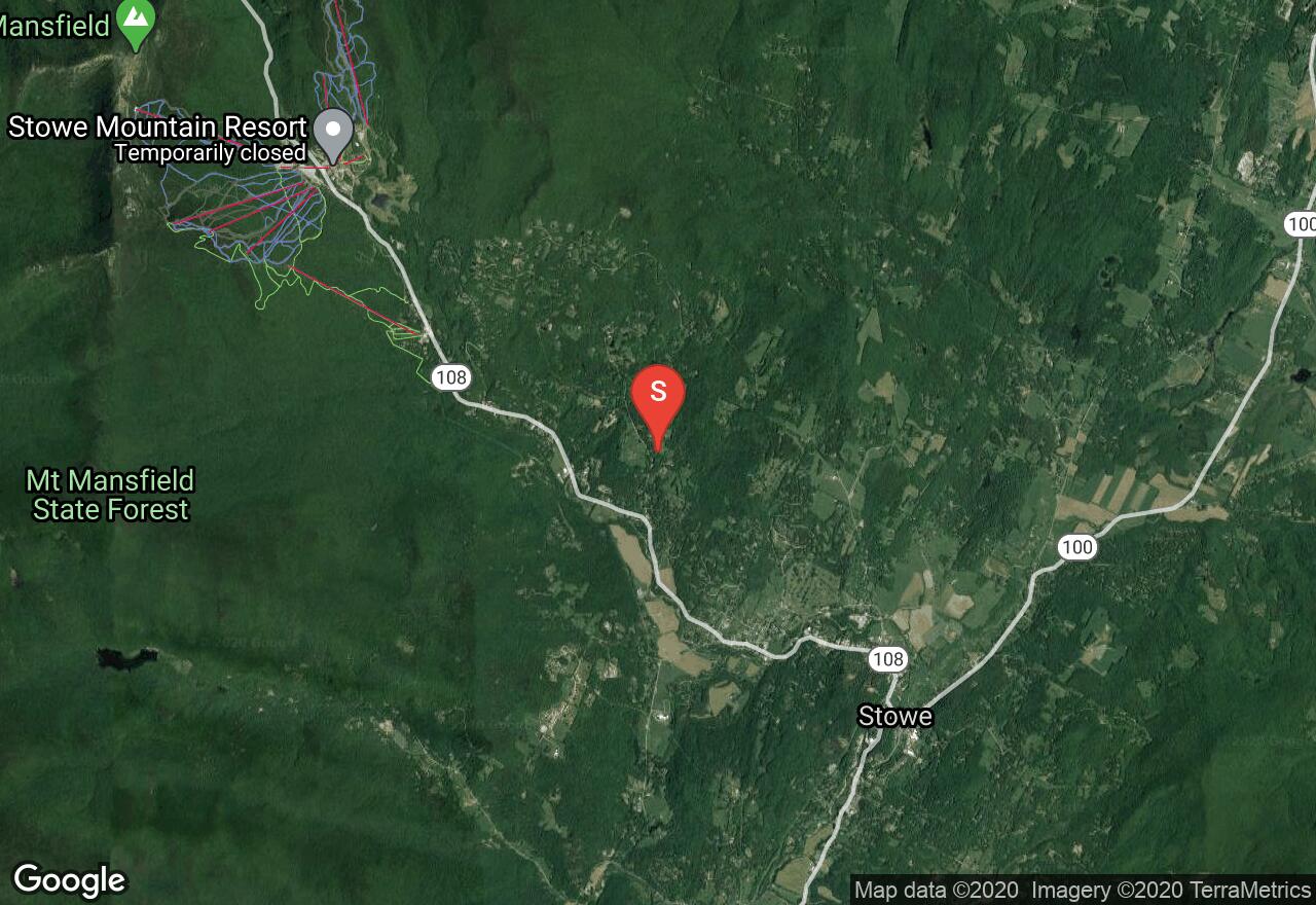
Located in the Mount Mansfield State Forest, this route is made up of 3 different trails exploring Mount Mansfield. You will begin on the Nebraska Notch Trail, then hop onto the Long Trail and end on Overland Trail. It is un-groomed but sees a lot of visitors during the winter months.
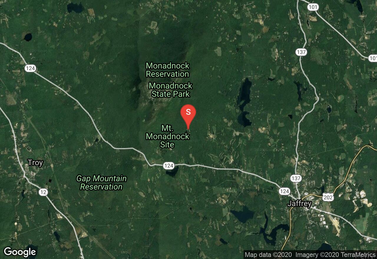
New Hampshire, Cheshire County
02 :59 hrs
2.8 mi
74.821625 ft
Easy
At the end of Poole Road, begin this tour through the classic New England forest landscape to Gilson Pond. Locate the park headquarters and the big blue sign pointing you to the cross-country ski trail junction. Follow the blue blazes, turn right at X-C 14 onto Harling Trail, turn left at X-C 18 onto Hinkley Trail (which has yellow blazes). Next, turn onto birchtoft Trail at X-C 27 following the red blazes. After reaching Gilson Pond, follow the loop pond trail to Gilson Pond Campground. Follow your tracks back to the the trail head, or if you plan ahead you can have another vehicle waiting at the campground parking lot.
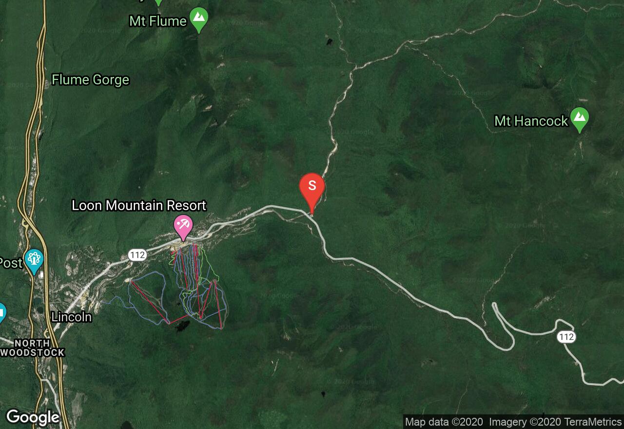
New Hampshire, Lincoln
04 :48 hrs
10.8 mi
150.82147 ft
Hard
This double track ski outing begins on the Kancamagus Highway and follows the East Branch of the Pemigewasset River into the wilderness of the White Mountain National Forest. The route experiences moderate elevation gain as it reaches its highest point near the foot of Mount Bond. At its furthest extent the trail crosses the river and descends on the other side.
See more adventures..
Explore complete list
Explore nearby adventures

