Best Climbing in Pennsylvania
Trying to find the best climbing in Pennsylvania? Bivy has great hiking, biking, paddling, climbing, skiing, riding and more, with hand-curated trail maps, as well as detailed driving directions.

Pennsylvania, Blair County
00 :27 hrs
1 mi
156.0159 ft
S2
Just east of Canoe Creek State Park is Short Mountain. This route climbs up the northern saddle to the summit and then descends down the southwest face toward Juanita River. This mountain in Pennsylvania is a lot of fun, as there is a large treeless section, making for great turns. The route is one way, but could be hiked back up and skied down the saddle or a northwestern face to make this an out-and-back.

Pennsylvania, Blair County
02 :43 hrs
5.1 mi
234.18488 ft
S2
Taking a southern descent and a southeast descent, this route explores two different skis down Schaefer Head, a 2,950 feet mountain in the Allegheny Mountains. The climb to the top is along the western ridge and uses a hiking trail, but may require some bushwhacking. The first descent is along a trail on the southern face and drops off a fairly steep ridge just after leaving the summit and then is not nearly as steep. The second run down the southeast face keeps a steep angle most of the descent in a bowl area. Use caution as the area is thickly forested, but can be an enjoyable run through the trees. Coordinates for the trailhead are: 40.310347, -78.568557

Pennsylvania, Blair County
00 :41 hrs
2 mi
301.06226 ft
S2
A peak in the Allegheny Mountains, Pine Knob is a fun and short ski down the western face of the ridge into a valley. The route starts where Tower Rd ends near Ritchey Knob. There is a path that goes along the saddle between the two knobs and leads to the top of Pine Knob. This route drops off the west side of the knob through trees that will need to be maneuvered around and into a valley that ends at Carson Run.

State Game Land 147, Blair County
00 :29 hrs
1.9 mi
321.33026 ft
S2
This one way route down a western face of Loop Mountain utilizes the State Game Road that leads to the top of the ridge and then down the other side. This route starts at the top of the road and then skis down the ridge for some great slopes that do have fairly dense trees. If desired, you could ski different runs down this ridge for a full day, as the mountain makes a 'U' shape and creates a north bowl, providing a variety of run possibilities.
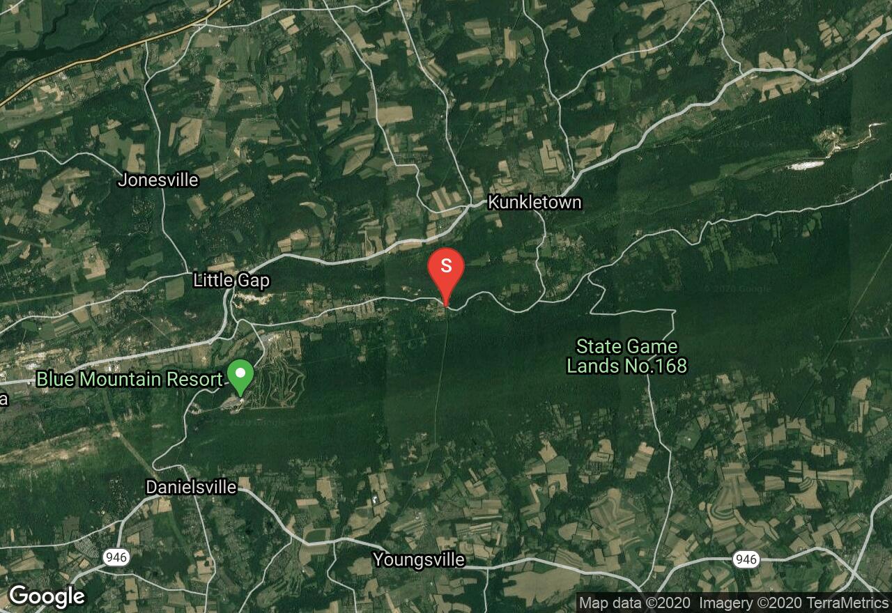
Pennsylvania, Monroe County
01 :23 hrs
0.9 mi
226.01825 ft
S2
Just east of the ridge from Blue Mountain Ski Resort, there is an enjoyable power line clearing that makes for some fun skiing in fresh snow with no trees. The route climbs up the power line trail to the top of the ridge where it intersects the Appalachian Trail. From the top, it is just an enjoyable ski back down the same path you ascended.
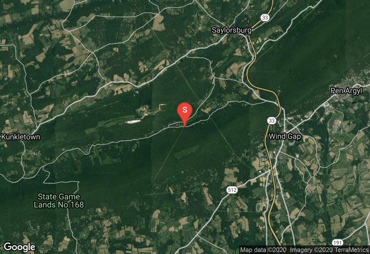
Pennsylvania, Monroe County
01 :05 hrs
0.7 mi
164.42479 ft
S1+
West of Wind Gap, this route climbs up Chestnut Ridge along a power line clearing. This treeless trail is enjoyable in fresh snow, making turns down the ridge. The descent is not steep and is great for beginners. The route climbs up the power line trail to the top of the ridge where it intersects the Appalachian Trail. From the top, it is just an enjoyable ski back down the same path you ascended.
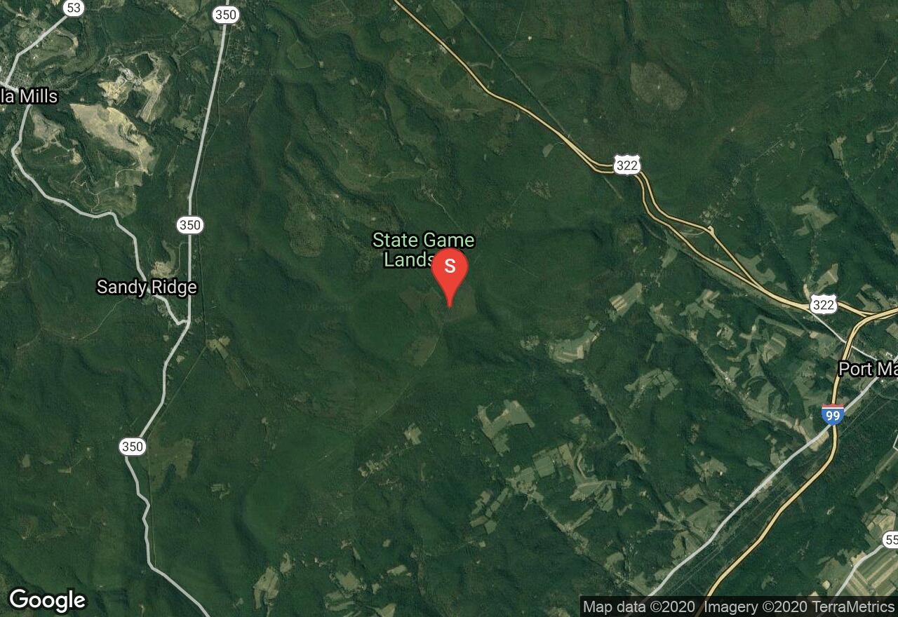
Pennsylvania, Rush township
00 :58 hrs
1.8 mi
162.26447 ft
S2
This trail originates from the Sandy Ridge Trail, which is a 22 miles bike trail. There is access from Hwy 322 north of this. The route drops off of Sandy Ridge into a bowl that leads to a valley with multiple farms. The route just drops into the bowl for some great turns among the trees and then climbs back up the saddle of the ridge to the trail. The views from the top are beautiful.

Pennsylvania, Blair County
00 :55 hrs
1.7 mi
177.84332 ft
S2
In the heart of central Pennsylvania, Short Mountain is one of the higher mountains in the region. This route utilizes an electric pole path and climbs up the western side of the ridge. The path provides clear access and a great treeless descent. The path also goes down the eastern side of the mountain as well and thus a run down toward the east could be made in the same trip as well.

Pennsylvania, Huntingdon County
02 :49 hrs
5.5 mi
355.13583 ft
S1+
Just above the community of Petersburg is this small hill, Round Top. The route climbs up the southwest saddle of the hill to the top and then descends down the southeast side. There are quite a few trees on the hill, but a section once you are nearly to the bottom has sections of clearings. There is also a Roundtop Mountain Ski Resort that is different from this location.

Pennsylvania, Blair County
02 :46 hrs
2 mi
405.52762 ft
S1+
Brush Mountain is a ridge in the Allegheny Mountains of central Pennsylvania. This route climbs up the southern-most part of the ridge along a power line trail to the top. The first descent is down the northern side, but use caution to not go all the way to the bottom of this valley as it is privately owned. This is an out-and-back route, so the second descent is back down the power line trail and is an easy and fun treeless run.
See more adventures..
Explore complete list
Explore nearby adventures

