Best Cross Country Skiing in Oregon
Trying to find the best cross country skiing in Oregon? Bivy has great hiking, biking, paddling, climbing, skiing, riding and more, with hand-curated trail maps, as well as detailed driving directions.
Oregon, Bend
03 :37 hrs
3.4 mi
79.081665 ft
Moderate
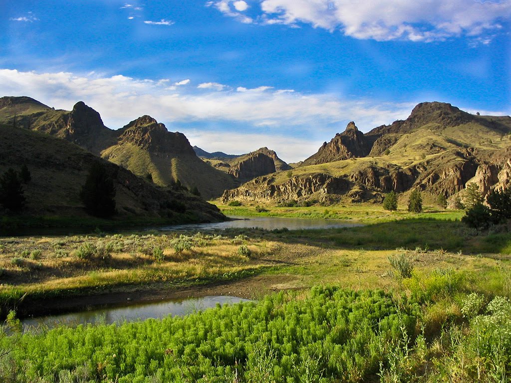
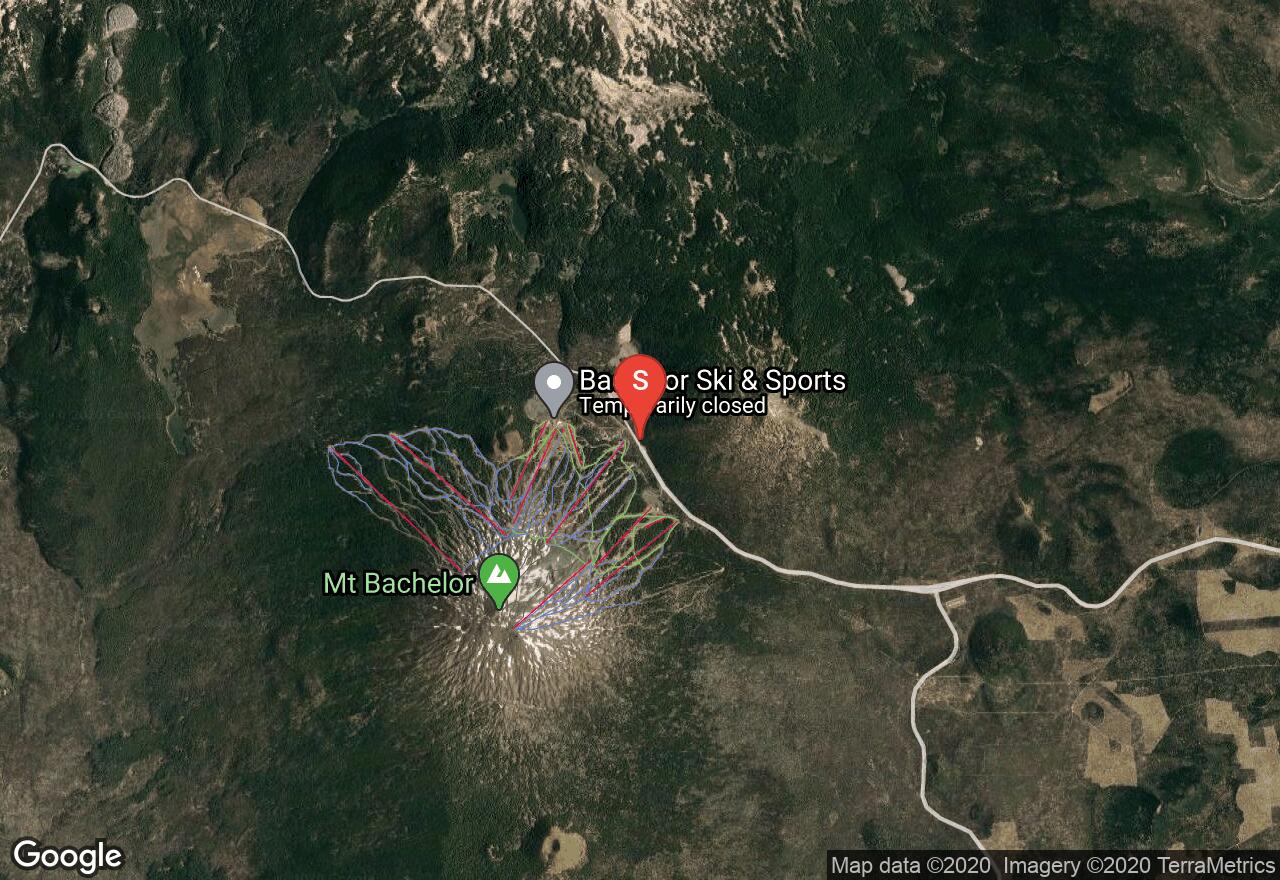
Beginning at the Dutchman Flat Sno-Park, this trail leads to the beautiful Todd Lake along the foothills of Mount Bachelor. Dutchman Flat is popular for skiing and snowshoeing with trails mostly in the beginner to intermediate range. This route is gradually downhill to the lake and thus uphill on the return trip. Gorgeous views of many of the Central Oregon Cascades and especially of Mount Bachelor from the north side of the lake.
Oregon, Bend
02 :45 hrs
5.7 mi
48.91101 ft
Moderate
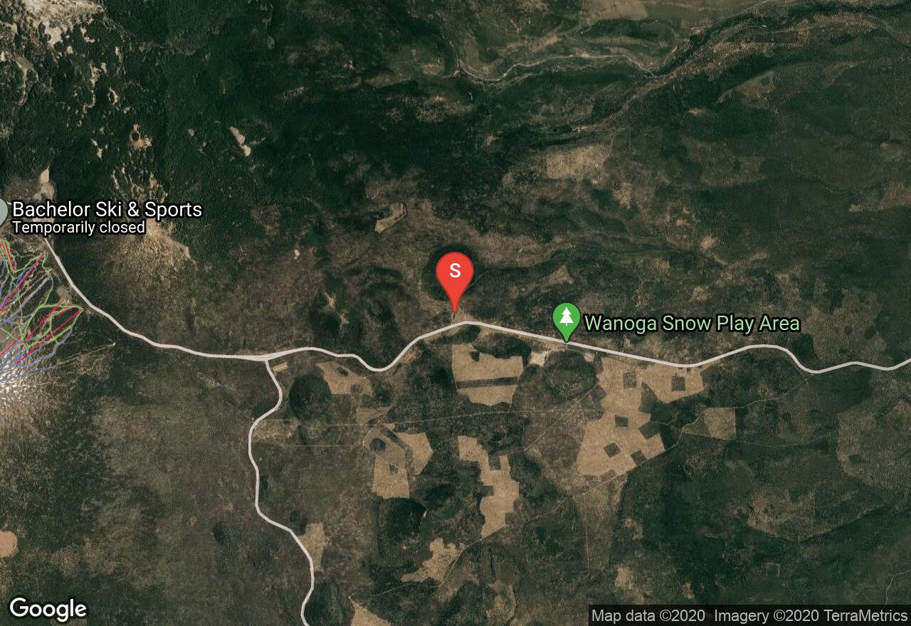
Swampy Lakes has numerous trails for snowshoeing and cross-country skiing for varying levels. This loop takes you through a lodge pole pine forest by three small lakes. The scenery is gorgeous with the Three Sisters in perfect view on a clear day and the area is serene and only 15 miles away from the city of Bend. Swampy Lakes area is popular on winter weekends, but there are enough trails that people take so as not to be crowded.
Washington, Skamania County
06 :18 hrs
4.3 mi
444.1447 ft
Hard
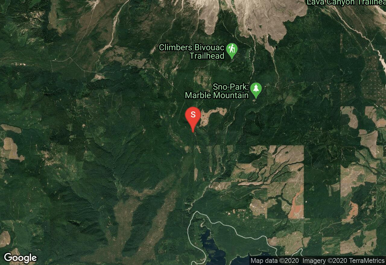
This adventure begins at the Cougar Sno-Park, which can get quite crowded with snowmobilers on weekends, but is usually nearly empty on weekdays. The Kalama Ski Trail begins right from the Sno-Park, but the first section is the steepest, so if conditions are unfavorable, it is possible to ascend Road 81 to one of the three "bear" loops and begin the trail there. Snowmobiles are allowed on the road to Climber's Bivouac, but there are generally few to none. The view from this summer parking area includes Mt St Helens and Mt Adams, so obviously, this adventure is best for a clear day. A Sno-Park permit is required to park at the trailhead.
Washington, Skamania County
06 :27 hrs
11.9 mi
271.36707 ft
Hard
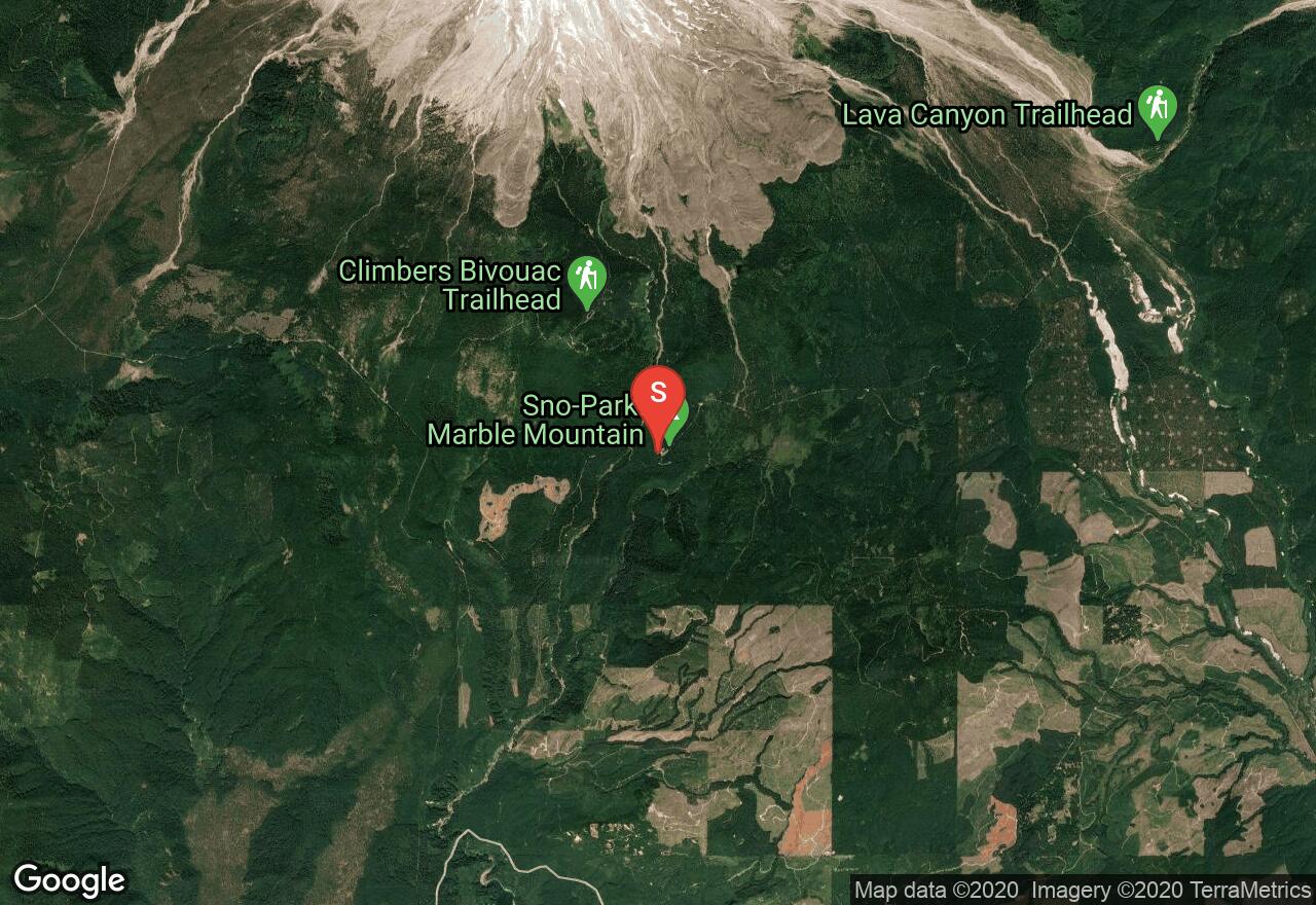
This Sno-Park is one of the most popular in the region for both motorized and non-motorized users, but there are separate trails for each type of use, keeping friction to a minimum. There are 49 miles of marked but ungroomed trails in this recreation area. The route shown here follows the four main loops on the following trails: Swift, Silver, Pika, June Lake, Pine Marten, Sasquatch, Wapiti, Marble. In general, the upper loops are difficult while the lower loops are easy. The waterfall at June Lake is very impressive in the winter (but the lake itself is generally not safe to cross.) There are great views of Mt St Helens when the weather is clear. A Sno-Park permit is required to park at the trailhead.
Oregon, Lane County
05 :30 hrs
3.5 mi
400.81348 ft
Moderate
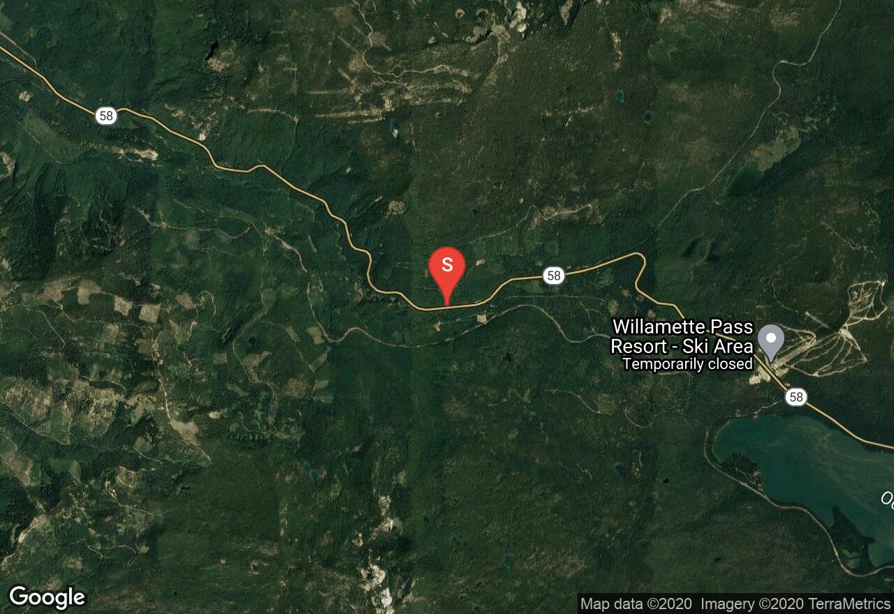
This trail follows Forest Road 5894 through a thick forest to the Fuji Shelter. The shelter was built in 1987 by the Eugene Oregon Marine Reserves Unit and has an inspiring view of Diamond Peak and Salt Creek Canyon. The road is directly across from the Salt Creek Falls access road and also the Salt Creek Sno-Park. From the shelter, there is access to numerous cross-country ski trails including Birthday Lakes, Pothole Meadows, Fuji Mountain, and Island Lakes. This shelter has a sleeping loft, a wood stove, wood picnic table and gravel floor and can accommodate four people overnight. Sno-Park permit required.

Oregon, Bend
01 :46 hrs
3.4 mi
108.11218 ft
Easy
Swampy Lakes has numerous trails for snowshoeing and cross-country skiing for varying levels. This trail is named the Beginner Loop and takes you on gentle terrain through a lodge pole pine forest. The scenery is gorgeous with the Three Sisters in perfect view on a clear day and the area is serene and only 15 miles away from the city of Bend. Swampy Lakes area is popular on winter weekends, but there are enough trails that people take so as not to be crowded.
Washington, Yakima County
08 :28 hrs
16.5 mi
282.4682 ft
Hard
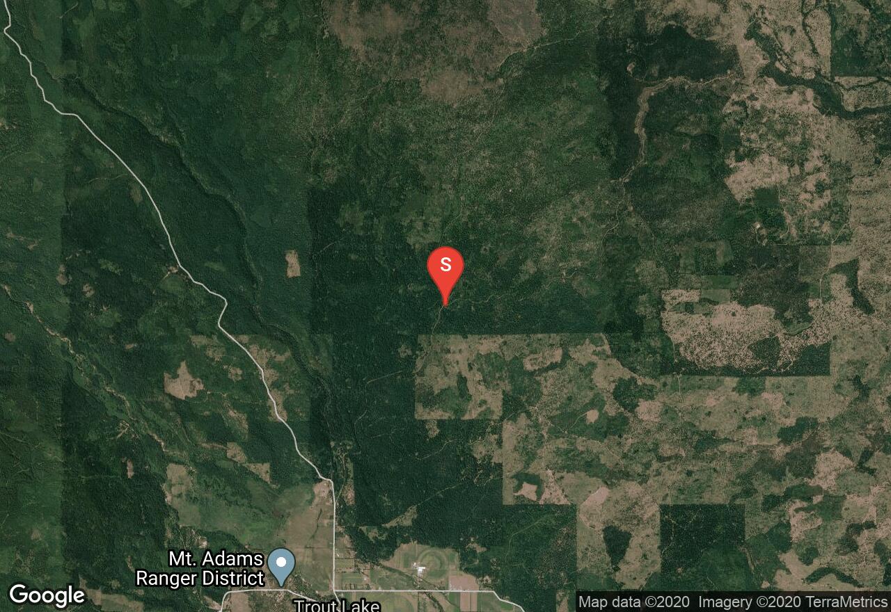
This popular recreation area on the south side of Mt Adams has 20 miles of groomed ski trails for all abilities. Most of the trails follow forest roads through selectively logged lands with occasional views of Mt Adams. If the Pineside Sno-Park is full, there is additional parking a few miles up the hill at Snow King. The route shown here follows the Big Tree, Hole-in-the-Gorund, Pipeline, Lava, Princess, and Eagle Loops. The access road is usually only plowed once per week. A Sno-Park permit is required to park at the trailhead.
Oregon, Hood River County
01 :39 hrs
3.4 mi
76.416504 ft
Moderate
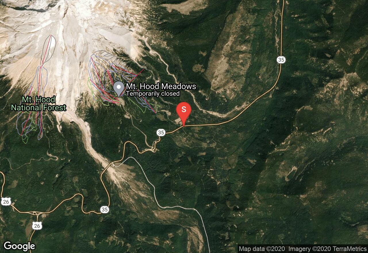
Just below Mount Hood, this groomed cross country ski trail goes along Teacup Lake and up a slight hill, allowing for an excited downhill. The trail is a loop, thus giving you more opportunities to explore the Mount Hood Wilderness. There is a fee to use the nordic trails at Teacup Lake in order to cover for the grooming and maintenance fees. No snowshoes allowed on groomed trails.
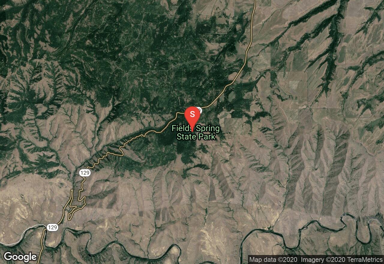
Washington, Asotin County
03 :19 hrs
6.5 mi
153.13574 ft
Hard
Each winter, the network of trails and service roads at Fields Spring State Park is covered with snow and converted to groomed cross-country skiing trails. The trails, which include all difficulty levels, are mostly under the cover of pine and fir forests, except for the southern part of the Grande Ronde trail, which enters a large meadow with views of the intricate canyons of the Grande Ronde River and south towards Hells Canyon. Another highlight of the network is the climb to Puffer Butte, where there are more views as well as a warming hut. The park also has a sledding hill for those in your group not interested in skiing. Snowshoers and dogs are not allowed on groomed trails; however, there is also a snowshoe trail network in the park and they are allowed on the eastern part of the Grande Ronde Trail to the meadow south of Puffer Butte. A Sno-Park permit is required to park at the trailhead.
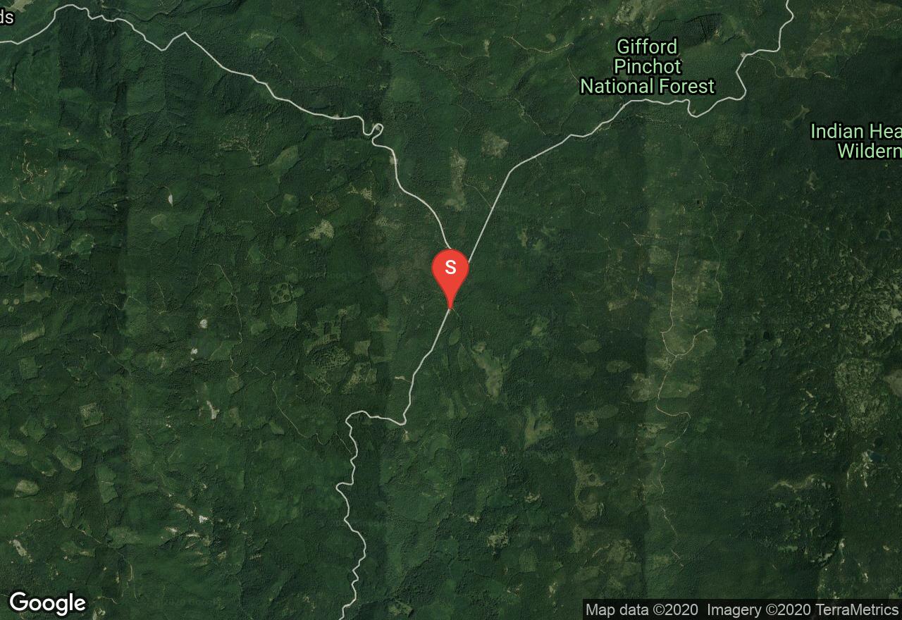
Washington, Skamania County
06 :06 hrs
12.6 mi
166.74622 ft
Hard
This ski area just west of the Indian Heaven Wilderness has 25 miles of trails, some of which are groomed and some of which are not. There is a wide variety of difficulty levels, with the easiest being the 5k out-and-back to McClellan Meadows, which have a view of the Indian Heaven peaks. The intermediate trails west of the road travel through clear-cuts that also have good views. The corridor along the Wind River Road sometimes receives limited maintenance and plowing, so it is possible that parking may be limited to the Koshko Sno-Park a bit to the south. A Sno-Park permit is required to park at the trailhead.
See more adventures..
Explore complete list
Explore nearby adventures

