Best Trail Running in New Hampshire
Trying to find the best trail running in New Hampshire? Bivy has great hiking, biking, paddling, climbing, skiing, riding and more, with hand-curated trail maps, as well as detailed driving directions.

New Hampshire, Carroll County
00 :57 hrs
2.5 mi
153.54933 ft
Easy
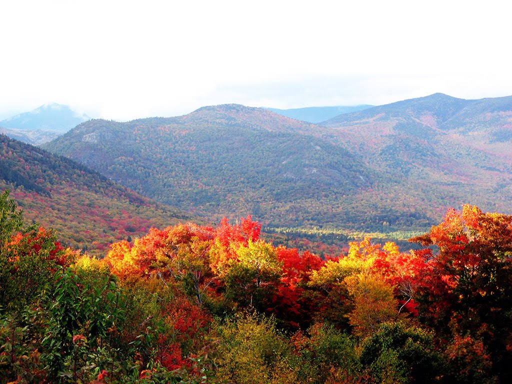
This trail follows the southeastern slopes of Lee Mountain. It is a family friendly hike that can be done by all ages. The scenery is refreshing and you’ll have an occasional glimpse of Lake Winnipesaukee before and eventually reach Shannon Pond. The trail does continue to Castle in the Clouds if you’re up for more adventure.
New Hampshire, Carroll County
01 :44 hrs
3.4 mi
404.15192 ft
Moderate
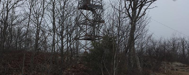
A fun and short hike to a fire tower overlooking Lake Winnipesaukee and Squam Lake. I Hiked with my dog and saw a deer.
New Hampshire, Belknap County
00 :52 hrs
2.4 mi
48.61151 ft
Easy
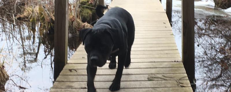
A lovely hike that travels through a beautiful forest setting. It is mostly flat, with groomed paths that are well marked. There is access to the beach, which is a great place to stop for lunch or relaxing. Lots of rocks for the kids to scramble on and ferns everywhere. Dogs are allowed but must be leashed at all times.
Maine, Cumberland County
00 :19 hrs
0.6 mi
78.569244 ft
Easy
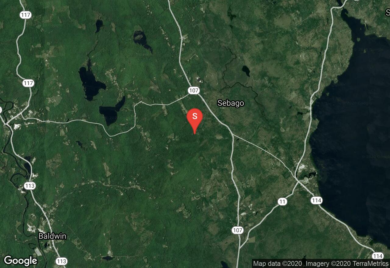
This short loop hike leads through dense forest up to a stone observation tower where hikers will enjoy awesome views of the surrounding landscape including nearby mountain ranges and Sebago Lake. The trail up to the small peak is short but a little steep. There are some additional connecting trails south of the tower for hikers who want to explore more of the area.
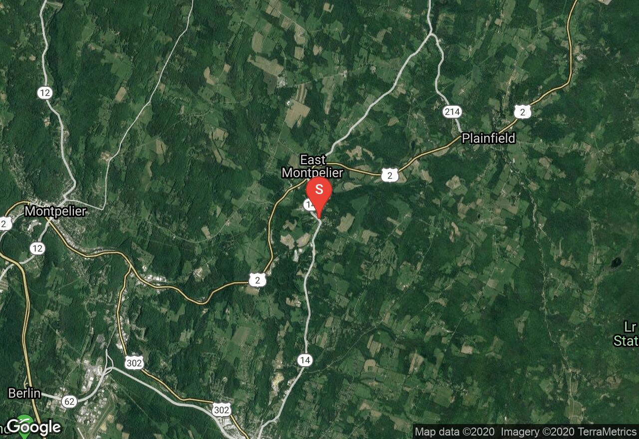
Vermont, Washington County
01 :03 hrs
2 mi
15.386902 ft
Moderate
This rail-trail follows the old Montpelier and Wells River Railroad, which ran across northeast Vermont carrying materials from quarries in Barre. It has three different sections for recreation. This section is a short but quiet wooded route in Plainfield and east Montpelier. There is a variety of wildlife to be seen and the trail surface is a mix of dirt, gravel, and sand.
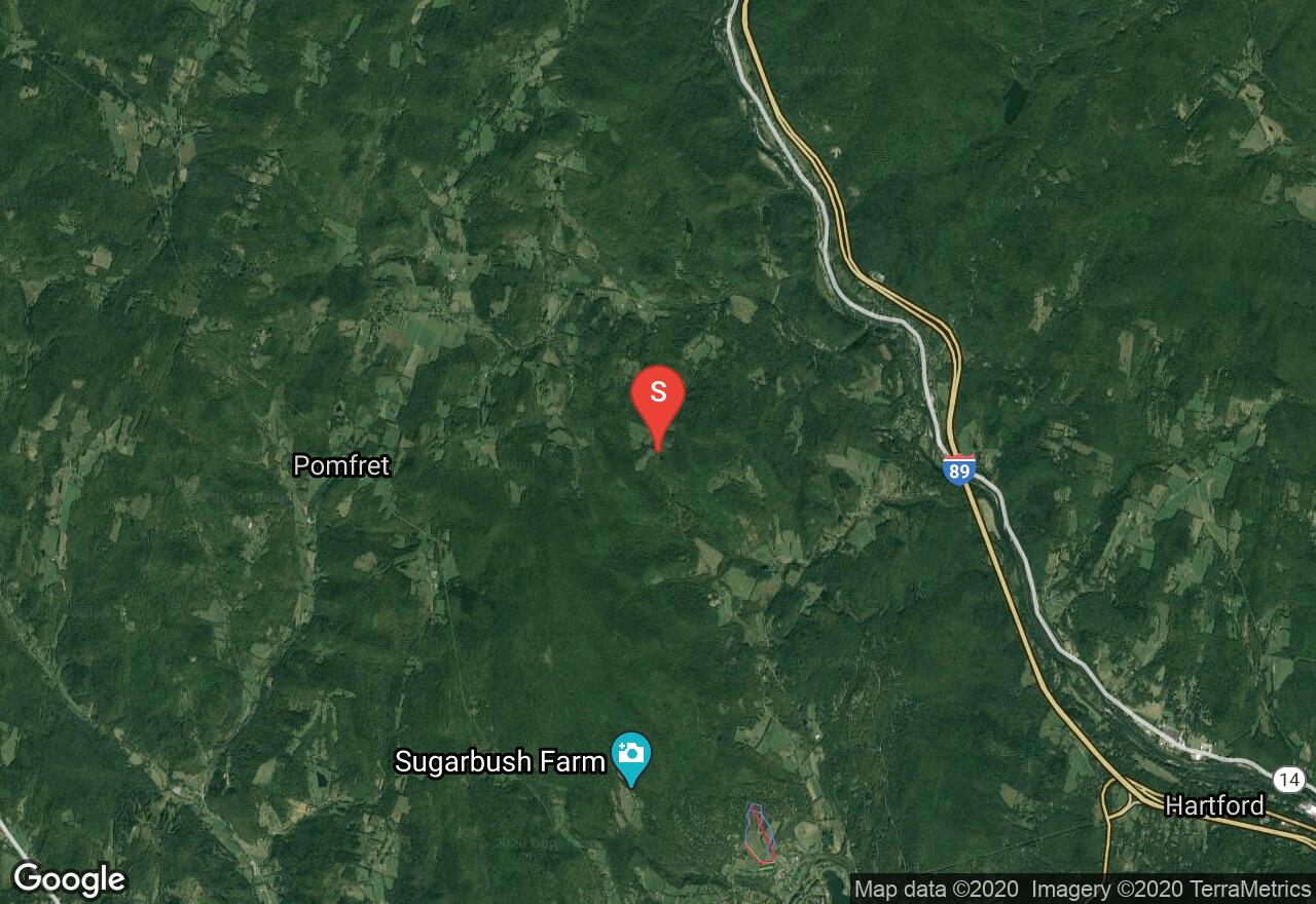
Vermont, Windsor County
04 :04 hrs
9.5 mi
292.0653 ft
Expert
The 2,185 miles of the Appalachian National Scenic Trail spans over fourteen states from Maine to Georgia. From the Connecticut River to the Green Mountains, Vermont offers 150 miles of the Appalachian Trail. This section of the trail begins on Joe Ranger Road and hikes through rugged countryside with scenic woodlands and overgrown farmlands. The trail has a moderate elevation change along a graded dirt trail. After 2 miles into the hike the trail passes Thistle Hills Shelter which is used for multi day/thru hikers. Avoid hiking the trails from April through to May, the wet sloppy conditions leads to serious trail erosion.
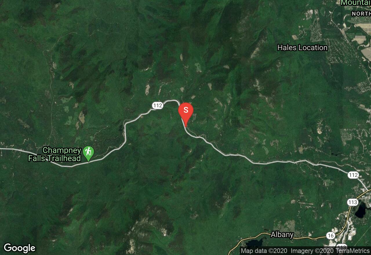
New Hampshire, Albany
05 :28 hrs
5.9 mi
107.05612 ft
Hard
This classic double track begins at Albany Covered Bridge and parallels the Swift River. The route experiences mild elevation gain over a little less than six miles as it climbs through hardwood and coniferous forest. At Bear Notch road you can reverse direction and coast back to your vehicle.
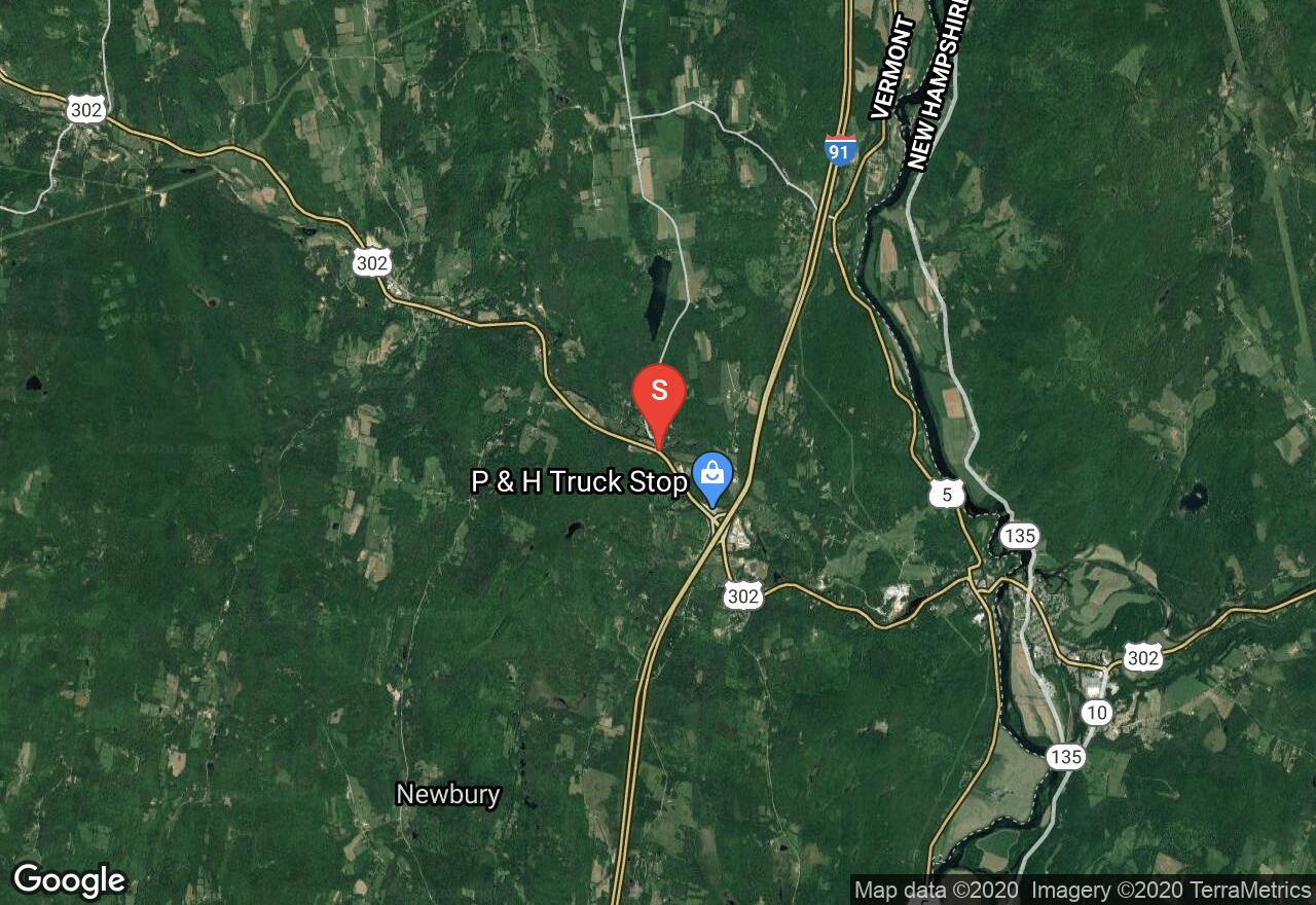
Vermont, Orange County
00 :54 hrs
1.8 mi
32.87973 ft
Moderate
This rail-trail follows the old Montpelier and Wells River Railroad, which ran across northeast Vermont carrying materials from quarries in Barre. It has three different sections for recreation. This section is between Wells River and Boltonville. It is a peaceful area with ponds and hiking trails. There is a variety of wildlife to be seen and the trail surface is a mix of dirt, gravel, and sand.
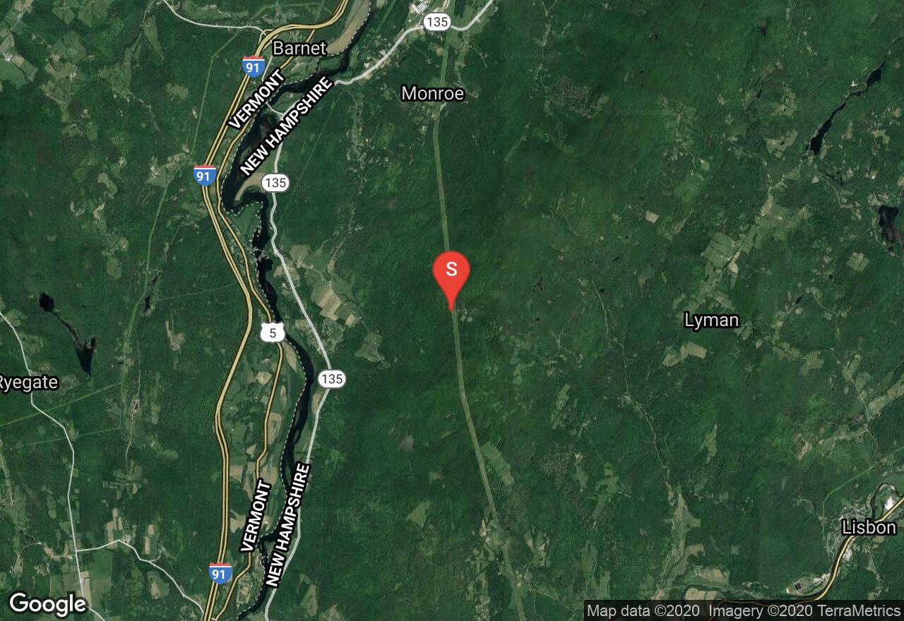
New Hampshire, Monroe
01 :52 hrs
7.6 mi
358.14822 ft
Hard
This trail starts near the summit of Hunt Mountain (which you may need a four-wheel drive to get to) and follows the more or less straight trajectory of the powerlines but with a whole lotta twists and turns; there are also plenty of little gaps and drops to keep it interesting. The trail runs out to Copper Mine Road where you find a short climb and then a long coast back to the long climb to your car. Bringing a second vehicle as a shuttle might be nice as well.
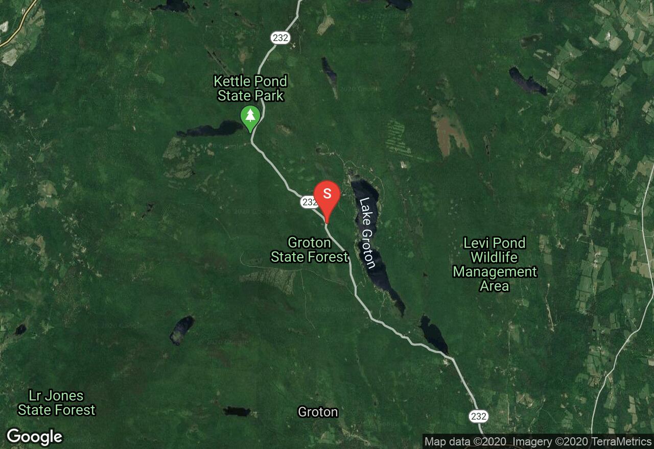
Vermont, Caledonia County
03 :60 hrs
7.8 mi
181.96043 ft
Moderate
This rail-trail follows the old Montpelier and Wells River Railroad, which ran across northeast Vermont carrying materials from quarries in Barre. It has three different sections for recreation. This section begins at Lake Groton and stretches north to Marshfield. You’ll pass by ponds, hiking trails, rural villages, thick wooded forests and there is a variety of wildlife to be seen. The trails surface is a mix of dirt, gravel, sand and some section of road.
See more adventures..
Explore complete list
Explore nearby adventures

