Best Mountaineering in New Hampshire
Trying to find the best mountaineering in New Hampshire? Bivy has great hiking, biking, paddling, climbing, skiing, riding and more, with hand-curated trail maps, as well as detailed driving directions.
New Hampshire, Sargent's Purchase
09 :39 hrs
3.8 mi
1295.6025 ft
II
A winter ascent of Mt Washington is achieved by following the Lions Head trail, which diverges climbers right from the Tuckerman Ravine trail. Exposure to weather and avalanche hazard increases considerably about 4,300 feet as the route emerges above treeline. The views from the summit are spectacular but be aware you will be on a developed mountaintop with a visitor’s center present. It is extremely important to check and heed weather reports and be mindful of avalanche conditions when traveling above treeline on Mt Washington as this area experiences some of the worst weather in the U.S. and the highest winds on earth; visibility is often limited. Crampons, ice axe and avalanche safety equipment are necessary for this outing.
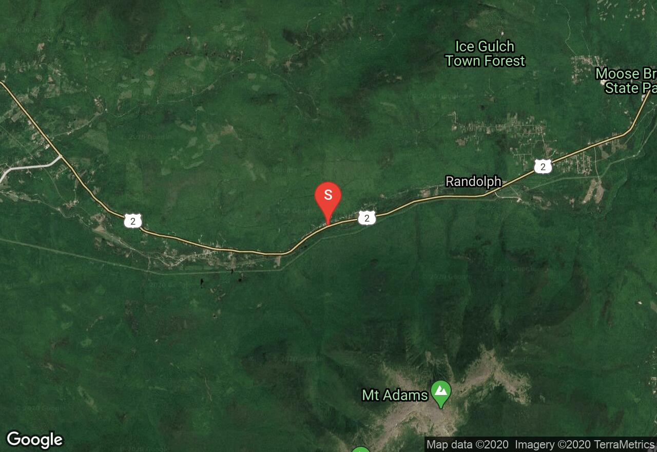
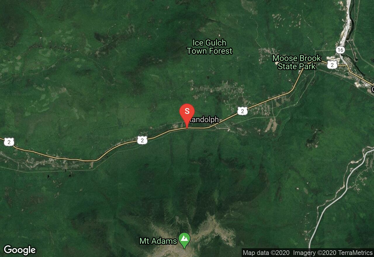
New Hampshire, Randolph
10 :16 hrs
4.3 mi
1295.9745 ft
II
A winter ascent of Mt Adams begins at Lowe’s store were trailhead parking is available for a small fee but is limited and at the discretion of the proprietor. The trail is icy and climbs steeply over rocky trail. Exposure to the elements and avalanche hazard increase considerably at approximately 4,400 as the trail emerges above treeline. The views from the summit are excellent if conditions are clear. It is extremely important to check and heed weather reports and be mindful of avalanche conditions when traveling above treeline on The Presidential Range as this area experiences some of the worst weather in the U.S. and the highest winds on earth; visibility is often limited. Snowshoes, crampons, ice axe and avalanche safety equipment are necessary for this outing.
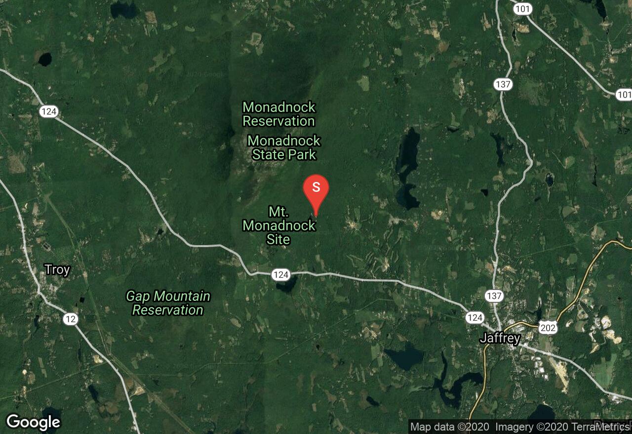
New Hampshire, Jaffrey
03 :01 hrs
3.7 mi
542.9433 ft
I
Mt Monadnock is one of the most climbed mountains in the world due to its proximity to major urban centers and the alpine aesthetics of its exposed granite summit cone. It is not a long outing and the ascent consists largely of walking well-established trail through dense woodlands. At about 2,600 feet the trail encounters craggy granite domes in coniferous forest. At 2,900 feet the route steepens considerably as you work your way up a section of ledges in the final stretch; these ledges are not terribly technical but fall consequences exist. It is extremely important to check and heed weather reports before setting out, visibility is often limited making route finding difficult. Crampons and ice axe are necessary for this outing.
New Hampshire, Randolph
04 :48 hrs
3.8 mi
1218.4642 ft
II
Climbing Mt Madison in winter uses the most common summer route, the Valley Way Trail. Conditions encountered in the cold season increase the challenge considerably however. The trail breaks treeline at about 4,400 feet and hazards imposed by exposure to weather and avalanche potential increase considerably. If conditions allow views of the surrounding White Mountains are impressive from the summit. It is extremely important to check and heed weather reports and be mindful of avalanche conditions when traveling above treeline on The Presidential Range as this area experiences some of the worst weather in the U.S. and the highest winds on earth; visibility is often limited. Snowshoes, crampons, ice axe and avalanche safety equipment are necessary for this outing.
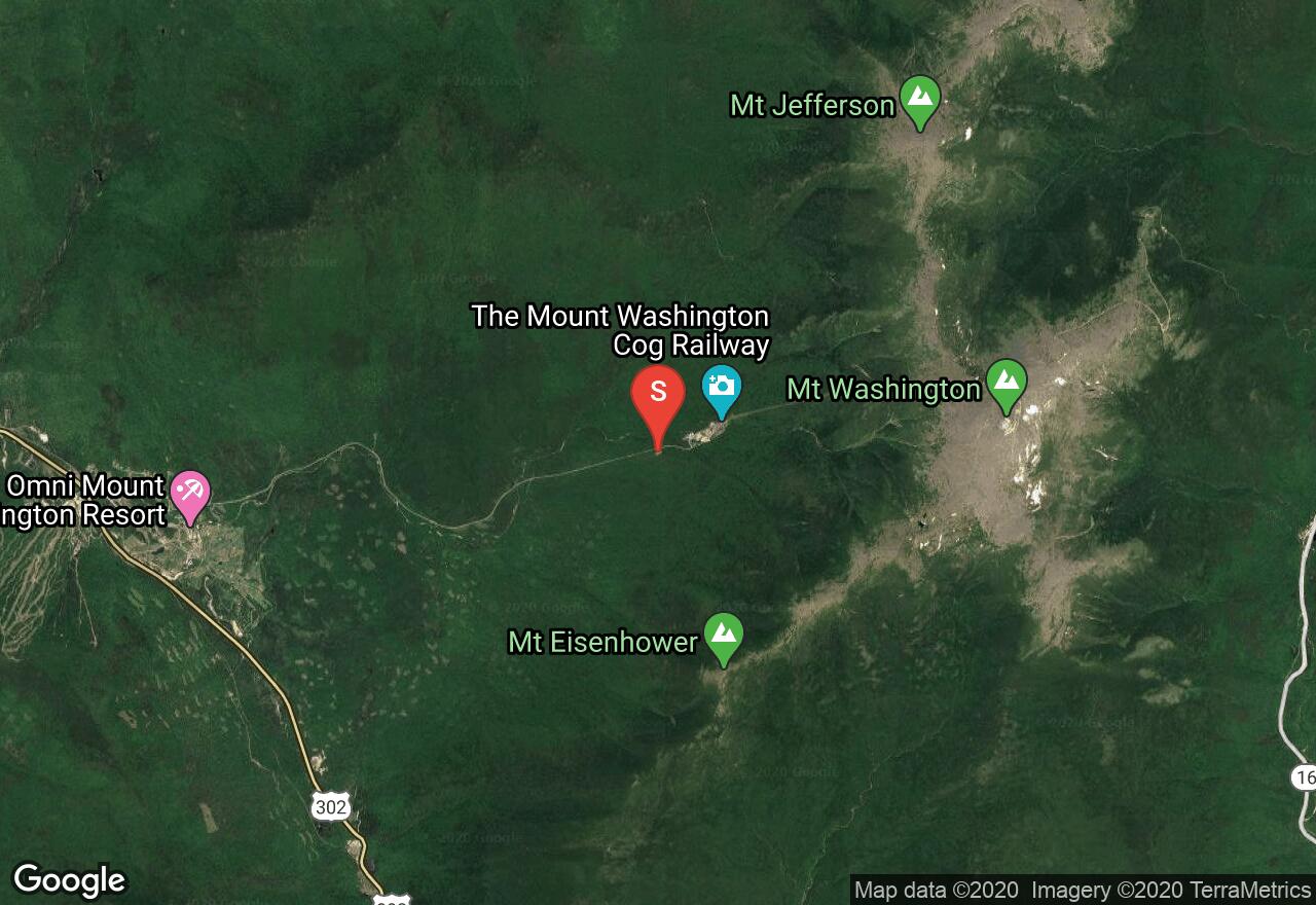
New Hampshire, Crawford's Purchase
09 :44 hrs
4.9 mi
977.403 ft
II
Mt Jefferson is perhaps the most difficult of the Presidentials to climb by winter. The summit ridge is acquired from the west on the Jewel Trail, which departs near the base of the Mt Washington rack railroad. At approximately 4,500 feet exposure to weather and avalanche risk increases considerably as the route breaks above treeline. An undulating ridge traverse runs out the rest of the distance to the summit. Views from the top can be spectacular provided there is visibility to enjoy them. Care must be taken on the descent to find the Jewel Trail, not always an easy task; placing wands would not be unwise. It is extremely important to check and heed weather reports and be mindful of avalanche conditions when traveling above treeline on The Presidential Range as this area experiences some of the worst weather in the U.S. and the highest winds on earth; visibility is often limited. Snowshoes, crampons, ice axe and avalanche safety equipment are necessary for this outing.
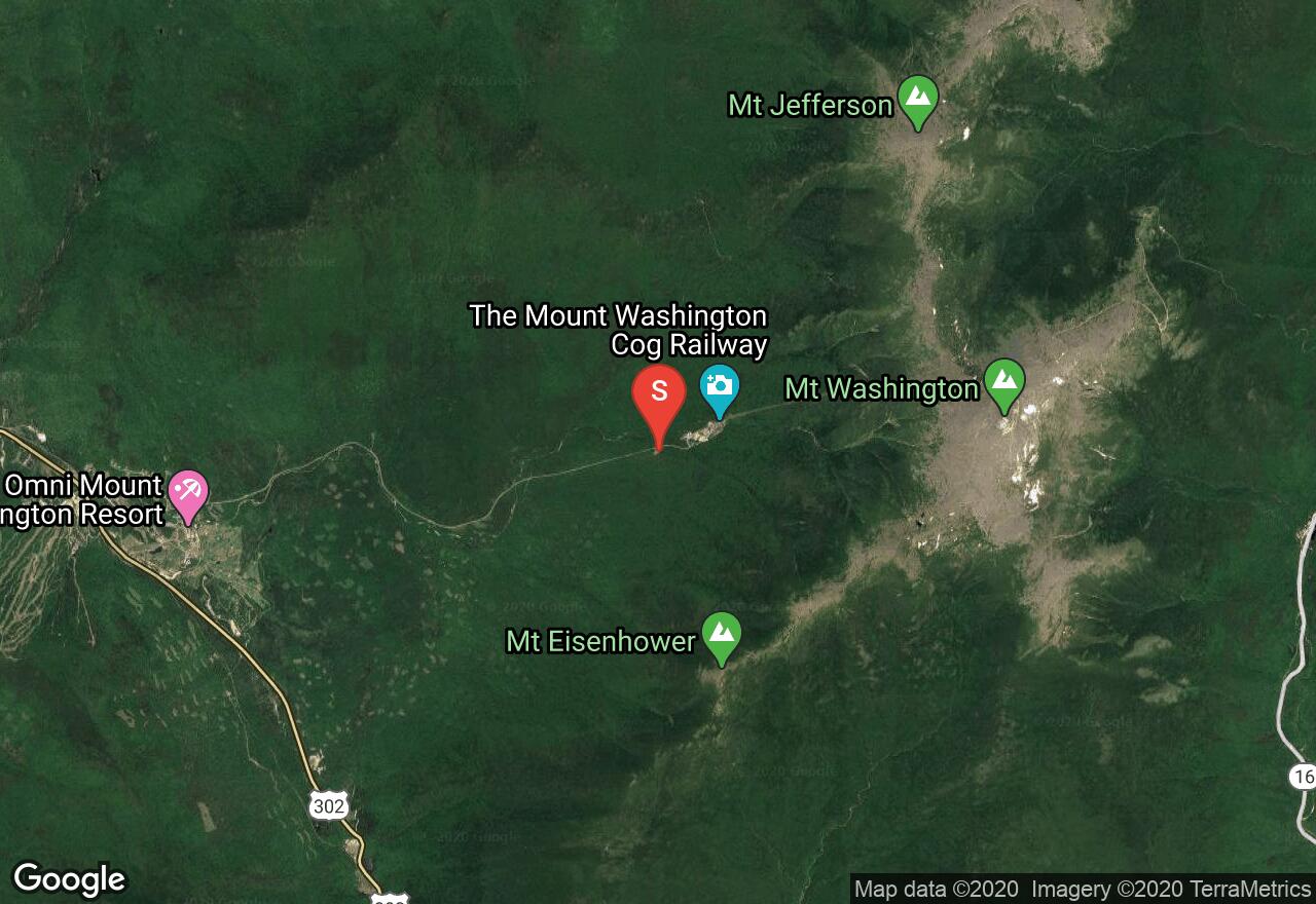
New Hampshire, Crawford's Purchase
06 :49 hrs
3 mi
867.9694 ft
II
Mt Monroe is the southern most summit of prominence in the Presidential Range and is best climbed via the Ammonoosuc Ravine Trail beginning near the base of the Mt Washington Cog Railroad. Shortly after emerging above treeline you’ll pass the Lakes of Clouds hut and then begin the ridge traverse to Monroe; direct exposure to the elements makes this a potentially hazardous zone. It is extremely important to check and heed weather reports and be mindful of avalanche conditions when traveling above treeline on The Presidential Range as this area experiences some of the worst weather in the U.S. and the highest winds on earth; visibility is often limited. Snowshoes, crampons, ice axe and avalanche safety equipment are necessary for this outing.
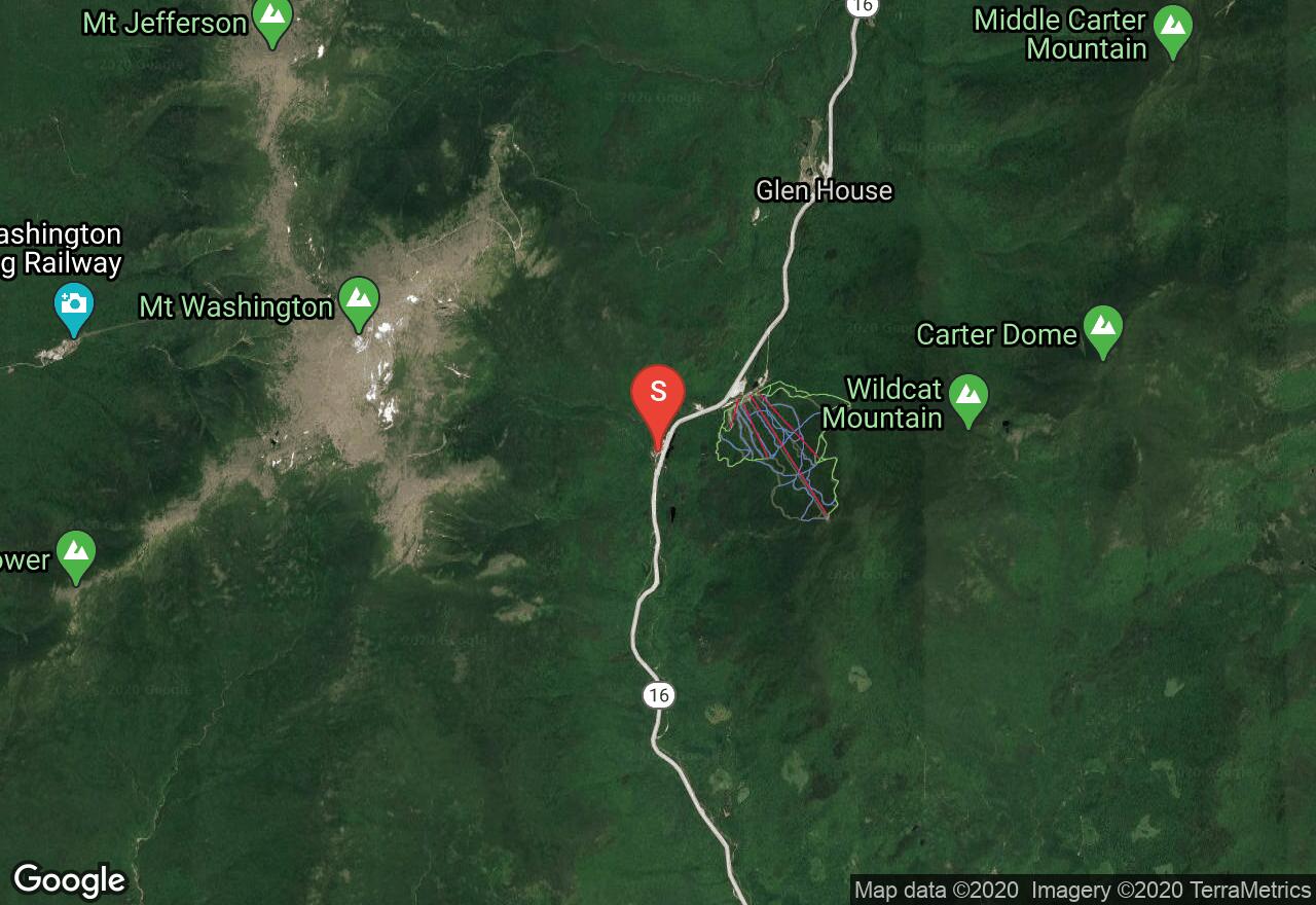
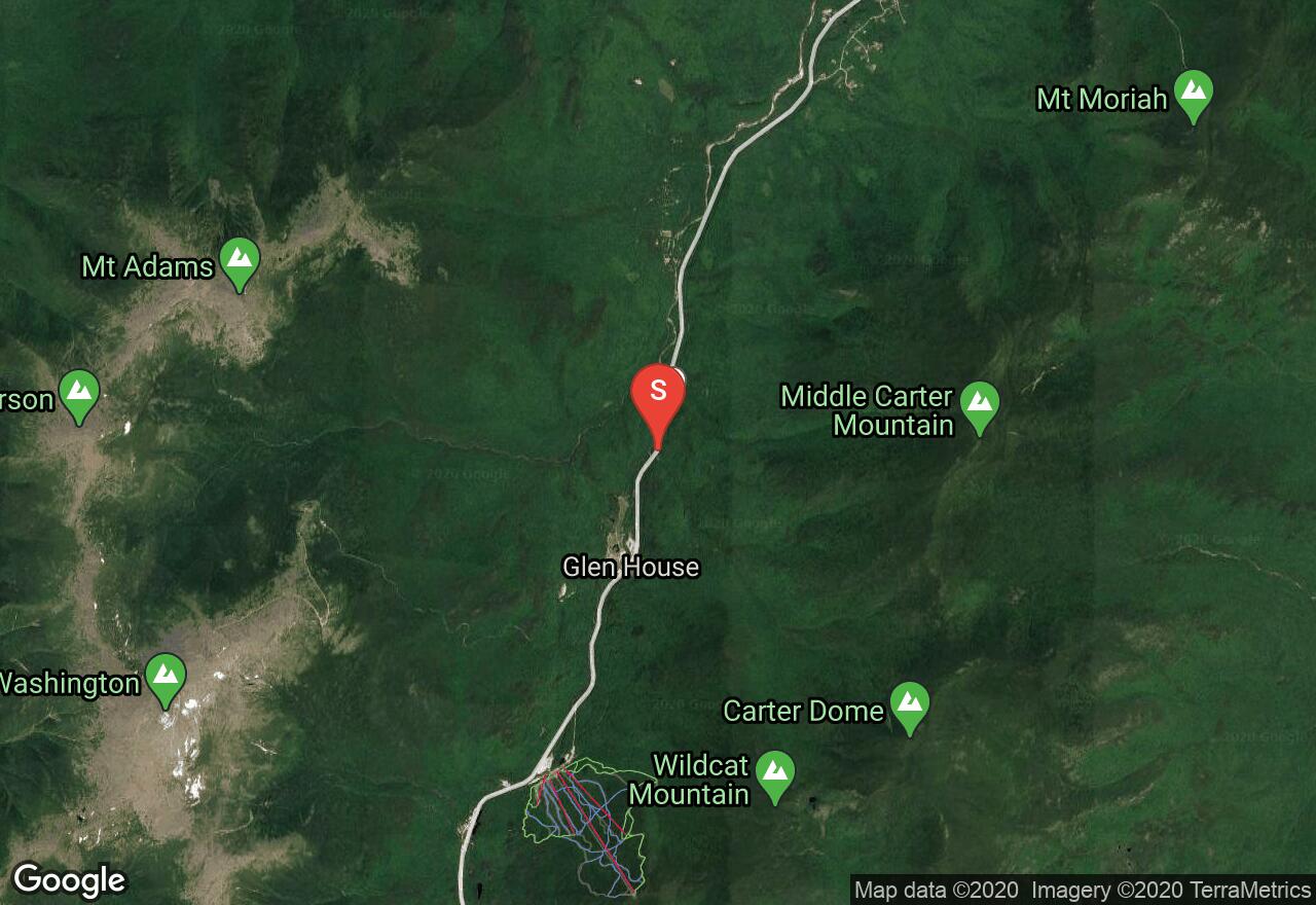
New Hampshire, Jackson
05 :32 hrs
4.5 mi
725.5301 ft
S3-
This side country adventure can be climbed from the vicinity of the Jackson Ski Touring Foundation headquarters or enjoyed as a one way outing from the top of the gondola at Wildcat Ski Area. This is one of the most popular touring areas in New Hampshire, which is evidenced by the excellent condition of this trail. Although the top of this descent is generally a little on the icy side conditions improve considerably after the first few turns.
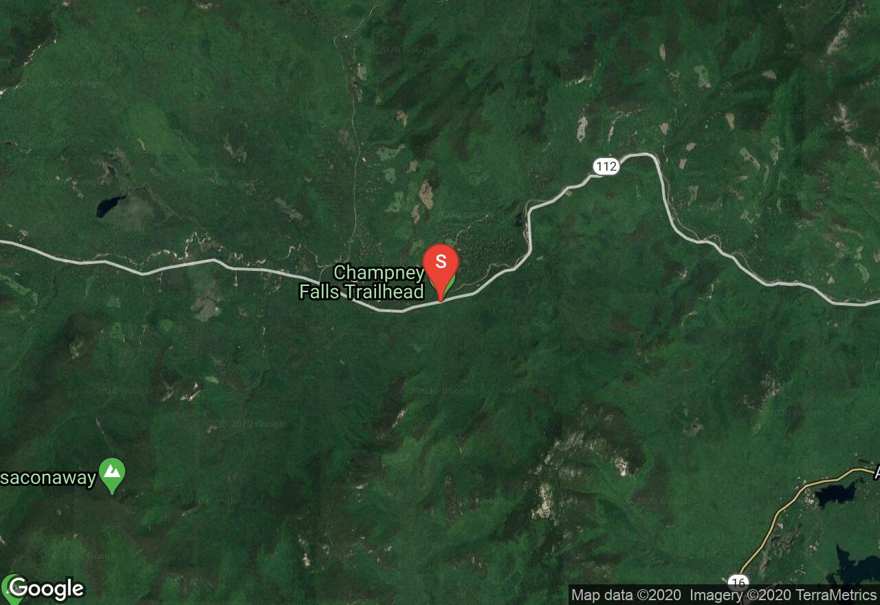
New Hampshire, Albany
04 :24 hrs
3.4 mi
658.67084 ft
S2
This scenic tour takes you through dense forest and past the frozen spectacle of Champney Falls. The climb is mild and maintains around a nine-degree slope over most of its length. As you travel you’ll have occasional but excellent views of the Pemigewasset Wilderness climaxing with the excellent unobstructed views from this mountain’s exposed summit. Be aware the final quarter mile of this adventure requires you shed your skis and climb over exposed granite ledges. The descent is a mixture of mild terrain with trails wide enough to make turns on and the occasional opportunity for off trail turns too.
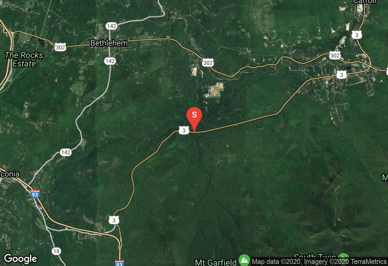
New Hampshire, Bethlehem
07 :15 hrs
5.8 mi
950.36505 ft
S2
The summit of Mt Garfield is a striking feature in the Franconia Range, easily making the list of New Hampshire four thousand footers. The climb to the summit is a little on the long side but the views on top and the descent make it worthwhile. On the trail you’ll find yourself in a forest setting of thick hardwoods at lower elevations giving way to evergreens that surround an exposed summit.
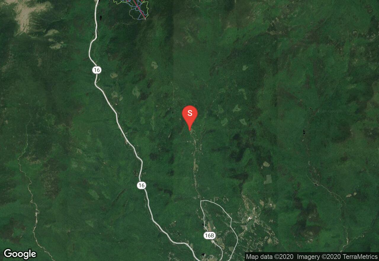
New Hampshire, Green's Grant
05 :21 hrs
9.3 mi
1009.7599 ft
S3
This tour begins along the Peabody River at the foot of the Presidential Range. The trail (Nineteen Mile Brook Trail) climbs at moderate grades into Carter Notch. There is a busy AMC hut in the notch that with planning could serve an overnight tour. From the notch it may be best to pack your skis and boot the rest of the way, as the ridge is steeper than the Brook Trail below; this is a good time to be mindful of weather conditions as well as you’ll be exposed to the full force of any storm that comes through. From the summit you’ll be able to enjoy excellent views of Mt Washington; for the descent it may be easiest to boot a little way down the Carter Dome Trail until it widens up enough to make turns.
See more adventures..
Explore complete list
Explore nearby adventures

