Best Kayaking in New Hampshire
Trying to find the best kayaking in New Hampshire? Bivy has great hiking, biking, paddling, climbing, skiing, riding and more, with hand-curated trail maps, as well as detailed driving directions.
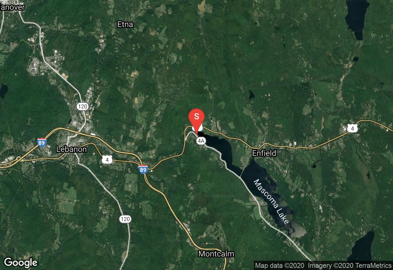
New Hampshire, Enfield
01 :08 hrs
2.9 mi
33.79341 ft
III
This is perhaps the most popular portion of the Mascoma for whitewater. An excellent put-in facility exists at the outlet of Mascoma Lake were this run begins. The area surrounding is fairly scenic, covered in woodlands and dotted by farms. There are two whitewater courses in this stretch of river, take care not disturb the equipment in place. Be sure to make the take-out, a small but dangerous dam is located down stream.
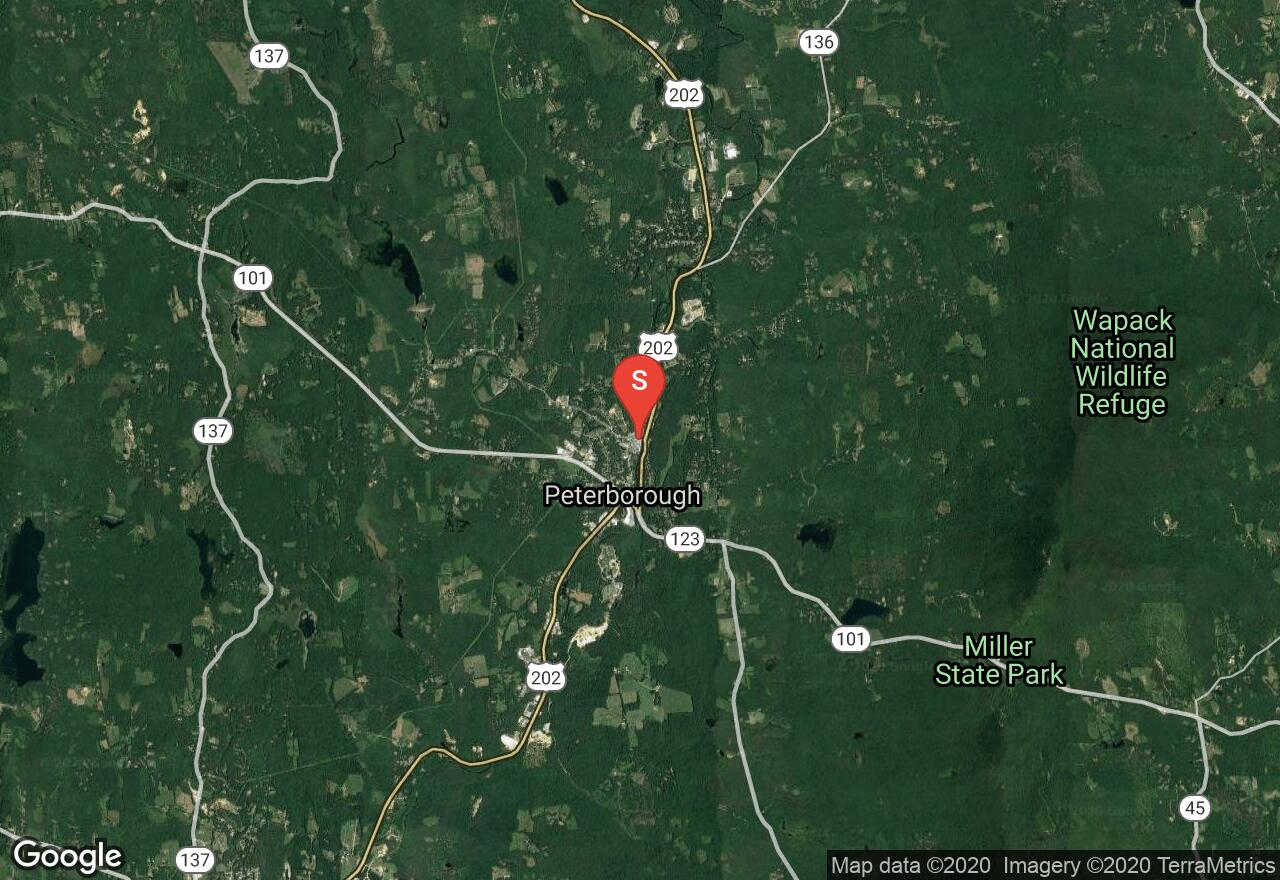
New Hampshire, Peterborough
03 :54 hrs
9.3 mi
15.003143 ft
I
This is nice paddle beginning in Peterborough; it wanders out of town into suburban and then pastoral settings ending at Powder Mill Pond. This stretch is almost always navigable and has a good blend of flat, quick and whitewater that makes it accessible for most. There is a portage along the way but it is a short one encountered at the outlet of the Contoocook Reservoir at about mile 1.8.
Vermont, Lamoille County
00 :55 hrs
2.8 mi
85.79712 ft
V
This section of the Winooski has a series of waterfalls, ledges, holes, and slides. Due to the nature of the area, this river-run can only be paddled a few days (on occasion) out of the year when the water is high. Recommended conditions require around 2,000 cfs on the New Haven River for this to be considered. Following alongside Route 12, one will paddle over many falls, one of which is a 15 footer as one nears the end of the course (which is shortly preceded by a small ledge). Be cautious on this 15 foot waterfall when attempting because there is a ledge part way down the fall. When in doubt, scout. At the end of the entire route, there is another waterfall at nearly the same height as the previous 15 footer. After the last fall, there is no real designated spot to exit the river at take-out, so one will need to find an area that suits.
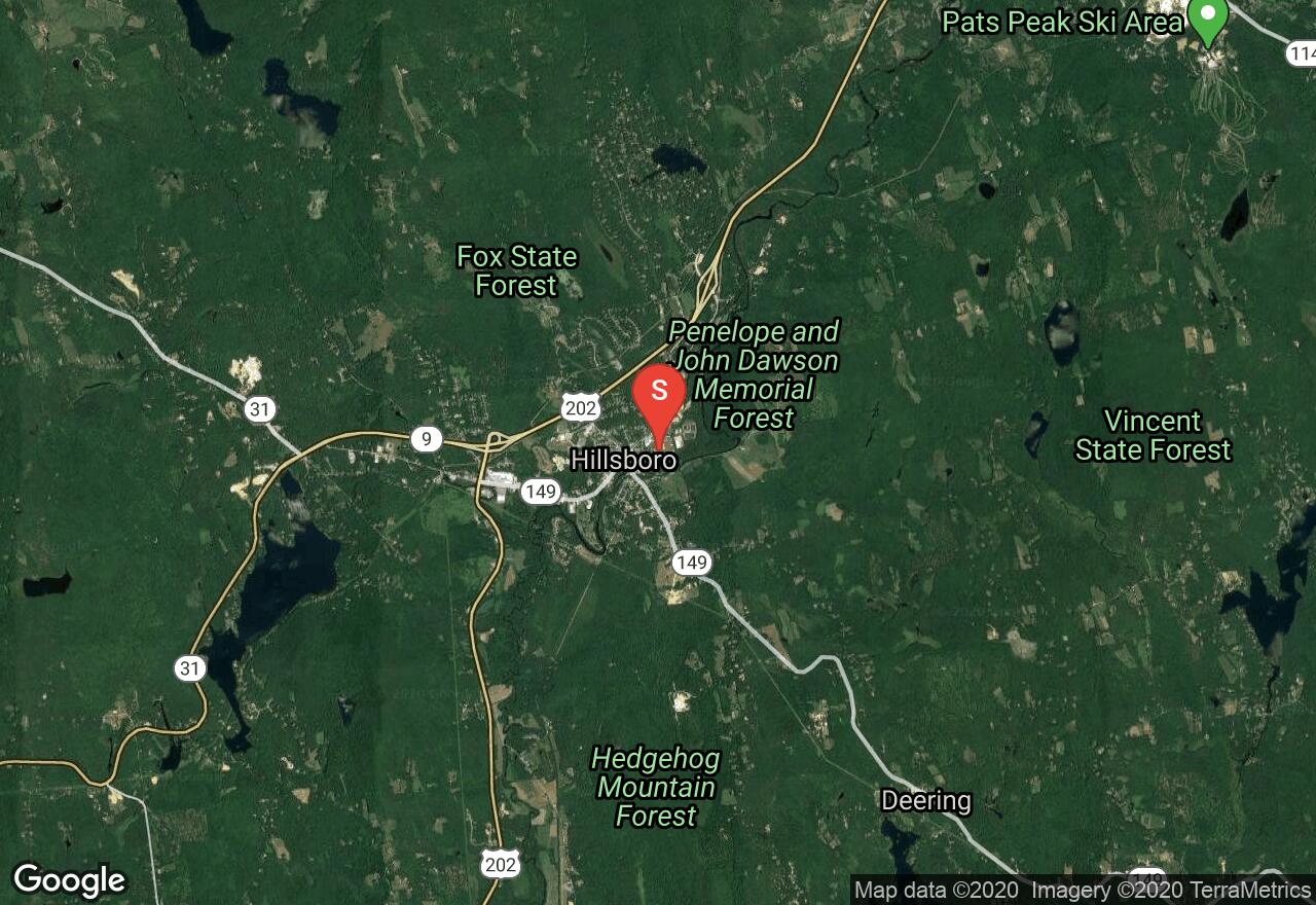
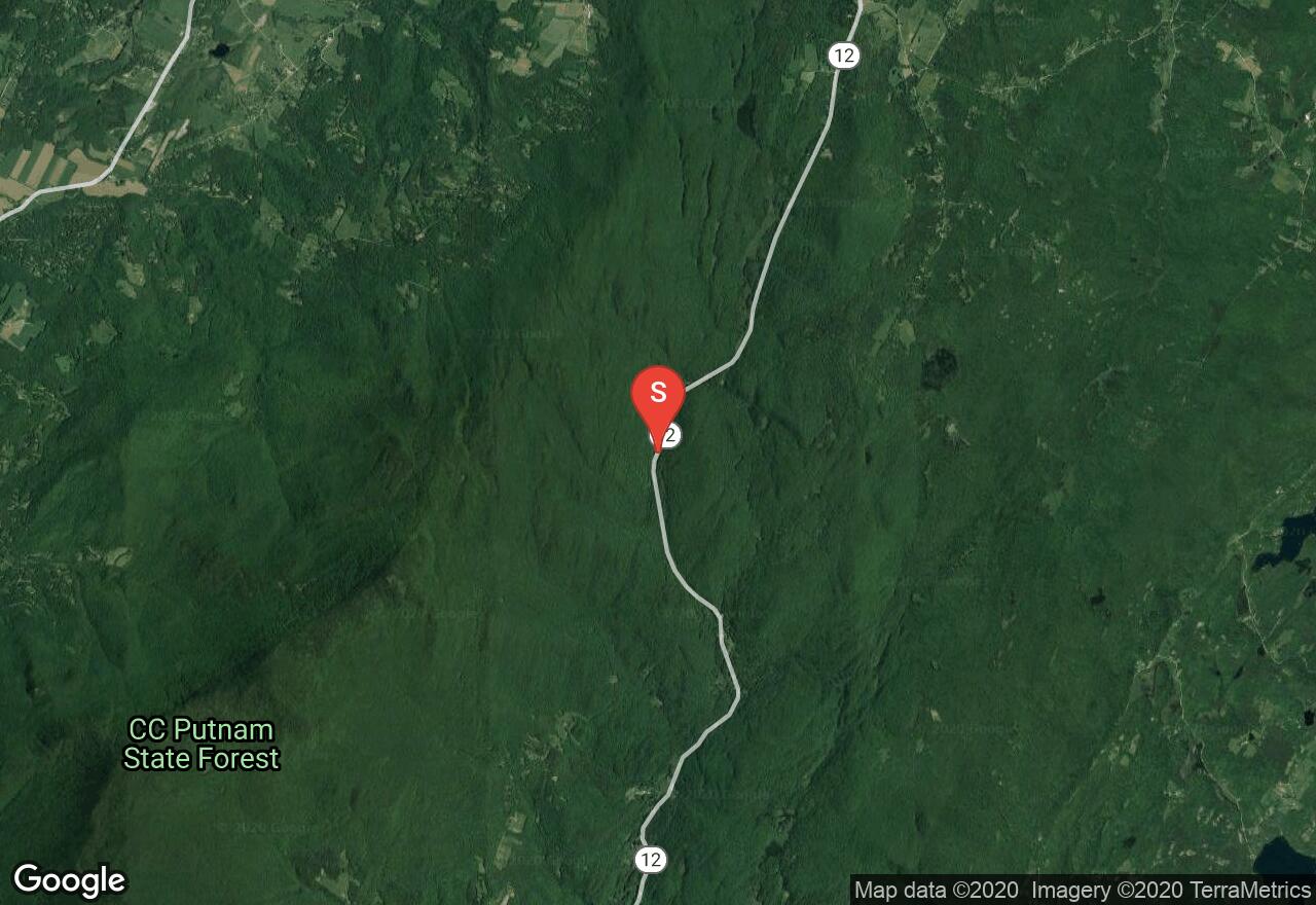
New Hampshire, Hillsborough
02 :51 hrs
7.1 mi
47.70008 ft
IV
This section of the Contoocook is among the more popular bits of whitewater in New England due to its challenging rapids and reliable flows. This outing is not for the beginner; there are many class III/IV rapids that must be scouted before attempting them; the GPS track provided does not imply a suggested course down river. Along with the challenge this float is enjoyable due to the natural condition of the riverbanks and surrounding woodlands.
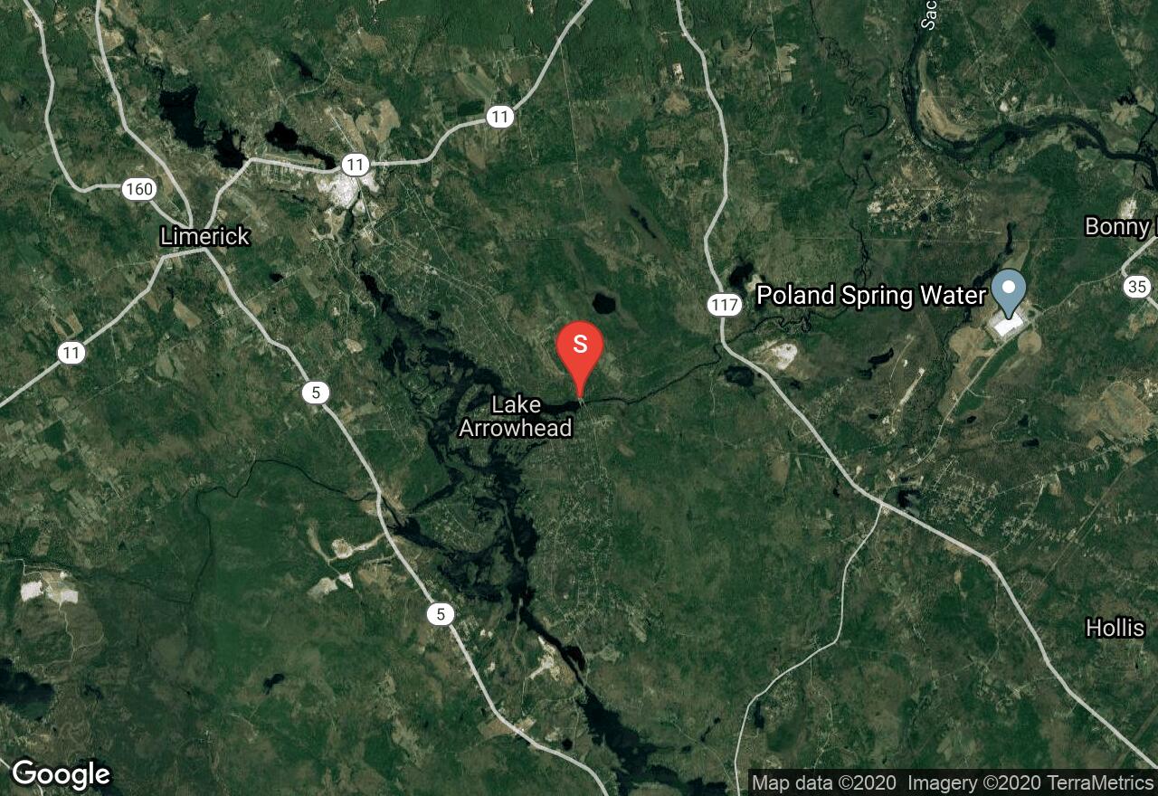
Maine, York County
04 :31 hrs
10.8 mi
26.03917 ft
II
The Little Ossipee is a scenic river that flows through southwestern Maine, offering paddlers some great one-day and multi-day trips. The scenery includes lots of wooded shoreline and some rural development. There is a ledge drop that should be portaged. It is located just past the 4-mile mark and can be portaged to the right. The take-out is Hardscrabble Road which is right before another ledge drop that would need to be scouted if continuing further down the river. Other than the rapids that are portaged, the river is otherwise mostly flatwater and quickwater that no other runnable rapids.
Maine, Oxford County
00 :39 hrs
1.8 mi
41.036438 ft
IV
Dependent upon water releases from the dam on Aziscohos Lake during the summer, the Magalloway River offers whitewater, flat water, and ledge drops - be cautious of holes in the middle of these ledges. When in doubt, scout. From the put-in at the power plant, there is immediately a run of class IV rapids. Some paddlers like to put-in about a hundred yards downstream from the power plant, but it's up to one's own discretion on where to put-in. Take-out is just on the other side of the Route 16 bridge at a small pull-off.
Maine, Oxford County
03 :60 hrs
9.4 mi
3.5966492 ft
I
The Androscoggin runs almost 180 miles through Northern New England, offering paddlers a variety of trip options on the scenic river. This half-day paddle covers the section between Hanover and Rumford and consists of natural and rural terrain with some scenery of the surrounding mountain landscape. This section offers lots of riffles but no major currents. The put-in and take-out are both public launches with easy access and parking.
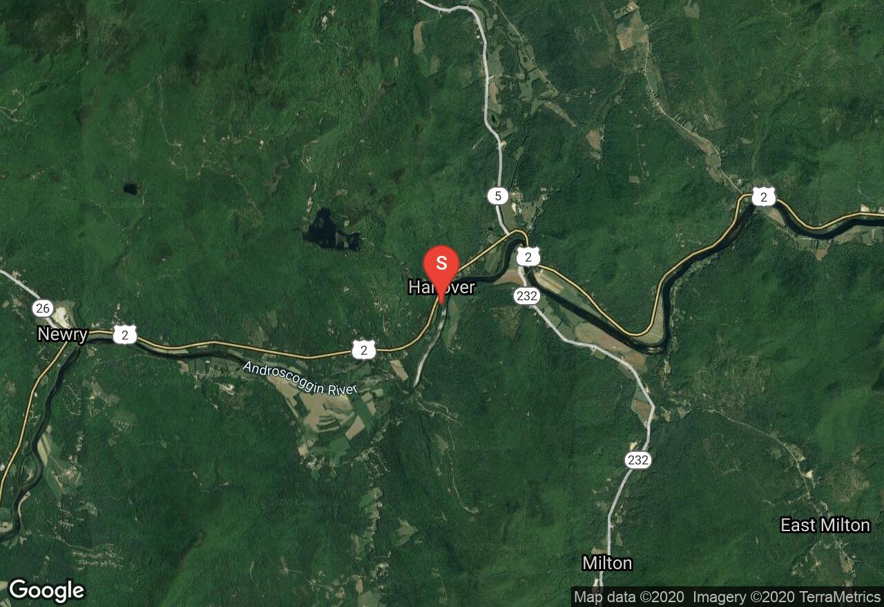
Maine, Oxford County
05 :03 hrs
11.9 mi
9.521652 ft
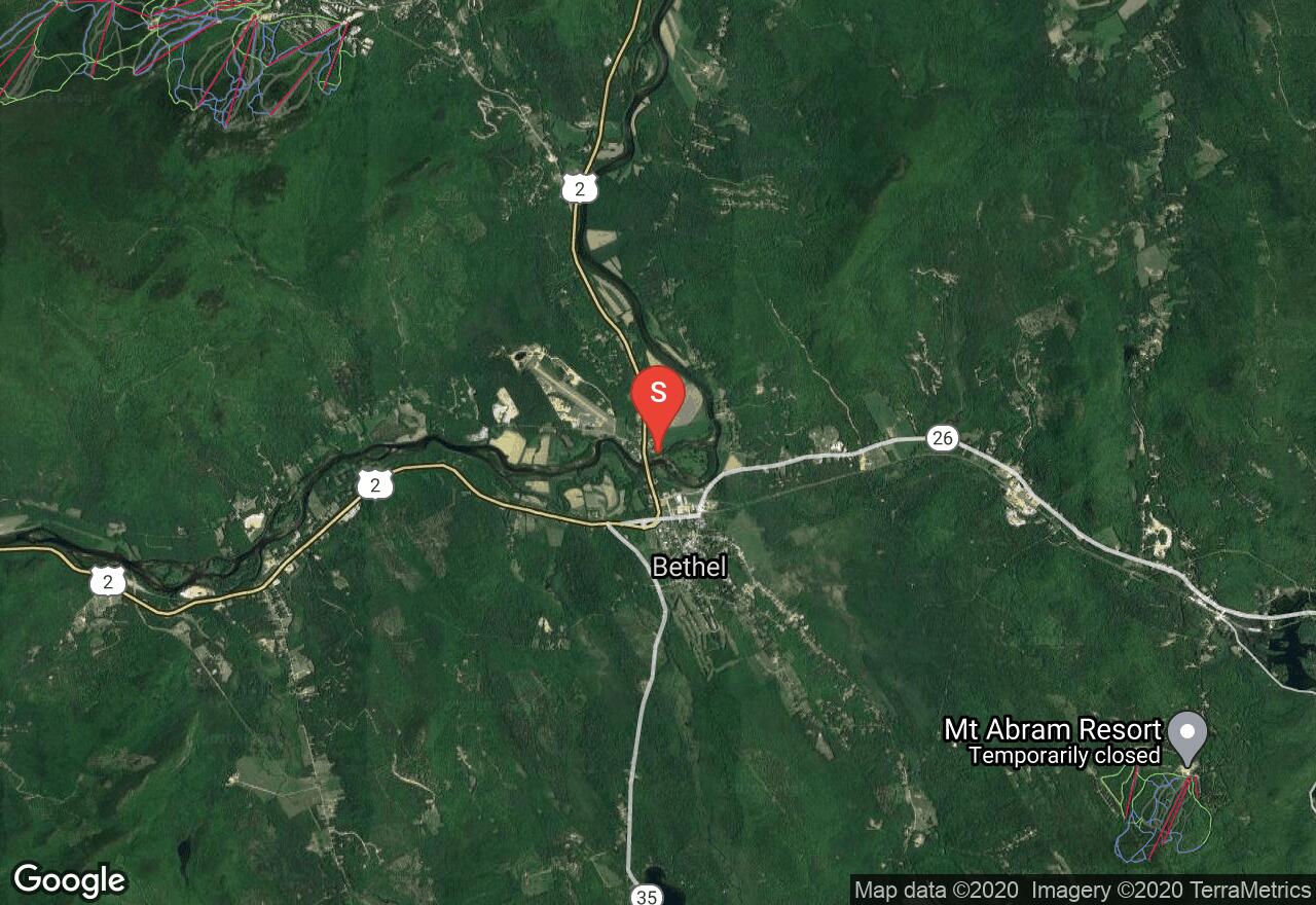
I
The Androscoggin runs almost 180 miles through Northern New England, offering paddlers a variety of trip options on the scenic river. This 12-mile section between Bethel and Hanover consists of lots of natural terrain and impressive scenery of the surrounding mountain landscape. This section offers some small riffles but no major rapids to navigate. The put-in is at a private campground so make sure to obtain permission first. The take-out is a public launch located in the town of Hanover.
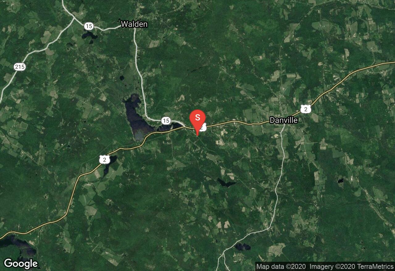
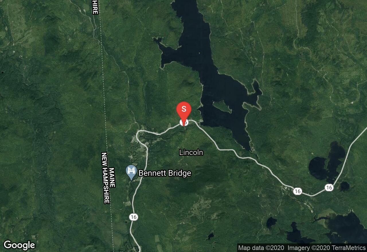
Vermont, Caledonia County
01 :37 hrs
4.5 mi
82.88873 ft
V
This route begins next to the brook by a power plant in West Danville. While on this narrow brook, one will travel through densely wooded areas as well as encounter slides, ledges, and whitewater. Most of the whitewater is a class III difficulty, with higher water causing higher difficulty ratings. The water level varies and is not able to be paddled most of the year until there has been heavy rainfall or snow-melt in order for the dam to release. Contact Green Mountain Power after heavy precipitation for spillage amount over the dam. Parking at the put-in and take-out locations are limited along small roads and require one to find a suitable entry and exit point to and from the water.
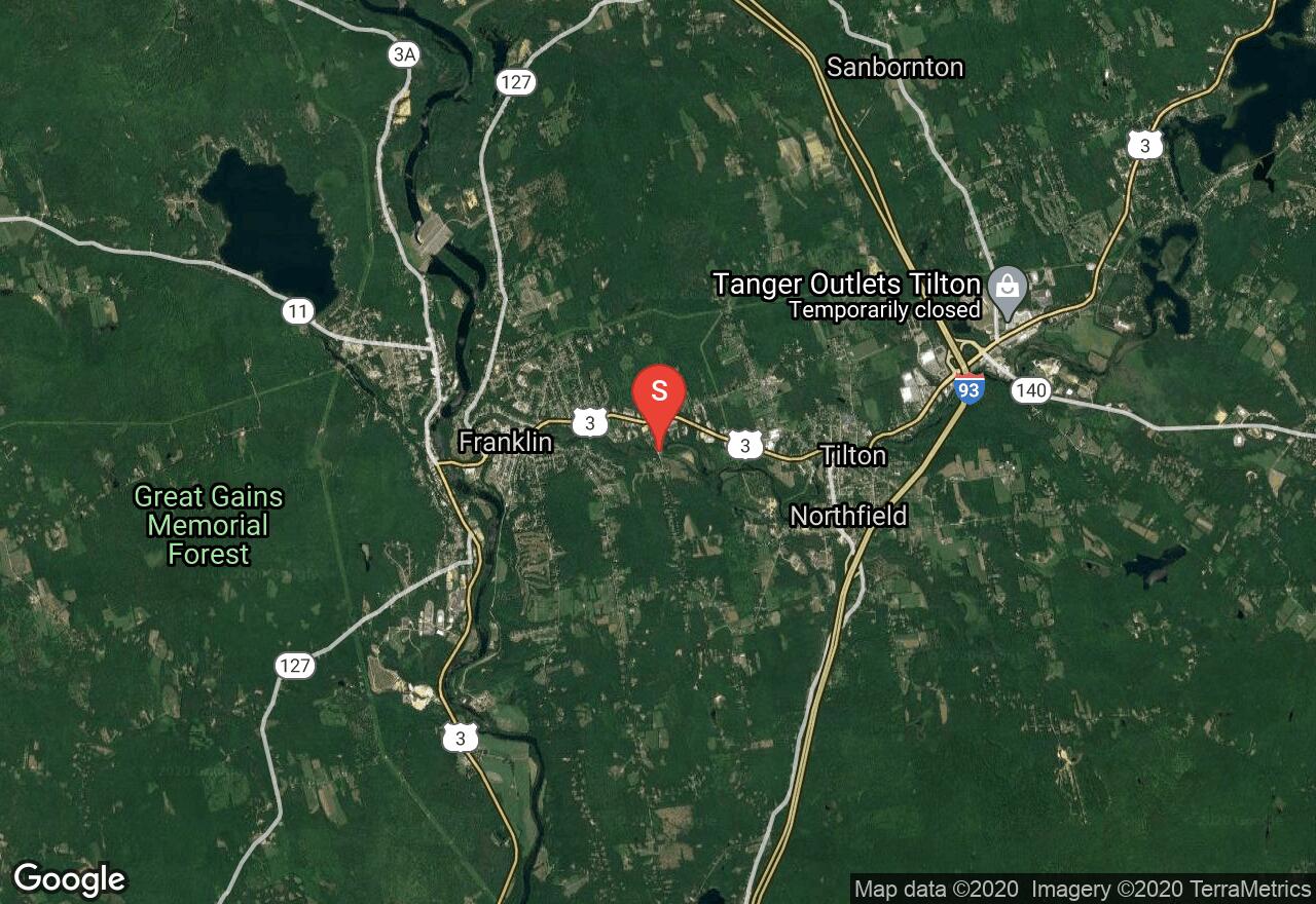
New Hampshire, Northfield
00 :27 hrs
1.3 mi
28.10131 ft
IV
This short, challenging stretch or whitewater and bounces over seven or eight rapids that range from class III to class IV depending on river flows. The surroundings of this paddle are scenic with heavily wooded banks on both sides punctuated by old dam and factory ruins. This float is of the degree of difficulty that you really should scout it before running; you can accomplish this from the Winnipesaukee River Trail that parallels the left bank. Also be aware that the GPS track provided is not intended to imply a suggested course down river.
See more adventures..
Explore complete list
Explore nearby adventures

