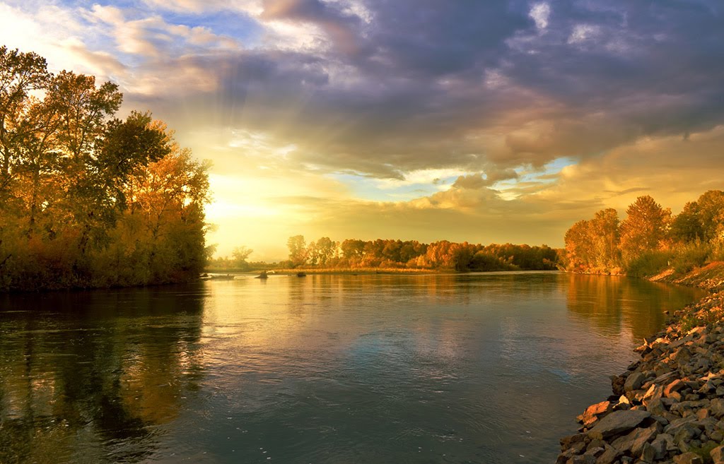
Best Waterways in New York
Trying to find the best waterways in New York? Bivy has great hiking, biking, paddling, climbing, skiing, riding and more, with hand-curated trail maps, as well as detailed driving directions.
New York, Albany County
00 :24 hrs
1 mi
16.20044 ft
I
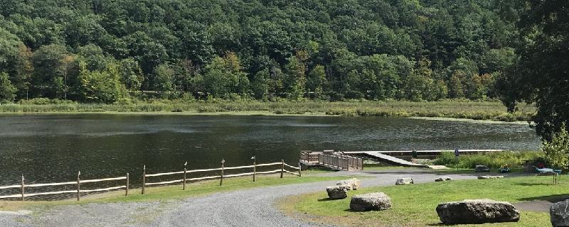
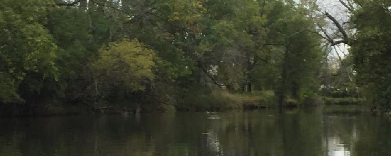
Lake is lovely and peaceful but very small. Super easy beach type launch area with picnic pavilion, portapotty and charcoal grills. Plenty of parking. No fees. Park has playground and hiking trails. Trails appear as if they might be good for mountain biking. Lake has lovely marshy areas at either end full of snapping and painted turtles, king fisher, great blue herons and other water birds. Didn't seem possible to navigate too far into the marshes before it became impassible. Seems to be popular with fishers. Lovely in every way except that there is little to explore. Even the laziest of paddles of the perimeter will take no more than an hour. Excellent location for a new paddler to test out a boat and skills.
New York, City of Saratoga Springs
02 :57 hrs
3.5 mi
13.973263 ft
I
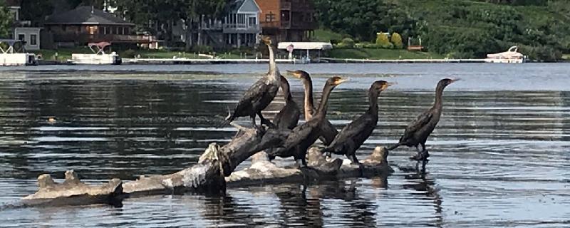
Possible wind and waves across Saratoga Lake. One mile to the entrance to the Kayadeross Creek. Paddle upstream against very gentle current. Plenty of water and no significant obstruction at water level 203.6 https://waterdata.usgs.gov/ny/nwis/uv/?site_no=01330884&PARAmeter_cd=62614,00065,00062 Possible side trip: One mile in is well marked turn off to the right. Lake Lonely Outlet, very pretty wooded one mile to Lake Lonely. Lake Lonely Livery rents kayaks and SUPS. Park and launch available for $8 per car. About 1.75 miles upstream from Lake Lonely turn off is Kayadeross Ave Launch. We were told there was room for about 5 cars and approximately 100 yard portage to water from parking. Beyond here it gets very noisy as you approach I-87. Mergansers, Herons, King Fishers, Turtles.
New York, Washington County
03 :14 hrs
7.5 mi
23.211758 ft
II
Enter South Bay, Whitehall Marina, Poultney River
New York, Erie County
01 :25 hrs
3.3 mi
9.245956 ft
I
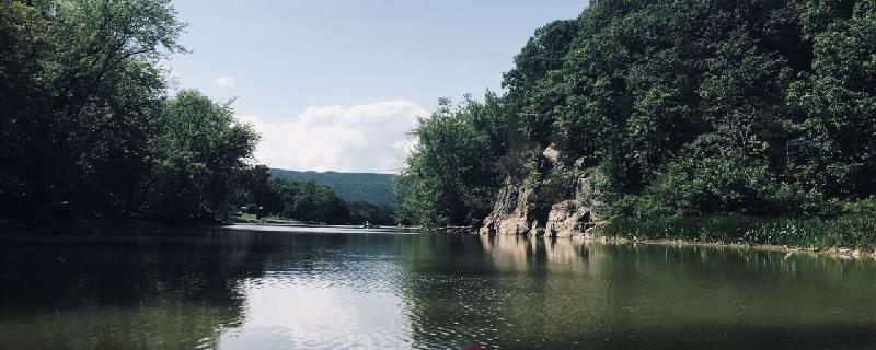
Ellicott Creek is a tributary of Tonawanda Creek in Western New York. This is easy paddling through smooth water, floating launch, and lots of wildlife.
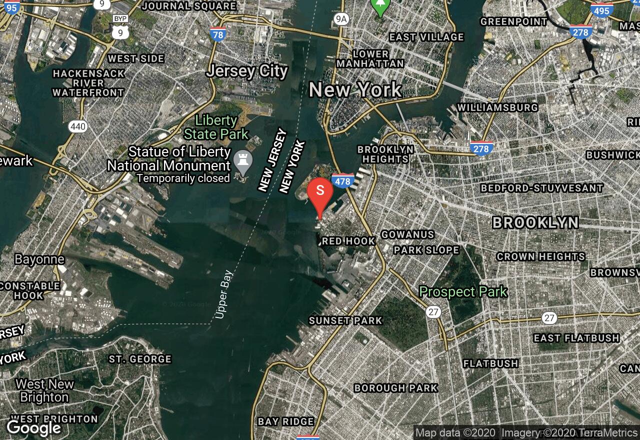
New York, NYC
02 :04 hrs
5.2 mi
- ft
SK III
There are great views along this route: the Brooklyn Bridge, the Manhattan skyline, and up-close paddling by the the Statue of Liberty and Ellis Island (keep clear of the restricted areas which are usually marked by buoys). The Upper Bay is busy with large vessels such as cruise ships, ferries, and cargo ships, so be very cautious while traveling across open water. Also, use good judgement deciding when to paddle because weather and other conditions can make the water's surface too treacherous for paddlers, Parking at the put-in site is usually available along nearby roads, but be attentive to restricted parking areas.
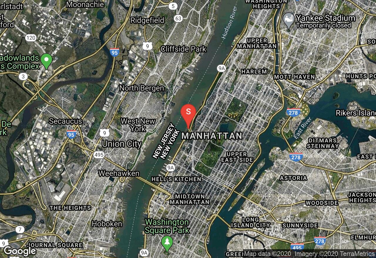
New York, NYC
03 :25 hrs
8.5 mi
0.89979064 ft
SK I
The Hudson River can suffer from tidal effects of the Atlantic Ocean and determine which direction to paddle. For this route, it's best to paddle during an outgoing tide. It can also be an out and back journey if one plans around the tides. The river is very wide and straight (compared to river standards), and this section is busy with large vessels such as cruise ships, ferries, and cargo ships - so be cautious. There are great views along the way: The Statue of Liberty, Brooklyn Bridge, and the Manhattan skyline. A permit is required to launch from the W. 79th St. Boat Basin (contact New York Parks Dept for details). Parking at the take-out site is usually available along nearby roads, but be attentive to restricted parking areas.
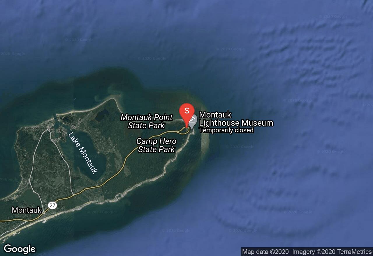
New York, Suffolk County
02 :13 hrs
5.5 mi
11.198705 ft
SK IV
Montauk Point is a true coastal paddling adventure. Traveling along the far eastern coastline of Long Island, one will be able to see into the vastness of the Atlantic Ocean. The state park lines much of the northern shore, offering views of nature rather than development. In spring or winter, one may have a chance to see wildlife such as seals on the banks. Once reaching Oyster Pond, the return trip begins back to view the Montauk Point Lighthouse. Be cautious around this area and steer clear of the shore below the lighthouse as the water can get very rough and it's best to be at a safe distance. If one desires, and the water is calm enough, paddling along the southern coastline is possible before turning around to head back to the launch site. There is almost a half mile carry to the water from parking. Permit may also be required to launch kayaks here (contact New York Parks Dept for more info).
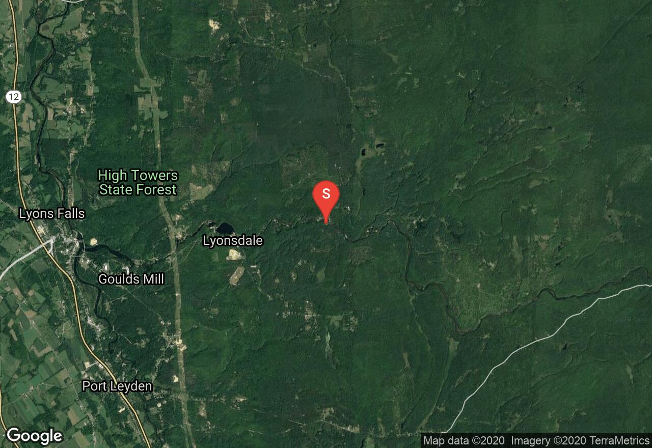
New York, Lewis County
01 :28 hrs
4.1 mi
88.760864 ft
VI
One of the more notable whitewater paddling adventures in New York is the Moose River Bottom. Very popular, and for good reason, it features several cascade falls, slides, rapids, and some flat water areas. Some noteworthy sections are Fowlersville Falls, Double Drop, Agers Falls, and Crystal. The center of Fowlersville Falls can be quite dangerous and many take the far left route - but be sure to scout it out. A little further downstream is Knife's Edge where most stay to the right and avoid the center pothole that has proved fatal in years past - again, be sure to scout it out. Shortly after, there is a required portage around a dam. Extreme caution should be used when attempting this course and only experienced paddlers should consider it. Be sure to study the route in more detail before attempting in order to be familiar with all hazards. Difficulty rating can fluctuate depending on water levels.
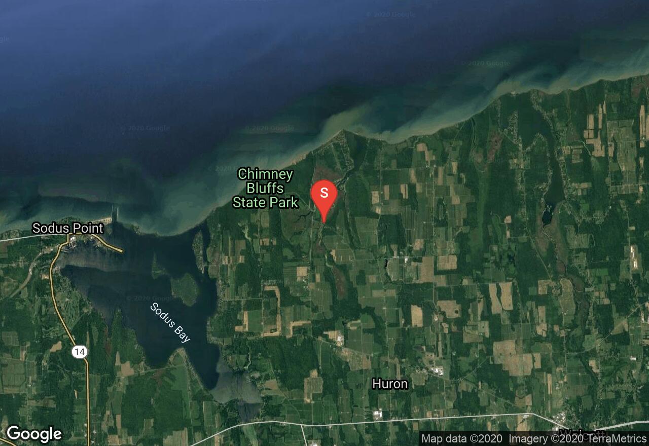
New York, Wayne County
04 :19 hrs
9.6 mi
1.1977997 ft
I
This is a mixture of creek, lake, and coastline-like paddling all in one adventure. One will begin navigating through narrow creeks that can sometimes be quite shallow. Then once making way through the creeks, one will come upon East Bay, a small, protected bay off of Lake Ontario. Those that are experienced paddlers can then travel out along the shoreline of Ontario to reach the Chimney Bluffs, which are an interesting geological formation of tall spires that can easily be viewed from the water.
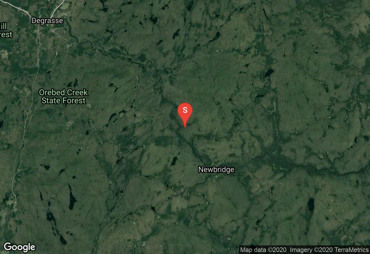
New York, Saint Lawrence County
02 :49 hrs
7.5 mi
126.285934 ft
V
This section of the Grass River features a series of large waterfalls and major rapids. The first of which is Large Marge, a 30 foot waterfall. There are also long slides and a 35 foot staircase falls named Twin Falls. Other notable falls include: Flat Rock, Adrenaline, Sinclair, and Bashford. There is a small area to park at put-in along the side of the road; with a trail leading to the river a hundred yards away or so. Take-out is at the bridge in Degrasse wherever suitable. Be attentive to restricted parking areas. Extreme caution should be used when attempting this course and only experienced paddlers should consider it. Be sure to study the route in more detail before attempting in order to be familiar with all hazards - and check water levels before going.
See more adventures..
Explore complete list
Explore nearby adventures

