Best Rock Climbing in New York
Trying to find the best rock climbing in New York? Bivy has great hiking, biking, paddling, climbing, skiing, riding and more, with hand-curated trail maps, as well as detailed driving directions.
New York, Essex County
00 :12 hrs
0.2 mi
51.617126 ft
Various
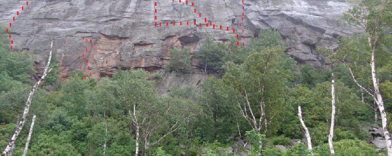
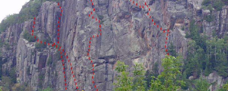
The Spider's Web was named, even before climbing began there, for the intricate cracks that run across the sheer rock face in several directions. The quality of the rock is unsurpassed in the Adirondacks: slightly overhanging, solid but full of cracks and virtually without ledges, and dry with a southern exposure and long climbing season. Accordingly, the Web is home to some of the best and most difficult routes in the Northeast, with several classics like It's Only Entertainment and Drop, Fly, or Die. There are several parking options near the start of the approach trail; the closest good option is in the camping area at the outlet of Chapel Pond. An information post in a clearing by the side of the road sometimes notes cliff closures for nesting falcons. Follow a trail through an open area with a view of the cliff, then descend via switchbacks into a bouldery ravine that is mysteriously cold, even in the middle of summer. Emerge onto the talus field on the far side and climb gradually through the boulders, staying left and relatively low (there is no trail here; the cliffs directly above are part of Lower Washbowl.) The trail meets the cliff on the far right end, beneath Romano's Route.
New York, Essex County
00 :03 hrs
0.1 mi
9.309021 ft
Various
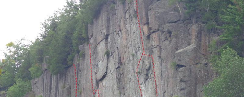
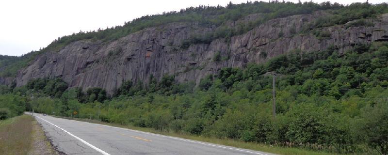
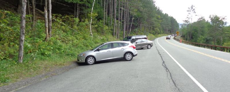
The main face at Poke-O-Moonshine Mtn offers one of the highest concentrations of quality multi-pitch climbing in the Adirondacks. There are 161 routes spread across the half-mile long face. The routes tend to cluster in the 5.10 to 5.11 range, but there is a good selection for most difficulty levels. The rock is a dark granitic gneiss that often forms large slabs with minimal protection, but is broken by diagonally-trending igneous dikes of lower quality that often form ledges. Please park only at the state campground, which is currently a day-use area only. Check the sign at the parking area for peregrine falcon closures in the early to mid-summer.
New York, Essex County
00 :11 hrs
0.3 mi
42.158264 ft
Various
The Upper Beer Wall forms the right side of the area collectively known as Beer Walls. The quiet (shielded from highway noise), scenic location, high quality rock, abundance of moderate routes, and ease of top-roping make the area one of the most popular in the Adirondacks. The Upper Beer Wall is best known for the popular toprope Seven Ounces, the cracks of the 5.10 Wall, and the corner of Frosted Mug. Expect company on nice weekends, but the abundance of routes leaves many nice choices. There are two parking areas: one above and one below the trailhead, which is marked by a log bridge across a ditch. The Upper Beer Wall is found by hiking to the height of land, then following the trail down a gully and to skier's left.
New York, Essex County
00 :03 hrs
- mi
16.682495 ft
Various
Pitchoff Chimney Cliff is an impressive rock face very close to Highway 73 near the top of Cascade Pass, overlooking Lower Cascade Lake. The cliff is named for an interesting chimney feature on the right end that actually separates a good portion of the cliff from the mountain behind it such that the rock face is almost a free-standing feature. The high elevation and cool breezes of the pass, combined with easy access, make this a very popular summer destination. The good rock (not the regional standard anorthosite) features several moderate to difficult, excellent crack and face routes in addition to the historic Chimney route. There is also a "Practice Wall" below the main cliff where there are several easy routes suitable for toproping. Parking is limited to the pullouts along the highway
New York, Essex County
00 :23 hrs
0.6 mi
44.469482 ft
Various
The Lower Beer Wall forms the left side of the area collectively known as Beer Walls. The quiet (shielded from highway noise), scenic location (with excellent views of the High Peaks from the top of the wall), high quality rock, abundance of moderate routes, and ease of top-roping make the area one of the most popular in the Adirondacks. The Lower Beer Wall is best known for the cracks of Rockaholic, the face of Blacksmith, and the toproping at Live Free or Die. Expect company on nice weekends, but the abundance of routes leaves many nice choices. There are two parking areas: one above and one below the trailhead, which is marked by a log bridge across a ditch. The Lower Beer Wall can be accessed one of two ways. For the left (far) side of the cliff, take the trail right along the ridge-top that swings around to the base. For the right side of the cliff, follow the main trail down the gully and take the second right (the first right goes to the separate Live Free or Die area.)
New York, Essex County
00 :03 hrs
0.1 mi
6.2380066 ft
Unknown
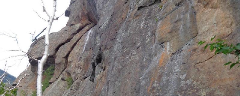
Chapel Pond Slab is home to some of the most popular slab climbs in the Northeast. It features several routes, some with decent protection, but some rated X, and all with great friction climbing and views of the cliffs and mountains across the pass. All of the routes begin in the same place, which can lead to some crowding on nice summer weekends. This historic area has attracted climbers for many decades, including the legendary Fritz Wiessner. The most common option for descent is to find a rough trail that leads down the climber's right from the top of Bob's Knob, a rocky cobble on the upper right of the slab that is the end of several routes.
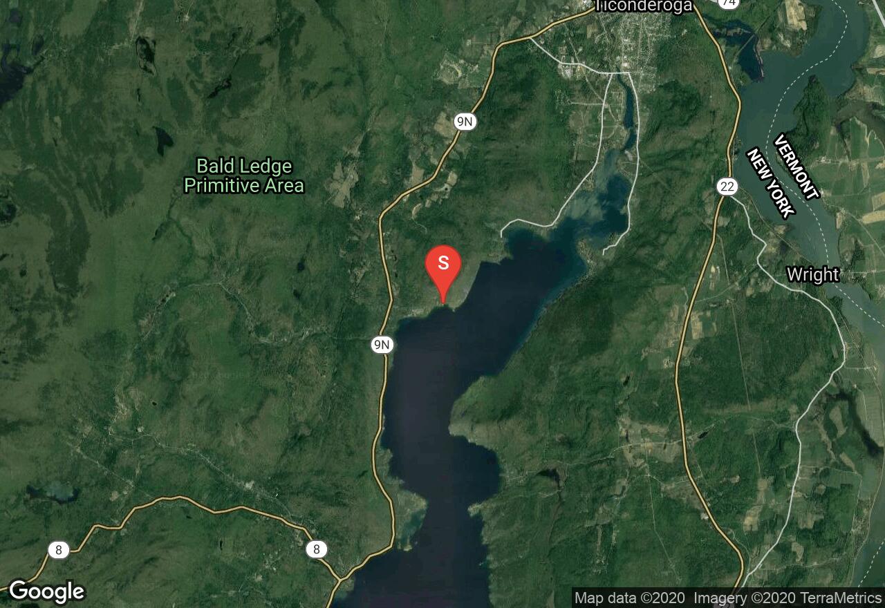
New York, Warren County
00 :15 hrs
0.5 mi
25.76789 ft
Unknown
Rogers Slide is an impressive off-vertical rock face that plunges 600 feet directly into the clear water of Lake George. Uniquely, its easiest access by far is via boat, most commonly from a small cove at the far end of the Rogers Rock state campground. Follow the shore past a smaller slab that meets the water (the Jolly Roger Slab) to an area of trees below the much larger Rogers Slide. Moor your boat in this area, then traverse north on foot 100' over rough terrain to the base of the climbing area.
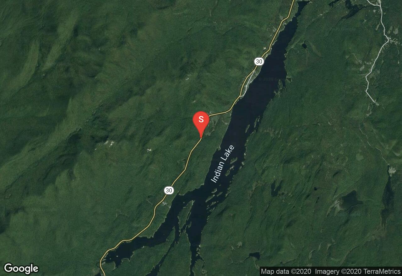
New York, Town of Indian Lake County
02 :38 hrs
3.4 mi
605.96844 ft
Various
The cliff just below the summit of Snowy Mountain, the highest peak in the Adirondacks outside of the High Peaks, offers a great combination of an airy environment, great views, and unique rock full of interesting features like huecos that are very rare in the Adirondacks. Also unusual is that most of the routes on the cliff are entirely or almost entirely bolt-protected, so having the correct gear is much less of a concern. However, the price for this unique climbing is a long approach up a steep, eroded hiking trail. To access the base of the cliff, follow the trail for about 3.3 miles and look for a small campsite on the left. If you reach a large clearing, you have gone a little bit too far. A faint trail on the left leads across the east ridge and then down about 100 vertical feet to the open, grassy ledges at the bottom of the summit cliff, with additional steep slabs below.
New York, Essex County
00 :22 hrs
0.3 mi
129.44586 ft
Various
This tall and steep cliff looms high above Chapel Pond with some of the best multipitch routes in the Adirondacks. In addition to views of the pass area, many of the High Peaks are also in plain sight from the cliff. There is a variety of climbing here due to the irregular surfaces of the rock, which is of good quality, ranging from broad faces to good cracks to large roofs. The cliff is divided into left and right sides, with the approach trail marking the divide. Use the approach trail for the Creature Wall, continuing to hike left once you reach that cliff. The trail then enters a talus slope and veers right to a small cliff, then travels left and steeply up through more talus to the base of Upper Washbowl. Please be aware of potential seasonal closures for nesting peregrine falcons in summer. In summer, the cliff receives shade until late morning, and is then in the sun the remainder of the day.
New York, Essex County
00 :50 hrs
1.2 mi
176.42145 ft
Various
Barkeater Cliff features a number of high-quality moderate routes on good rock on a cool, northwest-facing mountainside. Despite its remote feeling, there are a few dozen established routes and a very good approach trail. Much of the credit for route establishing and rock and trail maintenance goes to Ed Palen, whose guide service is located at the trailhead. The first part of the approach follows the Jackrabbit Ski Trail for about 0.8 miles until reaching a cairn 100 yards beyond a wooden bridge. Take the trail left and cross the brook, picking up the trail on the opposite side and follow it gradually uphill and past some interesting boulders to the base of the cliff on its left end (1.0 mile from the road.) The trail continues along the cliff base for another 0.15 miles or so before petering out.
See more adventures..
Explore complete list
Explore nearby adventures

