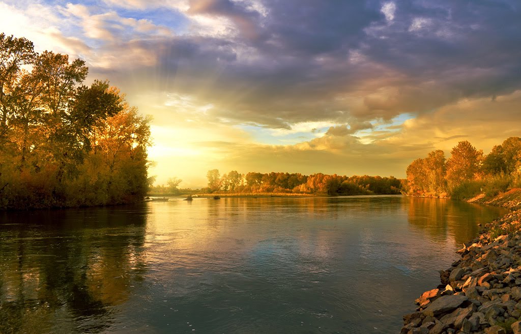
Best Crosscountry Skiing in New York
Trying to find the best crosscountry skiing in New York? Bivy has great hiking, biking, paddling, climbing, skiing, riding and more, with hand-curated trail maps, as well as detailed driving directions.
New York, Essex County
09 :21 hrs
5.3 mi
762.74927 ft
Hard
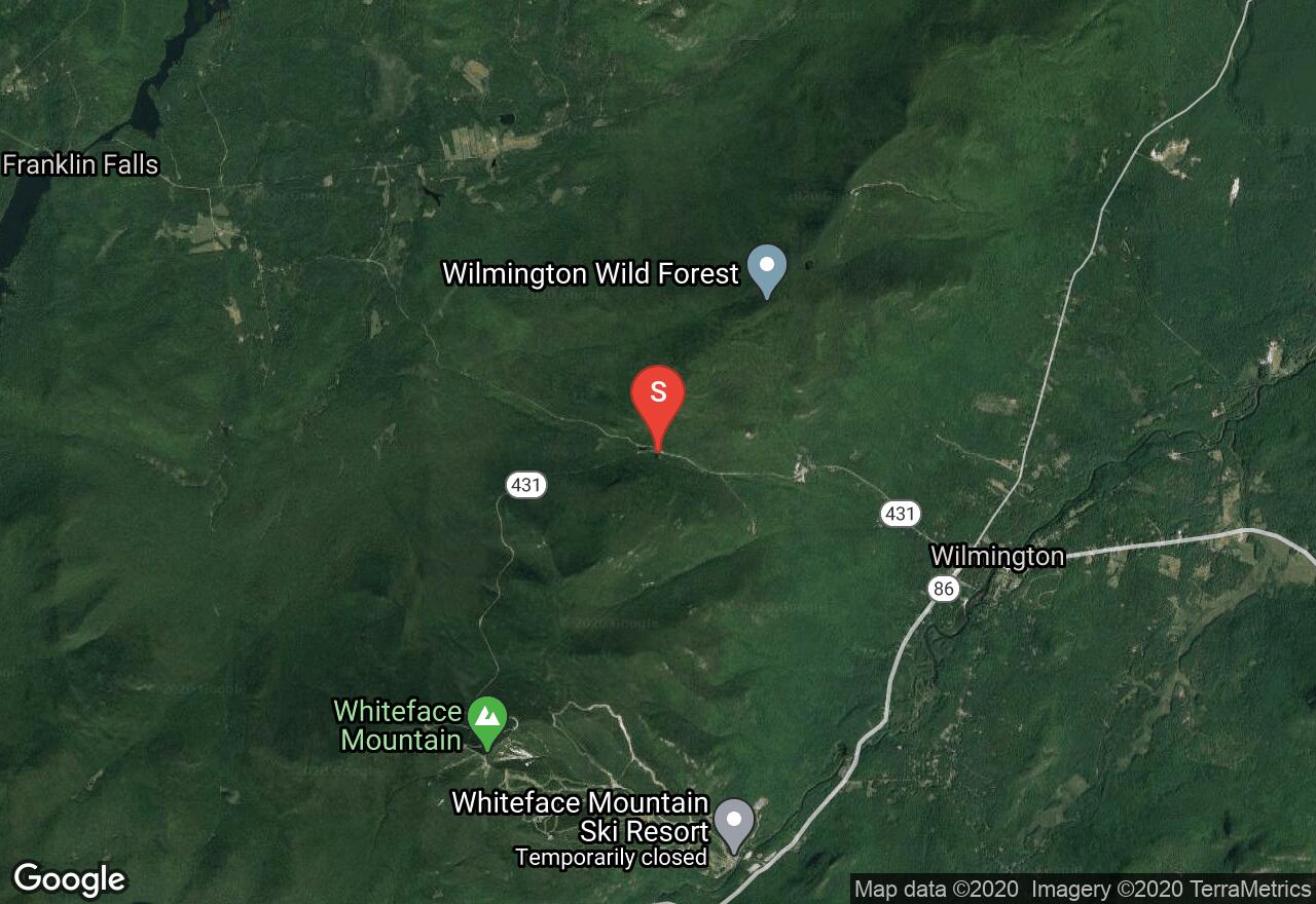
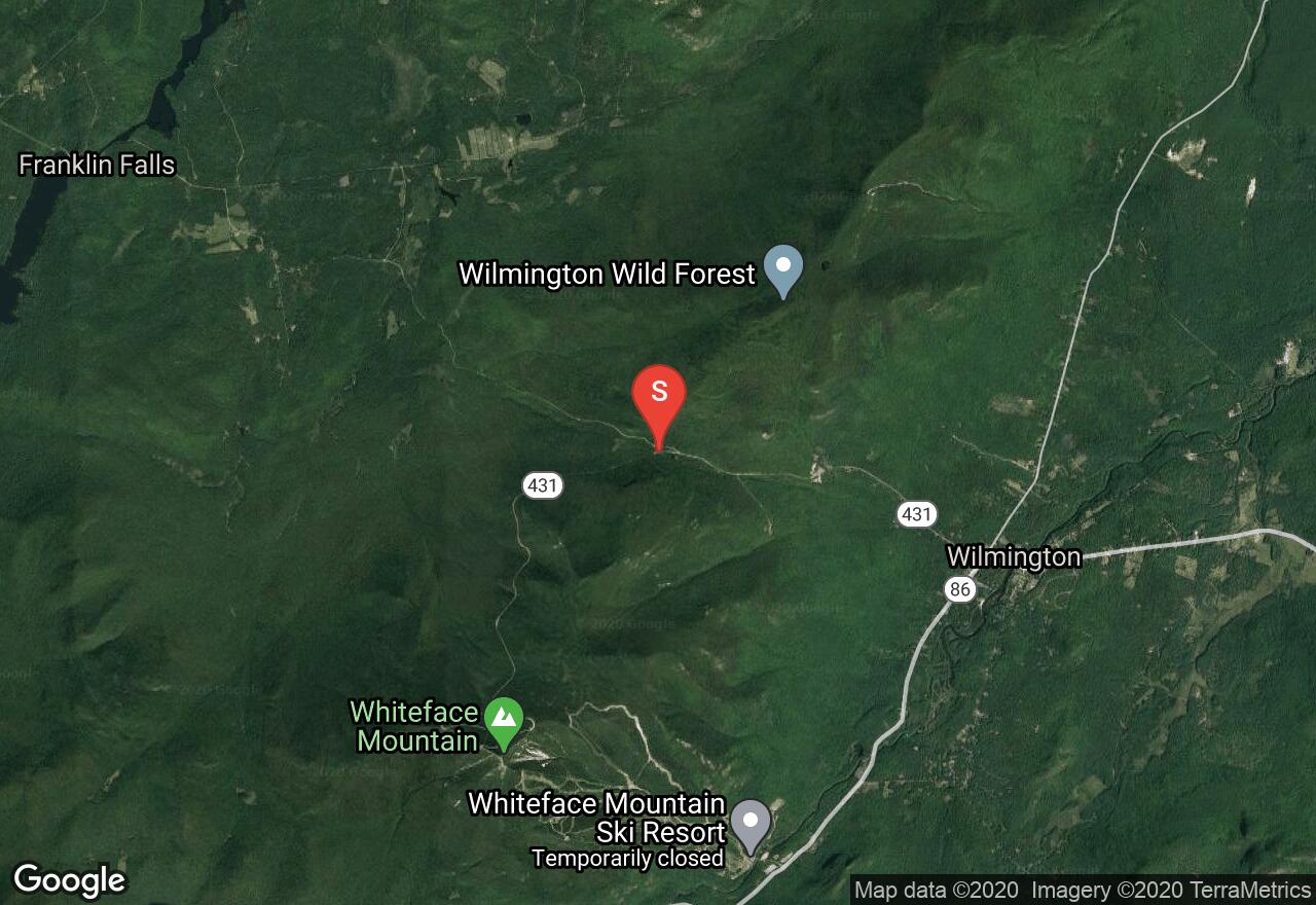
When presented with prime conditions during the winter months, this route provides great access to a nice 4,000ft ascent and descent. Due to it’s high altitude, the Whiteface Mountain Memorial Highway serves as a popular early season tour, or a last resort option during low -snow season. Park near Lake Stevens at the tollhouse to, and begin your ascent. At about 3.5 miles in you will reach a hairpin turn known as “Lake Placid Turn”. Here you will enjoy views of Lake Placid. Continue up past Wilmington Turn, which is located at about 4.5 miles before moving onto the castle near the summit. Finish to the summit by following the railing along the summer walkway. Enjoy this vista point before the exciting descent back to the vehicle.
New York, Essex County
08 :24 hrs
5 mi
674.93085 ft
Moderate
The Whiteface Veterans Memorial Highway was completed in 1936 and has introduced thousands of people to the splendors of Adirondack scenery without the need for strenuous exertion. A ski up the highway, which is closed to automobile traffic from the first snow until the last of it melts, is a wonderful adventure into the wintry alpine without the dangers of steep and rocky trails normally found at such high elevations. The road is generally plowed to a turn-around at the gate house at Lake Stevens. The highway offers a steady 8% grade that is neither too taxing on the ascent nor too steep on the descent. However, waxless skis with scales are recommended for most users both to aid with climbing and reduce speed on the descent. There are great views throughout the length of the road due to its width. However, this openness also means that it is frequently windy, and blowing snow can be a hazard, especially above 4,000 feet. Be aware that the castle and summit observatory are closed from mid October to mid May. For those wishing to summit the peak, it is generally safe to use the trail up the northwest ridge from the castle using your ski boots (due to the metal handrails) except in very icy conditions.
New York, Hamilton County
04 :33 hrs
2 mi
464.3316 ft
Expert
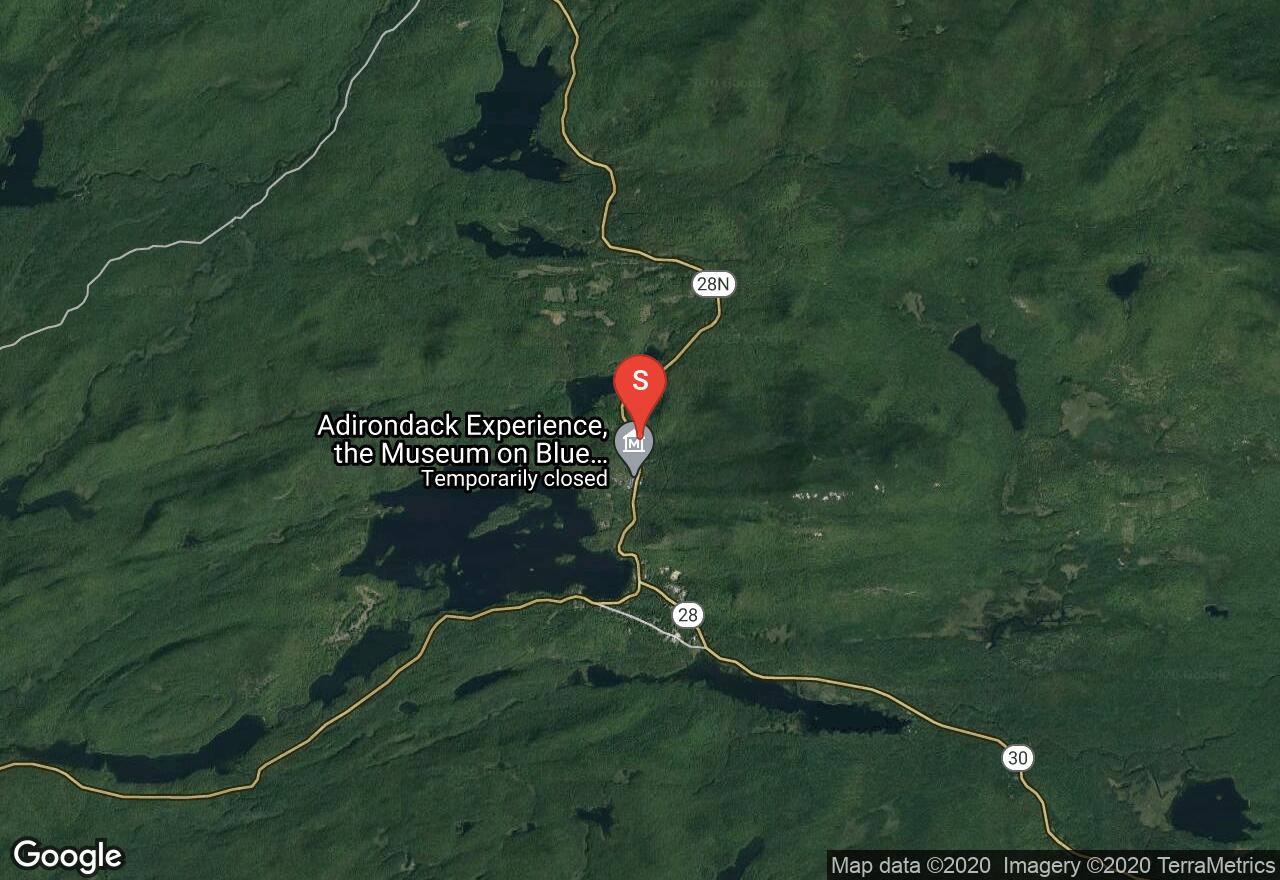
Located in the central region of the Adirondacks, Blue Mountain is one of the most popular destinations for hikers in the summer and serves as a great intermediate to hard route for both skiers and snowshoers. Locate the trailhead from the parking lot on the south side of NY 28N about a mile and a half from the Newcomb Visitor Center. Follow the red markers as the trail ascends and then heads right paralleling the highway. The trail soon moves left after a bridge over the brook before ascend the moderate climb to the summit. Once at the top, there are great views to the south and east. It is highly recommended to climb the tower and enjoy even greater views, from which you can see Santanoni Range, Algonquin Peak, and Mount Marcy. Follow your tracks back to the trailhead.
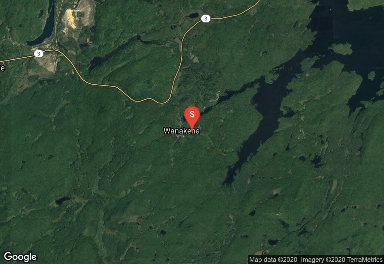
New York, Saint Lawrence County
02 :53 hrs
4.7 mi
230.74957 ft
Hard
As an extension of the High Falls Loop, Cat Mountain is located in the northern region of the Adirondacks and offers a great vista point at the summit. From the beginning of the Wanakena trail head head left (east) for 0.5 miles to reach the trail register. From here enjoy flat terrain for a mile to beaver pond. Winter conditions usually allow the ability to cross the pond (otherwise use the reroute to the right) leading to the gentle descent to the edge of Dead Creek at about 1.2 miles after the High Falls trail register. Next the trail follow the the shore to the next junction where a trail leads to a lean-to at Janacks Landing. After the junction the trail begins to ascend with some steep pitches until the Sand Hill junction. Turn left at the junction and follow the Cowhorn TRail to the waterfall at the outlet of Glasby Pond before proceeding to the the Cat Mountain junction. Go left at the junction and continue to the summit. Note, the last few hundred feet to the summit is not skiable terrain. After reaching the summit, enjoy vistas of Cat Mountain Pond, Three Mile Mountain and clear views of undeveloped lands as far as the eye can see. Retrace your tracks to your vehicle.
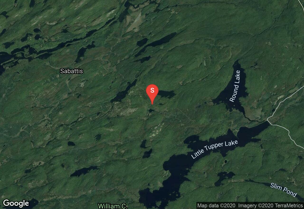
New York, Hamilton County
10 :24 hrs
10.5 mi
131.26074 ft
Hard
This longer route leading to Lake Lila and Frederica Mountain is located in a region that usually receives abundant snowfall in the Northern Adirondacks. If the road is not plowed, park along Sabattis Road and follow Lake Lila Road, passing Otter Pond, then the junction to East Charley Pond, and then the larger Charley Pond before reaching the summer parking lot and gate at the northeast end of Lake Lila. From here, either cross the lake, or if ice conditions are questionable, follow the road along the north west shore to reach the trail junction that leads to Frederica Mountain marked by yellow markers. Continue past the old railroad tracks before turning right at the next junction. After the junction, the trail ascends to the summit where great views of High Peaks await. Retrace your tracks back to the parking lot.
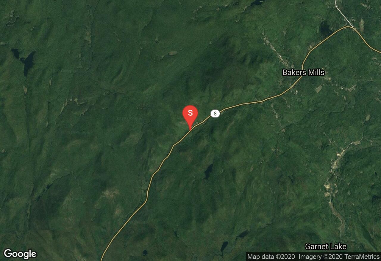
New York, Warren County
04 :28 hrs
9.9 mi
95.84442 ft
Moderate
As one of the more classic traverses in the Adirondacks, this section of the Sacandaga River Trail, known as the east branch, begins at the parking lot along NY 8, west of Bakers Mills. The trail starts with a steep climb to the shoulder of Eleventh Mountain. Soon after the climb you will notice the old stage road that merges from the left. Next the trail descends to Diamond Brook before following the the banks fo the river leading you to Burnt Shanty Clearing. After reaching the junction, you can either head right, which bypasses the lean to, but saves you 0.3 miles off your trip, or take a left which will continue to lead you along the river banks to the lean-to for a nice resting point with great views. After the lean-to the trail moves through a few tough spots continuing along the river banks before coming to yet another junction. If desired you can head left for a side detour, which will lead you to Big Shanty Flow. Otherwise stay right and continue to the bridge that leads over Cross Brook and a crossing over the East Branch on a bridge. Next ascend a few different climbs leading to a highlands region before descending down to a junction with the trail to Puffer Pond Trail. Continue past Old Farm Road clearing and finish to the parking area. You can either plan ahead and have another vehicle here or backtrack to the south trail head from which you began.
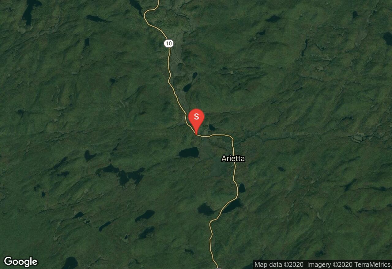
New York, Hamilton County
03 :12 hrs
3.2 mi
53.631653 ft
Moderate
Locate the trailhead along NY 10 just after one of the bridges that cross the west branch of Sacandaga River. Park at the pullout on the side of the road look for the trailhead on the opposite side of the road, which is marked with a small DEC sign. The trail begins with a gentle climb before descending and crossing a snowmobile trail. At the fork, head right and continue through some rolling ascents and descents. Cross an old bridge at 1.4 miles in and grab a glimpse of Dry Lake. From, Dry lake ascend up another gentle slope into a ravine before proceeding to east shore of Dexter Lake. To return, simply follow your tracks back to the trailhead. This route is flatter than other trails in the area and has less eroded sections. Because of this, it offers a great option when there is less than a foot of packed snow.
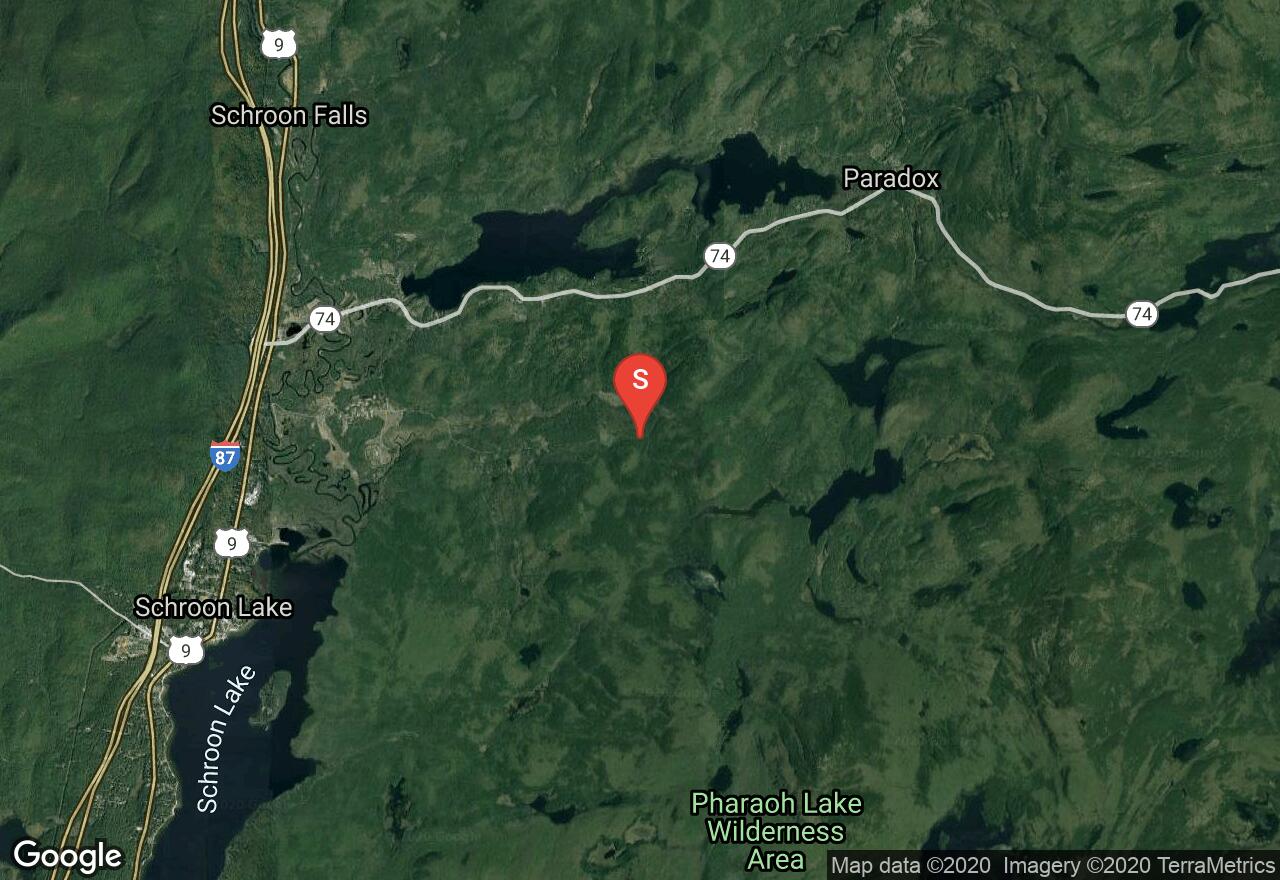
New York, Essex County
02 :11 hrs
4.8 mi
61.09424 ft
Easy
Locate the trailhead from the parking area at the end of Crane Pond Road, near the boundary of Pharaoh Lake Wilderness Area. The route begins with a easy uphill grade to a bridge over Alder Creek. After reaching the first junction, stay left to continue on Crane Pond Road. At the second junction, stay on Crane Pond Road, bypassing Long Swing Trail that cuts back left. Head to the end of Crane Pond Road to a vista point at the northwest end of the pond. From the vista point, back track and turn left to cross a bridge over the outlet of Crane Pond. After the bridge, cut right moving off the trail to ski along the open shoreline of Alder Pond. Continue along the shoreline until reaching the Goose Pond Trail. Turn left onto the trail and continue to Goose Pond. To return to the parking area, move back along Goose Pond Trail, moving across the bridge at the west end of Alder Pond to reach the junction of Goose Pond and Crane Pond trail that you passed at the beginning, (the first trail junction you encountered). From here, turn left and follow your tracks back to the parking lot.
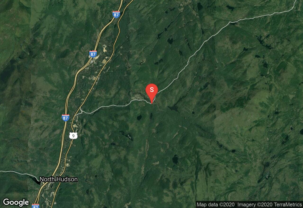
New York, Essex County
02 :59 hrs
2.9 mi
103.815216 ft
Moderate
This little known route to Moose Mountain Pond begins from one of the trailheads along North Hudson-Moriah Road at a small dirt parking lot on the south side of the road. Be sure not to be confused by the Challis Pond trailhead and Hammond Pond trailhead. Both of these trailheads are located less than a mile away from Moose Mountain Pond trailhead. After beginning the trail and reaching the edge of the marsh at 0.3 miles in, there is a new bypass trail that heads right. However, in the winter it is still best to follow the old road that leads through the marsh, reconnecting with the bypass trail at 0.7 miles in. Pass a small waterfall before the junction, where you will head left. Cross a bridge over the outlet to Berrymill Pond and continue to the south end of Moose Mountain Pond at 2.9 miles.To return, simply follow your tracks back to the trailhead.
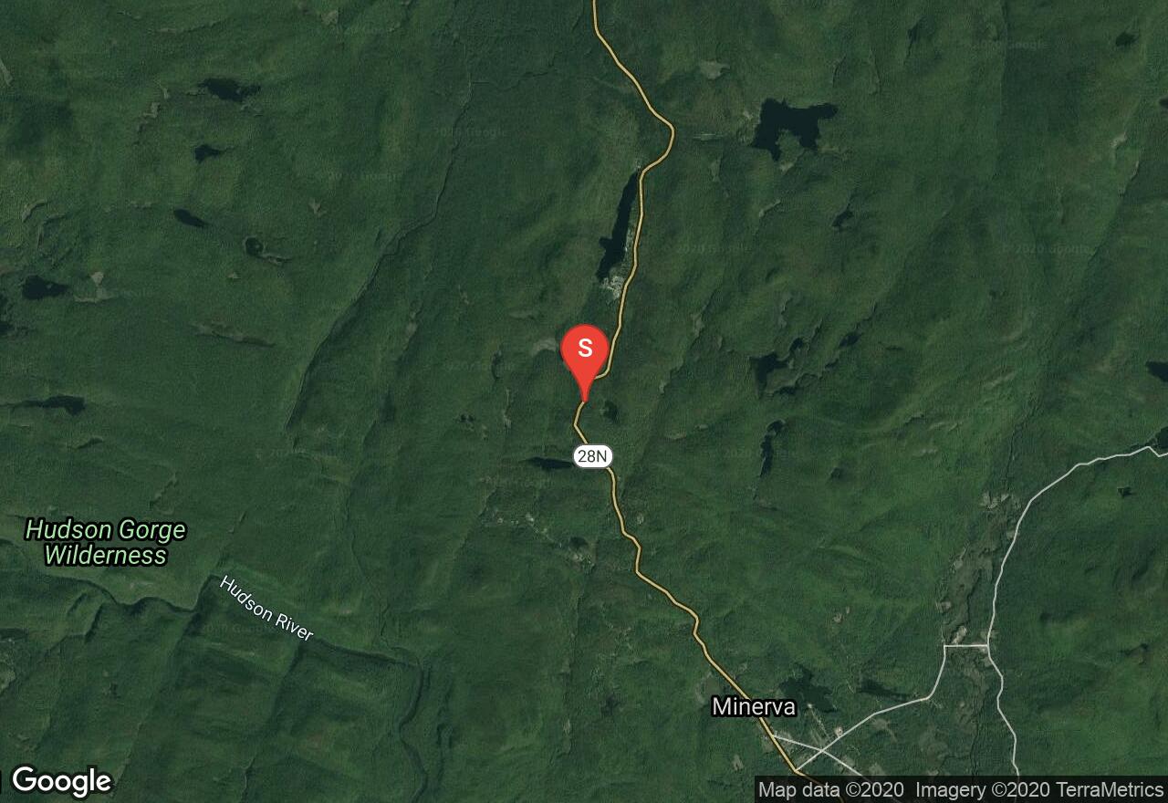
New York, Essex County
02 :58 hrs
2.8 mi
39.794373 ft
Moderate
This route offers a great tour of 3 ponds, with Stoney Pond being the largest. The trail begins along NY 28N and ascends a short hill before tapering off. At 0.3 miles in, a trail leads right, heading to a campground. Do not take this trail, instead continue on the mail trail and descend through a spruce swamp. Next you will be faced with a moderate climb and then a few more descents leading to the bottom of the valley. After crossing Stoney Pond Brook, begin to ascend once again, passing beaver dam ponds before ending at the lean-to at Stoney Pond. Stop here before following your tracks back to your vehicle or continue on to Little and big sherman Ponds for a larger tour before heading back to the trailhead.
See more adventures..
Explore complete list
Explore nearby adventures

