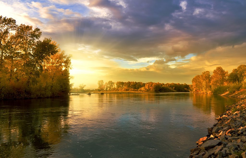
Best Back Country Skiing in New York
Trying to find the best back country skiing in New York? Bivy has great hiking, biking, paddling, climbing, skiing, riding and more, with hand-curated trail maps, as well as detailed driving directions.
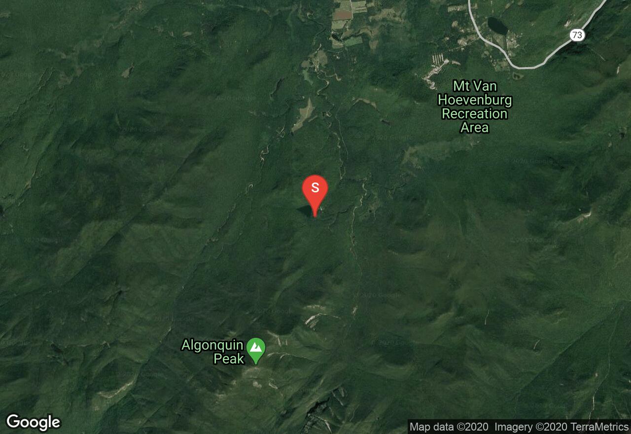
New York, Essex County
04 :15 hrs
3.1 mi
716.8031 ft
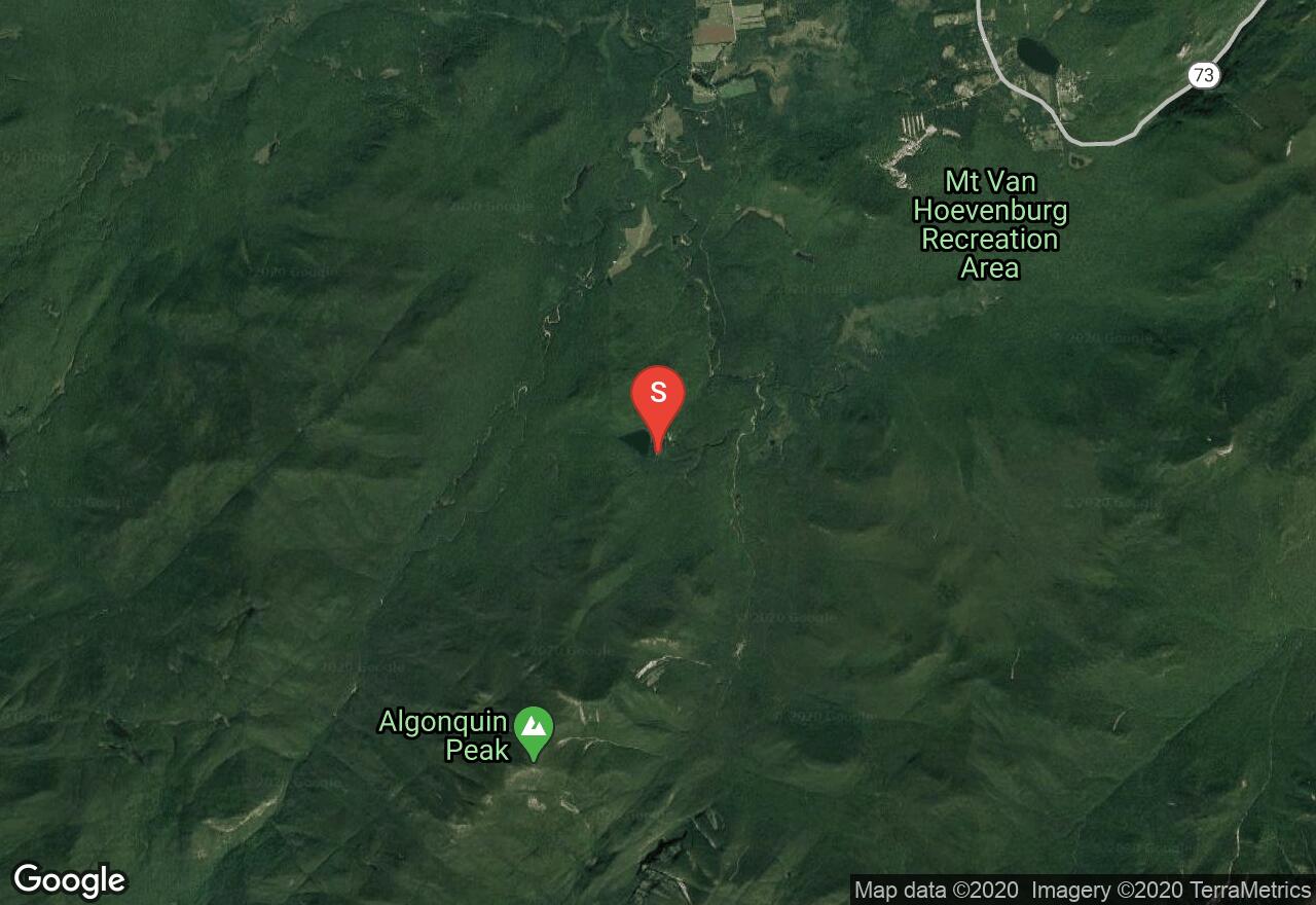
S1
This ski tour offers scenic views atop the summit and a historic route in the Adirondacks High Peaks. To reach this classic routel, begin from Adirondack Loj near Heart Lake and follow the Van Hovenberg trail towards Marcy Dam. Next, you will turn right at the junction and follow the Algonquin Trail that leads to Wright Peak. The trail soon steepens and at about 3000 ft, the ski trail branches off on the left hand side of the main hiking trail. Ascend up the ski trail to the top.. Enjoy the views before the fun descent. Follow your tracks back to the parking lot for the safest return. Note that there is a fee required to park at the Adirondack Mountain Club parking lot.
New York, Essex County
06 :30 hrs
12 mi
962.3865 ft
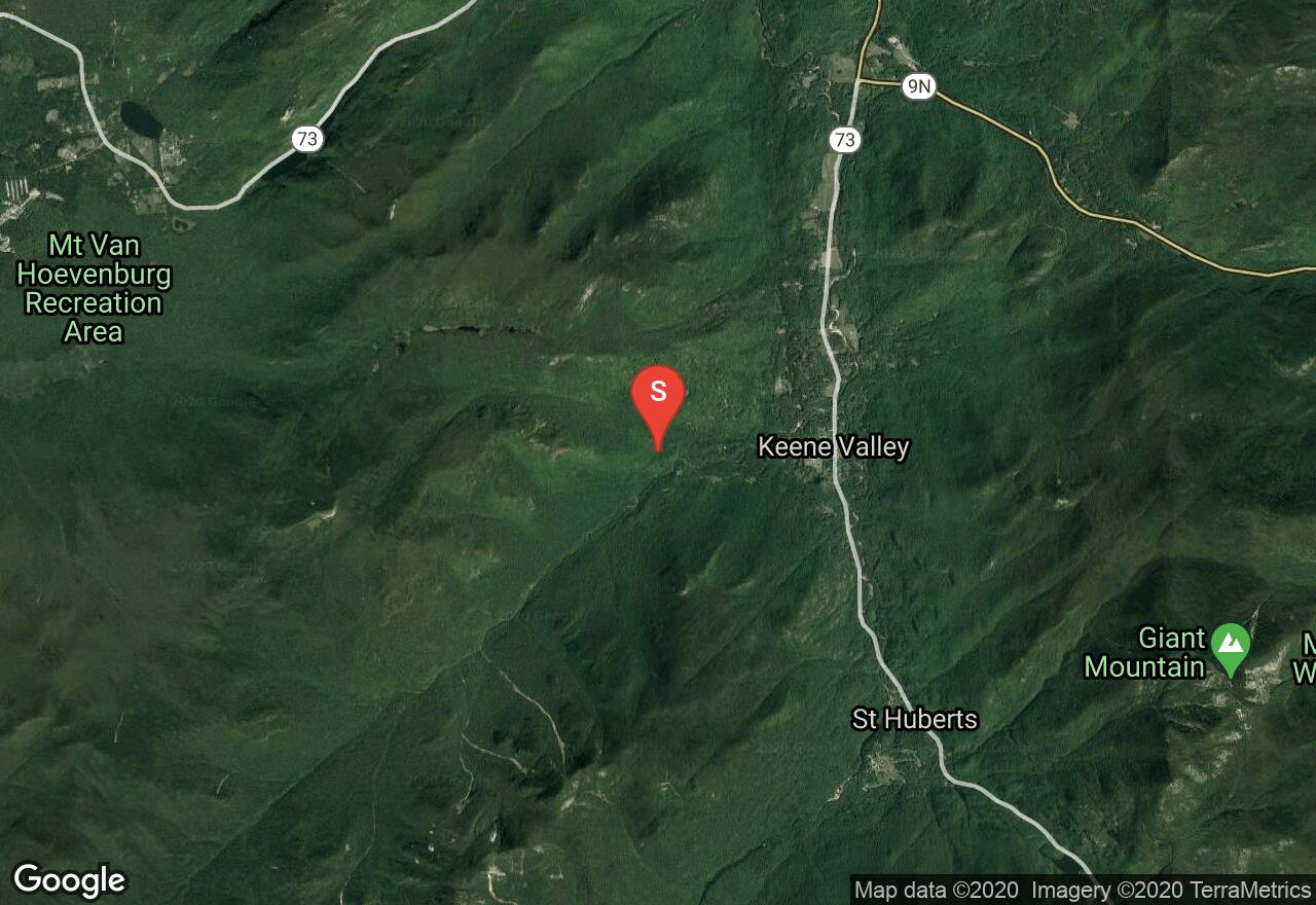
S2+
Located in the heart of the Adirondack High Peaks region, within the Johns Brook Valley, Gothics Slides is just one great option that involves the The Peggy O’Brien hut. Begin your trip from the Garden Parking Area and proceed up Phelps Trail/ John Brooks Trail. After 3.5 miles you will reach Camp Peggy O’Brien. Camp Peggy serves as a headquarters for some of the best hut based skiing in the Northeast. From the hut, follow the Woodsfall Trail and head right at the junction on Ore Bed Brook Trail. Continue to climb, crossing a slide. You can ski from the slide or continue ascending the Ore Bed Brook Trail until reaching another, yet steeper and longer slide. Both options lead back to Camp Peggy O’Brien. For more advanced skiers, Gothics also offers some more committing routes that require technical ski mountaineering. Make sure to asses the avalanche hazards before attempting any of these options. To return to the Garden parking area from Camp Peggy O’Brien, it is best reached by taking the Southside Trail, which has red blazes along half of the trails distance. From the point where the red blazes stop, move uphill a short distance until reaching the Jeep/snowmobile trail road. Follow this and look for the sign pointing you to the Garden Parking Area and head left. Cross the Johns Brook and link back up with the Johns Brook trail back to the parking area.
New York, Essex County
03 :18 hrs
4.9 mi
501.61014 ft
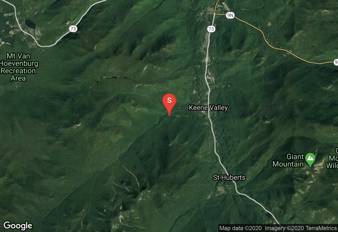
S1
Located in the heart of the Adirondack High Peaks region, within the Johns Brook Valley, Klondike Notch offers a great tour to a pass above John Brooks Lodge and Camp Peggy O’Brien. It is just one tour option that exists in the valley. Begin your trip from the Garden Parking Area and proceed up Phelps Trail/ John Brooks Trail. After 3.5 miles you will reach Camp Peggy O’Brien, which serves as a headquarters for some of the best hut based skiing in the Northeast. Proceed to John Brooks Lodge, and follow the red blazes that mark the trail beginning up the left bank of Black Brook. Pass the junction to Big Slide Mountain, and proceed up the steep grade to reach the saddle between Howard Mountain and Yard Mountain. To descend, either following the trail back to the lodge or venture through the trees back to the lodge.

New York, Essex County
04 :35 hrs
8.5 mi
692.01385 ft
S3
Located in the heart of the Adirondack High Peaks region, Bennies Brook Slide is one of the most easily accessible slides within the Johns Brook Valley, making also one of the most popular as well. Begin your trip from the Garden Parking Area and proceed up Phelps Trail/ John Brooks Trail. Ski 3.5 miles to reach Camp Peggy O’Brien and then ski across a bridge to gain access to the Southside Trail. Follow this trail to the major drainage of Bennies Brook. Ski up the drainage or ascend up alongside it on the left. Ascend up the drainage until moving out onto the slide where climbing become straightforward and continue as high up as desired. After descending down Bennies Brook and reaching the Southside Trail again, turn right and head back towards the Garden Parking Area. From the point where the red blazes stop, move uphill a short distance until reaching the Jeep/snowmobile trail road. Follow this and look for the sign pointing to the Garden Parking Area. Cross the Johns Brook and link back up with the Johns Brook trail back to the parking area.
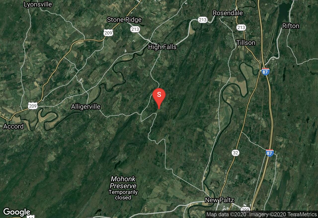
New York, Ulster County
00 :43 hrs
1.4 mi
120.39551 ft
S1+
Start at the Mohonk Preserve towards the end of Upper 27 Knolls Rd. and locate the trail from the parking area. Begin your ascent up the route and stay right at the junction moving further into the woods. After reaching the small lake, stay left and continue up until reaching the bend in the trail that begins to wrap around the ridge. From here, aim northwest, choose a line through the trees and go for it. Depending on snow levels, you will need to proceed with caution, as there are rocks and stumps that will bring you to a stop real quick. The descent will lead right back toUpper 27 Knolls Rd.
New York, Essex County
07 :55 hrs
6.4 mi
954.0625 ft
S2
This skit tour to the summit and back down from New York’s highest peak is one of the most popular routes in the East. Enjoy great views from the summit and great trail skiing. Begin this tour from the Adirondack Mountain Club parking lot (fee may be required), and locate the Van Hoevenberg Trail beginning from the ADK High Peaks Information Center. Follow the Van Hoevenberg Trail to Marcy Dam, pass the trail register and locate the blue blazed trail which marks the continuation of the Van Hoevenberg Trail up Mount Marcy. This is typically where people stop to put on ski skins. Continue ascending the trail to a four-way junction. At this point snowshoers will need to continue up the main trail, but skiers can move straight ahead to connect to the skier bypass. This bypass will eventually link back up with the main trail. Continue ascending towards the summit and bypass the junction with the Phelps Trail at 6.8 miles. The final stretch to the summit from here is above the tree line, which is exposed to all of the weather conditions that mother nature may throw at you. After reaching the summit, enjoy the 360 degree views. The descent from Mount Marcy is where the legendary fun begins. There are multiple descent options; the first option is to follow you ascents tracks,( this is recommended if visibility is low), the second options is to descend off the north face, which offers long lines, but you will need to make sure to cut back to the right near the bottom, so you can connect back up with the Van Hoevenberg Trail. Another option is to move to the summit cone and explore the numerous lines through ravines where hidden pockets of powder exist. No matter what option you choose, after linking back up with the Van Hoevenberg Trail, continue to follow you ascent tracks back to the trailhead.
See more adventures..
Explore complete list
Explore nearby adventures

