Best Mountaineering in Montana
Trying to find the best mountaineering in Montana? Bivy has great hiking, biking, paddling, climbing, skiing, riding and more, with hand-curated trail maps, as well as detailed driving directions.
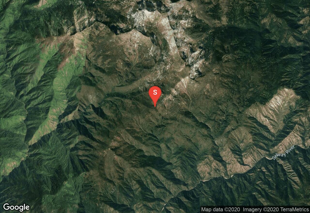
Idaho, Idaho County
31 :31 hrs
17.4 mi
1600.8064 ft
IV
This outing starts off Forest Road 6223 at the Selway River and Indian Creek Campground in. The route passes by 4 different peaks before reaching Watchtower including Indian Ridge, Green Mountain, Burnt Strip Mountain and Cooper Point. You'll definitely enjoy the scenery of pristine Selway Bitterroot Wilderness and Bitterroot National Forest as you travel along the ridge-tops and creek-sides. There are plenty of places to camp along the creeks, but there are also lots of mosquitoes. There are some nice camp sites high along the ridge-crest to Watchtower Peak with no accessible water but fewer mosquitoes.

Montana, Flathead County
05 :41 hrs
1.6 mi
825.6821 ft
I
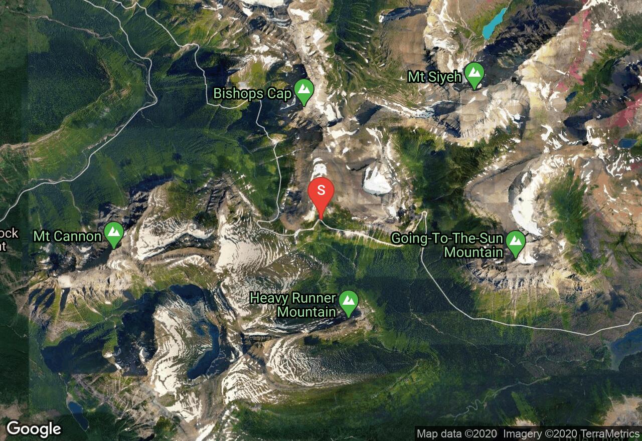
Pollock Mountain is the most southerly summit along the Garden Wall. The southwestern end of the mountain is often mistaken as the summit. The real summit is the isolated butte high above the Lunch Creek Basin. This route follows along lunch creek, once when you reach the bottom of the falls head east up what looks like a ramp, around the waterfall. The trail then is marked by cairns to the Piegan-Pollock Saddle. From here follow the base to the most dangerous section of the route known as the “Great Cleft”. This is a large break in the cliffs. The entrance to the Great Cleft is marked with prominent yellow lichen rock. Be aware there is a wrong route marked by cairns to the south of the “Great Cleft”. Watch for the yellow lichen rock. There are nice hand and footholds but inexperienced climbers should use a rope. Once you reach the top of the Great Cleft follow the trail to the summit.
Montana, Flathead County
07 :34 hrs
2.4 mi
823.95557 ft
II
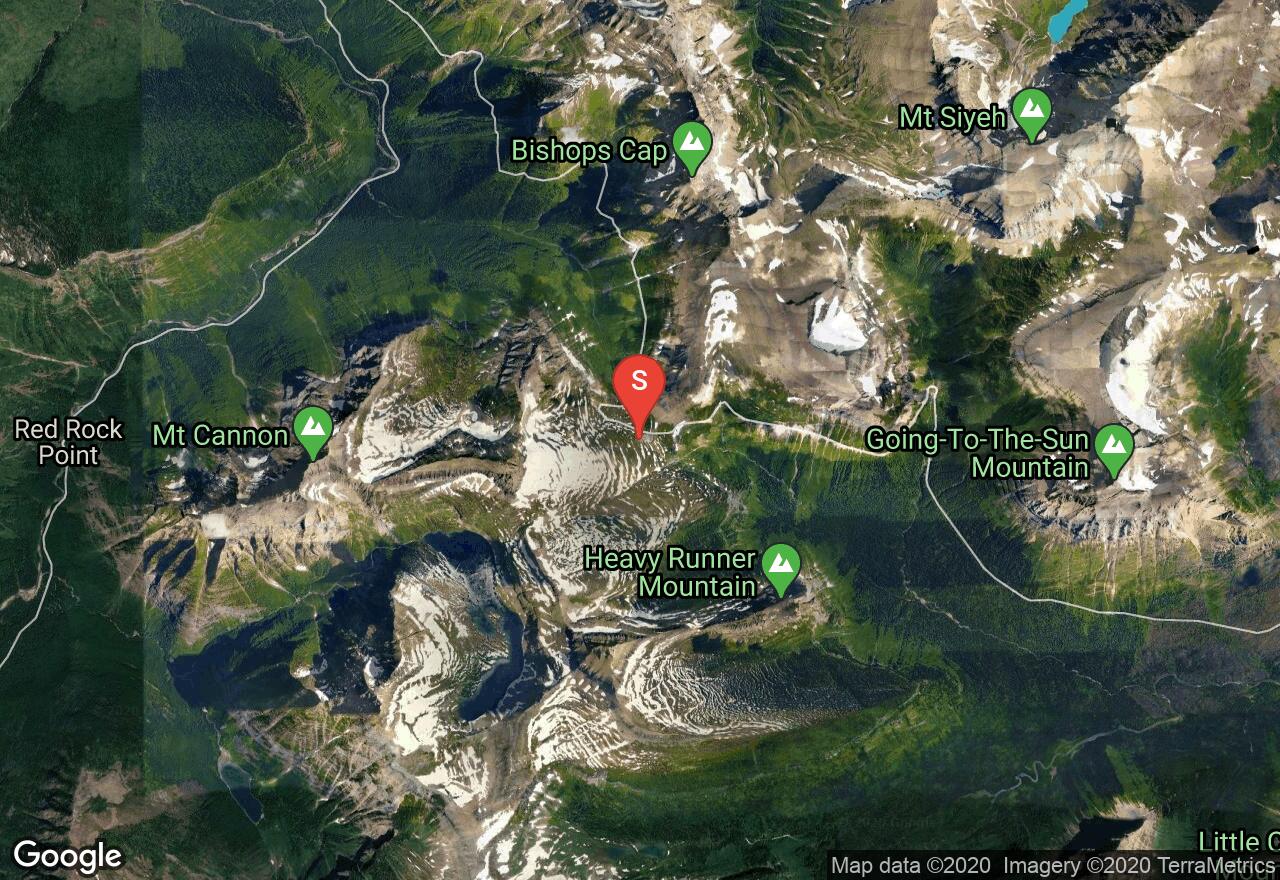
Bishops Cap is named for its formation that is a similar shape of a Roman Catholic bishops cap. This route goes to Pollock Mountain and then follows along the Continental Divide on to Bishops Cap. This is an exciting and exposed summit with only a 300 sq feet area at the top. The views are spectacular because of its location along the Garden Wall. There is some class 3 climbing to get to Pollock Mountain with the most difficult obstacle known as “The Great Cleft”. The climb from Pollock to the base of Bishops Cap is easy. There is some class 3 climbing and a class 4 cliff located on the southwest side to reach the summit. Bring a helmet, and a rope. There is an optional descent that drops down off the Continental Divide to the Highline Trail.
Montana, Cooke City-Silver Gate
21 :49 hrs
11.3 mi
1188.7888 ft
II
Granite Peak is Montana’s highest mountain and a popular destination in the Beartooth Range. This approach is up the south face. You should plan on 2 days and one night, a few ideal base camps are Elk Lake or Sky Top Lakes. The trailhead begins just north of Cooke City and passes by Lady of the Lake and a several other high mountain lakes. The trail heads east at the Broadwater River and up towards Elk Lake. Climbing up the face requires scrambling over enormous boulders and loose scree up the couloir. There is not too much exposure but early in the season it can be icy so a rope is recommended. Be careful of falling rocks while climbing up the couloir. Once at the top of the couloir climb right and make your way to the summit.
Montana, Flathead County
07 :25 hrs
3.1 mi
664.5332 ft
I
Mount Cannon is a rugged peak with fantastic views of the Garden Wall, Hidden Lake and Logan Pass. Be sure to bring the camera as there are breathtaking photos to be shot from any angle. The trail begins at the Hidden Lake Trailhead and follows the trail to the lake overlook. Shortly after watch for a marked trail that takes off uphill to the right towards Bird Woman Pass. This section is easy to follow from the marked cairns. There are some fun scrambles and a Class 4 cliff on the summit ridge with a lot of exposure. Bring a rope and helmet. There are good hand-holds and foot placement. Once on top of the cliff walk along the summit ridge to the top.
Montana, Stillwater County
22 :49 hrs
9.8 mi
1861.0889 ft
II
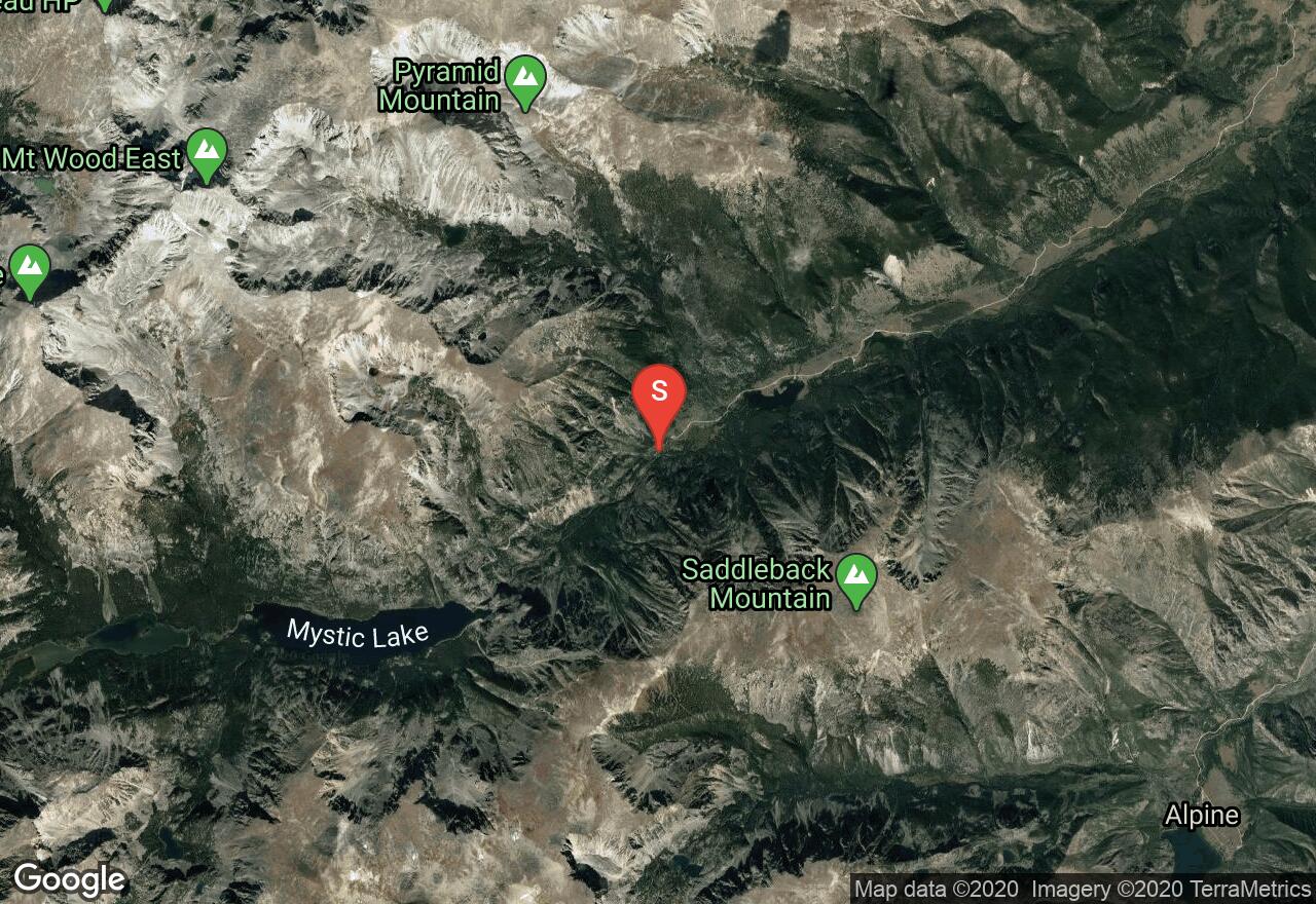
Granite Peak is Montana’s highest mountain and a popular destination in the Beartooth Range. This popular route is done via Avalanche Lake. Plan on two days for this adventure and climbing in August or early September is ideal. En-route you will travel through stunning high alpine lakes. As the climb begins it is a relaxing jaunt up to Mystic Lake. The trail follows along the shoreline of Mystic Lake to the West end; then turns south and climbs along Huckleberry Creek. Be cautious along this section as it is steep, narrow and sometimes icy if done early in the season. An ideal base camp is at Avalanche Lake. Be aware of the dangers of this open and exposed mountain, afternoon storms can hit unexpectedly. From Avalanche Lake it’s a short scramble to the ridge before the technical ascent begins. The panoramic views here are amazing and one you will never forget. The last 300-ft is technical with sections of exposed class 3 and 4 rock climbing. There are experienced climbers that do this without a rope. But it is best to be prepared with an ice axe, rope, harness, slings and a rappel device.
Idaho, Custer County
07 :37 hrs
2.3 mi
544.0056 ft
III
White Mountain is the highest summit in the Salmon River Mountains, and it's located just southwest of South Twin Peak. This route goes along the north ridge with mostly class 3 climbing, which is accessed from Twin Creek Lakes Trail and is seldom visited by visitors. The name of the mountain comes from the beautiful white rock found along the sides, while the summit itself is a pile of grayish brown perforated jagged towers and rocks. Incredible panoramic views are offered from the summit with the surrounding Salmon River Mountains, Challis National Forest, and the Frank Church River of No Return Wilderness.
Idaho, Shoshone County
10 :33 hrs
5.2 mi
1092.7216 ft
II
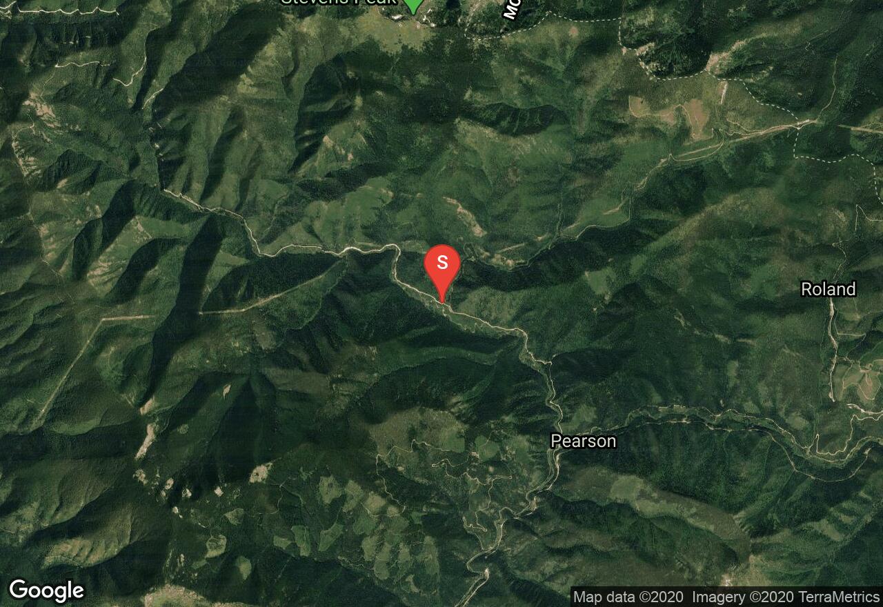
There are several different routes to take, but this one is more of a direct way to get to the peak. Stevens Peak is a rugged alpine summit that sits west of the main Bitterroot divide and just south of Mullan and I-90. Spokane mountaineers have used the peak for their snow-climbing school in the past. Ice axes and crampons will be needed for winter adventures.
Idaho, Idaho County
13 :08 hrs
6.4 mi
584.34766 ft
III
This outing starts at Big Fog Mountain Trailhead in Idaho County. From there, you will go straight up the ridge and over Big Fog Mountain on trail 343, and then continue on the main ridge to the north towards South Three Links Lake and Fenn Mountain. This is the highest point in the Selway Crags and offers a lot of route possibilities. Eventually the trail will vanish, but it forms again as the ridge narrows and peels off the east side on its way to Legend Lake. Expect the trail to be a bit spotty and sometimes covered in snow, so cross country travel may need to be done. You can camp at Legend Lake before the climb to Fenn Mountain, or you skip the lake entirely and just continue on the ridgeline to a small saddle above the lower South Three Links Lake.
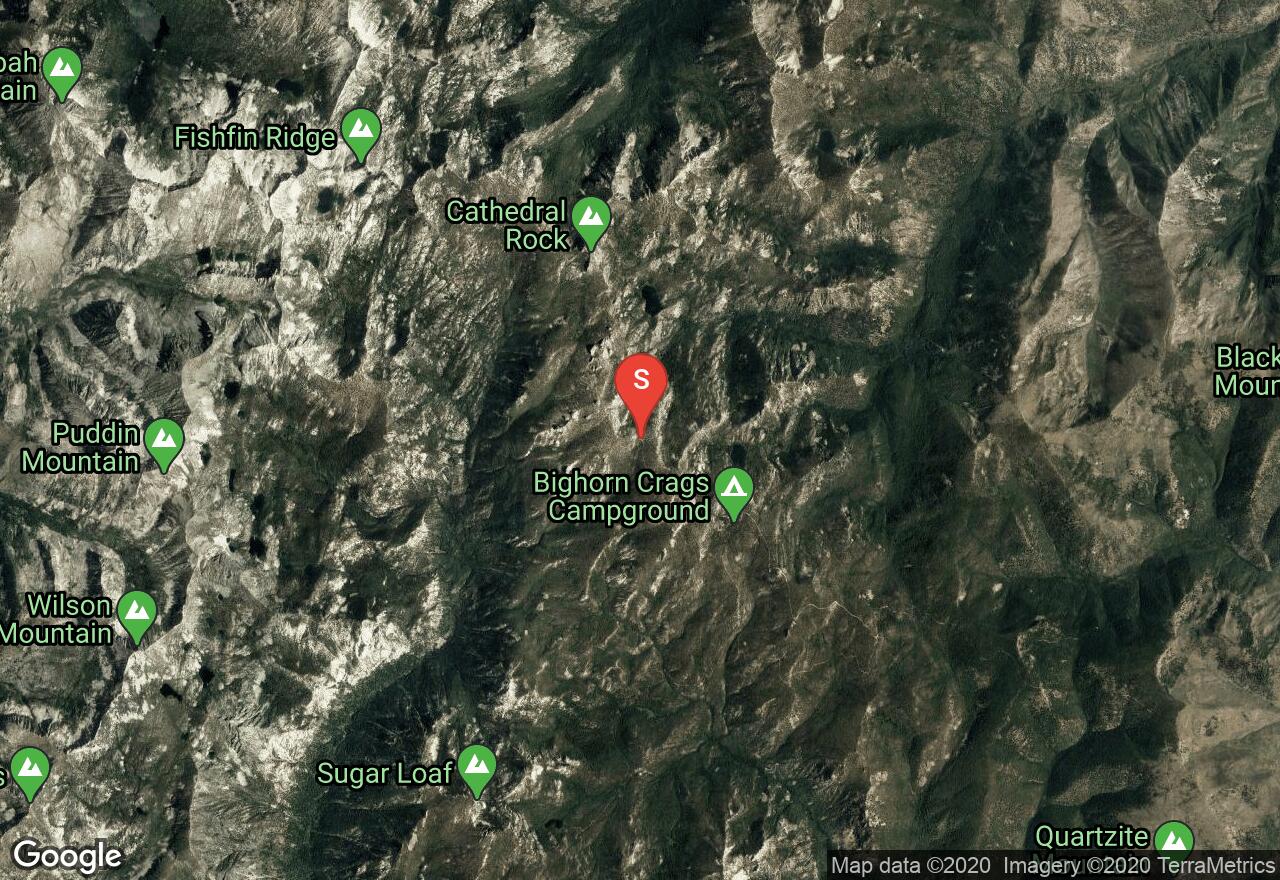
Idaho, Lemhi County
13 :17 hrs
7.3 mi
524.89575 ft
III
Sheepeater Mountain is very rugged with cliffs and couloirs, and there are many lakes visible along with beautiful scenery from the summit. You'll start hiking from Crag Campground through the Frank Church River of No Return Wilderness, and meet with a variety of trail junctions. The scramble to the summit from the southeast ridge is more challenging than the south ridge. Once you get to the summit, views of Ship Island Lake are absolutely stunning.
See more adventures..
Explore complete list
Explore nearby adventures

