![]()
Pollock Mountain (Glacier NP)
Flathead County, Montana
Uploaded by Bivy Team
05 :41 hrs
1.6 mi
2709 ft
I
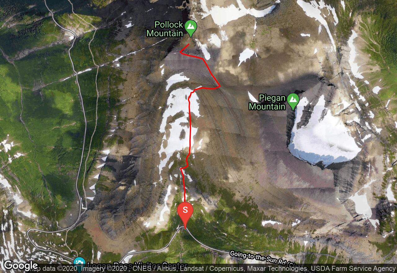
Pollock Mountain is the most southerly summit along the Garden Wall. The southwestern end of the mountain is often mistaken as the summit. The real summit is the isolated butte high above the Lunch Creek Basin. This route follows along lunch creek, once when you reach the bottom of the falls head east up what looks like a ramp, around the waterfall. The trail then is marked by cairns to the Piegan-Pollock Saddle. From here follow the base to the most dangerous section of the route known as the “Great Cleft”. This is a large break in the cliffs. The entrance to the Great Cleft is marked with prominent yellow lichen rock. Be aware there is a wrong route marked by cairns to the south of the “Great Cleft”. Watch for the yellow lichen rock. There are nice hand and footholds but inexperienced climbers should use a rope. Once you reach the top of the Great Cleft follow the trail to the summit.
2 photos
[{"url":"https://images.bivy.com/lgMap/968037.jpg"},{"url":"https://images.bivy.com/lgTrailMap/968037.jpg"}]
Pollock Mountain (Glacier NP) | Flathead County, Montana
Pollock Mountain is the most southerly summit along the Garden Wall. The southwestern end of the mountain is often mistaken as the summit. The real summit is the isolated butte high above the Lunch Creek Basin. This route follows along lunch creek, once when you reach the bottom of the falls head east up what looks like a ramp, around the waterfall. The trail then is marked by cairns to the Piegan-Pollock Saddle. From here follow the base to the most dangerous section of the route known as the “Great Cleft”. This is a large break in the cliffs. The entrance to the Great Cleft is marked with prominent yellow lichen rock. Be aware there is a wrong route marked by cairns to the south of the “Great Cleft”. Watch for the yellow lichen rock. There are nice hand and footholds but inexperienced climbers should use a rope. Once you reach the top of the Great Cleft follow the trail to the summit.