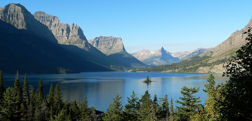
Best Waterways in Montana
Trying to find the best waterways in Montana? Bivy has great hiking, biking, paddling, climbing, skiing, riding and more, with hand-curated trail maps, as well as detailed driving directions.
Idaho, Fremont County
01 :41 hrs
4.2 mi
24.875488 ft
II
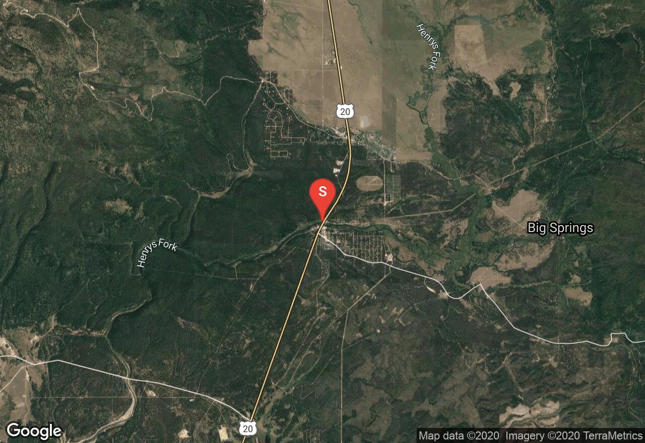
This section of the Henrys Fork starts at Island Park Dam near Box Canyon Campground. The waterway offers continuous class II rapids as it flows through the canyon within the plateau. The river is also great for fishing, and there are excellent views of the surrounding villages and mountains. The take-out is located near Last Chance and Highway 20.
Montana, Meagher County
24 :26 hrs
59.7 mi
286.23877 ft
II
Smith River is a pristine river that offers an excellent river trip. Best to plan on minimum of 3 days and 2 nights. It flows through a colorful canyon with plenty of wildlife, spectacular scenery and good fishing. The river requires a float permit by calling Montana Fish, and Wildlife. You must also declare your boat campsites before leaving. The permits are a first-come, first-served system. The highlight of the trip is a deep limestone canyon with towering rock formations and thick forests. Best float times are May through June before the water gets too low from irrigation. Flows can pick back up in September for a Fall trip where you might find some solitude. Be prepared for cold and rainy weather which is common even in the warm months.
Montana, Madison County
03 :25 hrs
8.2 mi
15.976929 ft
I
This is a lazy float on the Jefferson River. You won't see any rapids but the fishing is great with spinners. Put in at Kountz Bridge Boat Launch. Take out is at Cardwell Boat Ramp.
Montana, Missoula County
10 :26 hrs
21.5 mi
106.65234 ft
III
Some of the river’s most difficult rapids lie in this section of the Blackfoot River. About 3 miles downstream from Russell Gates Memorial watch for a few drops with big rocks and high waves. Most of the drops are followed by big pools for recovery in case of problems. During high water these rapids are fierce and only strong paddlers should attempt this section. A big rock garden that lasts for several hundred yards lies further downstream followed by continuous rapids with little time for recovery in some areas. The last 6 miles is quiet and a nice stretch to catch your breath.
Idaho, Island Park
02 :36 hrs
6.3 mi
18.763184 ft
III
The put-in is located at Macks Inn Bridge and Highway 20 at Island Park. The trip leads into a secluded, scenic area with an increase in water flow. You'll pass by Upper Coffee Pot Campground and then run through a series of pool-drop rapids called "Coffee Pot". Be on the look out for log hazards and wildlife. The take-out is at McCrea Bridge on Kilgore-Yale Road near the campground. There are also great views of the Centennial Mountains to the northwest and the surrounding Yellowstone Plateau.
Idaho, Fremont County
06 :53 hrs
15.3 mi
6.3637695 ft
II
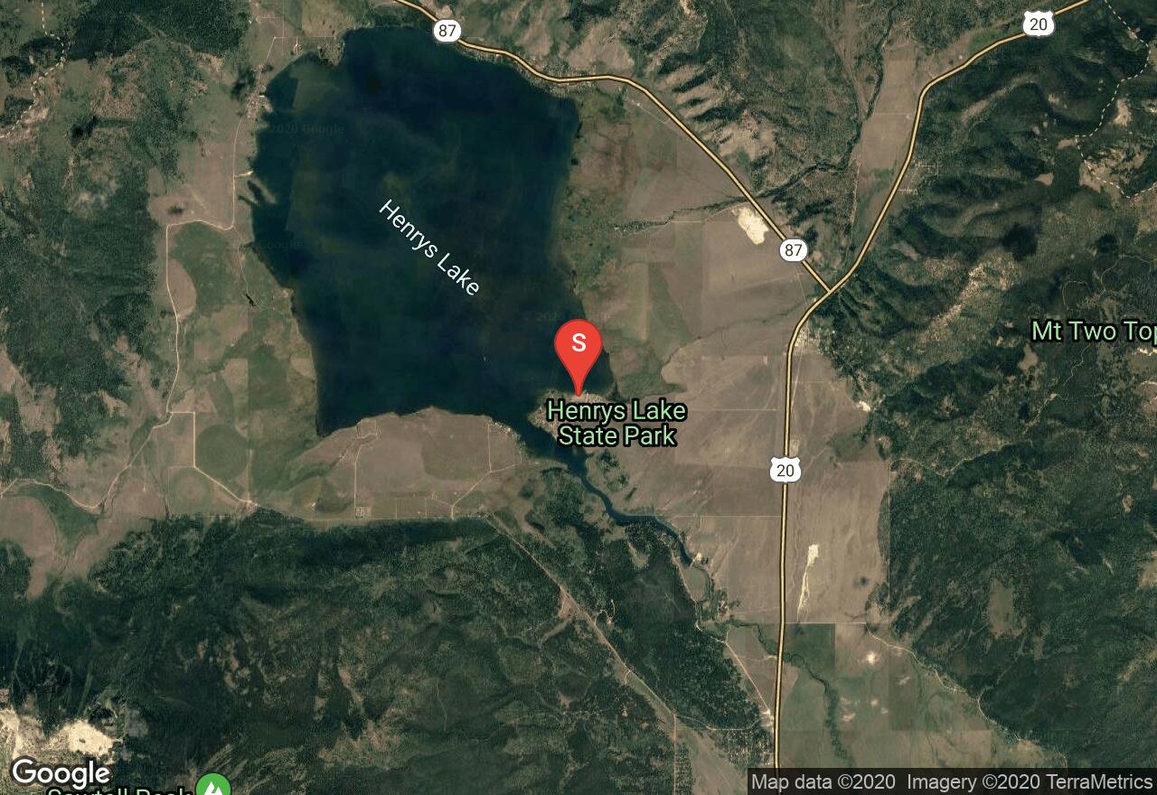
Henry's Lake is located in Fremont County off Highway 87 and near Highway 20. The lake is situated on the Yellowstone plateau ecregion of Idaho, and the area offers beautiful vistas of the surrounding Henry's Lake Mountains. A dam built in 1923 for irrigation purposes enlarged Henry's Lake, and it is now a common stop for visitors. The lake averages about 12 feet in depth, has 14 miles of shoreline, and is 6,500 surface acres when full. Cutthroat, rainbow and brook trout are known to be stocked in the water. There is also a $5.00 day use fee required. Facilities & services in the area include boat ramps/docks, parking, drinking water, grocery stores, lodging, hotels, trails, dining, restrooms, and campsites.
Montana, Mineral County
04 :45 hrs
9.8 mi
52.879517 ft
IV
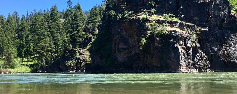
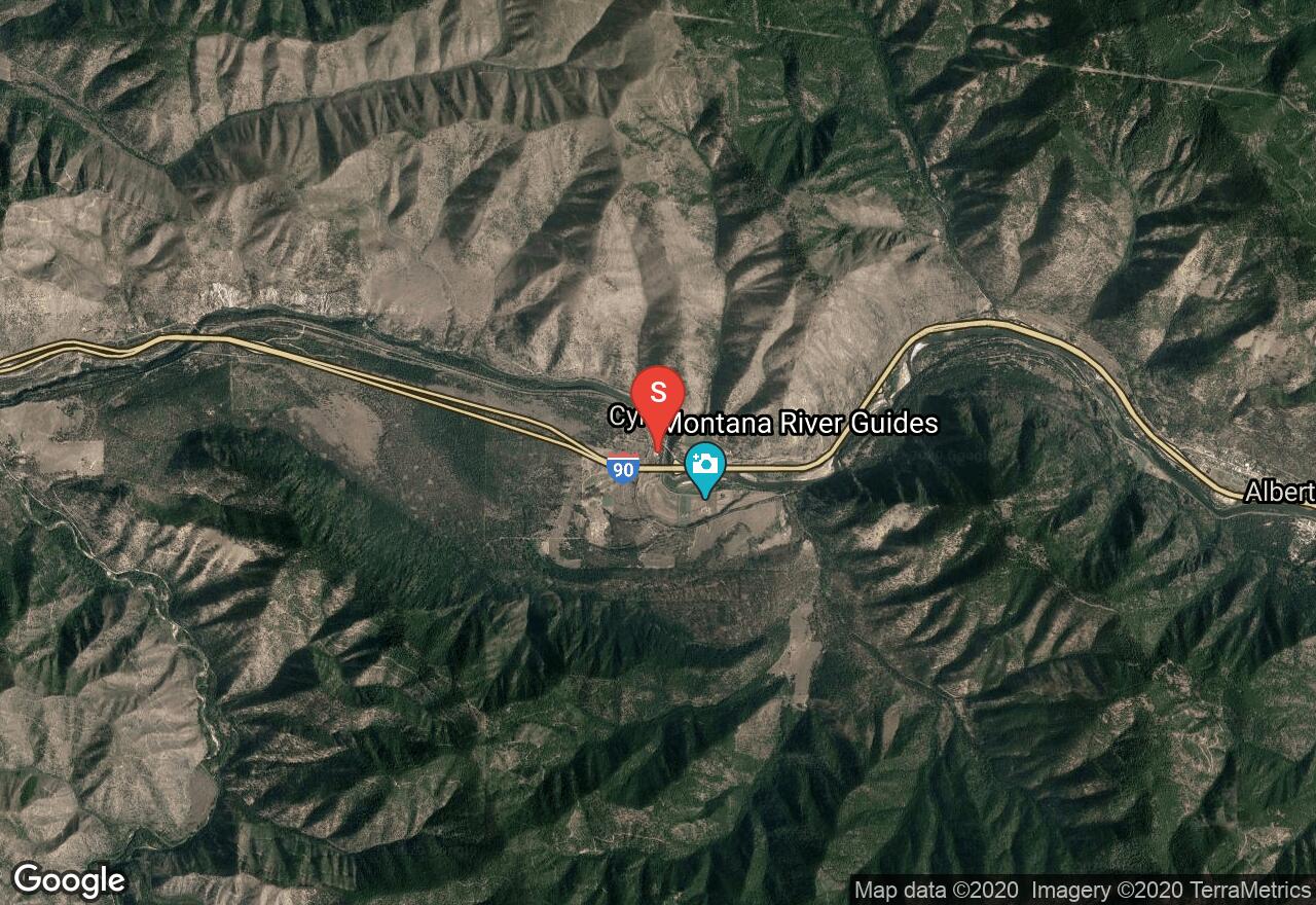
Alberton Gorge is known for its whitewater and is sometimes referred to as Cyr Canyon. The whitewater begins quickly with a few minor Class II rapids. Watch for steep cliffs to warn you before the solid Class III waves known as the “Ledge Rapids”. Expect big waves, a narrow passage and some jagged rocks. Shortly after are the Cliffside rapids that are bigger and steeper with lower flows. When the canyon narrows the gorge’s most difficult rapids are approaching. There is a pullout to scout out the “Tumbleweed Rapids”. At low flows it’s a Class III and with high flows it becomes a difficult Class IV. It is best to stay left. A few more exciting, but not too challenging, rapids follow. Alberton Gorge changes dramatically based on the water flow, so be sure check with local stations for current conditions. Average conditions can be found between 2,000 and 10,000 cfs.
Idaho, Valley County
07 :16 hrs
18 mi
114.245544 ft
IV
This outing starts near Soldier Bar - US Forest Service Airport at the confluence with Middle Fork Salmon River from Big Creek. The trip heads north through the Selway-Bitterroot Wilderness and ends at Salmon River Road. Good camping is available along the way and a Middle Fork of the Salmon permit is also required. There are areas with large boulders and class IV rapids below Coxey Bar. Also, there may be areas where you will be jumping from eddy to eddy, trying to find the right lane to get through the maze of boulders. The best whitewater is found in the Big Creek Gorge, which is near the confluence with Middle Fork Salmon River.
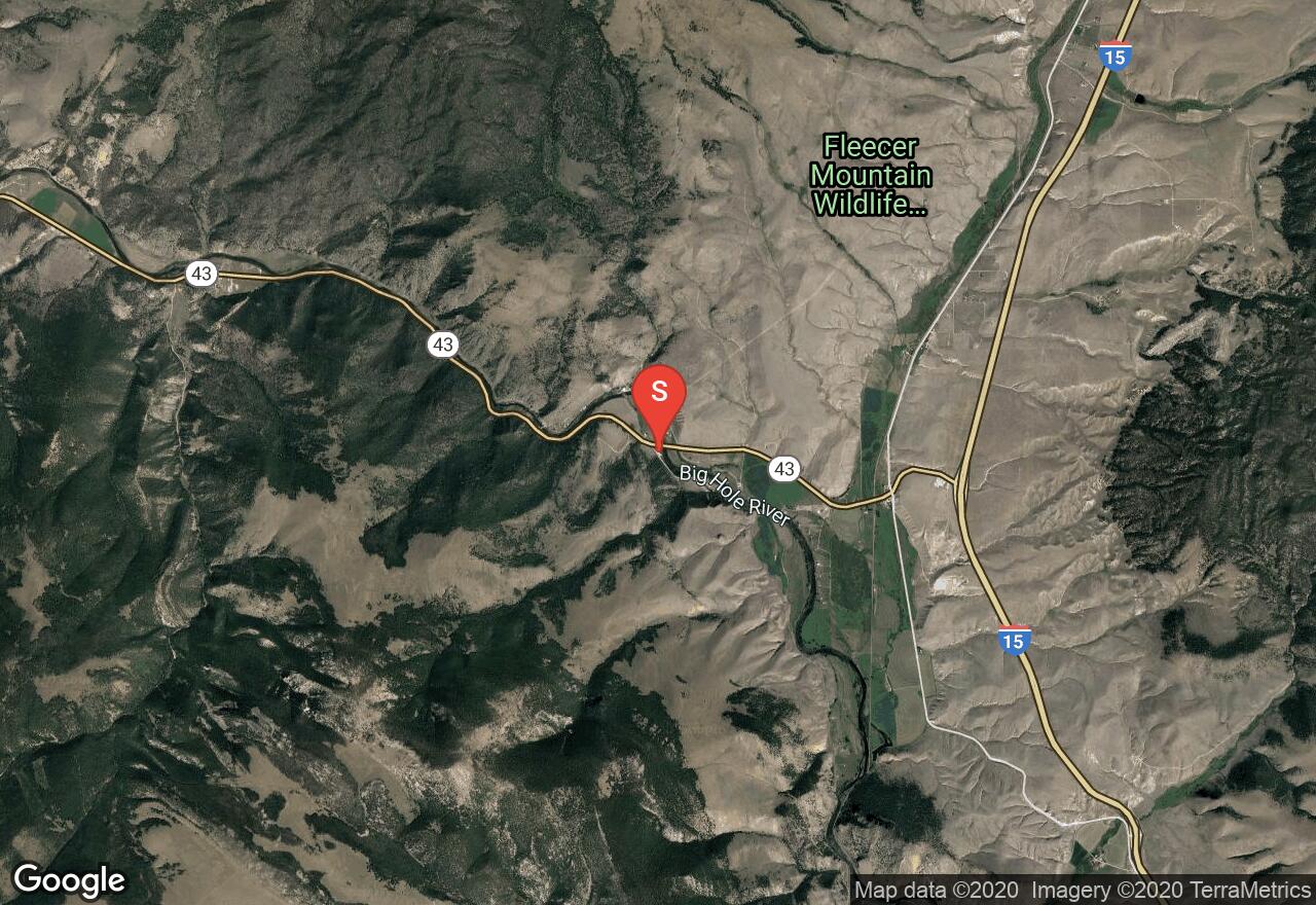
Montana, Beaverhead County
07 :00 hrs
14.5 mi
73.77734 ft
III
This section is the most heavily recreated part of the Big Hole River. The fishing pressure is high but the sheer beauty of this portion of the river is spectacular. The river flows through a scenic canyon where bighorn sheep graze along the shorelines and eagles soar high above the cliffs. If you are searching for solitude, avoid floating from mid June through July when the outfitters are in their peak. Montana Fish, Wildlife and Parks designate specific days for residents, nonresidents and outfitters to float and fish. During high flows this section may be too rough for intermediate canoeists. Watch out for downed trees and logjams.
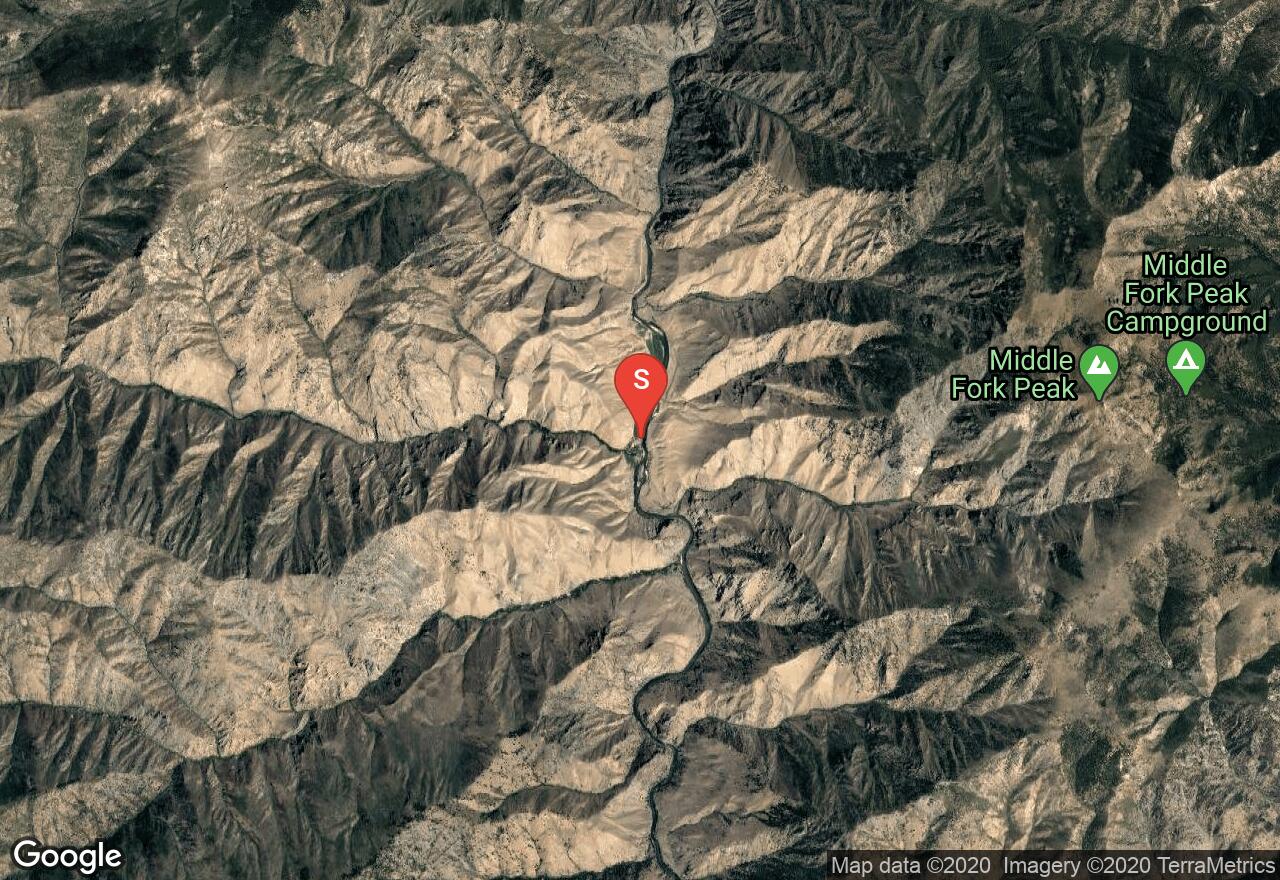
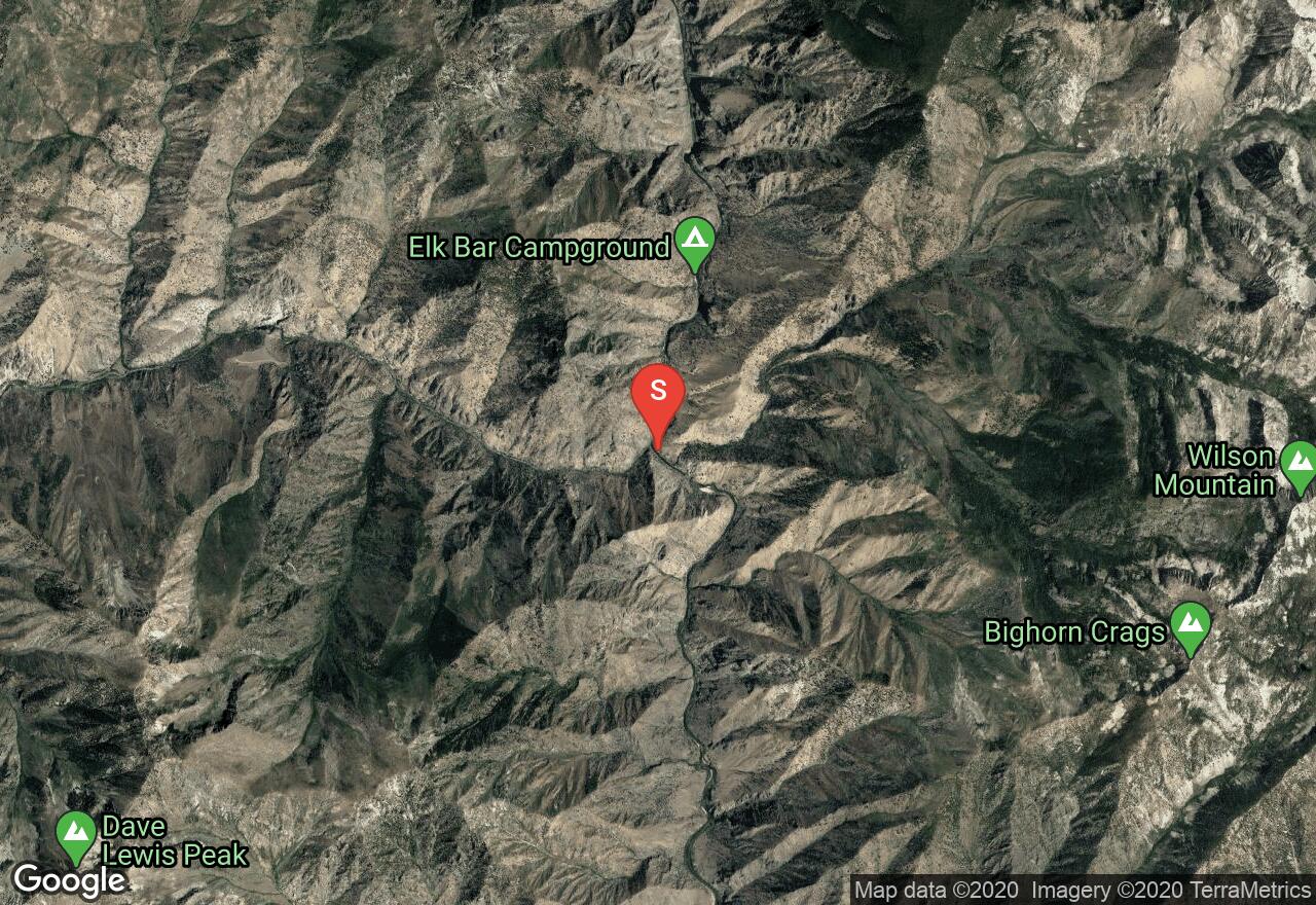
Idaho, Lemhi County
11 :45 hrs
29.1 mi
191.4737 ft
IV
The Middle Fork of the Salmon River offers one of the most popular river trips in America, and applications are required to be filled from December 1st through January 31st. This is a dedicated trip that will take up to 8 days to accomplish over 100 miles of a beautiful, scenic waterway. This section of the trip starts at Bernard Bridge and heads north through the Selway - Bitterroot Wilderness and the Frank Church River of No Return with deep canyons and forested mountains. The whitewater sections can be challenging but not too threatening, especially during high water flow. There are also over 100 riverside campsites to choose from, sandy beaches to dig you toes into, and hot springs to soak in. A forest service permit is required with a group of up to 24 people, for up to 8 days. There are also great vistas of the surrounding Salmon River Mountains, Bighorn Crags, and Bitterroot Range. The trip finally ends at the Salmon River confluence and Salmon River Road.
See more adventures..
Explore complete list
Explore nearby adventures

