Best Off Road in Virginia
Trying to find the best off road in Virginia? Bivy has great hiking, biking, paddling, climbing, skiing, riding and more, with hand-curated trail maps, as well as detailed driving directions.


Virginia, Craig County
00 :22 hrs
7.4 mi
476.719 ft
Unknown
Potts Mountain Jeep Trail is one of the only public trails in all of Virginia that caters specifically for technical and challenging off-roading. The trail is rated as difficult and is not for stock four-wheel drive vehicles. There are multiple obstacles to navigate through and over including large boulders, tall ledges, tree stumps, water crossings, off-camber areas, etc. There are some bypasses along the way but many of them are not much easier. The trail travels through scenic but very remote wilderness in the Jefferson and George Washington National Forest so it is not advised to drive the trail alone.

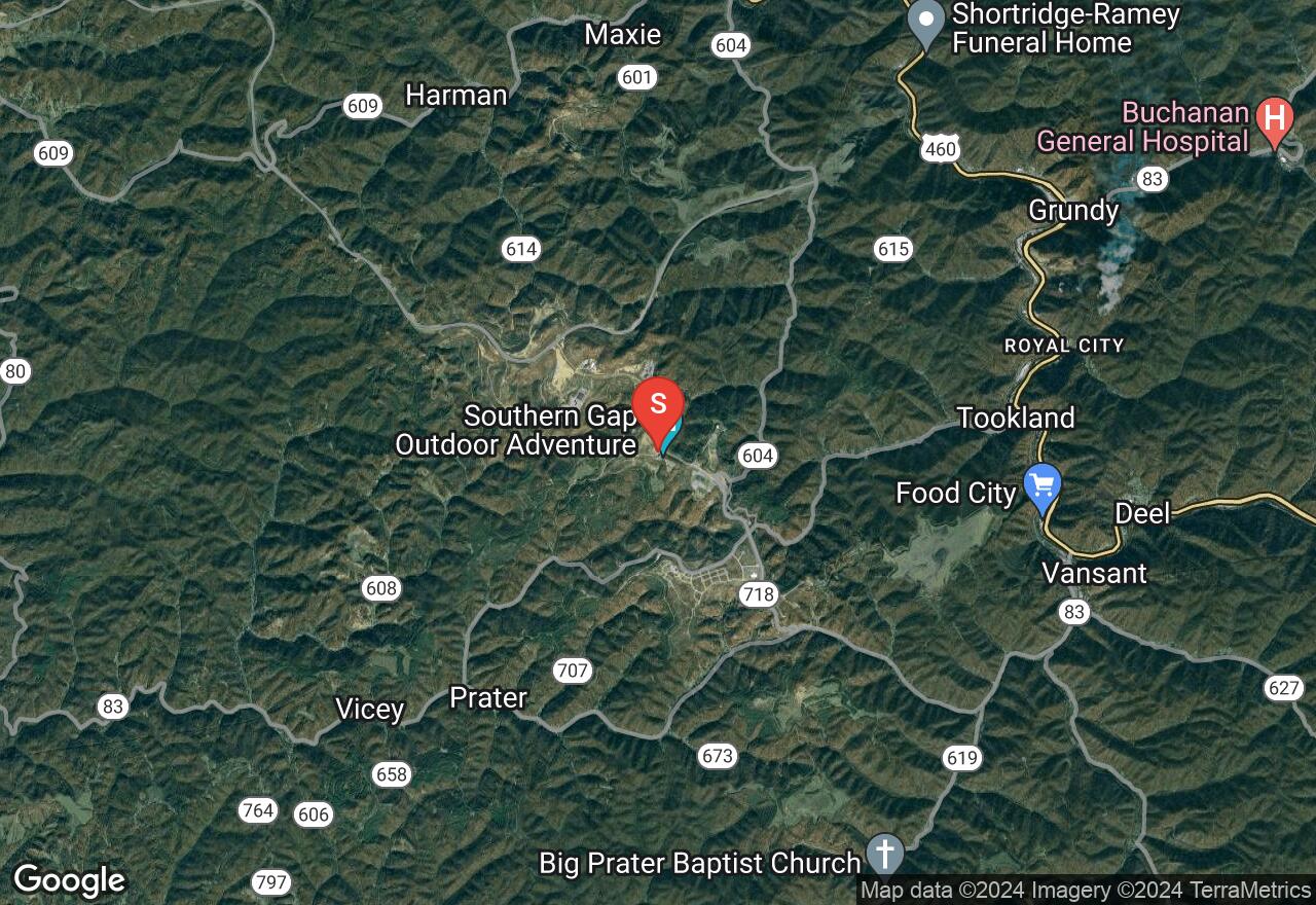
Virginia, Buchanan County
01 :20 hrs
8.2 mi
305.621 ft
Unknown
The Coal Canyon Trail System consists of 114 miles of multi-use trails that are open for off-roading located near Poplar Gap Park in western Virginia. The trail system offers a variety of trail options that range in difficulty and length. This ride follows the main trail to trail #49 which then heads east towards the highway and Royal City. The trail is rated as easy-to-moderate and has no major obstacles or hazards. The trails are also open to hikers and mountain bikers so watch out for other users of the trail. A Spearhead trail permit is required for all drivers and passengers and these can be obtained through local retailers. Please visit the Spearhead Trails website for more information.

Virginia, Dickenson County
00 :39 hrs
3.9 mi
117.37201 ft
Unknown
Haysi's Ridgeview Trail System consists of 78 miles of multi-use trails that are open for off-roading just outside of the town of Haysi. The trail system offers a variety of trail options that range in difficulty and length. Trail #30 takes off from the main trail and runs north adjacent to trail #0. The trail is rated as moderate in difficulty but connects to trails that are rated as easy. The trails are open to hikers and mountain bikers so watch out for other users of the trail. A Spearhead trail permit is required for all drivers and passengers and these can be obtained through local retailers. Please visit the Spearhead Trails website for more information.

Virginia, Buchanan County
00 :55 hrs
11.3 mi
215.92902 ft
Unknown
The Coal Canyon Trail System consists of 114 miles of multi-use trails that are open for off-roading located near Poplar Gap Park in western Virginia. The trail system offers a variety of trail options that range in difficulty and length. This ride follows trail #50 to complete a loop that is rated as easy-to-moderate and has no major obstacles or hazards. The trails are also open to hikers and mountain bikers so watch out for other users of the trail. A Spearhead trail permit is required for all drivers and passengers and these can be obtained through local retailers. Please visit the Spearhead Trails website for more information.

Virginia, Dickenson County
00 :52 hrs
5.7 mi
215.44699 ft
Unknown
Haysi's Ridgeview Trail System consists of 78 miles of multi-use trails that are open for off-roading just outside of the town of Haysi. The trail system offers a variety of trail options that range in difficulty and length. Trail #15 runs from Breaks Interstate Park to the junction with the main trail. The trail is rated as moderate in difficulty. The trails are open to hikers and mountain bikers so watch out for other users of the trail. A Spearhead trail permit is required for all drivers and passengers and these can be obtained through local retailers. Please visit the Spearhead Trails website for more information.

Virginia, Harrisonburg
01 :16 hrs
8.3 mi
579.199 ft
Unknown
This scenic drive follows Skidmore Fork and Dunkle Hollow Road through beautiful mountain terrain of George Washington National Forest. The road climbs slowly up to the ridgeline just northeast of Flag Pole Knob. The trail does present some challenge in the form of creek crossings, steep grades, and rock beds. These features will be even more challenging during and after heavy rains so pay attention to the weather. There are bypasses available for the difficult sections making the route a good option for drivers of all skill levels. Stock trucks and SUVs will manage but 4WD is recommended.

Virginia, Amherst County
01 :13 hrs
13.3 mi
276.13297 ft
Unknown
The South Pedlar ATV Trail System is located in the George Washington & Jefferson National Forests and features 19 miles of fun and scenic designated ATV trails for riders to enjoy. This loop ride follows sections of the South Pedlar, Lasso, and Lone Mountain trails to complete a 13-mile loop. The trails are open to vehicles less than 50 inches in length. The trails are mostly packed dirt with some rocks. There are few obstacles or hazards. Riding the trails does require a special permit that must be acquired before arrival. These can be obtained from local vendors in the area.
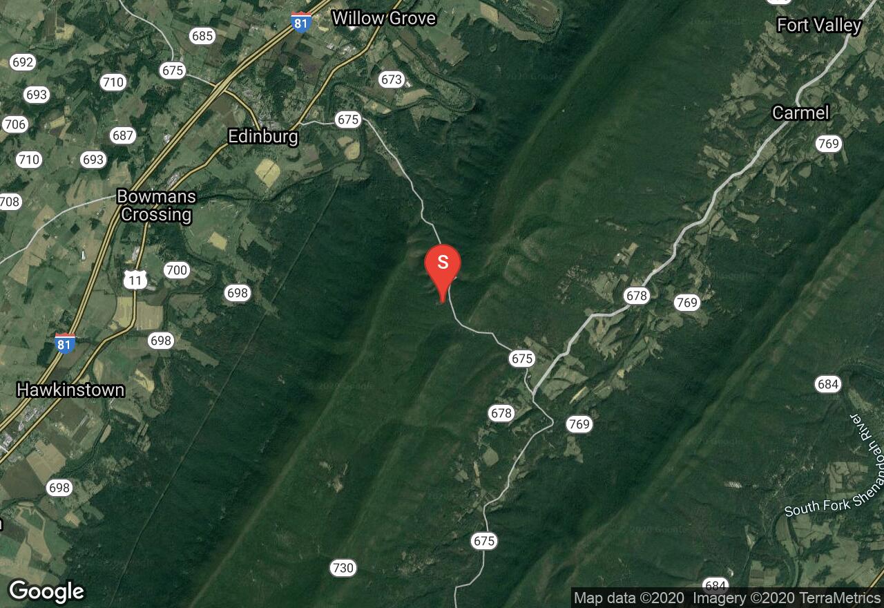
Virginia, Shenandoah County
01 :25 hrs
7.8 mi
368.035 ft
Unknown
Peters Mill Run/Taskers Gap OHV Trail Complex is the largest in the whole state of Virginia and provides a scenic and rugged destination for riders to enjoy. The Green Mountain trail is part of the Peters Mill section and follows trail #457 for 7 miles parallel to Peters Mill Run. The trail is rated as moderate in difficulty but it connects to multiple trails in the system that are easier as well as more difficult. The trails are open to vehicles less than 50 inches in width. To ride the trails a special recreation permit is required. Permits are available through local vendors.

Virginia, Dickenson County
02 :23 hrs
11.9 mi
- ft
Unknown
Haysi's Ridgeview Trail System consists of 78 miles of multi-use trails that are open for off-roading just outside of the town of Haysi. The trail system offers a variety of trail options that range in difficulty and length. Trail #1 is the main trail that runs from the parking area providing access to many of the other trails in the system. The trail is rated as easy and has no major obstacles or hazards. The trails are open to hikers and mountain bikers so watch out for other users of the trail. A Spearhead trail permit is required for all drivers and passengers and these can be obtained through local retailers. Please visit the Spearhead Trails website for more information.
Virginia, Buchanan County
01 :17 hrs
8.2 mi
233.143 ft
Unknown
The Coal Canyon Trail System consists of 114 miles of multi-use trails that are open for off-roading located near Poplar Gap Park in western Virginia. The trail system offers a variety of trail options that range in difficulty and length. Trail #101 is a main trail that starts from the trailhead and heads west and connects to the Ridgeview Trail System. The trail is rated as easy and has no major obstacles or hazards. The trails are also open to hikers and mountain bikers so watch out for other users of the trail. A Spearhead trail permit is required for all drivers and passengers and these can be obtained through local retailers. Please visit the Spearhead Trails website for more information.
See more adventures..
Explore complete list
Explore nearby adventures

