Best Snowshoeing in Virginia
Trying to find the best snowshoeing in Virginia? Bivy has great hiking, biking, paddling, climbing, skiing, riding and more, with hand-curated trail maps, as well as detailed driving directions.
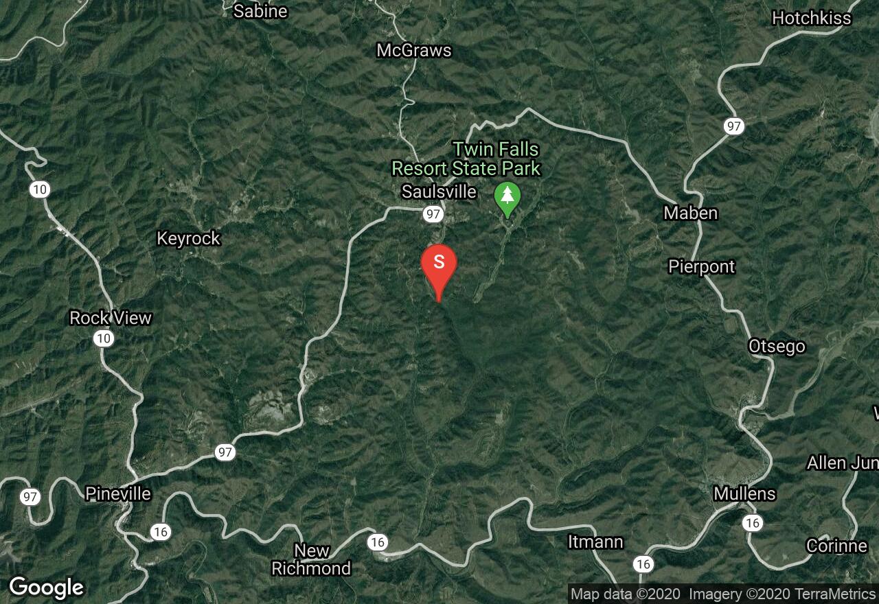
West Virginia, Wyoming County
00 :28 hrs
1.1 mi
47.15863 ft
Easy
Nestled in the Allegheny Plateau, Twin Falls Resort State Park offers many hiking trails. The popular Falls Trail is surrounded by densely forested mountains, and travels to the high volume cascades of Marsh Fork Falls and Black Fork Falls. Part of the trail travels over a century old logging road, which was the old entrance into the park. There are towering maple and hemlock along the trail canopy with mountain laurels and rhododendron in the understory. The waterfalls are at their highest volume during spring.
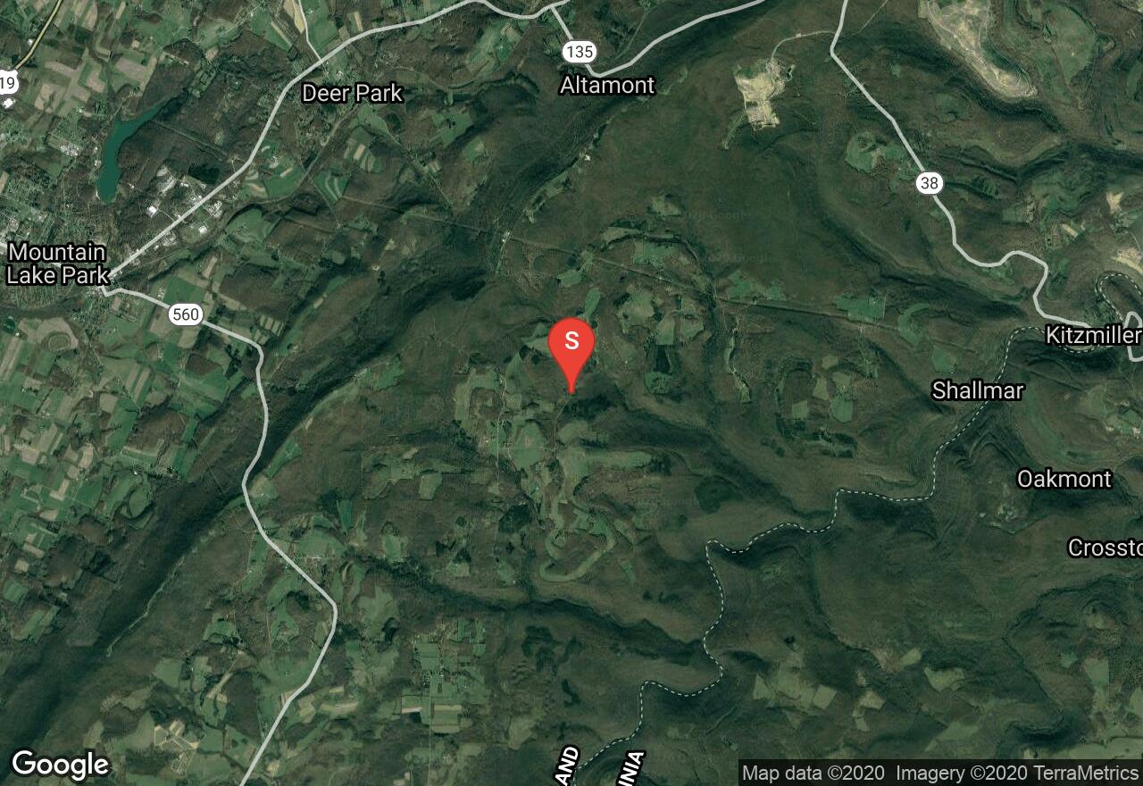
Maryland, Garrett County
02 :47 hrs
3.3 mi
200.36536 ft
Hard
Located in the Potomac State Forest, this is a gorgeous hike through a hemlock and mountain laurel filled canyon which follows Lostland Run all the way to the Potomac River. There are several stream crossings on footbridges, a waterfall, and many opportunities to view wildlife. The first mile of the hike is over rough and rocky terrain but it becomes easier as you approach the stream.
Maryland, Howard County
00 :54 hrs
2.5 mi
33.545555 ft
Moderate
Moderate loop trail with hills and long flat stretches. Off the Red Trail. Green to Blue to Green and back to Red. Intersections are marked with some trail blazing as well.

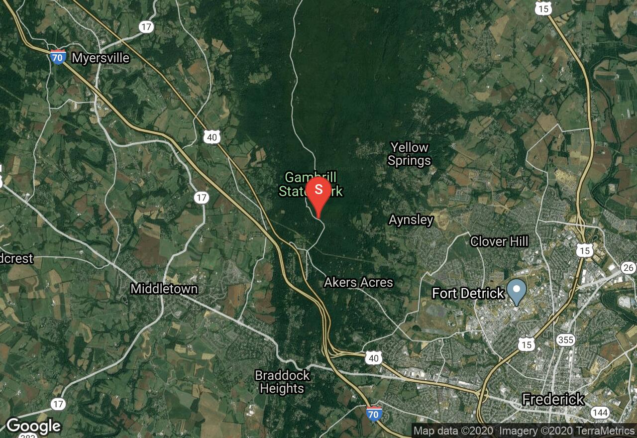
Maryland, Frederick County
02 :35 hrs
10.2 mi
205.58014 ft
Expert
Gambrill State Park is a beautiful mountain park located on the ridge of the Catoctin Mountains and its most popular feature is the network of trails. The Blue Trail is a challenging and demanding ride that is very popular and sought out for its beauty and difficulty. The trail is rocky singletrack running through dense woods and over mountainous terrain. There are some strenuous climbs involved as well. You will reach the top of High Knob where there are three stone overlooks with breathtaking views of the Frederick and Middletown Valleys.
Maryland, Frederick County
01 :23 hrs
5.5 mi
154.48193 ft
Hard
Gambrill State Park is a beautiful mountain park located on the ridge of the Catoctin Mountains and its most popular feature is the network of trails. The Yellow Trail is a challenging and demanding ride. The trail is rocky singletrack running through dense woods and over mountainous terrain. There are some strenuous climbs involved as well. You will reach the top of High Knob where there are three stone overlooks with breathtaking views of the Frederick and Middletown Valleys.
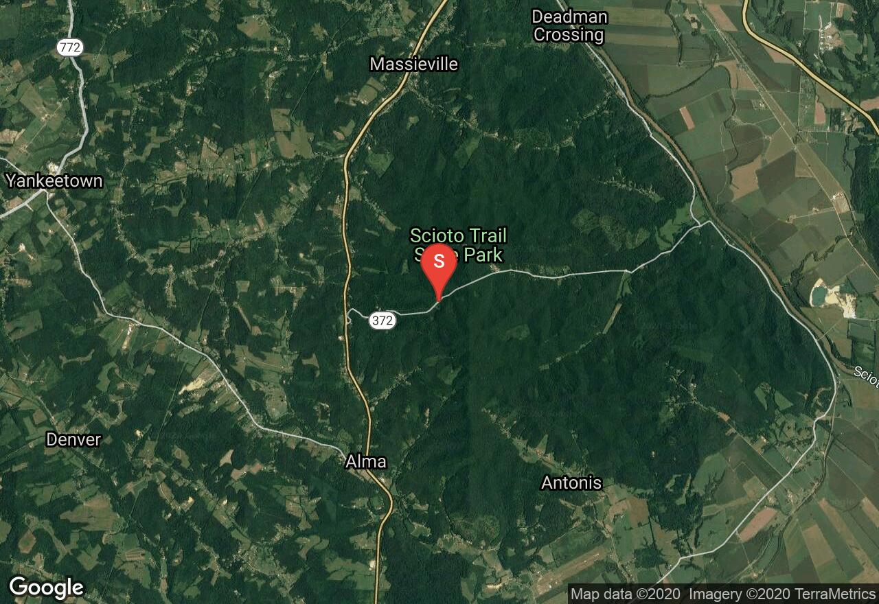
Ohio, Ross County
04 :11 hrs
11 mi
132.71419 ft
Expert
Scioto Trail and State Forest Park offers miles of trails for hiking and riding. There are big hills and beautiful scenery through dense pine forests. There are trails for all levels of riding. This loop climbs up to the top of ridges in quiet wooded forest. It retraces an old Shawnee trail. The views from these ridges are spectacular and colors during the fall are amazing.
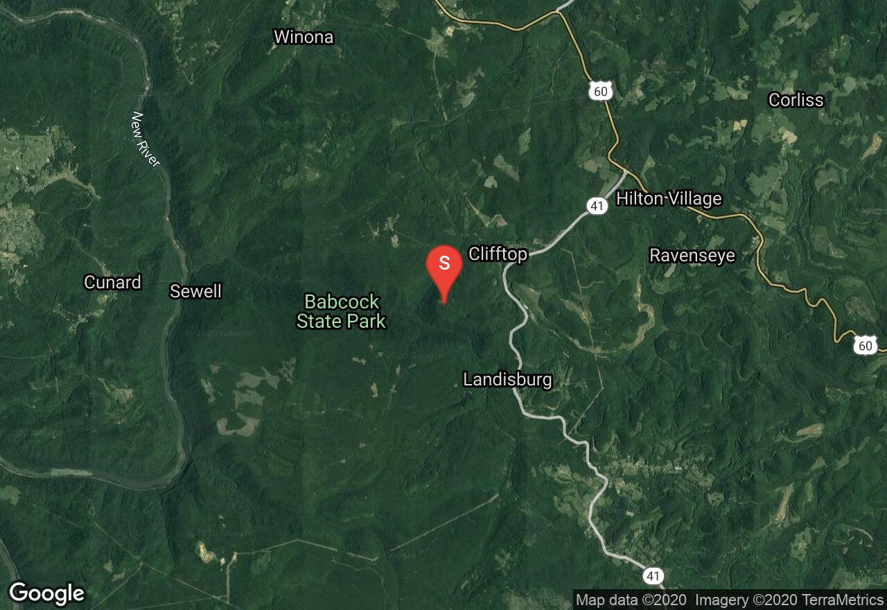
West Virginia, Fayette County
01 :28 hrs
1.5 mi
76.838684 ft
Moderate
The Skyline Trail begins at Manns Creek Picnic Area, located in Babcock State Park. The trail slowly gains elevation as is passes Boley Lake. There are large sandstone boulders that lead to one of the lookouts of the Glade Creek Valley. This trail travels through thick oak forest with mountain laurels and rhododendrons. During early summer Catawba and Rosebay rhododendron in bloom. Although the park facilities are closed during winter, most park roads are graded to facilitate cross-country skiing.

West Virginia, Ritchie County
03 :41 hrs
7.1 mi
63.06935 ft
Moderate
The 72 mile North Bend Rail Trail offers numerous spectacular bridges and thirteen old railroad tunnels made of brick and sandstone. This section of the trail travels along an easy flat crushed limestone path through heavy wooded forest, offering stunning natural scenery. This trail offers many wildlife encounters, especially birds and deer. The North Bend Rail Trail can be traveled any length and section by using a shuttle plan.
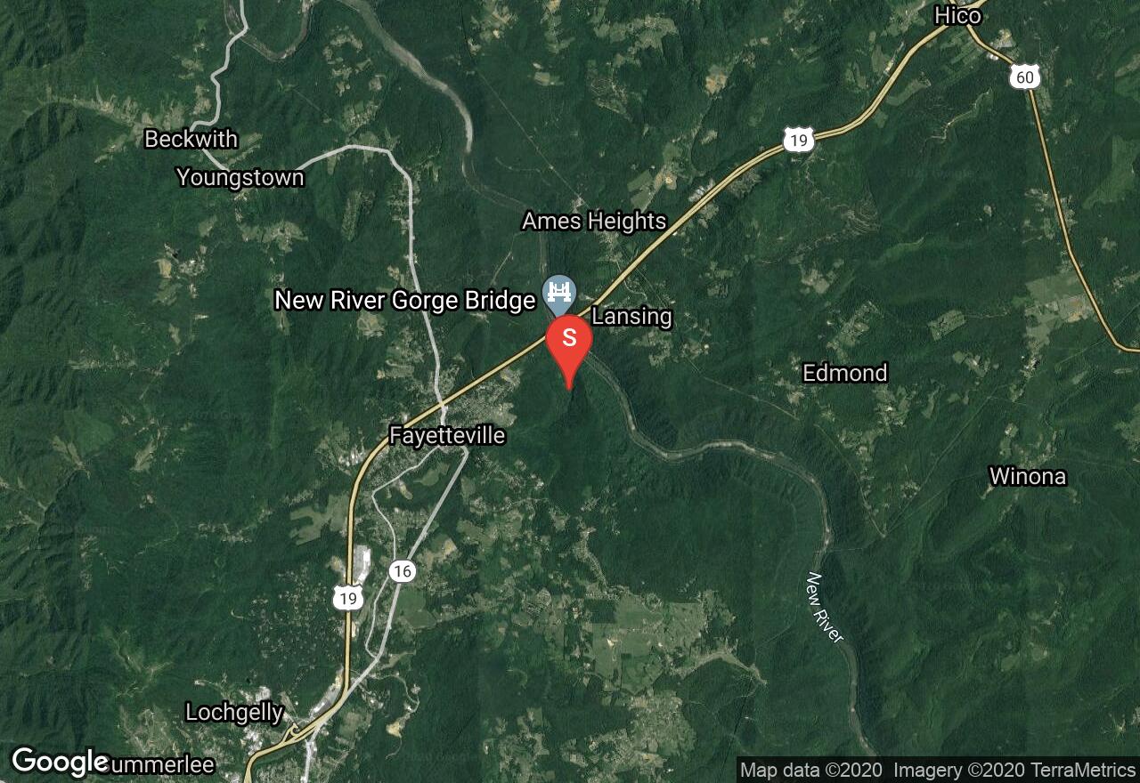
West Virginia, Fayette County
03 :53 hrs
3.8 mi
240.56433 ft
Hard
The Fayetteville Trail is one of many trails located in Fayetteville. This trail travels along the southern wall of the New River Gorge, ascending and descending through the ravines of streams and crossing ridges. The trail travels through thick forests of maple, sycamore, and chestnut oak trees. there are amazing views of the New River Gorge Bridge as the trail travels over ridge lines. There is the opportunity for a shuttle plan, the trail has two access points one of Fayette station road and the other on Kaymoor road.
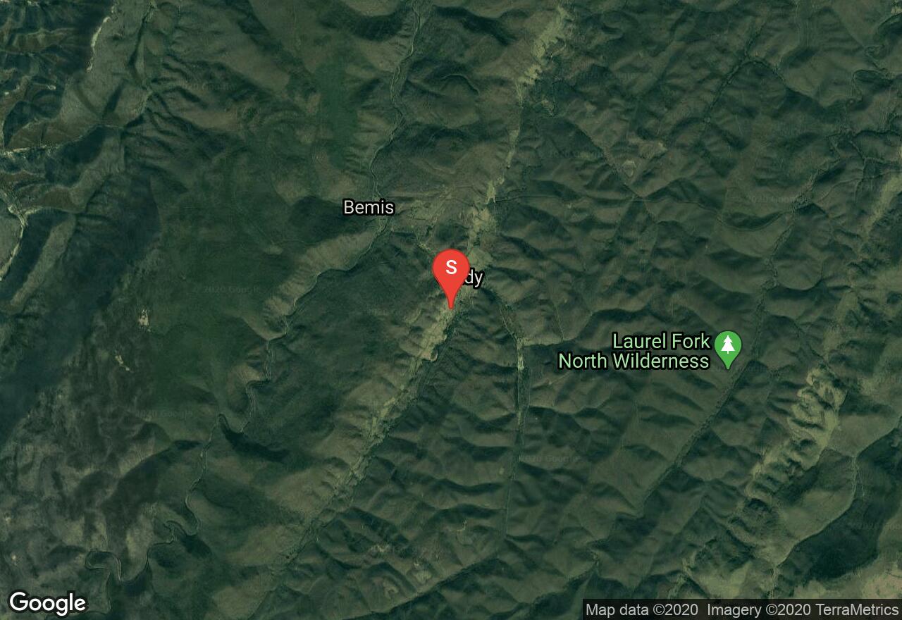
West Virginia, Randolph County
07 :32 hrs
22 mi
130.29193 ft
Extreme
The West Fork Greenbrier River Trail lies on the old railbed of the Coal and Iron Railroad. It first started in 1903, traveling from Elkins to Durbin. The trail crosses many old train bridges as it follows the West Fork River for the majority of the trail. Traveling through the remote mountain setting, the trail begins with gradual uphill for the first 5 miles then it levels out with a slight decline as it follows the river downstream. The Trail has a gentle grade and is exceptionally scenic with glorious colored vistas during fall and wildflowers in the spring and summer months. This trail offers many wildlife encounters, including many bird species, deer and even black bears. This is a multi-day hike, or there is the option to shorten the trail as is travels through small towns. A shuttle plan is needed for this trail.
See more adventures..
Explore complete list
Explore nearby adventures

