Best Mountain Biking in Virginia
Trying to find the best mountain biking in Virginia? Bivy has great hiking, biking, paddling, climbing, skiing, riding and more, with hand-curated trail maps, as well as detailed driving directions.
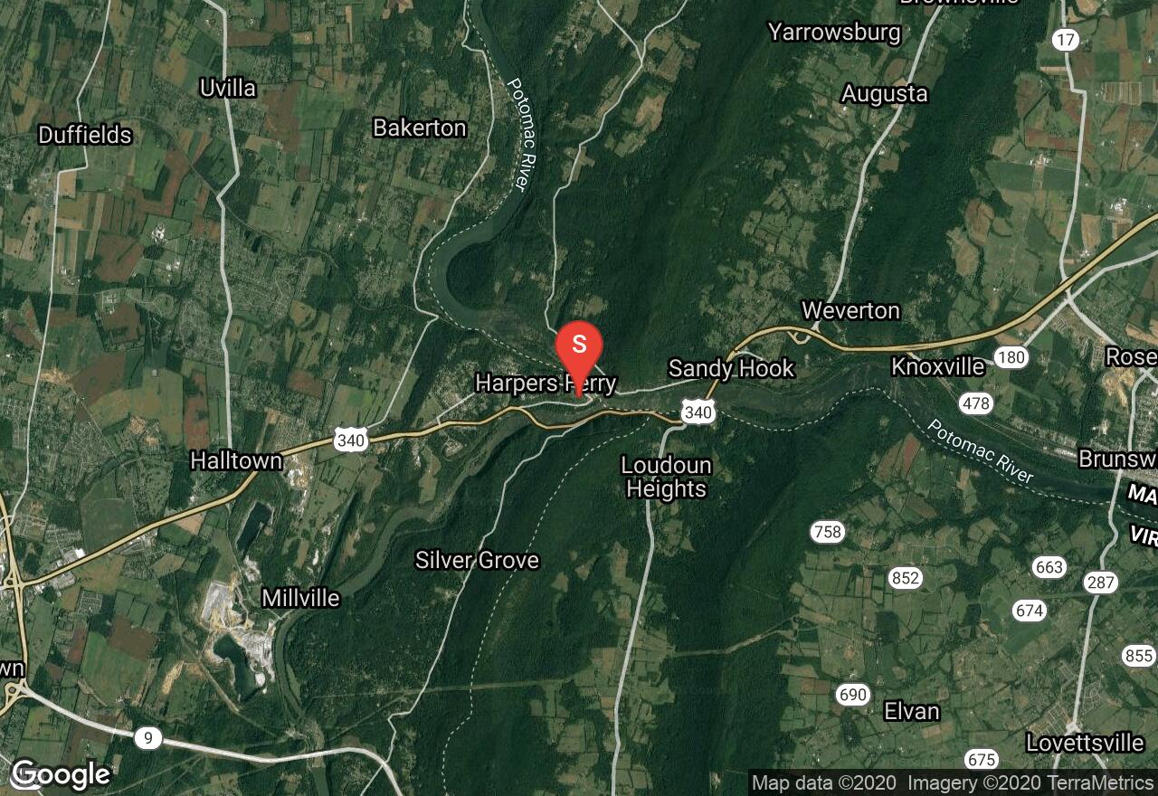
West Virginia, Jefferson County
03 :27 hrs
6.5 mi
62.382416 ft
Easy
The Chesapeake & Ohio Canal Towpath is a historic trail running 184.5 miles from Cumberland, Maryland to Washington, DC . It is relatively flat and is made of crushed stone and clay. This small section of the towpath begins in Harper's Ferry. The park represents over 1,000 years of history, including the arrival of the first successful American railroad, John Brown's attack on slavery, and the largest surrender of Federal troops during the Civil War. As the trail travels to Brunswick MD, it is very scenic and offers many wildlife encounters. A parking fee is required in Harper's Ferry.
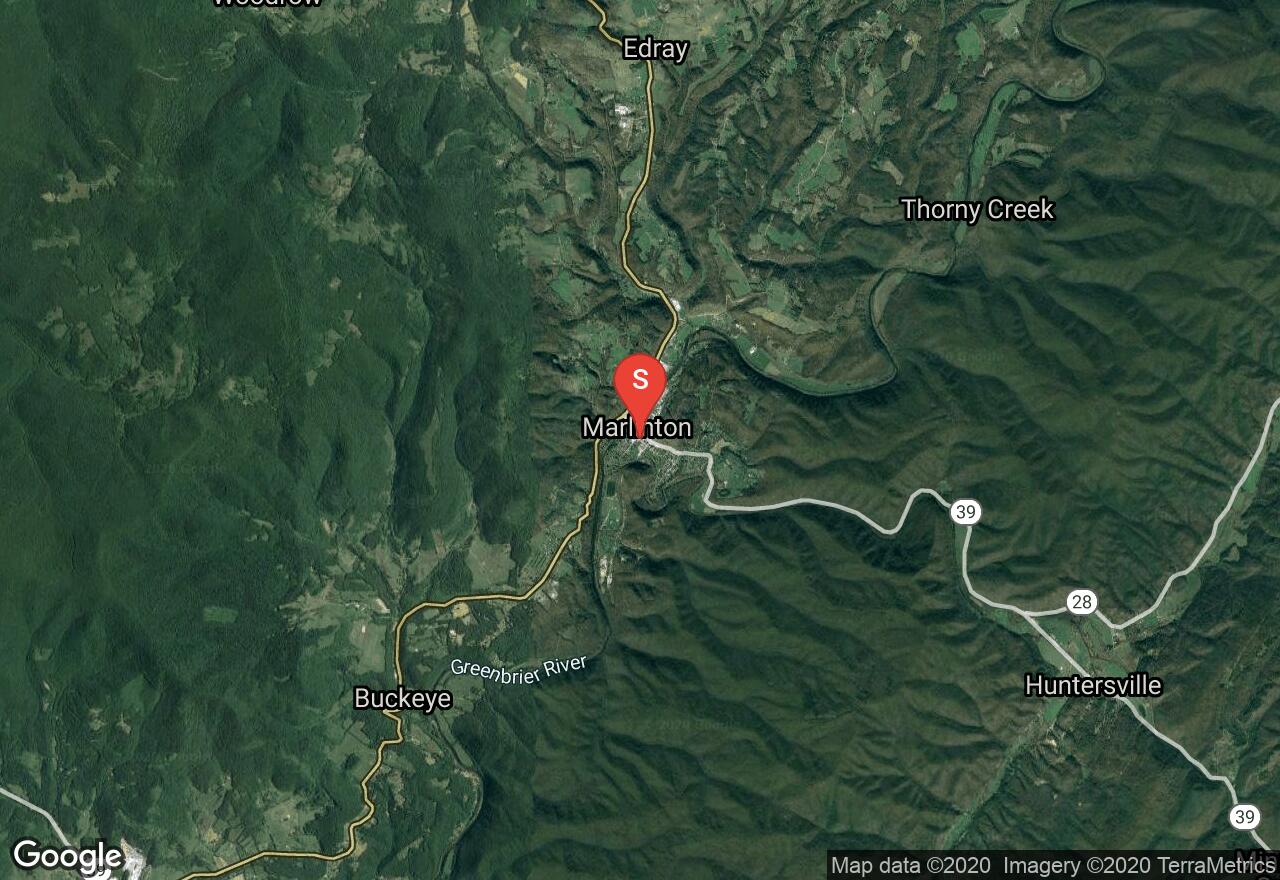
West Virginia, Pocahontas County
06 :37 hrs
24.2 mi
101.51495 ft
Moderate
The 77 mile Greenbrier River Trail operated by West Virginia State Parks, is one of America's premier rail-trails. This former railroad is now made from crushed limestone with some paved sections making it wheelchair accessible is some sections. This trail crosses 35 bridges and passes through 2 tunnels and many small towns. It travels through a forest full of sycamore and river birch as well as maple and mountain ash. During Spring through Fall there are many seasonal wildflowers including phlox, dutchman's-breeches and trillium. Throughout the trail there are many bird and wildlife encounters possibly black bears and bald eagles. There are many camping and access points along the Greenbrier River Trail, making it easy to travel any section or length of the trail. Marlinton to Cass is the most popular and scenic section with not a lot of development and travels through the 511 feet long Sharps Tunnel, built in 1899. A shuttle plan is needed for this trail.
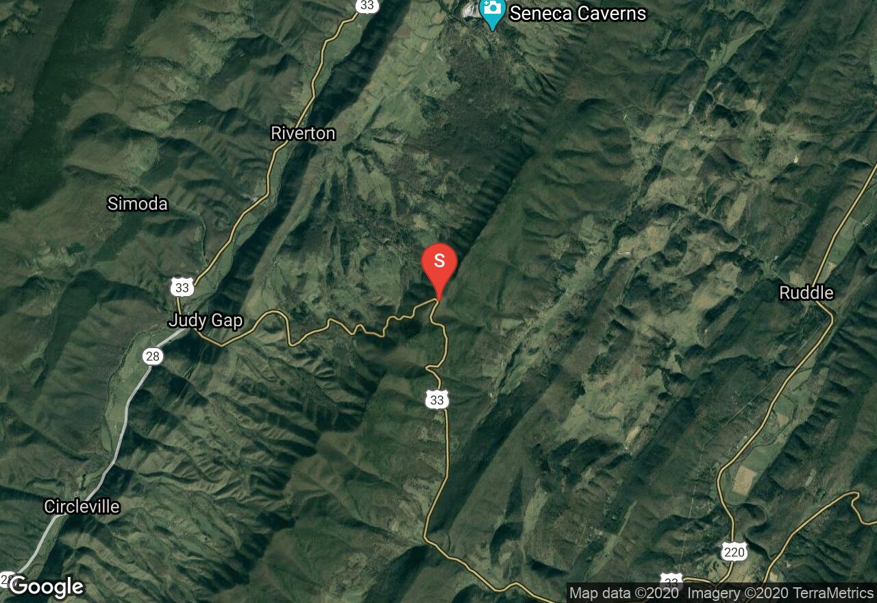
West Virginia, Pendleton County
05 :09 hrs
23.2 mi
811.30896 ft
Expert
Located in Monongahela National Forest, this trail is considered one of the best mountain bike trails in West Virginia. the trail starts in thick forest cover with a few short ascents and moderate downhill sections. As the trial progresses, there are some difficult short steep uphill sections as well as a couple hike-a-bike sections. The ridge line has interesting rock formations and features amazing views of the valley below. There are few narrow places along the trail that involve careful maneuvering. As the trail descends there are small berms on some of the turns as well as a few switchbacks. The trail is well marked and is in good shape. It is typically tackled using a shuttle and starts from the South end traveling to the north end.
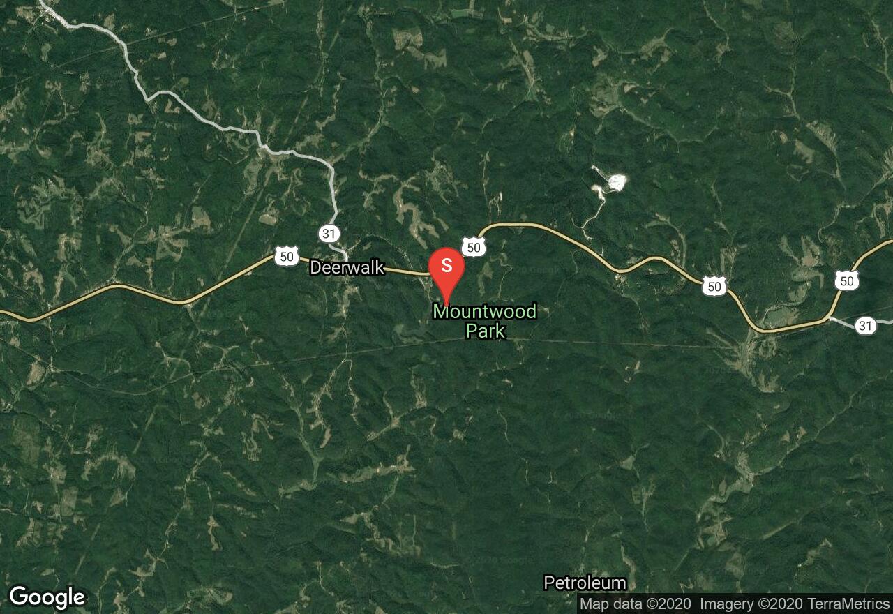
West Virginia, Wood County
04 :09 hrs
16.4 mi
124.55699 ft
Hard
Located in Mountwood Park, this loop is made with the majority of the parks singletrack trails. This loop has only one hike-a-bike section as well as many uphill sections with rewarding downhills. There are some technical features along the way like, shaved logs, bridges, and rocks. All the trails are well marked and maintained. The trails are open year round offering four seasons of riding through scenic, rocky woodlands, as well as the historic ruins of the nineteenth century oil community of Volcano.
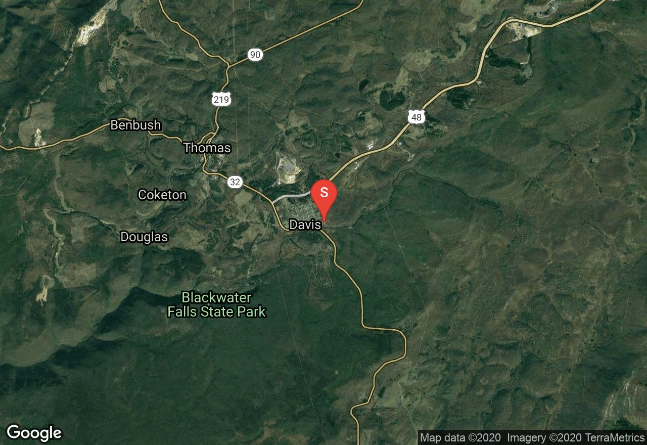
West Virginia, Tucker County
03 :52 hrs
14.8 mi
163.80096 ft
Expert
This loop offers the best riding of the Canaan Valley Institute, with the famous Moon Rocks section, and amazing 360° views on top of Hoodoo Rocks. The beginning of the trail travels through meadows and forest with some rocky sections as well as a stream crossing. Trials Road trail can be very muddy, even in dry weather the mud bogs can be an issue. Along the loop there are many downhill and uphill sections which can get quite technical and steep. Moon rocks are a cratered ridge forming a plateau that offer a challenging ride. The trail ends south of Davis on highway 32, travel the main road back to the parking lot.
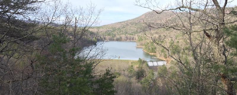
Virginia, Bath County
01 :16 hrs
5.2 mi
251.41156 ft
Hard
This is a good ride for novice-advanced riders. It will test your skills with tough climbs, rocks and blowdowns. There will be rocks on the creek bed that drains the falls at the beginning of the ride. When you get to the falls, take a right turn. Follow the trail, and you will ride by the lake on a great downhill stretch.
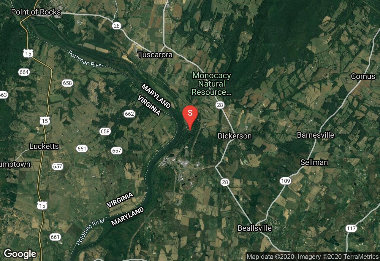
Maryland, Montgomery County
11 :30 hrs
42.6 mi
38.822243 ft
Easy
The Chesapeake and Ohio Canal, abbreviated as the C & O Canal, operated from 1831 until 1924 and runs parallel to the Potomac River from Washington D.C. to Cumberland. The total length of the canal is about 184 miles and has an elevation change of 605 feet that is accommodated by 74 canal locks. There were over 150 culverts and 11 aqueducts for the crossing of streams. The canal way is now maintained as a park that is overflowing with history. The trail is wide, flat, and made up of hard-packed dirt. Along with stunning river, forest, and mountain views throughout, this section of the towpath passes Harpers Ferry at the confluence of Shenandoah and Potomac Rivers, a great place to visit.
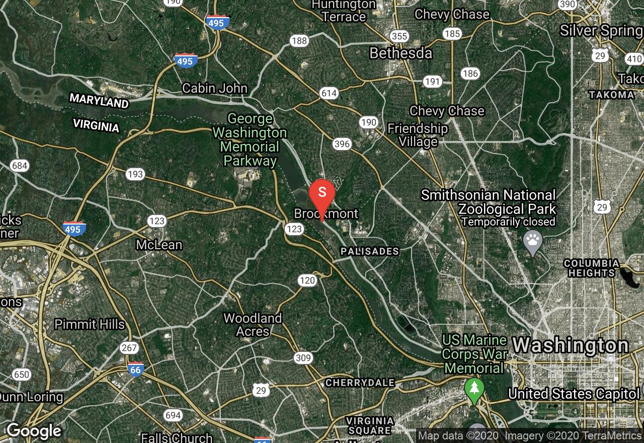
Maryland, Brookmont
10 :02 hrs
37.1 mi
54.41784 ft
Easy
The Chesapeake and Ohio Canal, abbreviated as the C & O Canal, operated from 1831 until 1924 and runs parallel to the Potomac River from Washington D.C. to Cumberland. The total length of the canal is about 184 miles and has an elevation change of 605 feet that is accommodated by 74 canal locks. There were over 150 culverts and 11 aqueducts for the crossing of streams. The canal way is now maintained as a park that is overflowing with history. The trail is wide, flat, and made up of hard-packed dirt. Along with stunning river, forest, and mountain views throughout, this section of the towpath passes through Great Falls Park with a majestic waterfall. There are many parking areas, usually every few miles, allowing you to shorten or lengthen your ride.

Maryland, Frederick County
02 :35 hrs
10.2 mi
205.58014 ft
Expert
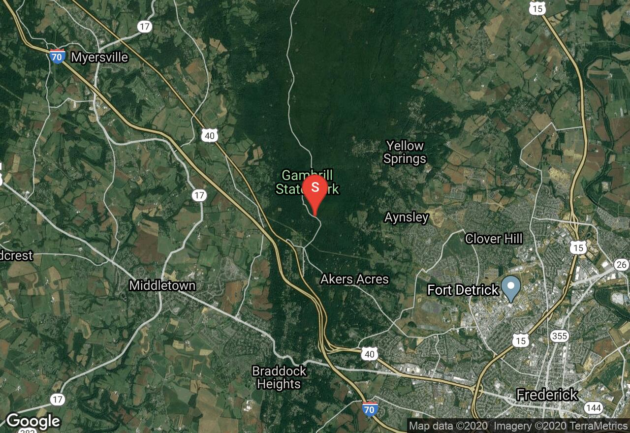
Gambrill State Park is a beautiful mountain park located on the ridge of the Catoctin Mountains and its most popular feature is the network of trails. The Blue Trail is a challenging and demanding ride that is very popular and sought out for its beauty and difficulty. The trail is rocky singletrack running through dense woods and over mountainous terrain. There are some strenuous climbs involved as well. You will reach the top of High Knob where there are three stone overlooks with breathtaking views of the Frederick and Middletown Valleys.
Maryland, Frederick County
01 :23 hrs
5.5 mi
154.48193 ft
Hard
Gambrill State Park is a beautiful mountain park located on the ridge of the Catoctin Mountains and its most popular feature is the network of trails. The Yellow Trail is a challenging and demanding ride. The trail is rocky singletrack running through dense woods and over mountainous terrain. There are some strenuous climbs involved as well. You will reach the top of High Knob where there are three stone overlooks with breathtaking views of the Frederick and Middletown Valleys.
See more adventures..
Explore complete list
Explore nearby adventures

