Runtime.80ab492fe3d778817936.js in Vermont
Trying to find the best in Vermont? Bivy has great hiking, biking, paddling, climbing, skiing, riding and more, with hand-curated trail maps, as well as detailed driving directions.
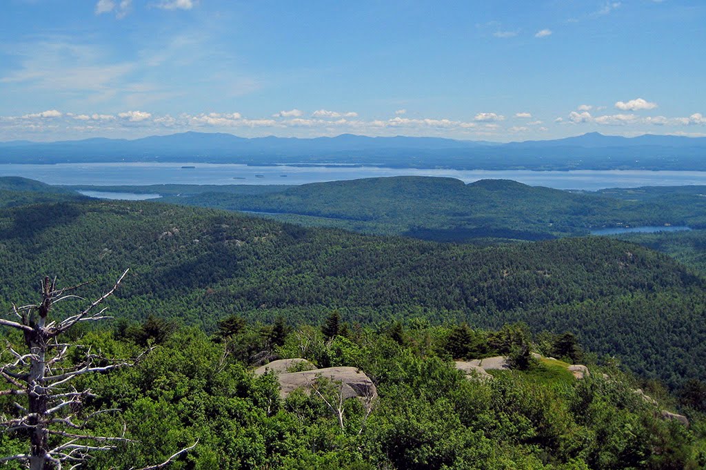
Vermont, Washington County
01 :42 hrs
3.5 mi
60.452118 ft
Moderate
Woods, rolling hills, fields & views
Vermont, Rutland County
02 :43 hrs
6.1 mi
259.70514 ft
Moderate
This was a wonderful afternoon. Great test for a new app.
New Hampshire, Franconia
05 :54 hrs
4.6 mi
886.8779 ft
Hard
This well graded trail takes you to the summit of Mt Garfield with its excellent three hundred sixty degree views. The path begins in hardwood forest roughly paralleling Spruce Brook and emerges on an exposed summit surrounded by spruce and fir. The peak is also the site of an old fire watchtower. Check and heed weather reports before going and bring appropriate clothing for conditions. Bring extra food and water and be prepared for emergencies. The Gale River Loop Road that accesses this trailhead is closed in winter. A parking permit is required at trailheads in the White Mountain National Forest.
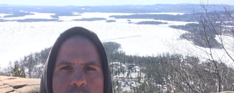
Vermont, Lamoille County
07 :22 hrs
14.8 mi
941.0039 ft
Extreme
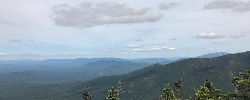
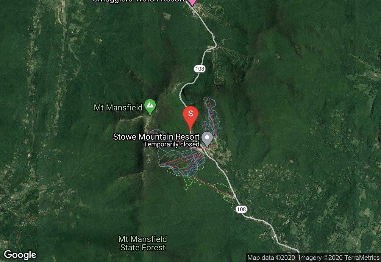
The Long Trail is the oldest long distance trail in the United States. It runs 272 miles in Vermont along the main ridge of the Green Mountains, and connects with the Appalachian Trail for 100 miles. This section of the trail is very scenic and it begins near the Stowe Mountain Resort. The trail has a difficult ascent for the beginning 2.5 miles to the summit of Mount Mansfield. This is the highest point in the State and offers beautiful views of the surrounding mountains. This section of the hike is not recommended during bad weather or high winds. The remaining of the trail there are some easy gradual elevation changes. There are two shelters along this section of the Long Trail which are used for multi day/thru hikers. The Butler Lodge requires a small fee with a capacity of 14 people and is located almost 5 miles into the hike. The Puffer Shelter is located just over 10 miles from the beginning and has a capacity of 6 people. Avoid hiking the trails from April through to May, the wet sloppy conditions leads to serious trail erosion. A shuttle plan is needed for this trail.
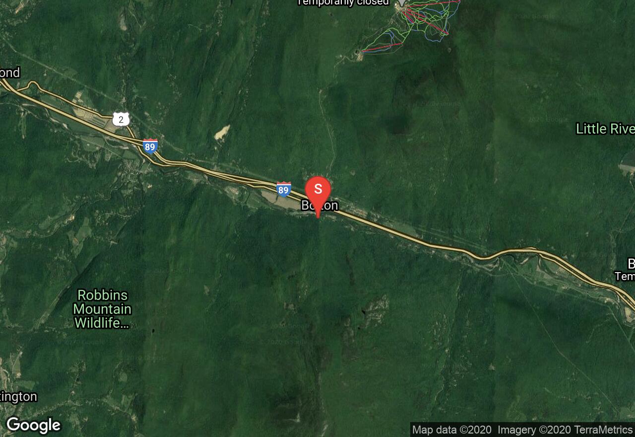
Vermont, Chittenden County
02 :47 hrs
5.8 mi
756.2539 ft
S2
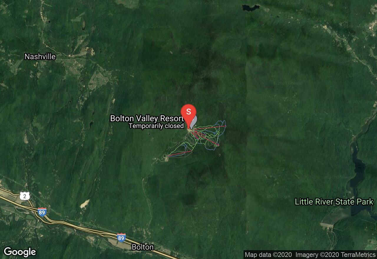
The Bolton Trapp Tour is one of the most popular sections of the longer, 300-mile Catamount Trail, and is also the most challenging section. This scenic tour begins from the Bolton Valley Nordic Center and crosses over the shoulder of Bolton Mountain and descends into Nebraska Valley ending at the Trapp Family Lodge. Park at the Bolton Valley Ski Area parking lot to begin. Park a vehicle at the TRapp Family Lodge if you arranged a parking agreement from the owners, otherwise have a vehicle parked at a small plowed pullout area near the lodge. You must purchase a cross-country ski ticket from the Bolton Valley Nordic Center where the trail begins before starting your tour.
Vermont, Chittenden County
02 :54 hrs
5.4 mi
14.103136 ft
Moderate
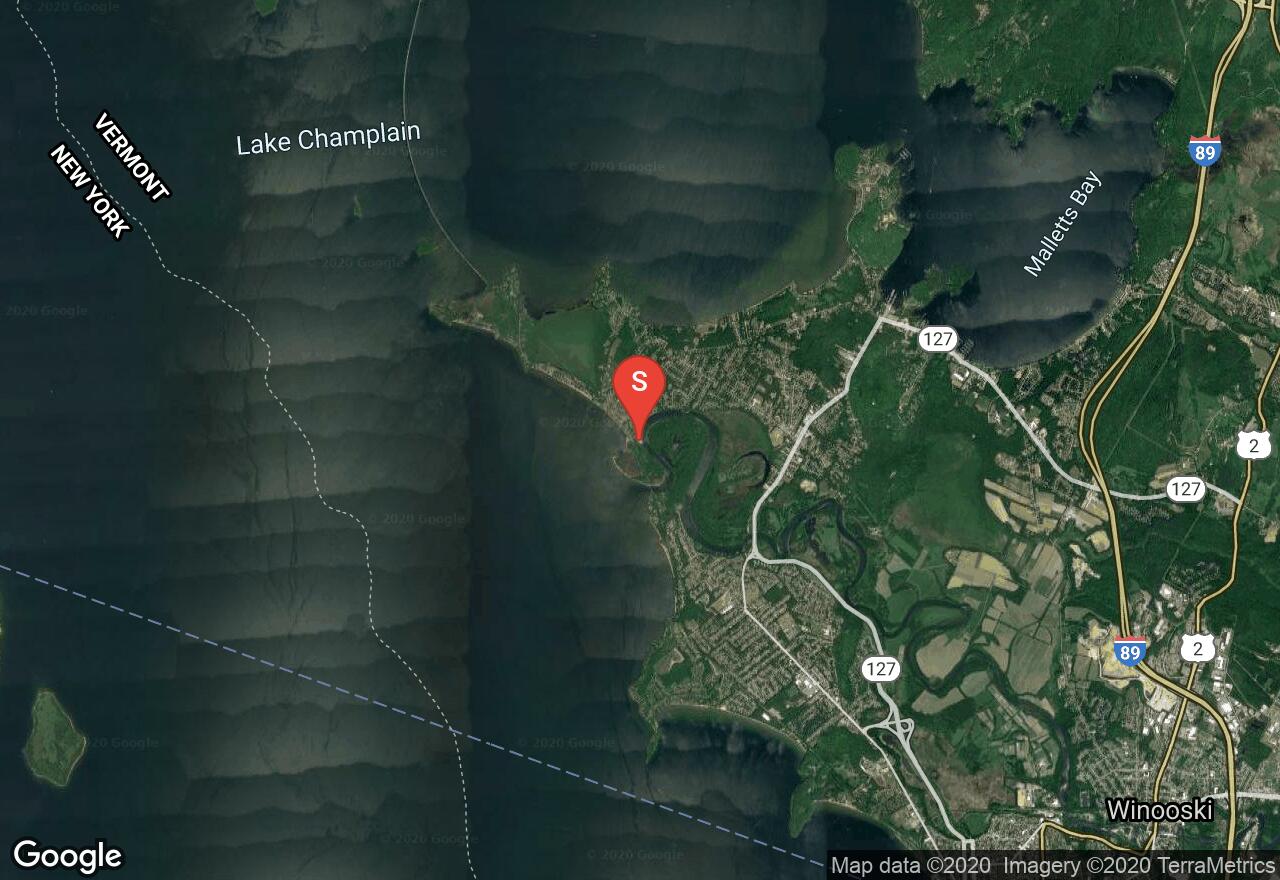
Also known as the Burlington Bikeway, the Island Line rail-trail is very popular and one of the best trails in the area. It is flat and follows along Lake Champlain offering unique scenery and access to parks through the town of Burlington. This section begins at Derway Island and travels south through the town providing access to the lake. The surface is a mix of paved and gravel. You will find several access points and parking.
New Hampshire, Coös County
08 :52 hrs
19 mi
405.0631 ft
S2+
This classic north to south traverse through the Pemigewasset Wilderness is classic long-distance backcountry ski tour in New England. Begin from the plowed parking lot on the north side of the Zealand Campground. The terrain is moderate, and travels through wilderness areas along old logging railroads. Enjoy the serenity of the the wilderness as you follow rivers and pass waterfalls enroute to reaching your destination at the Lincoln Woods Trailhead/Visitor Center. To begin, ski along on the unplowed Zealand Road (shown here), or take the Spruce Goose Trail to reach Zealand Trail. After reaching Zealand Trail, it is another 2.7 miles to the AMC Zealand Falls Hut. From the hut, continue south to Thoreau Falls Trail. Connect to the Wilderness Trail that links into the Pemi East Side Trail leading to your destination.
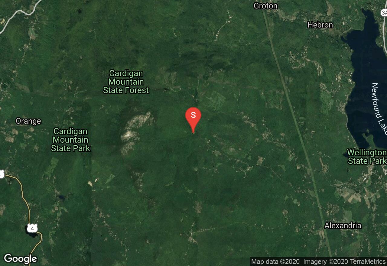
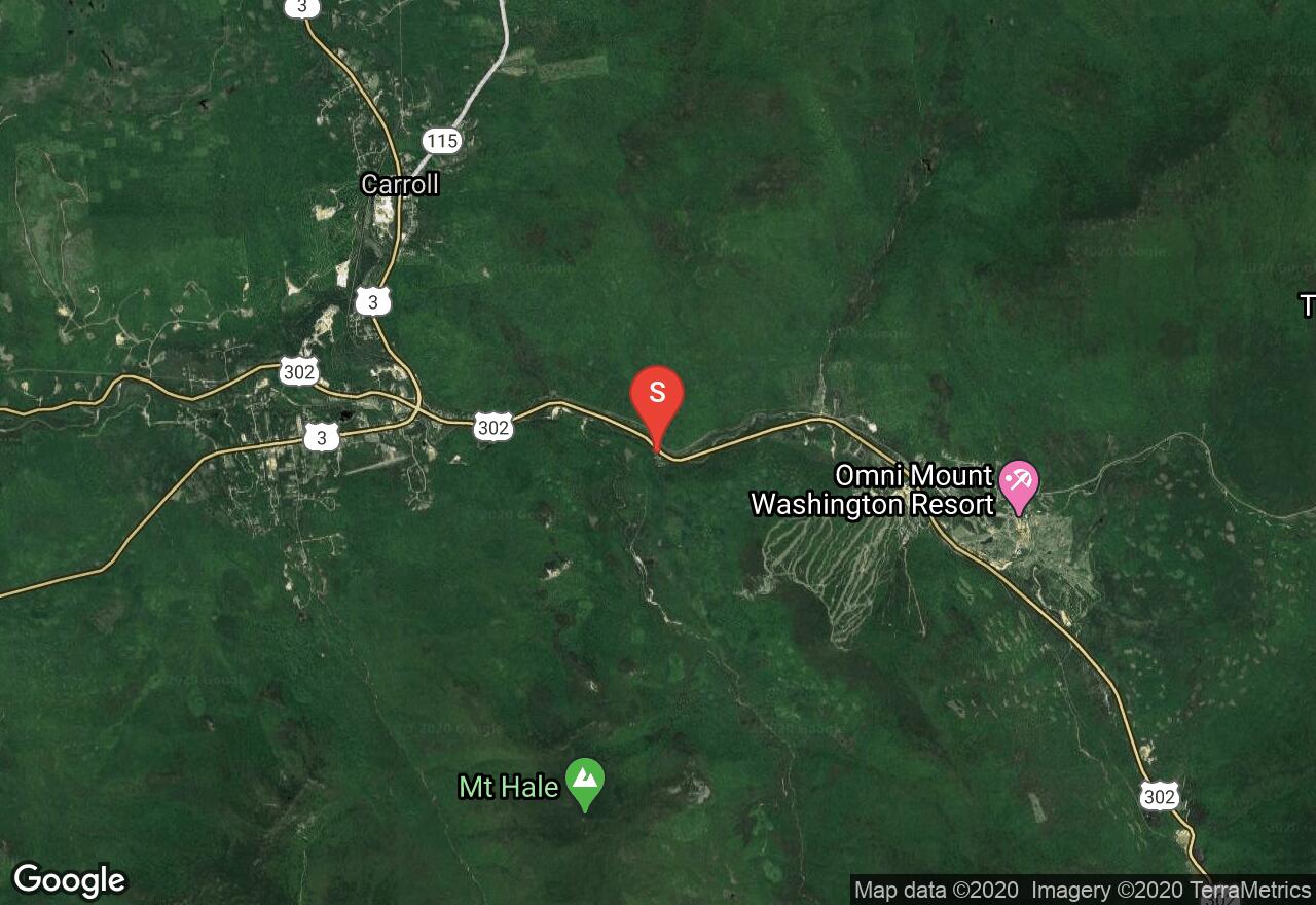
New Hampshire, Grafton County
02 :34 hrs
4.6 mi
518.45996 ft
S2+
Located on the east side of the Cardigan summit ridge, this classic route descends down to Appalachian Mountain Club’s Cardigan Lodge. Drive to the end of Shem valley Road and park at the Cardigan Lodge. From the lodge begin on Holt Trail, after reaching the “grand Junction”, continue straight ahead to merge onto the Alexandria Trail. From PJ Ledge, continue to ascend to the summit via Clark Trail. Depending on snow levels, the summit cone may or may not be skiable and may require crampons to reach the true summit. Descend via Clark Trail to meet up with Alexandria Trail which offers lots of turns down sustained and steeper terrain. After reach the Grand Junction on your descent, you can either finish back to the lodge via the Holt Trail, (continue straight), or turn right onto the unmarked but well established Kimball Trail which is marked with blue blazes. After an easy ascent to a clearing upon a knoll, the Kimball Trail heads east through a softwood forest ending back at the lodge.
Vermont, Washington County
08 :21 hrs
15.2 mi
1121.3198 ft
Extreme
The Long Trail is the oldest long distance trail in the United States. It runs 272 miles in Vermont along the main ridge of the Green Mountains, and connects with the Appalachian Trail for 100 miles. The trail begins with a steep ascent for the first 5.5 miles to the top of Camels Hump. The summit offers treetop panoramic views, and on a clear day one can see the highest peaks of Mount Marcy in New York, Mount Washington in New Hampshire and Vermont's Mount Mansfield. The remaining of the trail there are some moderate elevation changes. There are a few shelters along this section of the Long Trail which are used for multi day/thru hikers. The Montclair Glen Lodge requires a small fee with a capacity of 10 people and is located almost 7 miles into the hike. Avoid hiking the trails from April through to May, the wet sloppy conditions leads to serious trail erosion. A shuttle plan is needed for this trail.
See more adventures..
Explore complete list
Explore nearby adventures

