Best Rafting in Ohio
Trying to find the best rafting in Ohio? Bivy has great hiking, biking, paddling, climbing, skiing, riding and more, with hand-curated trail maps, as well as detailed driving directions.
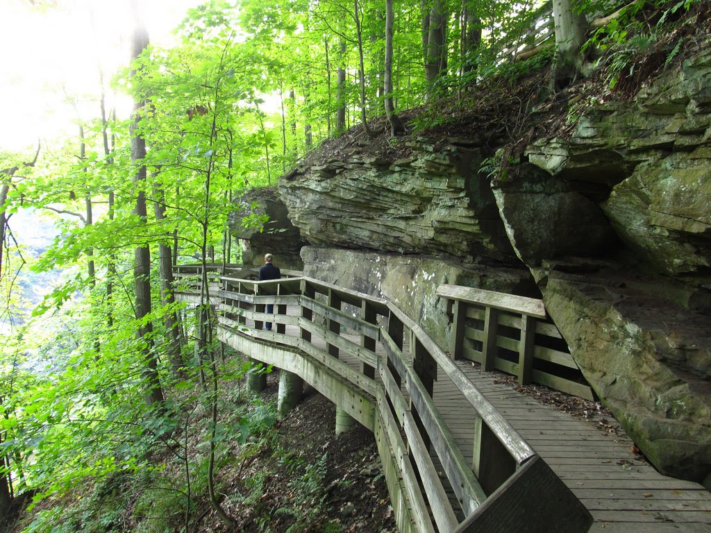
Ohio, Highland County
01 :60 hrs
4.1 mi
14.146545 ft
III
Rocky Fork Creek is one of the most scenic rivers in the state. This popular paddle begins at Browning Road and is combines beauty with a mix of some class III white-water just below the confluence of Rocky Fork and Paint Creek. At one point the river carves through two giant boulders that create a natural bridge.
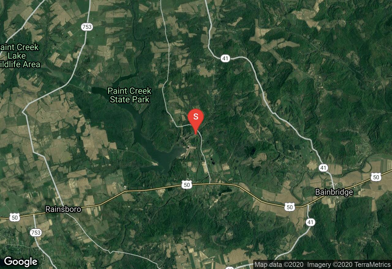
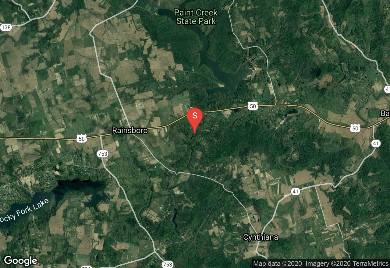
Ohio, Ross County
03 :36 hrs
7.3 mi
13.867065 ft
III
Paint Creek is a tributary of the Scioto River. This run begins just below the dam at Paint Creek Lake. It begins slowly until it meets up with Rocky Fork. Shortly after, is a section of popular class III rapids known as “The Chutes”. The river is wide and shallow with standing waves during high water. It then forks into two deep channels where it drops over ledges with hydraulics. Scouting the Chutes before paddling them is recommended. Takeout is in Bainbridge at the OH 41 bridge.
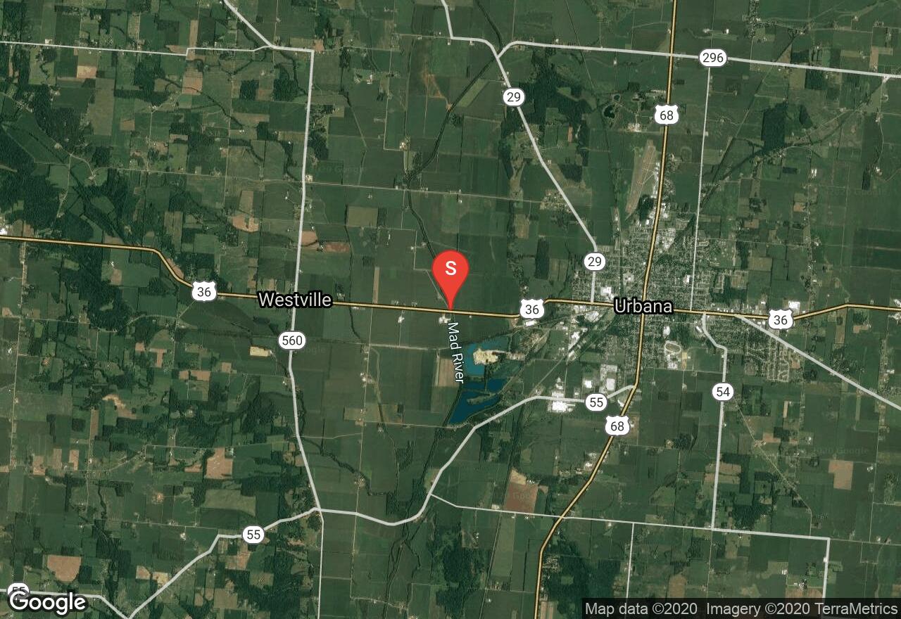
Ohio, Champaign County
05 :09 hrs
10.5 mi
26.208527 ft
I
The Muskingum River is the largest navigable river that lies entirely in Ohio. This river is popular to paddle and easy to navigate. There are10 hand-operated locks and dams along the river. The area is rich in history with good with fishing, birds and wildlife to see. You will have to obtain a permit/pass to use the locks and check the current conditions ahead of time by calling the lock information line: 740-453-4377. Beginning at Stillwell Road bridge this section flows to Ellis Lock #11, access is river right at dam.
Ohio, Fairfield County
03 :24 hrs
6.9 mi
11.96402 ft
I
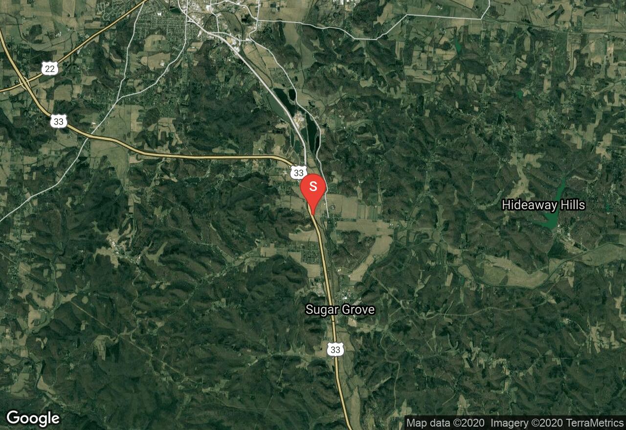
The Hocking River is a tributary of the Ohio River. It is a popular river to paddle and has commercial trips that operate on the mid and upper sections. It flows through Fairfield, Hocking and Athens Counties. Beginning at Horns Mill Road this section offers a peaceful paddle before the river gets busy from commercial trips. It is scenic and has unique rock formations. Takeout is at Rockbridge Road. Be sure to check out the natural arch that is visible from the river.
Ohio, Hocking County
03 :38 hrs
7.3 mi
7.2044525 ft
III
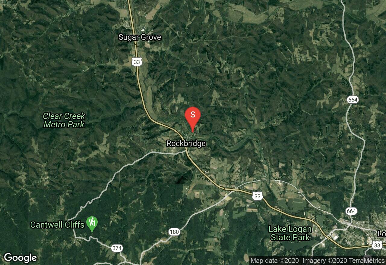
The Hocking River is a tributary of the Ohio River. It is a popular river to paddle and has commercial trips that operate on the mid and upper sections. It flows through Fairfield, Hocking and Athens Counties. Beginning at Rockbridge Road this section is a popular and flows past the Hhocking Valley Canoe Livery and to the Falls just below OH 664. There is a stretch of class III water where the river drops over a series of ledges. Midriver is the best but watch for large rocks on the lower end of the rapids. You can scout the rapids from the bridge. You can takeout at the falls or run through them and takeout at the dam a few more miles down river.
Ohio, Nelsonville
08 :23 hrs
16.8 mi
9.43985 ft
II
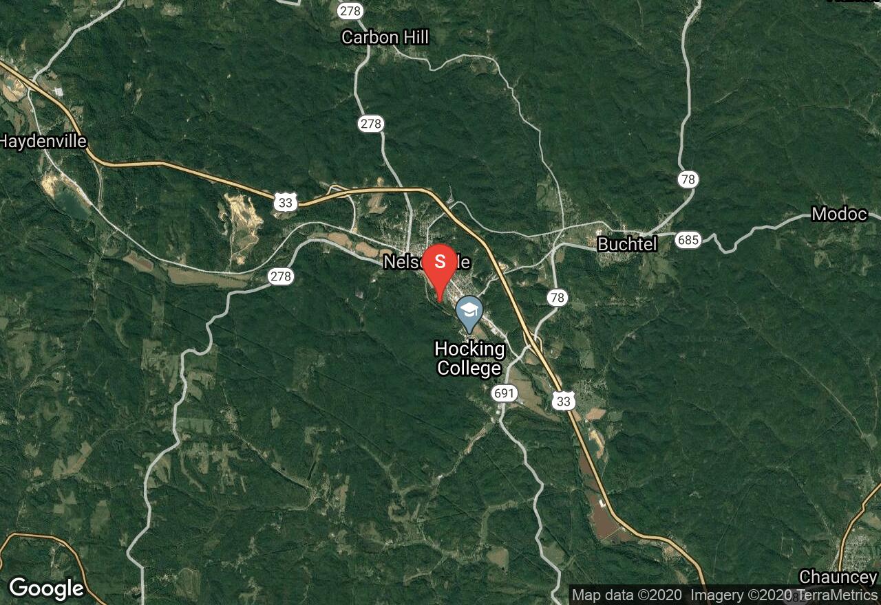
The Hocking River is a tributary of the Ohio River. It is a popular river to paddle and has commercial trips that operate on the mid and upper sections. It flows through Fairfield, Hocking and Athens Counties. Beginning in Nelsonville this section flows to Athens. Watch for the low-head dam in Nelsonville that has hydraulics.
Ohio, Zanesville
04 :18 hrs
8.6 mi
5.8972473 ft
I
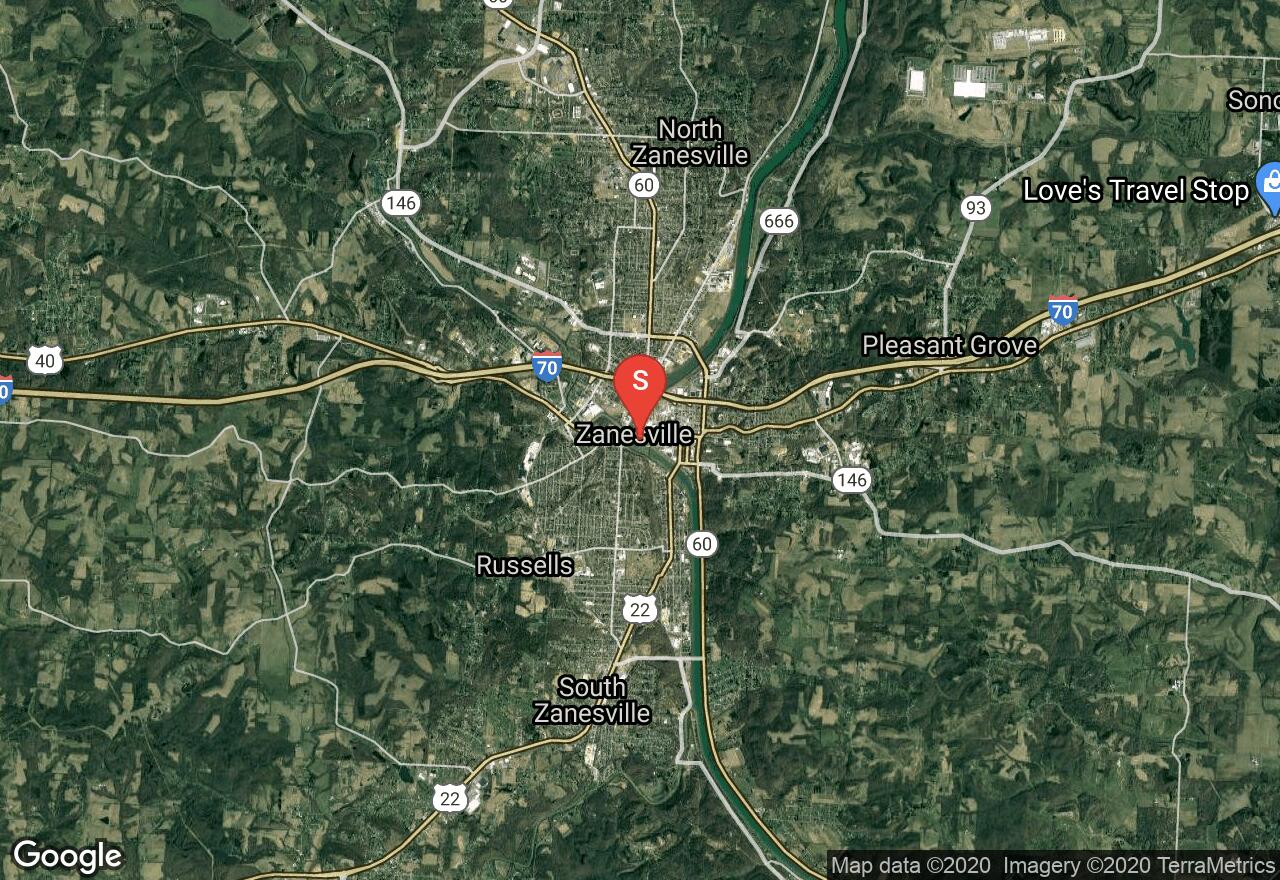
The Muskingum River is the largest navigable river that lies entirely in Ohio. This river is popular to paddle and easy to navigate. There are10 hand-operated locks and dams along the river. The area is rich in history with good with fishing, birds and wildlife to see. You will have to obtain a permit/pass to use the locks and check the conditions ahead of time (740-453-4377). Beginning at Lock #10 this section flows to Philo where Lock #9 is located with access on river left and both put in and takeout locations.
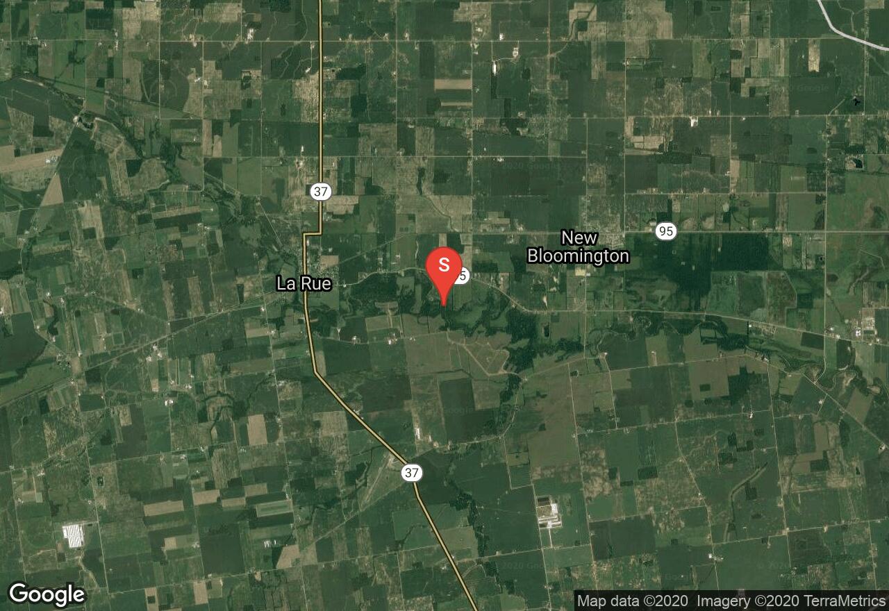
Ohio, Marion County
07 :08 hrs
14.3 mi
3.7715454 ft
I
The Scioto River is the second largest drainage basin in Ohio with almost 200 miles of water to paddle. It was home to many Native American cultures and is now currently primarily used for farming and recreation. The northern section beginning in LaRue where the river flows slowly with wooded banks surrounded by flat farmland and the marshes of Big Island Wildlife Area. Takeout it is at Green Camp Park.
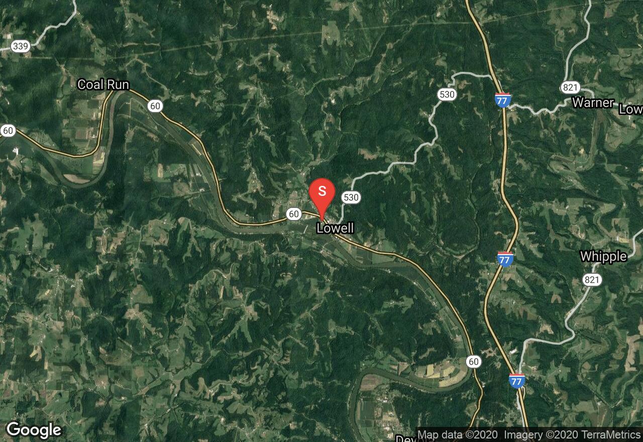
Ohio, Lowell
06 :01 hrs
12 mi
2.359253 ft
I
The Muskingum River is the largest navigable river that lies entirely in Ohio. This river is popular to paddle and easy to navigate. There are10 hand-operated locks and dams along the river. The area is rich in history with good with fishing, birds and wildlife to see. You will have to obtain a permit/pass to use the locks and check the conditions ahead of time (740-453-4377). Beginning in Lowell at Lock #3 the river flows through Devola Lock #2 with access on river left. It goes on to Indian Acres park in Marietta of Linwood Avenue. Takeout is on river left.
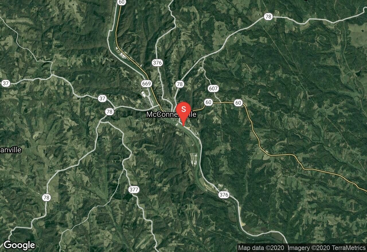
Ohio, McConnelsville
04 :36 hrs
9.2 mi
8.761688 ft
I
The Muskingum River is the largest navigable river that lies entirely in Ohio. This river is popular to paddle and easy to navigate. There are10 hand-operated locks and dams along the river. The area is rich in history with good with fishing, birds and wildlife to see. You will have to obtain a permit/pass to use the locks and check the conditions ahead of time (740-453-4377). Beginning in McConnelsville Lock#7 this section flows down to Stockport Lock #6. Both are accessed on river left.
See more adventures..
Explore complete list
Explore nearby adventures

