Best Waterways in Missouri
Trying to find the best waterways in Missouri? Bivy has great hiking, biking, paddling, climbing, skiing, riding and more, with hand-curated trail maps, as well as detailed driving directions.
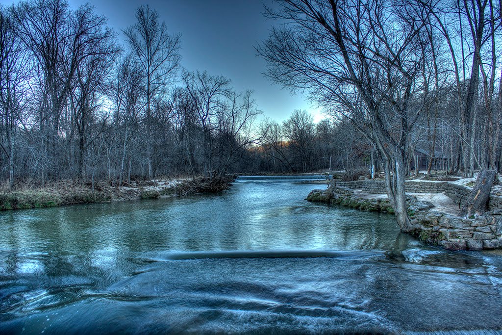
Kansas, Douglas County
11 :44 hrs
26.1 mi
6.0884705 ft
I
Clinton Lake is part of Clinton State Park, which is one of the state’s newest state parks constructed in the mid 1970’s. Its close proximity to Kansas City, Lawrence, and Topeka make it a very popular destination, with nearly 600,000 annual visitors from across the country. Many improved campsites, hiking and mountain biking trails, playgrounds, swimming, and other outdoor activities are available. The privately owned and operated marina is one of the newest and largest of any of Kansas’ lakes. In addition to the lake’s accessibility and amenities, it’s beautiful shoreline and vistas are a great attraction. Miles of rugged wooded shoreline, high bluffs, wildflowers, and prairie grasses are some of the natural beauties. Wildlife is also common and includes white-tailed deer, turkeys, waterfowl, songbirds, and a variety of small mammals.
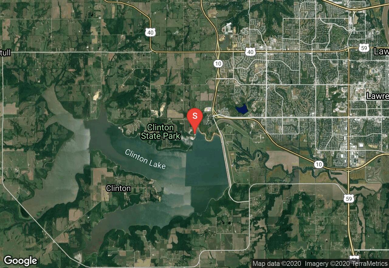
Missouri, Jasper County
02 :26 hrs
5.8 mi
9.543976 ft
II
Water was up so nice float except three major log jams.
Illinois, Madison County
02 :06 hrs
5 mi
11.650528 ft
I
Nice slow creek with lots of paddling.
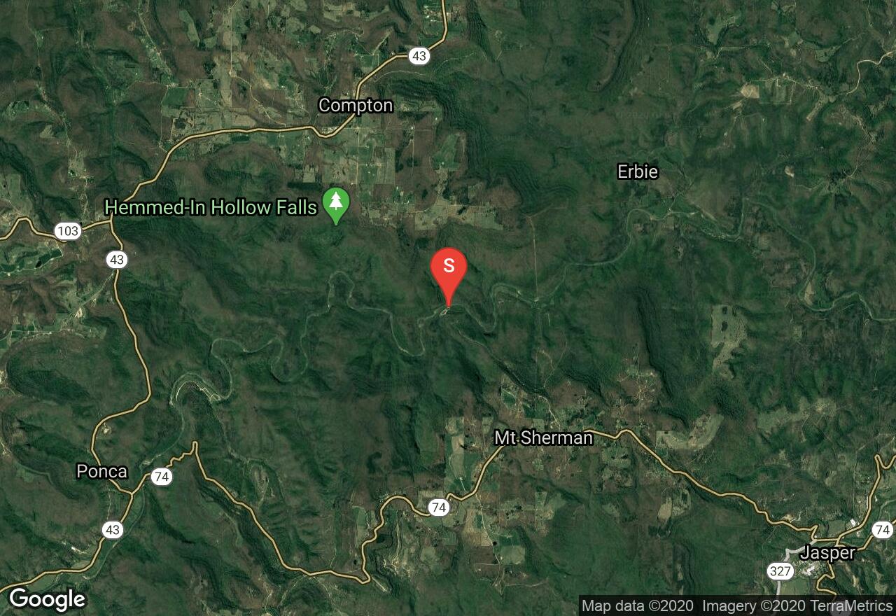
Arkansas, Newton County
05 :33 hrs
13.2 mi
31.87941 ft
II
This paddle offers some moderate whitewater on the Buffalo National River; some of the best paddling in middle America. Be wary of the low water bridge at Erbie Ford, the need to portage is likely. The scenery is excellent, dense hardwood forest blanketing hill country and the highest rock faces in the region. Be on the lookout for willow thickets that can trap boat.
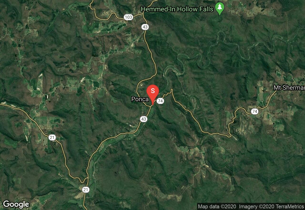
Arkansas, Newton County
04 :26 hrs
10.7 mi
44.10614 ft
II
This paddle offers some moderate whitewater on the Buffalo National River; some of the best paddling in middle America. The scenery is excellent, dense hardwood forest blanketing hill country and the highest rock faces in the region. Be on the lookout for willow thickets that can trap boat.
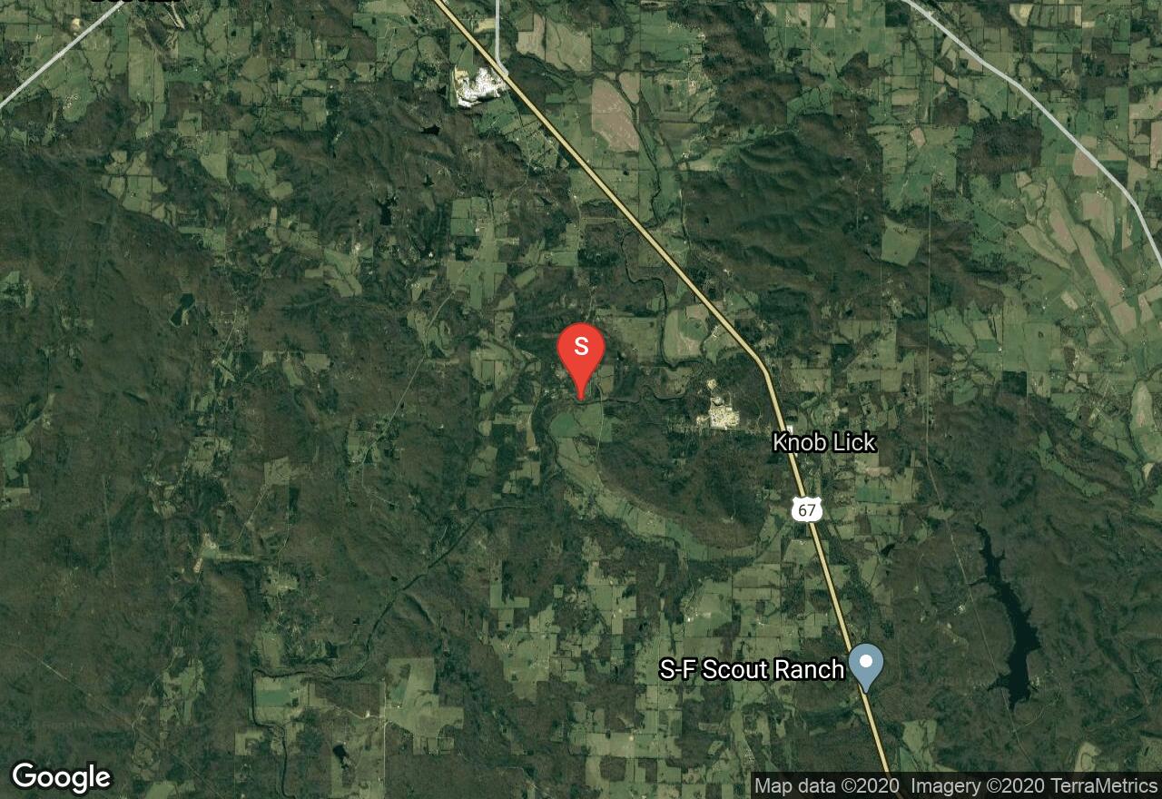
Missouri, St. Francois County
06 :56 hrs
16.3 mi
- ft
III
This straight river is definitely not a "float" river. It can be challenging even to the experienced paddler. There are boulders throughout the river making it only possible to do in high waters. There are shut-ins all along the river. This section of the river has Class II and Class III rapids. At the Roselle Access, about 14 miles in, there are some good rapids with fast riffles. The next 1.5 miles will have some 3 sharp drops and continuous rapids. The steepest drop is 4-6 feet. A portage is advised at the Silver Mine Dam. The left side is runnable, but can swamp the craft in high waters due to a high wave that is produced.
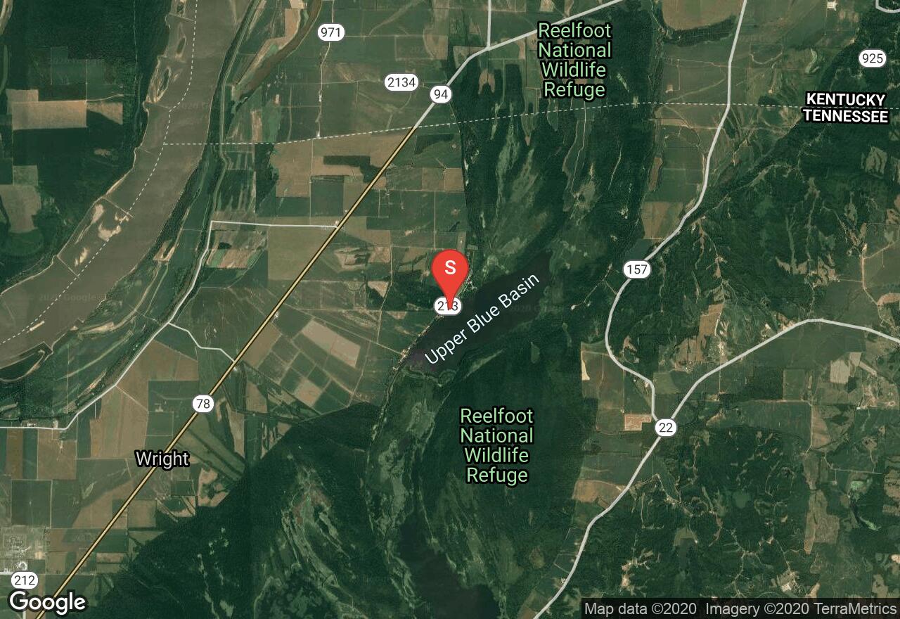
Tennessee, Lake County
02 :37 hrs
5.8 mi
0.93775177 ft
I
Reelfoot Lake is one of the only large natural lakes in Tennessee. It was formed during the New Madrid earthquakes of 1811. The old forest, which stood before the earthquake, still lies just beneath the surface. Most of it is swampy with bodies of water called basins. The average depth is only 5-6 feet. Known for some of the best hunting and fishing around, you may also get to see bald eagles, which call their home in bald cypress trees. The Upper Blue Basin is located on the north end of the lake. The scenery here is mystical with large trees coming out of the water everywhere.
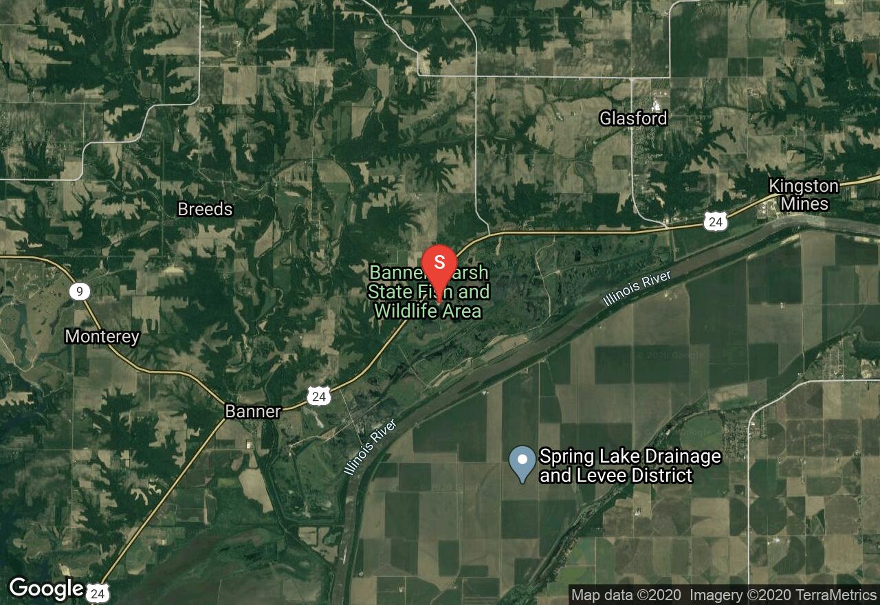
Illinois, Peoria County
04 :33 hrs
10.1 mi
5.0227814 ft
I
Located 25 miles southwest of Peoria, the Banner Marsh State Fish and Wildlife Area provides and excellent spot for paddling on a protected body of water along the Illinois River. The area is known for its excellent wildlife observation and birdwatching opportunities. The marsh offers lots of side channels and coves that make for an interesting trip. The area provides a boat ramp, restrooms, and picnic sites.
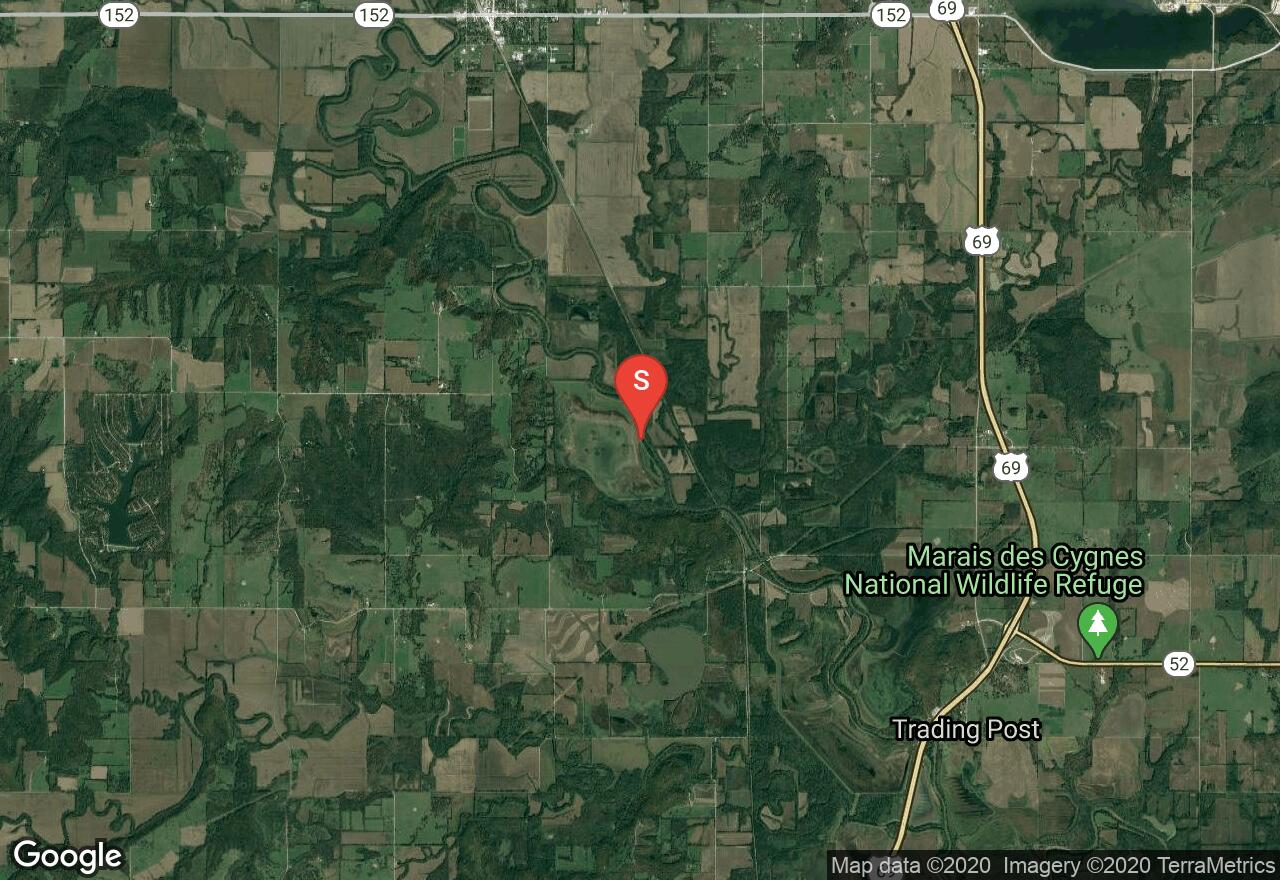
Kansas, Linn County
02 :22 hrs
5.3 mi
23.376846 ft
I
The last 14.5 miles of the Marais des Cygnes River that flow through Kansas meander through the Marais des Cygnes National Wildlife Refuge and Marais des Cygnes State Wildlife Area. This long river segment is easily broken into two completely distinct parts. This section is upstream of US-69 and holds enough water at any time of the year for a good float. A natural limestone dame located below the US-69 bridge creates a big pool that extends beyond the end of the wildlife area. This calm piece of water is nice for paddlers, bird-watchers, photographers, anglers, and hunters. It is well protected from the wind and has spectacular scenery.
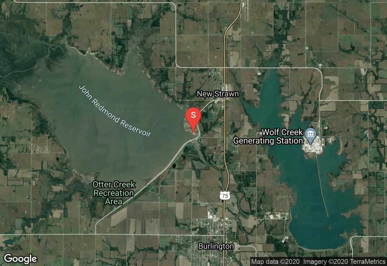
Kansas, Coffey County
07 :34 hrs
16.8 mi
4.4605103 ft
I
Located 2 ½ miles north of Burlington in US-75 you will find the beautiful John Redmond Reservoir, a great fishing lake with a maximum depth of only 12 feet. The lake has very natural surroundings and is bordered by several Wildlife Areas and Recreation Areas including the Flint Hills National Wildlife Refuge, John Redmond Wildlife Area, Otter Creek, Redmond Cove, and Hickory Creek Recreation Areas. It is an important resting stop for many species of migrating waterfowl, and habitats are preserved for many shorebirds, grassland animals, bald eagles, white-tailed deer, rough-legged hawks, and several species of small mammals. This is a very beautiful paddling destination with wild scenery and many wildlife viewing opportunities.
See more adventures..
Explore complete list
Explore nearby adventures

