Best Road Biking in Missouri
Trying to find the best road biking in Missouri? Bivy has great hiking, biking, paddling, climbing, skiing, riding and more, with hand-curated trail maps, as well as detailed driving directions.
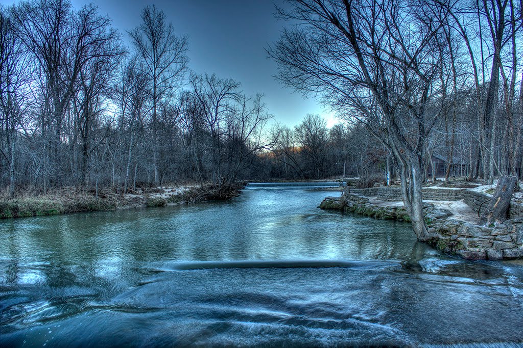
Illinois, Mason County
03 :03 hrs
30.6 mi
24.70366 ft
Hard
Starting from the east side of Chautauqua Lake, this ride heads east into the Sand Ridge State Forest over rolling hills through woodlands, prairies, and pine forests before following the scenic shoreline of Spring Lake. The scenery is very remote and natural all along the way. The ride does have some hills but nothing too steep or physically challenging. Also be aware of a few sections of gravel road.
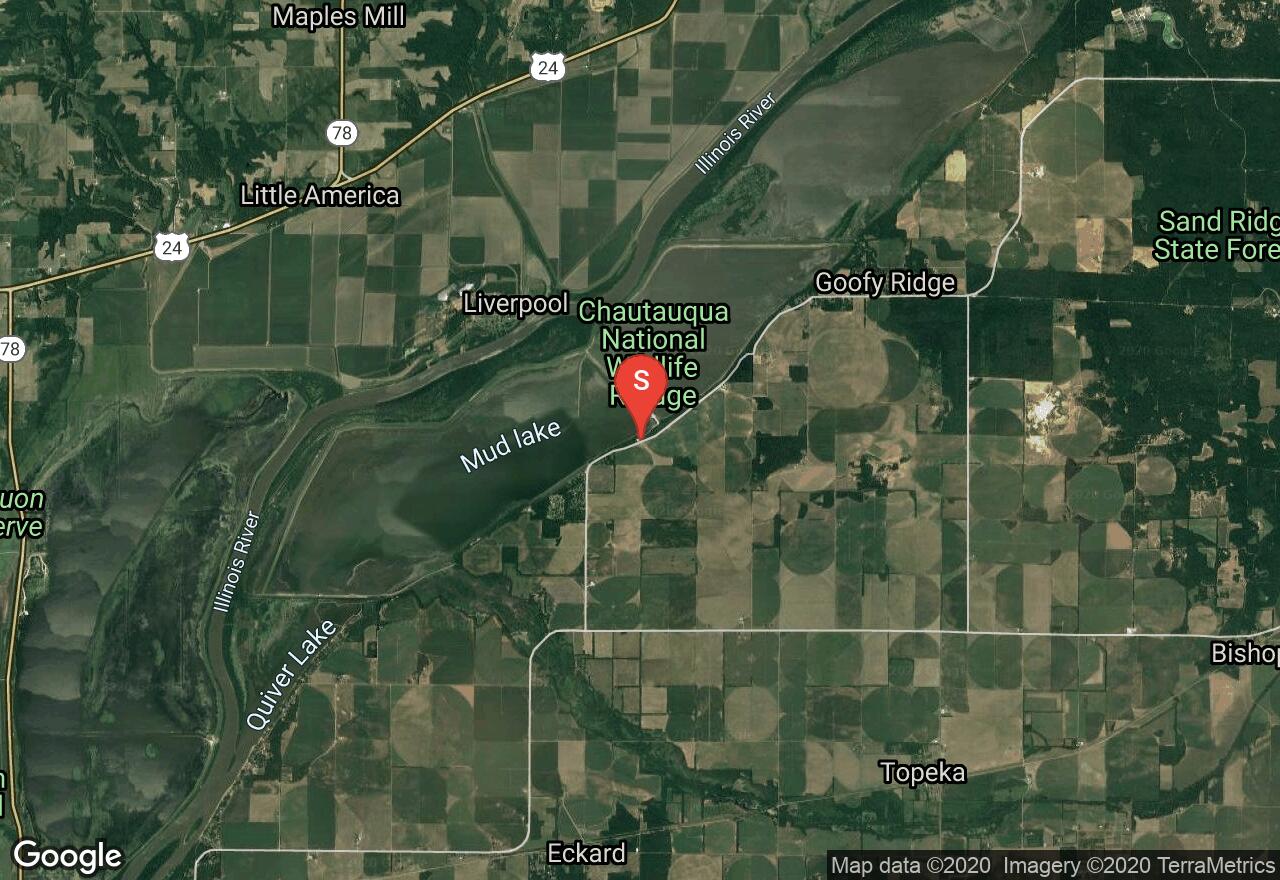
Illinois, Litchfield
03 :29 hrs
35 mi
33.850586 ft
Hard
Starting just south of Lake Lou Yeager in central Illinois, this ride travels through remote and rural countryside comprised of diverse terrain between the cities of Hillsboro and Litchfield. Much of the ride follows the route of the popular Hillsboro-Roubaix Spring Class bike race. The ride has sections of flat terrain mixed with rolling hills that make the ride challenging and scenic. The ride follows a lot of quiet and narrow roads that make for a peaceful ride. There is not a whole lot of traffic along this course but do watch out for vehicles along the narrow, and sometimes curvy roads.
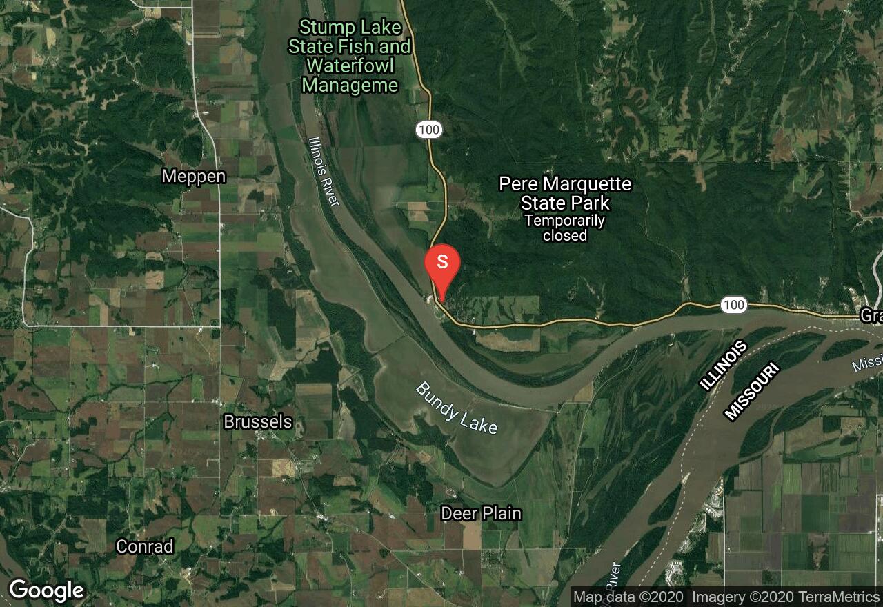
Illinois, Jersey County
04 :00 hrs
20.5 mi
33.130646 ft
Expert
This rails-to-trails route is one of the best in Illinois for road biking as it travels near a large scenic river, against big bluffs, and offers excellent wildlife and plantlife along the route. Starting from Pere Marquette State Park, the trail follows the Illinois River to its confluence with the Mississippi River and onward through multiple small towns and wildlife refuge areas that are home to abundant wildlife, especially eagles during the winter. Sections of the ride merge with the scenic byway that is known for river scenery on one side and large rock bluffs on the other. The trail ends at Piasa Park where riders can learn about the legend of the Piasa Bird for which the park is named. The ride can be done as a longer out-and-back or a one-way trip by shuttling vehicles between the two trailheads. The route is all asphalt path and paved roadway with some hills, especially in the first 3 miles, that add some challenge to the ride.
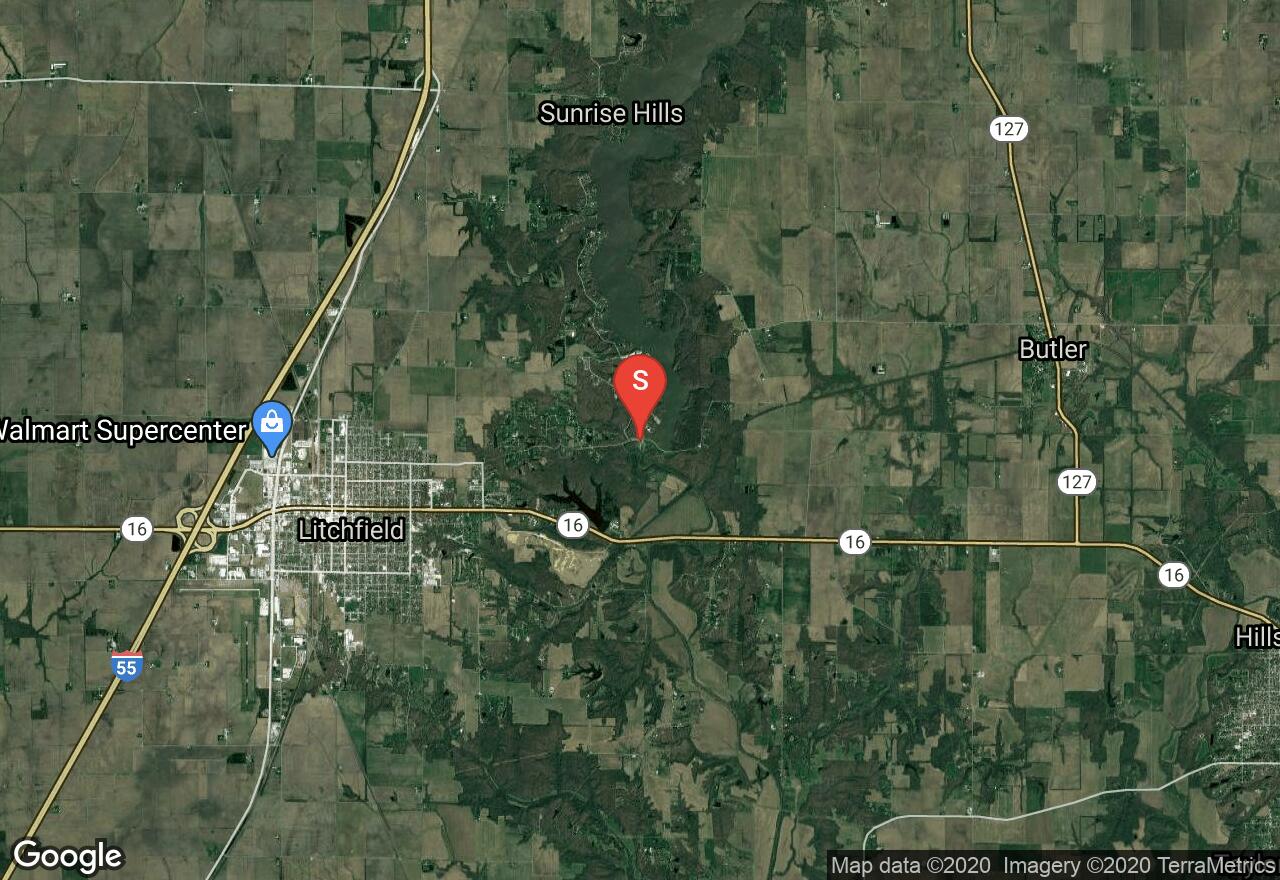
Kansas, Leawood
00 :54 hrs
8.8 mi
30.600494 ft
Easy
More than 12 miles of paved trail follow a greenbelt along the Indian Creek, through Overland Park, and along Tomahawk Creek, through Leawood. It weaves through a business park, residential areas, and thirteen park areas in Overland Park. Much of the trail is surprisingly quiet and some parts are even secluded, despite travelling through the city. The trail is very beautiful and scenic and showcases the natural beauty of the creeks and the forest that borders the creeks. The trail can be quite crowded and congested at times. Several access points are found throughout, making it easy to customize your trip for different lengths.

Missouri, Platte County
00 :14 hrs
2.4 mi
46.487793 ft
Hard
This is a popular trail for bicyclists and hikers. If you come in the fall, you will enjoy the beautiful fall colors. Along the trail, you will see views of the Missouri River. You will not find any natural obstacles but there are some steep grades over parts of the trail. Bicyclists are to travel counter-clockwise on the trail.
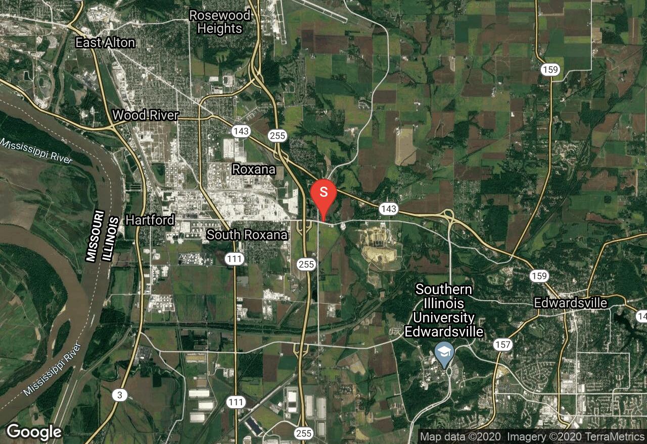
Illinois, Madison County
00 :58 hrs
4.9 mi
21.953018 ft
Easy
This trail follows an old railroad corridor between the towns of Roxana and Edwardsville and is named after the Watershed Nature Center which it travels near along its eastern section. The trail passes through mostly shaded wooded terrain that is quiet and peaceful. The trail has just a little bit of elevation change but nothing that is too physically strenuous and is all paved making it a great option for riders of all skill levels. The trail also connects to the Goshen Trail (which also connects to multiple other trails in the area) and the hiking loop trail located at the Watershed Nature Center which is also a scenic and interesting place to visit.
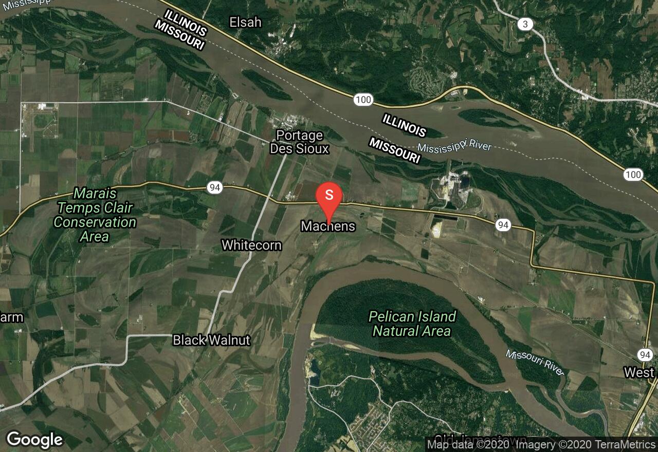
Missouri, St. Charles County
06 :50 hrs
34.3 mi
23.690826 ft
Extreme
The Katy Trail is a 237 mile trail stretching across most of Missouri. It is America's longest "rails-to-trail" project, formerly the MKT rail line. This trail starts with quiet farmland and then follows large river bluffs. The recommended tire width for the trail is 25mm or wider. The trail is flat and scenic. There are long distances without access to water, so runners and hikers should carry water and plan ahead.
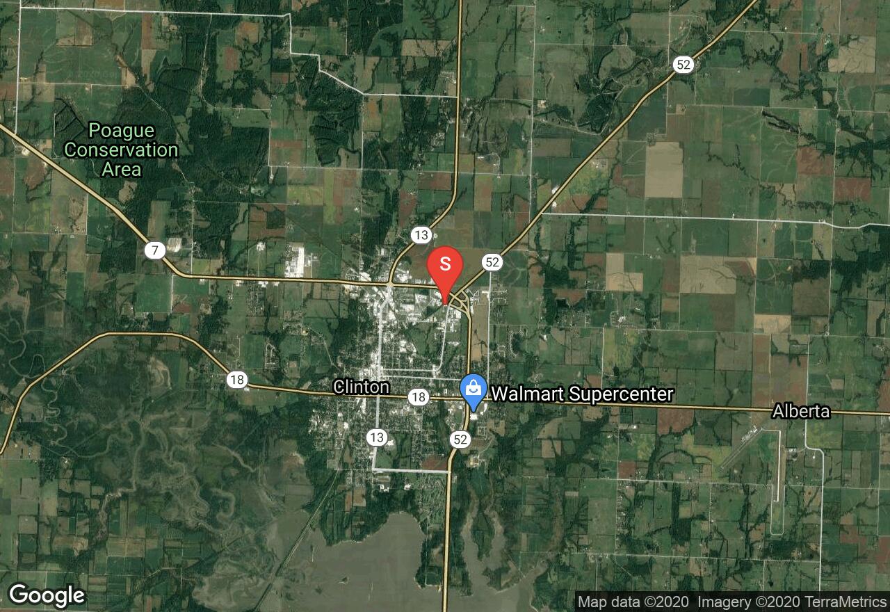
Missouri, Henry County
23 :45 hrs
239 mi
154.01756 ft
Moderate
The Katy Trail is a 239 mile trail stretching across most of Missouri. It is America's longest "rails-to-trail" project, formerly the MKT rail line. Over half of it follows the Lewis and Clark's path up the Missouri River. If you are planning to do the entire trail, you will want to drop off a vehicle at the end destination, making this a one-way adventure. The trail follows large river bluffs that then lead through quiet farmland. Many cross-country cyclists include the Katy Trail in their tours. The recommended tire width for the trail is 25mm or wider. Running is very popular on the for long distance runs, because of its nice and flat surroundings. Also, the crushed limestone trail surface is easy on your legs. There are long distances without access to water, so runners and hikers should carry water and plan ahead. There are expeditions along parts of the trail where the towns offer water, groceries, or vending machines that are not too far apart.
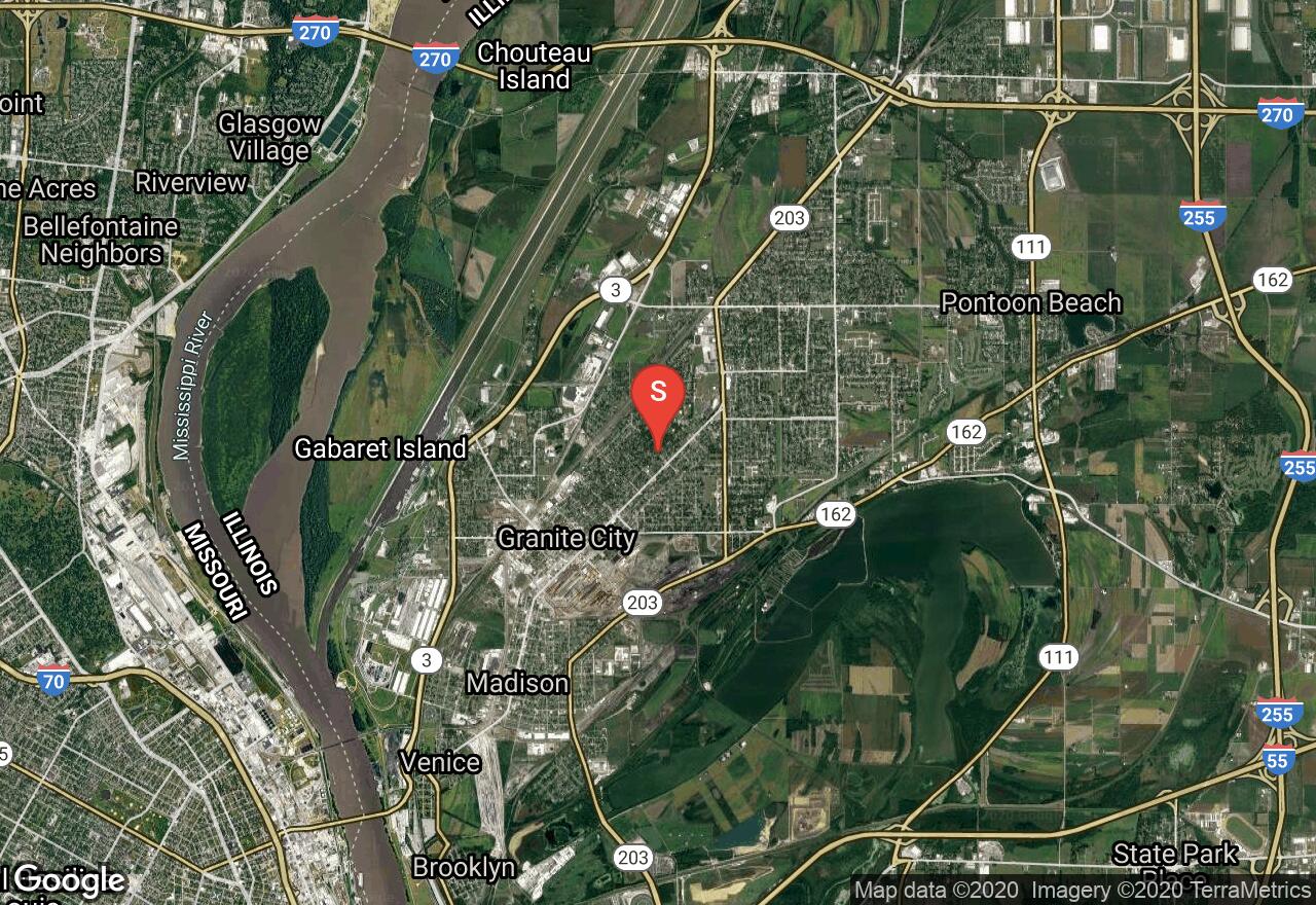
Illinois, Granite City
02 :36 hrs
13.1 mi
48.08142 ft
Hard
The MCT Nature Trail stretches between the cities of Granite City and Edwardsville leading through wooded terrain past diverse scenery including Horseshoe Lake and a college campus. The trail is one of the many MCT trails in the area and is popular with both students and recreational users. The trail is very scenic and also provides lots of opportunity for viewing wildlife and plantlife. The trail is all asphalt and is fairly flat making it a nice trail to ride for cyclists of all skill levels. The trail connects to many of the other trails within the MCT system making it easy for customizing a ride that explores even more of Madison County.
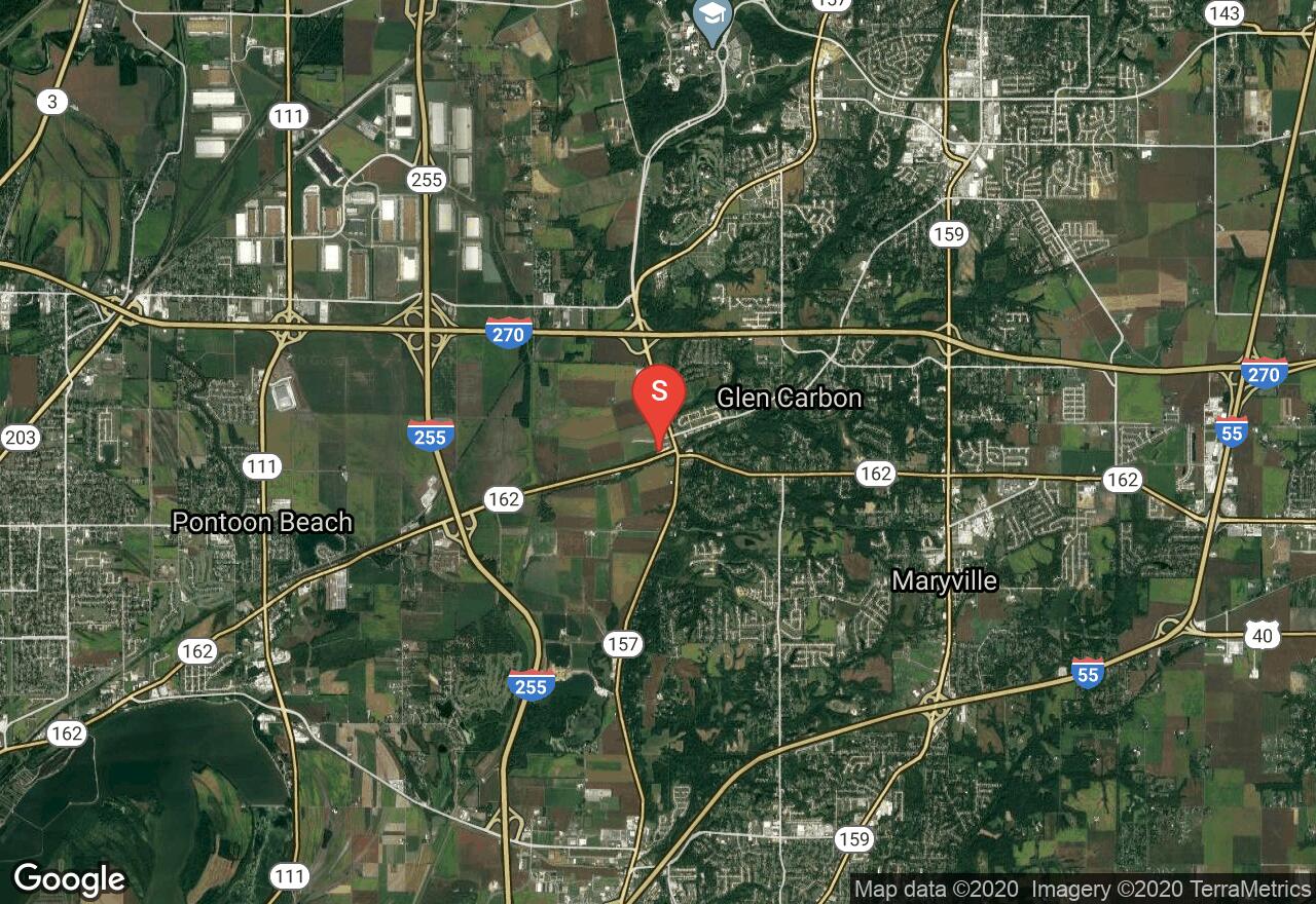
Illinois, Madison County
03 :47 hrs
19.1 mi
36.07457 ft
Hard
The Nickel Plate Trail follows a greenway corridor for many miles connecting multiple small towns and villages in and around the Edwardsville area and providing lots of diverse scenery and terrain along the way. The trail passes through some industrial areas but mostly travels through wooded terrain and rural areas with farmland, parks, golf courses, and some small lakes and ponds. The trail connects to multiple other trails in the MCT system providing riders with numerous trip options and opportunity for exploring Madison County. The surface is all asphalt and crushed stone and is mostly level making it an enjoyable ride for cyclists of all skill levels.
See more adventures..
Explore complete list
Explore nearby adventures

