Styles.ec1e20f1fbaef179e0af.css in Massachusetts
Trying to find the best in Massachusetts? Bivy has great hiking, biking, paddling, climbing, skiing, riding and more, with hand-curated trail maps, as well as detailed driving directions.
Massachusetts, Middlesex County
01 :13 hrs
2.9 mi
2.959999 ft
I
Beautiful scenery, easy but can get get a little rough with waves when windy. Can be short trip but exploring every nook and cranny along with the islands could be an all day event. Some of the islands have small charcoal grills for picnics and swimming is allowed, good family day activity. Motor boats are allowed under 15 mph for fishing, and no jet skis, so beginner friendly.
Massachusetts, Becket
01 :21 hrs
3 mi
2.503662 ft
I
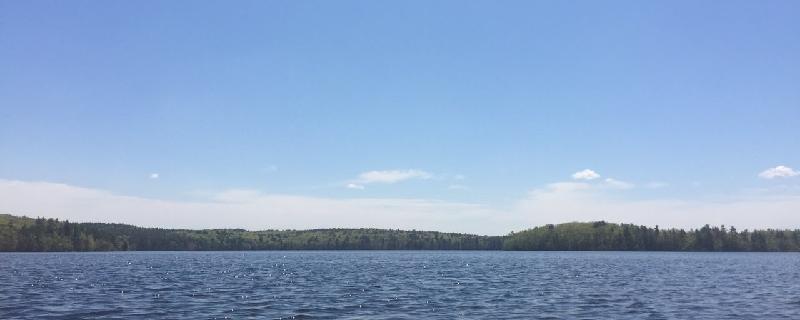
This is the largest body of water in October Mountain State Forest, the largest state forest in the commonwealth. The shoreline is heavily forested and gorgeous to look at, especially in fall. This state forest is well-known for its fall foliage and Buckley-Dunton Lake is a great place to view the fall colors. Beavers and herons are active along the shore and there are many coves and inlets to explore and watch for signs of other animals such as porcupines and moose that inhabit the area. There is no actual boat ramp at the lake but there is a gravel area near the dam to launch small boats. The quiet nature of the lake makes it an ideal place to explore by canoe or kayak.
Massachusetts, Great Barrington
02 :30 hrs
6.3 mi
193.83307 ft
Hard
This trial will take you all the way around Monument Mountain and to its high peak, called Squaw Peak. As you hike around the mountain you will walk along a narrow hiking path through the deep, quiet woodlands, past beautiful flowers and a waterfall. At Squaw Peak there is a large, free-standing pillar of stone called Devil’s Pulpit and there are amazing lookout points over rocky cliffs. The views from Squaw Peak include the Housatonic River Valley, The Berkshires, the Taconic Mountains, and the Catskill Mountains.
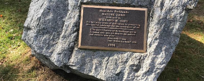
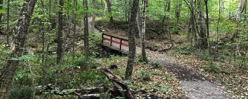
Massachusetts, Worcester County
01 :05 hrs
2.9 mi
9.104996 ft
Easy
Nice walk around the pond. Be aware the Blue Trail just ends. But if you follow the railroad tracks to the left, then Freedom Street to the Hopedale Pond Dam, then Hopedale Street, you'll get back to the start.

Massachusetts, Pittsfield
02 :10 hrs
4.8 mi
7.447754 ft
I
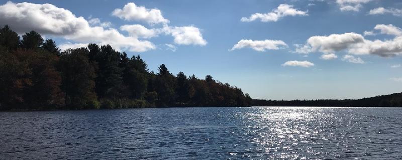
Pontoosuc Lake is a 480-acre great pond that is located in Pittsfield and Lanesborough. Aquatic vegetation is abundant, extending to depths of 10 feet or more from most of the shoreline and it is particularly thick in the northern coves. The shoreline is heavily developed and the lake supports heavy recreational use throughout the year. Beautiful views of the Taconic Range to the west provide a backdrop to these waters. Public access is provided by a paved boat ramp located at the southernmost tip of the lake off of Hancock Road. Fishing on Pontoosuc Lake is great but shoreline is virtually non-existent because of the tightly packed homes all around the lake.
Massachusetts, Williamstown
01 :11 hrs
3.1 mi
92.845795 ft
Moderate
This trail is in the northwestern corner of Massachusetts in the Taconic Mountain Range. You will begin your hike at the Buxton Garden and hike up into the thick hardwood forest. As you climb you will notice spots on the trail where you can look back for a view over Williamstown. You will hike down along the Birch Brook for a bit before climbing up to a ridge. The trail will then follow the ridge all the way back down to your car. This forest is filled with an array of wildlife, watch for signs of these on your hike.

Massachusetts, Pittsfield
02 :46 hrs
6.2 mi
0.9999695 ft
I
This lake is located in Pittsfield and lies at the foot of the Taconic Mountains. Smith Mountain, Pine Mountain, Tower Mountain, and Berry Hill provide a stunning backdrop to the lake. On the shore of Onota Lake is Burbank Park where there are two separate parking areas and launching spots. There are several homes along the shore but there are also many areas that are densely forested. The trees around the lake display stunning foliage in autumn. The lake is very popular for fishing, swimming, and boating.
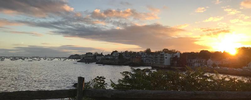
Massachusetts, Essex County
00 :51 hrs
2.2 mi
21.745916 ft
Easy
Start your walk in downtown Marblehead and end up at Fort Sewall. Look out over Picturesque Marblehead Harbor.

Massachusetts, Berkshire County
00 :52 hrs
2.1 mi
90.469025 ft
Moderate
Kennedy Park in the Berkshires. Wide paths and helpful signs along the way.
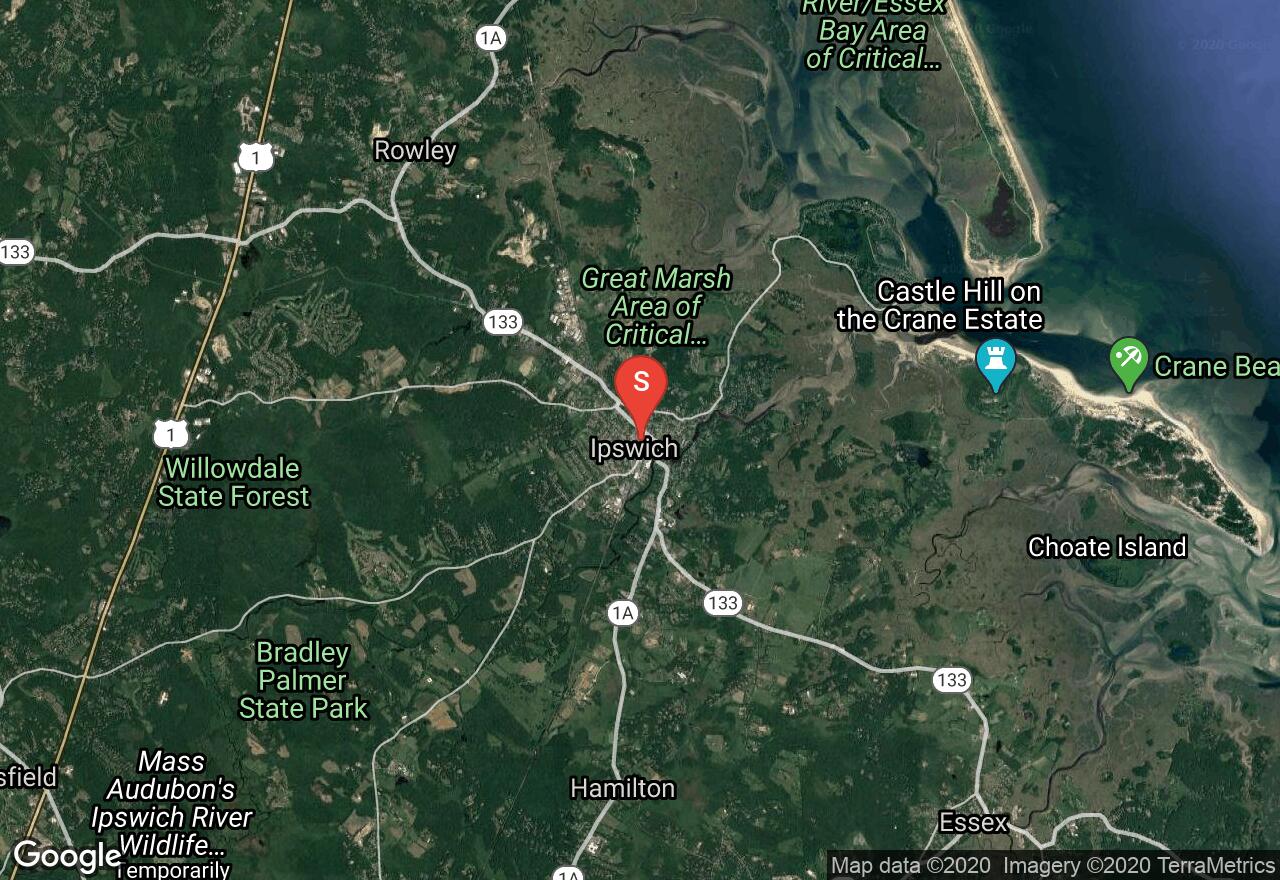
Massachusetts, Ipswich
02 :02 hrs
20.4 mi
31.720919 ft
Moderate
Ipswich is one of the most beautiful towns in the state of Massachusetts with expansive beaches, forests, farmland, country estates, and winding rivers as well as gorgeous architecture and history. The Ispwich River Ramble is an enjoyable flat route with a few short hills, one of which allows you to visit the Crane Estate on Castle Hill. One section on State Route 1A can be busy and congested but the rest of the route is on quieter country roads. On this ride you will visit Crane Beach, Castle Hill which features a grand estate and stunning views, ramble through vast salt marshes, tour open farmland, and border a section of the Ipswich River.
See more adventures..
Explore complete list
Explore nearby adventures

