Best Mountain Biking in Alabama
Trying to find the best mountain biking in Alabama? Bivy has great hiking, biking, paddling, climbing, skiing, riding and more, with hand-curated trail maps, as well as detailed driving directions.
Alabama, Pelham
05 :17 hrs
20.6 mi
231.64395 ft
Expert
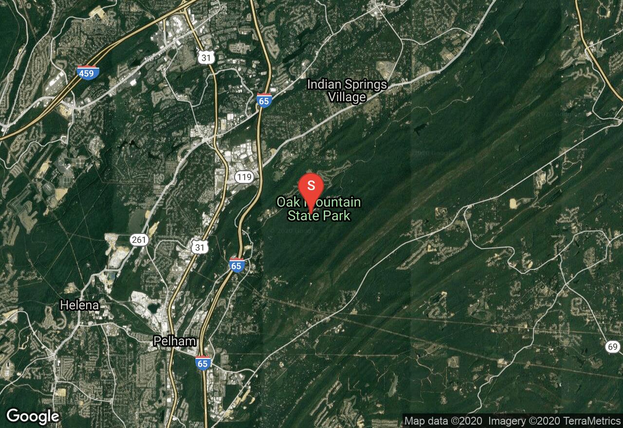
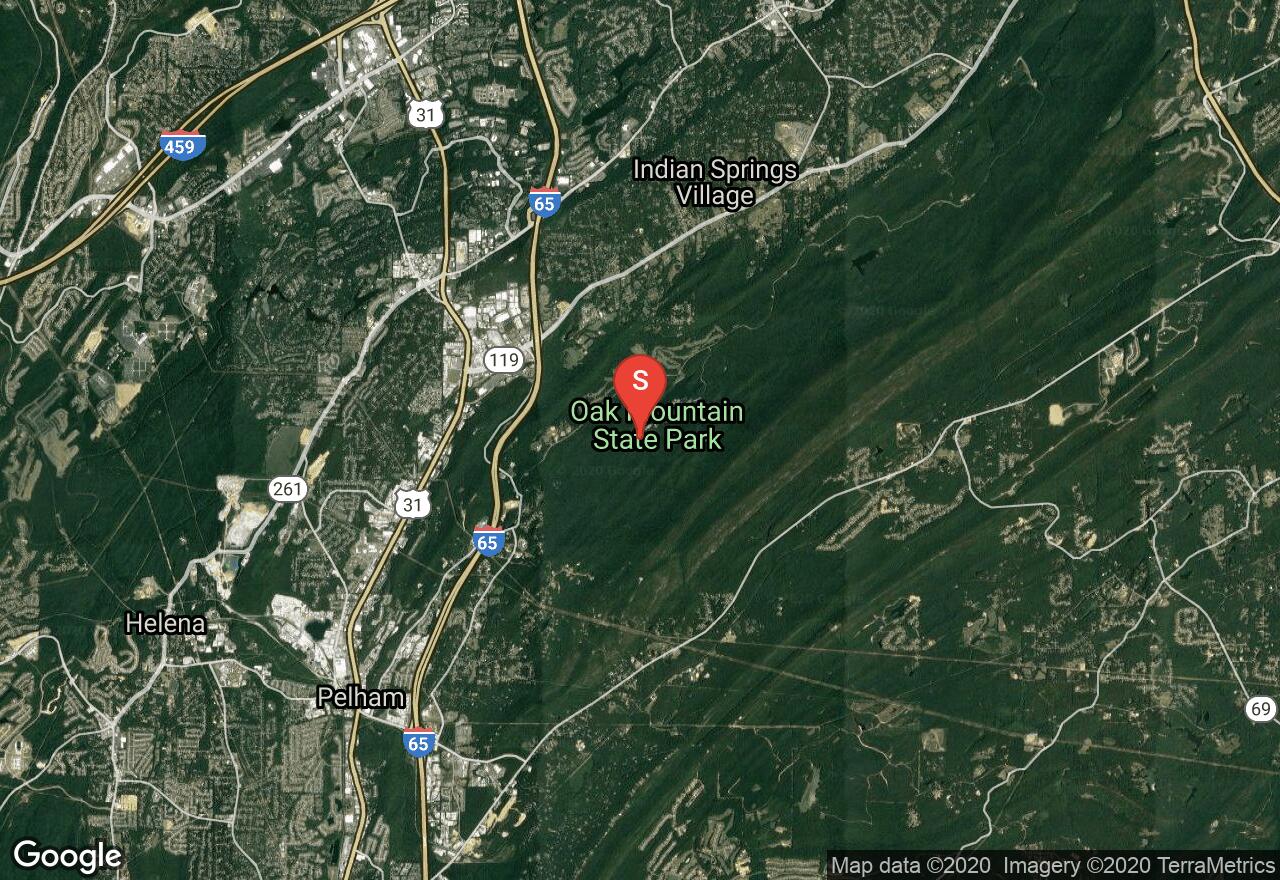
Located just 20 minutes from Birmingham, this challenging loop inside Oak Mountain State Park gives you miles of vistas and a wide variety of terrain offering a great tour loop of the parks lakes, hills, plant and animal life. Begin from the parking lot at Double Oak Lake and start on the Lake Trail before connecting to Seven Bridges with a descent through a technical wooded section, before finishing with Group Camp Road. This loop is made up of multiple trails that range from easy to difficult, as such your ride or hike can be split up for shorter distances if desired. Note that all bikes must stick to trail sections that are marked with red blazes. You will receive a fine if caught on any other trail.

Alabama, Elmore County
02 :30 hrs
9.7 mi
27.437798 ft
Hard
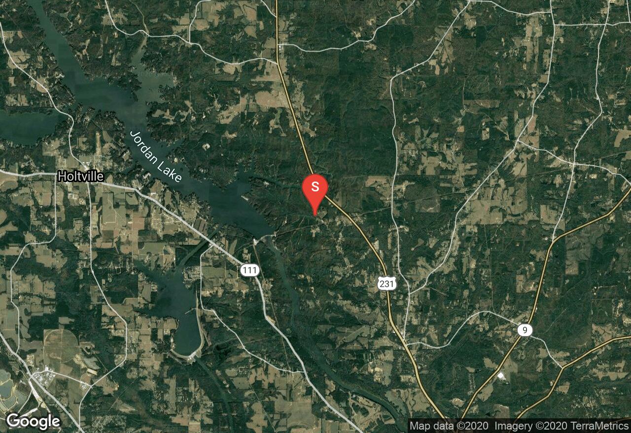
The Swayback Back Bridge trail system built and maintained by TOLA (Trail of Legends Association), has something to offer for the whole family. This particular route is the longest in distance, combining the entire trail system. Begin at the Swayback Bridge trailhead west of Wetumpka following the black trail blazes. Your journey will be through the thick forested area surrounding the southern portion of Lake Jordan. With a full canopy above providing shade, this trail also offers beautiful views of Lake Jordan and the Swayback Bridge as you make your way back to the trailhead. There are several short but steep climbs and for more advanced riders, some wooden features have been added. If desired, the Swayback Bridge Trail can be split up into shorter sections by following the blue, green, yellow, or red trail blazes. Open to hikers, trail runners and mountain bikers.
Alabama, Pelham
04 :02 hrs
15.8 mi
201.44475 ft
Hard
Built by BUMP (Birmingham Urban Mountain Pedalers), the Double Oak Trail system is located inside Oak Mountain State Park. Most of the trails on this loop are single track, with a few miles of double track with varied difficulty ratings throughout. Listed as an “Epic Ride” by IMBA (International Mountain Bike Association), making that list as one of the top 52 trails in the world. This trail can be ridden in either direction, and split up into shorter loops if desired. Entrance fees are $3 for adults, children ages 6-11 and Seniors are $1.
Alabama, Tuscaloosa
01 :53 hrs
7.2 mi
26.934364 ft
Hard
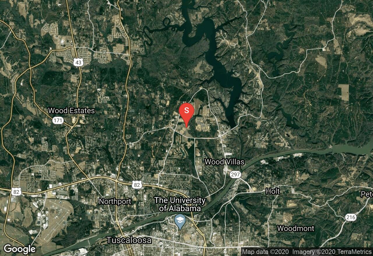
If you are looking for a great practice race loop and test your endurance give this trail a go. This loop at Munny Sokol Park in Tuscaloosa is actually a race loop held at the park. The direction of course changes every year, but shown here it is done in a clockwise direction. Go for one full loop and enjoy the flow of the combining trails that create this unique loop, or challenge yourself by completing multiple laps. This trail uses a combination of the Mars Trail, Swingset, Main Trail, Della Raye, Troll, Upper Psycho, Lower Psycho and Bunny Trail that route themselves through the woods surrounding the park. This area is also popular for trail runners, so be aware of others on the trail as well.
Alabama, Tuscaloosa
02 :09 hrs
8.4 mi
67.71616 ft
Hard
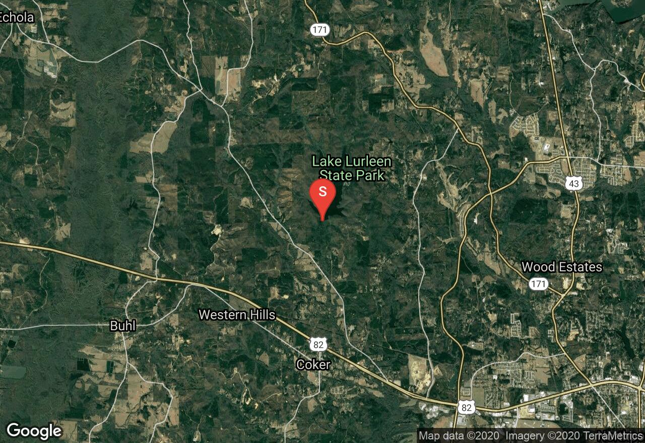
Located inside Alabama’s Lake Lurleen State Park, The Tashka Trail is the main trail vein within the park. This trail begins where the Lakeside Trail ends, near the end of lake Lurleen Dam. Steep graded sandy and/or loose gravel sections will be encountered as well as tight turns long climbs and descents. This is a multi-use trail, access to the trail system is limited to either the North or South Trailheads. Take note that once you are on the trail system, you are in a wilderness environment and there are no paved roads or shortcuts. Entrance fees are $3 for adults and $1 for Children 6-11 years of age.
Alabama, Tuscaloosa County
01 :39 hrs
6.5 mi
58.311005 ft
Moderate
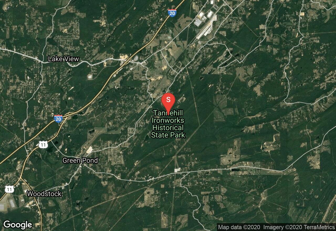
Located in Tannehill State Park, this adventure rides on a combination of trails (Slave Quarters Trail, IMBA, Dirt Dragon, Furnace) that make up a good loop for riding. There are several historical things to see as well.
Alabama, Elmore County
01 :37 hrs
6.2 mi
26.968315 ft
Moderate
The Swayback Back Bridge trail system built and maintained by TOLA (Trail of Legends Association), has something to offer for the whole family. Begin at the Swayback Bridge trailhead west of Wetumpka following the red trail blazes. Your journey will be through the thick forested area surrounding Lake Jordan, with a full canopy above providing shade. Continue to follow the red trail blazes making your way back to the parking lot shown here, or add on milage and take the entire Swayback Bridge Trail route following the black trail blazes if desired. Open to hikers, trail runners and mountain bikers.

Alabama, Tuscaloosa County
00 :41 hrs
1.3 mi
24.103653 ft
Moderate
Located in Tannehill State Park, this is a well maintained route on old dirt roads used during the civil war. It is easy hiking with several historical points of interest to see along the way.
Alabama, Guntersville
02 :27 hrs
9.8 mi
83.39807 ft
Hard
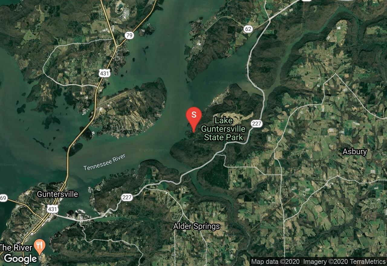
Located inside Lake Guntersville State Park, this loop combines three trails with the Tome Bevil Trail being the center point of the route. Travel through heavily wooded areas passing old home sites, enjoy vistas of Lake Guntersville, travel along Short Creek and spot a variety of waterfowl and possibly an Eagle depending on the season. Begin on a portion of the Cave Trail after parking along Lodge Drive Road next to the Cave trail start point. Climb to the Tom Bevil Trail traveling in a clockwise fashion before taking the Cutchenmine Connector Trail as you cross AL Highway 227. Begin along the old coal mine road of the Cutchenmine Trail. When reaching the end of Cutchenmine Trail backtrack until you connect back to Tom Bevil Trail once again, finishing the in a clockwise fashion before ending back at your starting point.
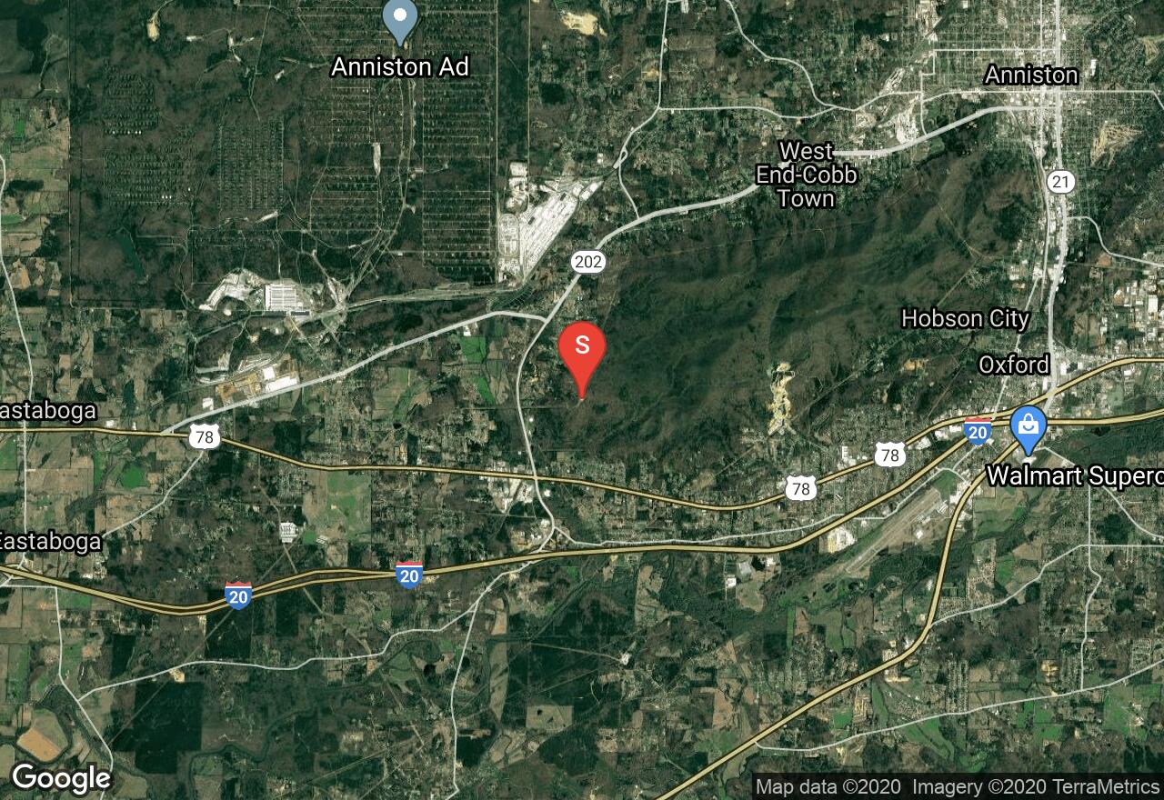
Alabama, Oxford
02 :32 hrs
10.2 mi
267.4983 ft
Hard
Bomb Dog Loop at Coldwater Mountain is part of a newer trail system with features that include: flowy downhill sections, berms,rollers and jumps mixed in with the single track trails. This trail begins at the Cold Springs Trailhead using the two-way trail before meeting up with the Bomb Dog trail. From here the trail will then take you through the features listed previously ending back at the gravel parking lot of the Cold Springs Trailhead.
See more adventures..
Explore complete list
Explore nearby adventures

