Best Sea Kayaking in Wisconsin
Trying to find the best sea kayaking in Wisconsin? Bivy has great hiking, biking, paddling, climbing, skiing, riding and more, with hand-curated trail maps, as well as detailed driving directions.
Wisconsin, Bayfield County
06 :02 hrs
15.1 mi
1.964798 ft
SK III
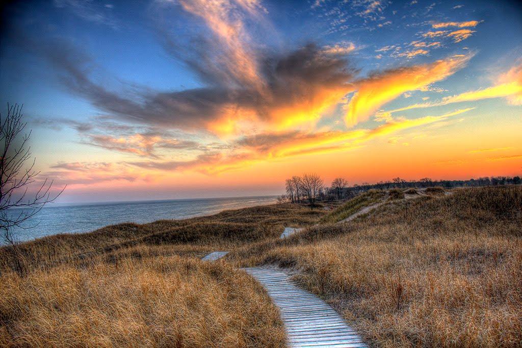
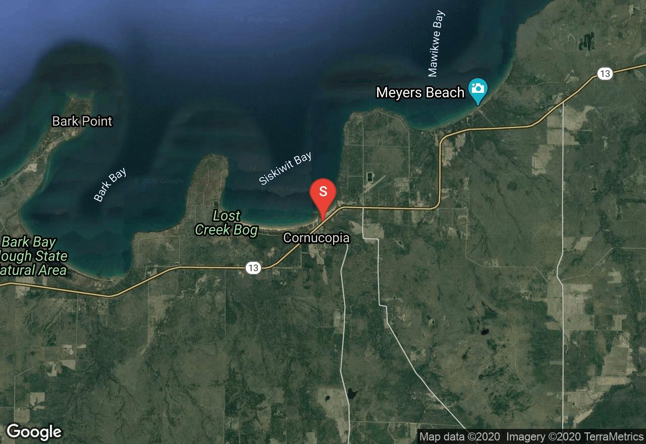
Wisconsin’s Lake Superior Water Trail is a network of launch areas, points of interest, picnic areas, and campsites spread across 153 miles of mainland coastline and Madeline Island. It includes 12 segments, each with its own distinct character, challenges, and rewards. Heading east out of Cornucopia, the coastline changes from sandy beach to steep banks, then to bedrock outcrops. You will pass Mawikwe Bay and Meyers Beach and enter the boundary of the Apostle Islands National Lakeshore. Continuing east, spectacular sea caves and sculpted sandstone formations stretch along the shoreline for about two miles. This is a very popular spot among sea kayakers but is hazardous in high winds. East of the caves is another beautiful sand beach extending up the western shore of Sand Point. You will then round Sand Point, pass a beautiful isolated beach area, and end at the Little Sand Bay marina.
Wisconsin, Bayfield County
02 :52 hrs
3.6 mi
1.876648 ft
SK I
This is a gorgeous tour along Lake Superior’s shoreline with long, stretching views across the Great Lake as well as views of the Apostle Islands. It is suitable for beginners as it hugs the shoreline with the protection of the many large Apostle Islands. Beginning at Roy’s Point Marina, a wonderful out-and-back paddle features very pretty red cliffs, sandy beaches with a forested backdrop, and shipwreck sites. The Fedora was a ship that caught fire and sank in 1901. The steel and oak beams have endured over time and can be seen both above and below the waterline. You will also near the wreckage of the tugboat Ottawa and the Coffinberry. Eagles, cormorants, kingfishers, loons, blue herons, otters, beaver, and woodchuck are likely to accompany your outing!
Wisconsin, Bayfield County
03 :37 hrs
4.5 mi
9.131409 ft
SK I
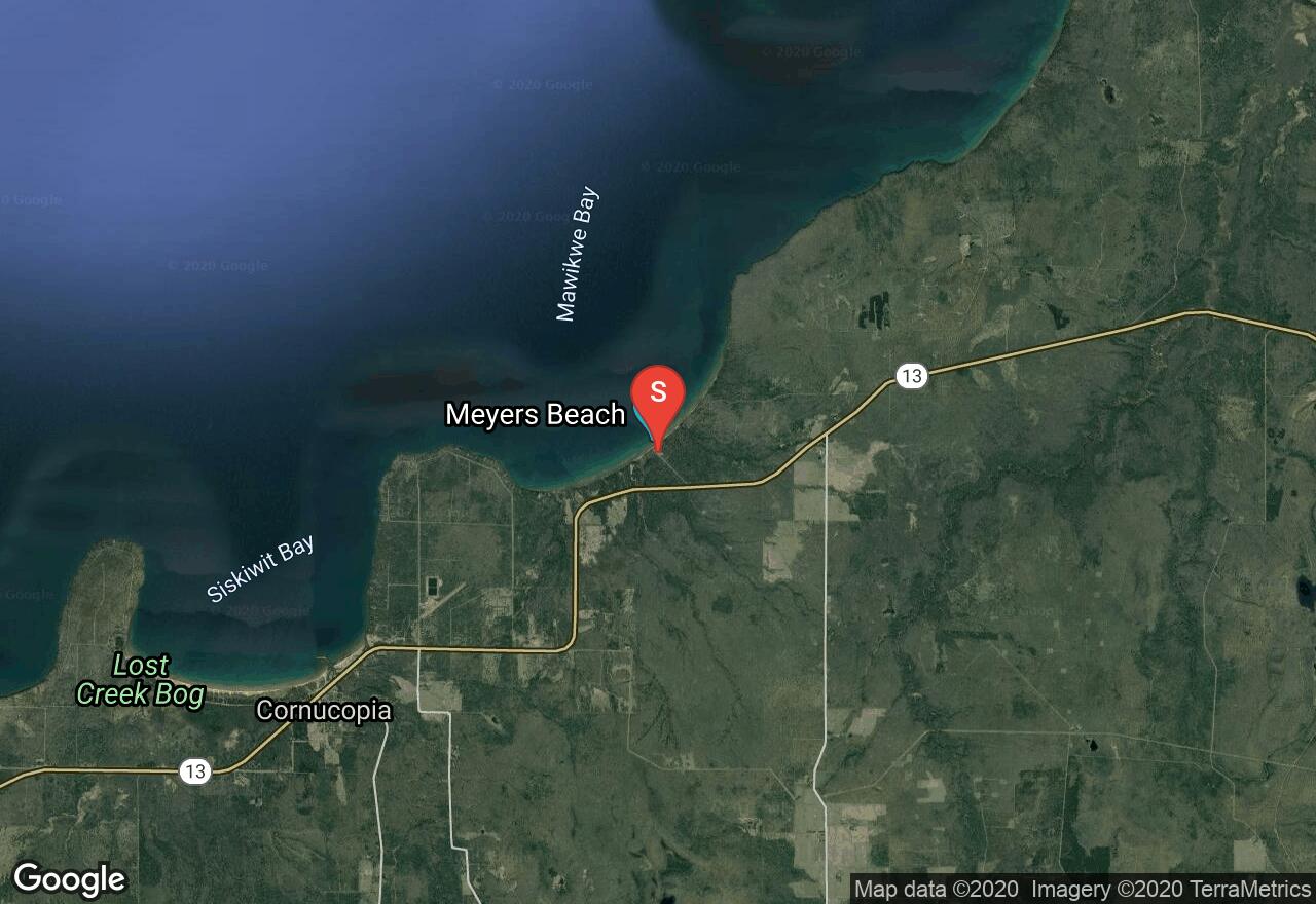
This is a beautiful spot on the Apostle Islands National Lakeshore of Lake Superior. The geology is awe-inspiring as huge red sandstone cliffs and sea caves show evidence of centuries of wave action and freezing and thawing. You will have the opportunity to paddle under arches, vaulted chambers, and into deep recesses. A full day is recommended to explore and fully experience the complex caves. Leaving from Meyers Road, a 3-mile paddle along the caves and cliffs to Driftwood Beach is a wonderful place to get out of your boat and enjoy lunch or a good leg-stretch. Views across the lake include Sand and Eagle Island, a rookery for cormorant and herring gulls.
Wisconsin, Bayfield County
07 :12 hrs
18 mi
2.2074127 ft
SK IV
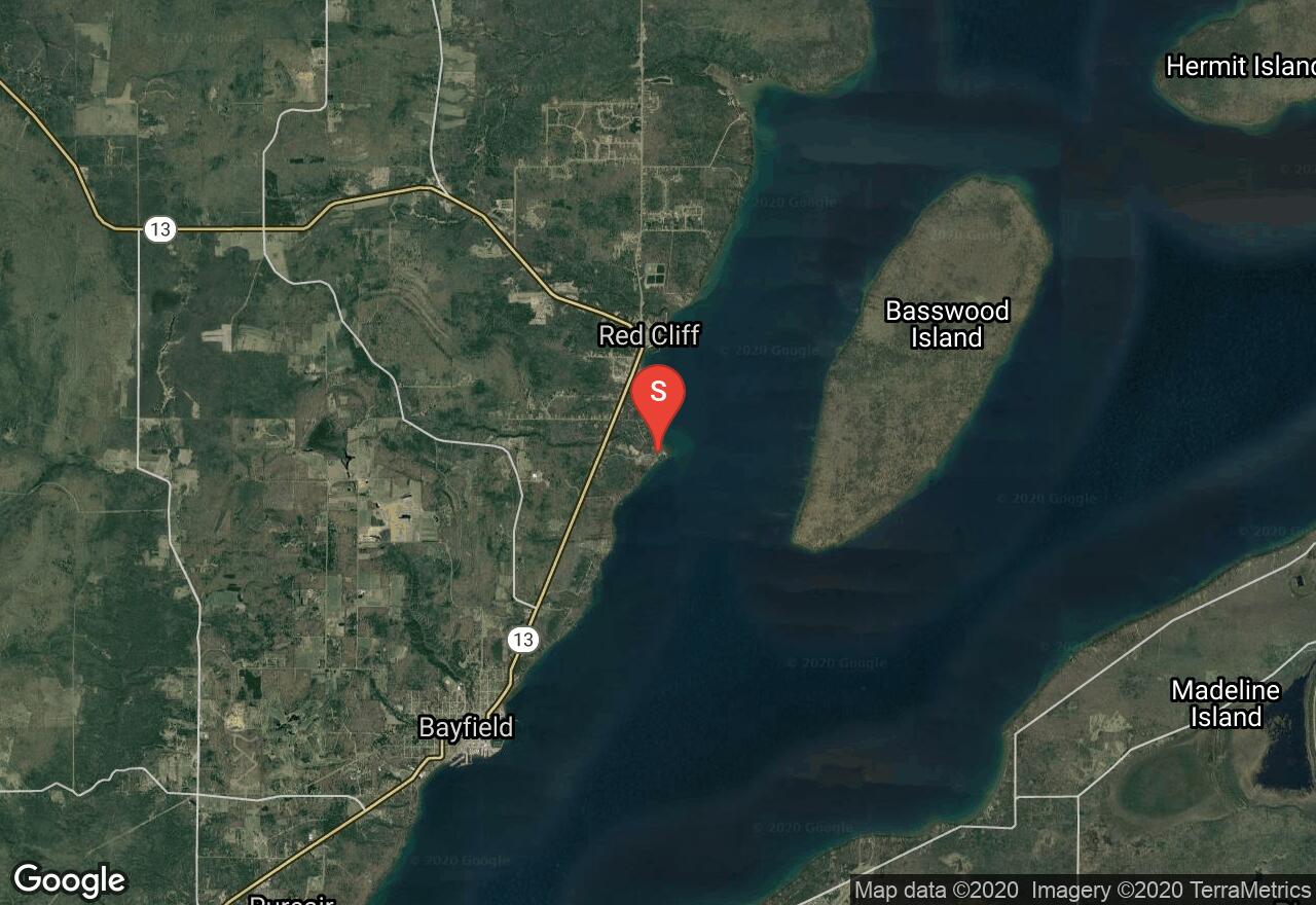
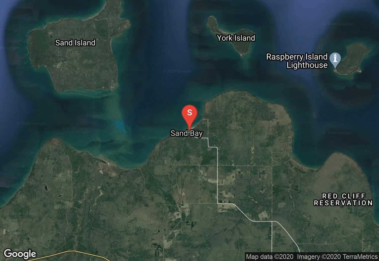
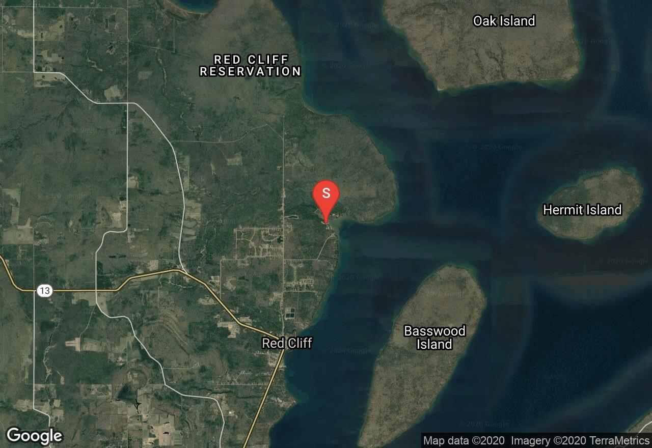
Wisconsin’s Lake Superior Water Trail is a network of launch areas, points of interest, picnic areas, and campsites spread across 153 miles of mainland coastline and Madeline Island. It includes 12 segments, each with its own distinct character, challenges, and rewards. This segment is one of the most scenic of the water trail. It features a coastline that is remote, sparsely developed, rugged, and wild. You will parallel Red Cliff Reservation lands which are not open to non-tribal members. Later, York and Raspberry Islands clearly come into views and an open water crossing to the islands can be a rewarding side trip. Other great views and points of interest include sandstone/brownstone formations, sea caves, ledges, sand beaches, diverse flora and many rare plant species, a panoramic view of the Apostle Islands at Red Cliff Point, and the remains of the wooden steamer Fedora from a wreck over a century ago. Potential hazards on this course include reflective wave conditions, limited access to emergency landing sites, and rapidly changing weather conditions.
Wisconsin, Bayfield County
11 :22 hrs
28.4 mi
1.9978943 ft
SK III
This route allows you to explore and view many of the smaller islands of the Apostle Island National Lakeshore. Beginning at the Schooner Bay Marina, you will paddle around the east side of Oak Island and Bear Island, round its northern tip and head to York Island and Sand Island, and end at Little Sand Bay. Oak Island has beautiful rocky cliffs and forested shoreline with an impressive rock face on the north side of the island, Bear Island is similar but it contains many large, sandy beaches that make great lunch spots before venturing to York Island. Here, you will find a labyrinth of red sandstone sea caves and tunnels and large, wide open sandy beaches. On the east side of Sand Island, more outstanding rock formations and tunnels will add to the trip before reach Little Sand Bay. Many options for paths to explore these islands are available and there is too much to see and do all in one day. Be cautious of strong currents in the channels and adverse weather forecasts. Camping is available on Oak Island.
Wisconsin, Ashland County
03 :38 hrs
9.1 mi
0.7994232 ft
SK III
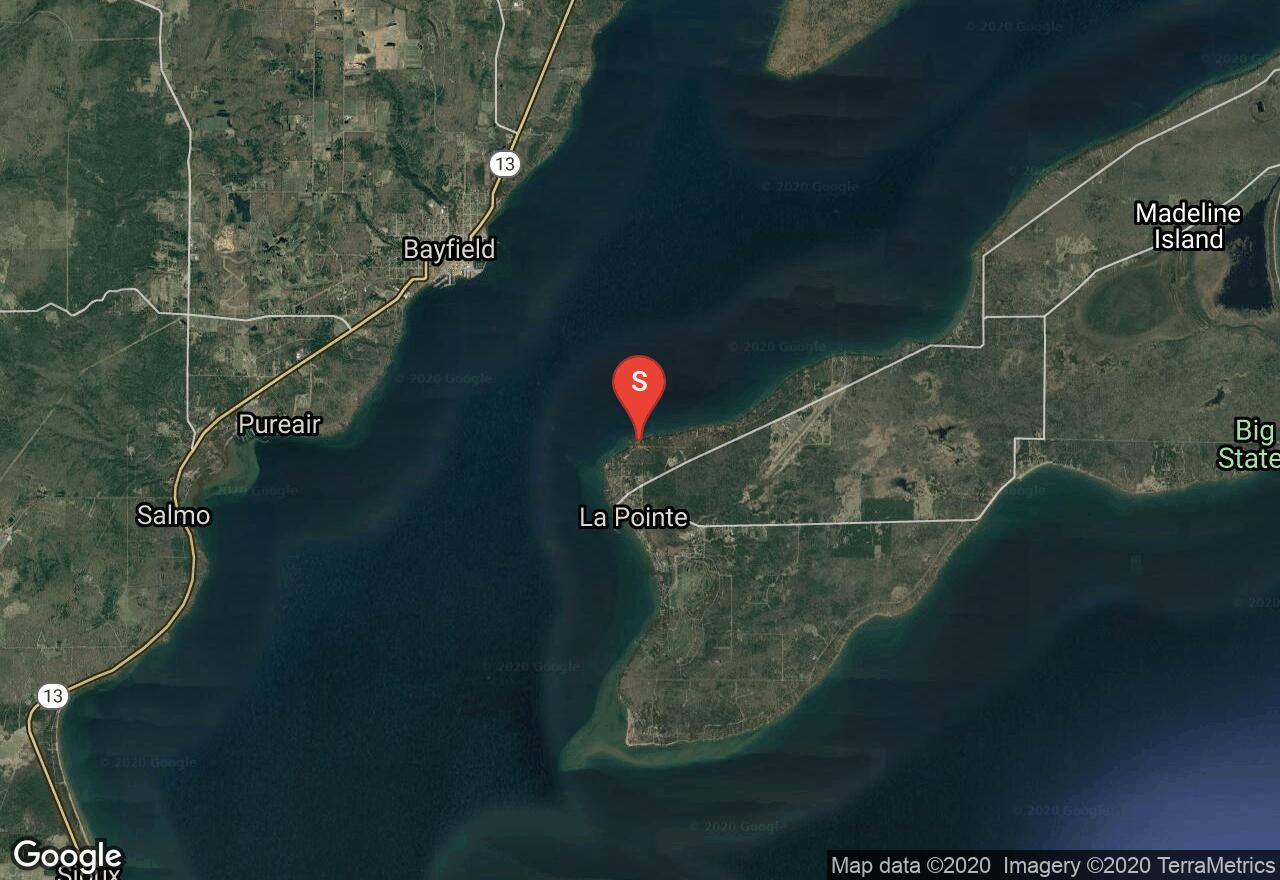
Wisconsin’s Lake Superior Water Trail is a network of launch areas, points of interest, picnic areas, and campsites spread across 153 miles of mainland coastline and Madeline Island. It includes 12 segments, each with its own distinct character, challenges, and rewards. Madeline Island is the largest of the Apostle Islands and is the only island to have a permanent settlement on it. The Madeline Island coastline is beautiful with azure blue waters, sand and cobble beaches, exposed rocky shores and cliffs, undeveloped shoreline near Devil’s Cauldron and long the parks, and some sections lined with seasonal homes and cottages. Circumnavigation of the island is 32 miles but lodging and camping is found on the island. On days when it is rough on the open waters, Big Bay Lagoon is a good option for a reprieve from the waves (see Canoe: Big Bay Lagoon). Take caution of strong currents in both the North and South Channel.
Michigan, Big Bay
09 :22 hrs
23.4 mi
2.8999786 ft
SK IV
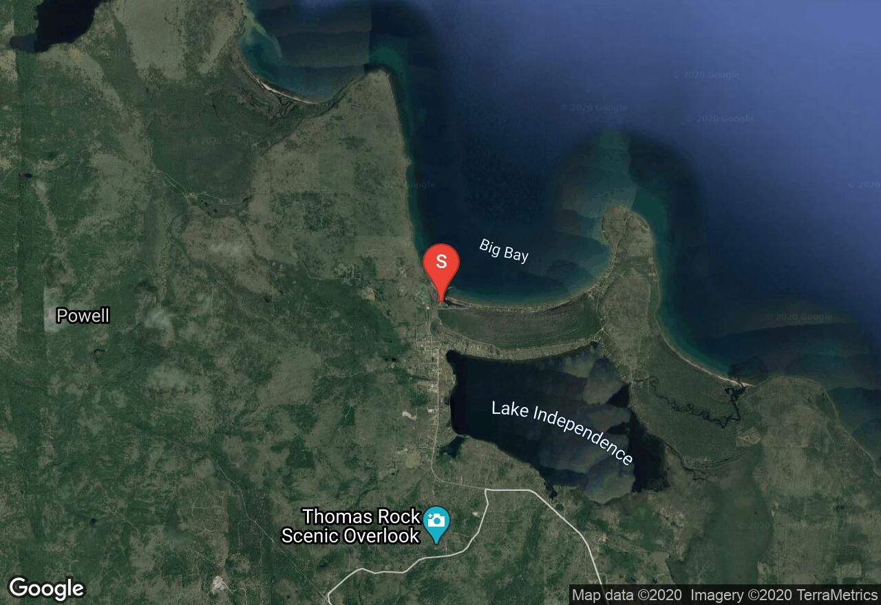
This section of Lake Superior coastline between Big Bay and Little Presque offers paddlers some scenic but very rugged waters for paddling. Much of the shoreline is privately owned but still largely undeveloped making it a worthwhile trip. The shoreline mainly consists of sandstone cliffs, rocky headlands, and bedrock coast that can result in rough waters. There are a few sandy beaches along the way for landing but no camping is allowed so the trip must be done as a one-day paddle. Do not attempt paddling when winds are strong, especially coming from the northeast.
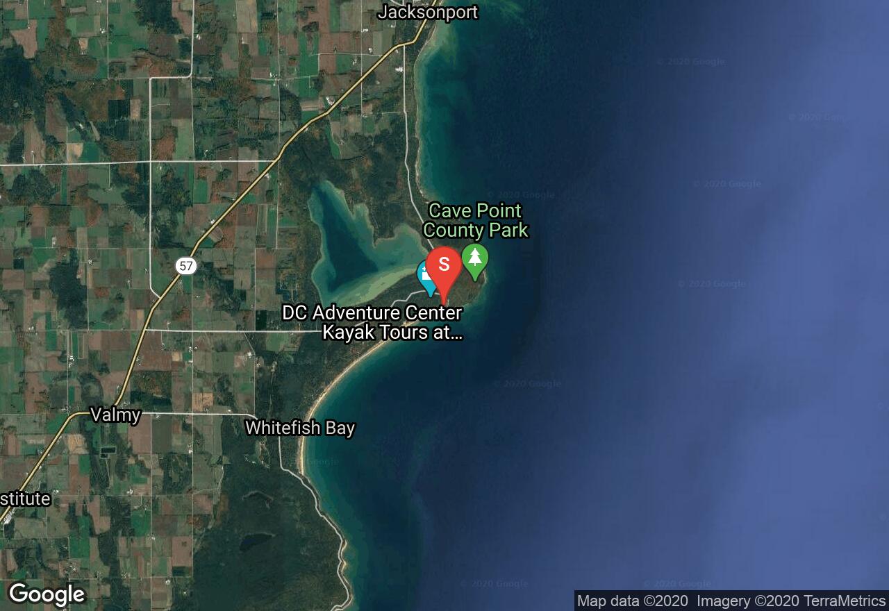
Wisconsin, Door County
01 :03 hrs
1.3 mi
6.993866 ft
SK I
This short and sweet trip has a great sand beach and some very good examples of the limestone cliffs that Door County is known for, including several stone grottos and caves. The clear green water contrasts with the white sand and gray rock, making the scenery wonderfully rich in color. Launch from the beach but take caution of strong southerly winds that can create big waves on the beach and cause a rip current at the north end of the beach. As you paddle east and north along the shore, the shoreline changes from sand to a low rock shelf and then to taller cliffs around Cave Point. Take your time and explore the caves and grottos around Cave Point. More caves continue north along the shore but the best are right around the point. Watch for reflection waves along the cliffs. The shoreline is all part of Whitefish Dunes State Park and Cave Point County Park with hiking trail to visit the caves if the water conditions are not welcoming.
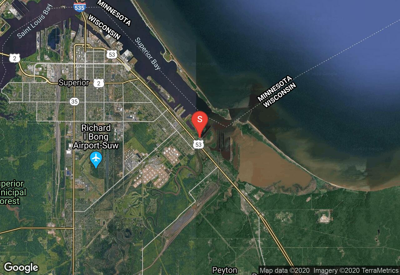
Wisconsin, Superior
04 :30 hrs
11.2 mi
2.6002045 ft
SK III
Wisconsin’s Lake Superior Water Trail is a network of launch areas, points of interest, picnic areas, and campsites spread across 153 miles of mainland coastline and Madeline Island. It includes 12 segments, each with its own distinct character, challenges, and rewards. This route offers a remote wilderness experience featuring glacially deposited red clay bluffs which dominate the shoreline interrupted only by the Brule and Amnicon rivers and dozens of streams and drainages. Wherever streams enter the lake they create estuaries, sand bars, and remote beaches. At average or low lake levels, there may be miles of beaches just below the bluffs. Atop the bluffs, Wisconsin’s boreal forest stands beautifully. Challenges on this course include few access points and no shelter from storms.
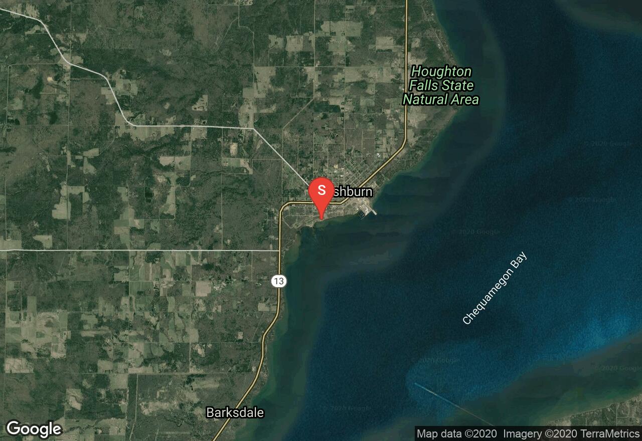
Wisconsin, Bayfield County
02 :34 hrs
6.4 mi
4.199951 ft
SK II
Wisconsin’s Lake Superior Water Trail is a network of launch areas, points of interest, picnic areas, and campsites spread across 153 miles of mainland coastline and Madeline Island. It includes 12 segments, each with its own distinct character, challenges, and rewards. This section is characterized by predominantly shallow waters and gentle bluffs. Several small streams that enter the lake, some of the largest populations of salmonid species, a wonderful paddle through the Fish Creek Sloughs, a complex wetland habitat, and plentiful waterfowl and wildlife are among some of the highlights of this trip. . The Fish Creek Sloughs provide a great opportunity to explore the many channels reaching up into the wetlands where the river merges with the lake. Birding is also popular, especially in May when the annual Chequamegon Bay Birding and Nature Festival is held
See more adventures..
Explore complete list
Explore nearby adventures

