![]()
Lake Superior Water Trail: Washburn - Fish Creek
Bayfield County, Wisconsin
Uploaded by Bivy Team
02 :34 hrs
6.4 mi
14 ft
SK II
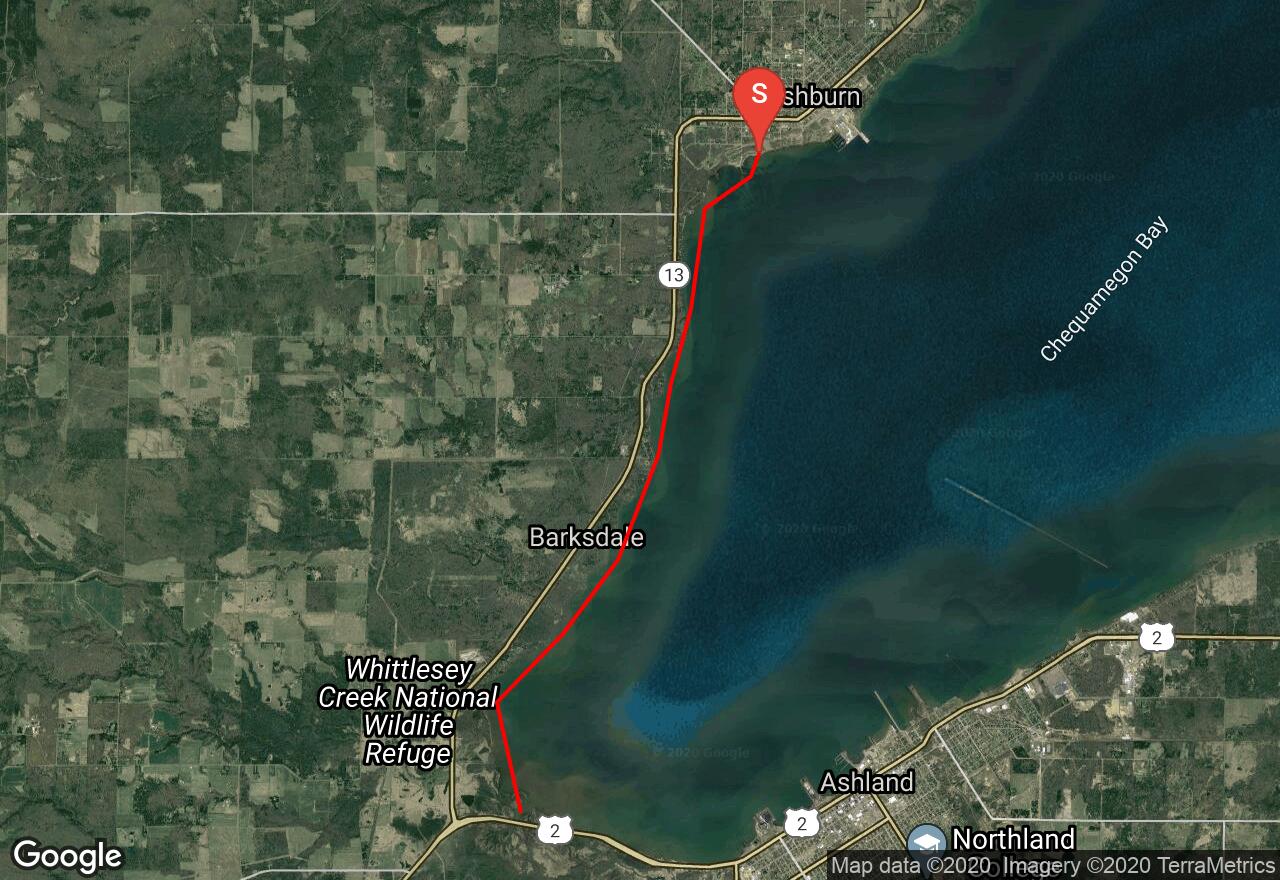
Wisconsin’s Lake Superior Water Trail is a network of launch areas, points of interest, picnic areas, and campsites spread across 153 miles of mainland coastline and Madeline Island. It includes 12 segments, each with its own distinct character, challenges, and rewards. This section is characterized by predominantly shallow waters and gentle bluffs. Several small streams that enter the lake, some of the largest populations of salmonid species, a wonderful paddle through the Fish Creek Sloughs, a complex wetland habitat, and plentiful waterfowl and wildlife are among some of the highlights of this trip. . The Fish Creek Sloughs provide a great opportunity to explore the many channels reaching up into the wetlands where the river merges with the lake. Birding is also popular, especially in May when the annual Chequamegon Bay Birding and Nature Festival is held
2 photos
[{"url":"https://images.bivy.com/lgMap/5330968336400384.jpg"},{"url":"https://images.bivy.com/lgTrailMap/5330968336400384.jpg"}]
Lake Superior Water Trail: Washburn - Fish Creek | Bayfield County, Wisconsin
Wisconsin’s Lake Superior Water Trail is a network of launch areas, points of interest, picnic areas, and campsites spread across 153 miles of mainland coastline and Madeline Island. It includes 12 segments, each with its own distinct character, challenges, and rewards. This section is characterized by predominantly shallow waters and gentle bluffs. Several small streams that enter the lake, some of the largest populations of salmonid species, a wonderful paddle through the Fish Creek Sloughs, a complex wetland habitat, and plentiful waterfowl and wildlife are among some of the highlights of this trip. . The Fish Creek Sloughs provide a great opportunity to explore the many channels reaching up into the wetlands where the river merges with the lake. Birding is also popular, especially in May when the annual Chequamegon Bay Birding and Nature Festival is held