Polyfills.0a64bc0ab28cc026ece0.js in Missouri
Trying to find the best in Missouri? Bivy has great hiking, biking, paddling, climbing, skiing, riding and more, with hand-curated trail maps, as well as detailed driving directions.

Missouri, Weston
01 :04 hrs
3.1 mi
11.779449 ft
Hard
This is a popular trail for hikers and bicyclists looking for a fun and easy-going trail. You will see glimpses of the Missouri River along the way. Keep your eyes out for waterfowl and migratory birds. The trail is mostly flat but does have some gentle grades. The north half of this trail is paved and the south half has a fine gravel surface.
Missouri, St. Louis County
00 :51 hrs
2.2 mi
45.18907 ft
Easy
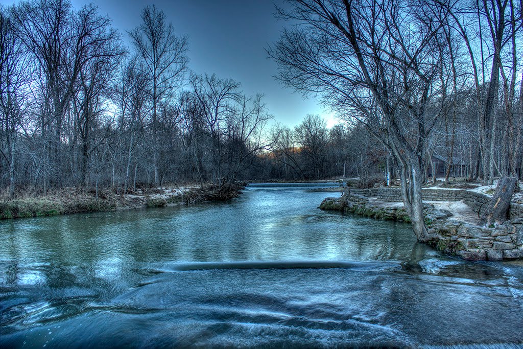
Bee Tree Park is located on a bluff overlooking the Mississippi River. The scenery is a mix of mature woodlands open areas and charming fishing lake. The park is known for its display of wildflowers in the spring. This route combines sections of a few different trails in the park making a nice loop.

Kansas, Lenexa
02 :23 hrs
3.3 mi
15.321228 ft
Hard
The Shawnee Mission Park is a 1,600-acre park located in Shawnee that contains several miles of trails for the use of hikers, mountain bikers, and equestrians. The network of trails throughout the park and surrounding the lake provides a scenic retreat from nearby suburban areas. This trail travels along a secluded, wooded ridge above the lake’s south shore. There are many vantage points for great views and for observing the geese, ducks, and herons that frequent the lake in winter. This trail is shared with equestrians.
Missouri, Greene County
01 :53 hrs
5 mi
50.14499 ft
Easy
A hike offering historic interest as well as beauty located in Wilson's Creek National Battlefield.
Missouri, Adair County
01 :30 hrs
3.6 mi
53.69461 ft
Hard
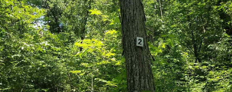
Side trail off of main trail. Blazed with the #2. Go left when you come to the "T". It circles around back to the main trail and the lake.
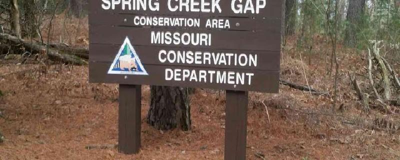
Missouri, Maries County
02 :21 hrs
5 mi
111.024765 ft
Easy
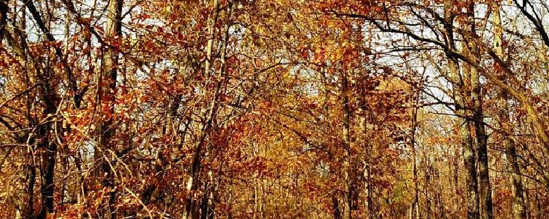
Spring Creek Gap is located 10 miles southeast of Vienna. There is a combination of forests, woodlands, and old fields. The scenery is awesome, especially during the fall. The trails are not well marked so be prepared when coming out here

Kansas, Douglas County
01 :30 hrs
5.7 mi
20.462463 ft
Expert
Clinton Lake is surrounded by more than 60 miles of hiking trails that pass through scenic woodlands, prairies, and over ridges along the lakeshore. The main trunk of the trail system is on the north shore of the lake and is blazed in blue and white. This route begins on the white-blazed trail and then makes a small loop through the woods on a red-blazed trail before following the blue-blazed trail back to the start. The red section of this route is meant to challenge mountain bikers as it is a very narrow trail. There is little room for your bike tire on the trail and the thick woods leave little room for anything else. The white trail includes several ups and downs. There are great views of the lake and beautiful scenery through the woods.
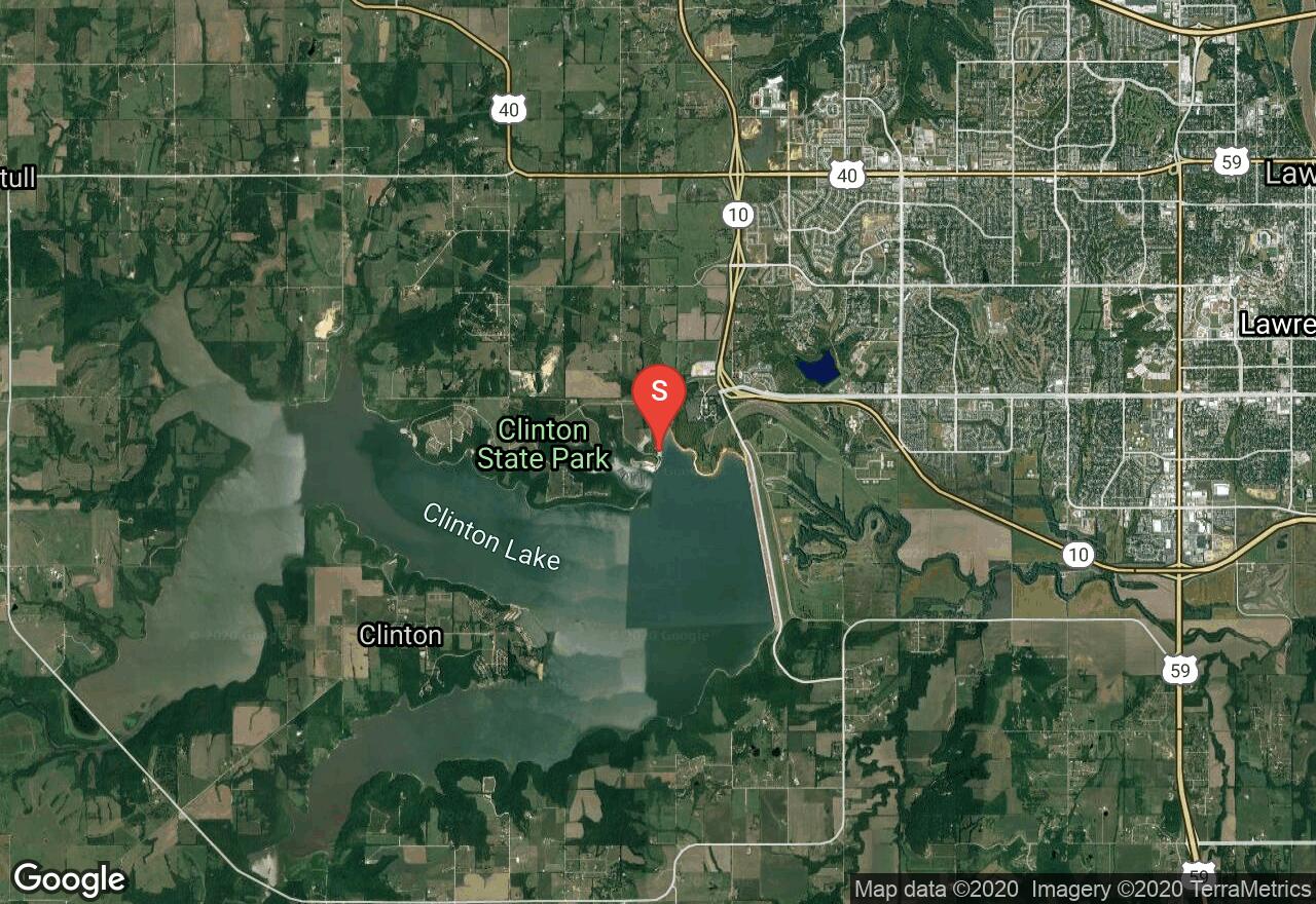
Kansas, Douglas County
11 :44 hrs
26.1 mi
6.0884705 ft
I
Clinton Lake is part of Clinton State Park, which is one of the state’s newest state parks constructed in the mid 1970’s. Its close proximity to Kansas City, Lawrence, and Topeka make it a very popular destination, with nearly 600,000 annual visitors from across the country. Many improved campsites, hiking and mountain biking trails, playgrounds, swimming, and other outdoor activities are available. The privately owned and operated marina is one of the newest and largest of any of Kansas’ lakes. In addition to the lake’s accessibility and amenities, it’s beautiful shoreline and vistas are a great attraction. Miles of rugged wooded shoreline, high bluffs, wildflowers, and prairie grasses are some of the natural beauties. Wildlife is also common and includes white-tailed deer, turkeys, waterfowl, songbirds, and a variety of small mammals.
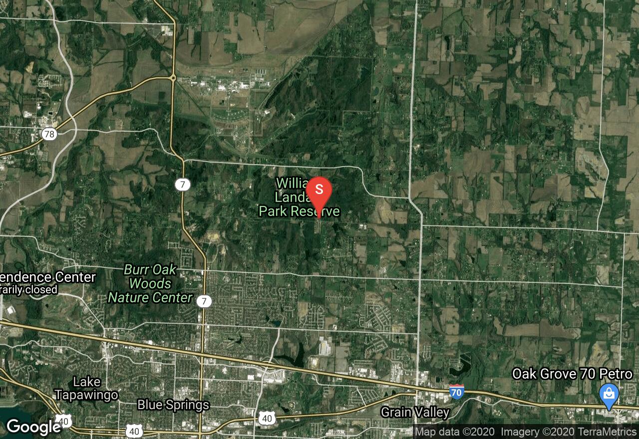
Missouri, Grain Valley
02 :22 hrs
6.1 mi
50.40515 ft
Hard
Located at Landahl Park, this route follows the Tasty Goodness Trail for most of the way. Very fun with quite a bit of gain for Missouri
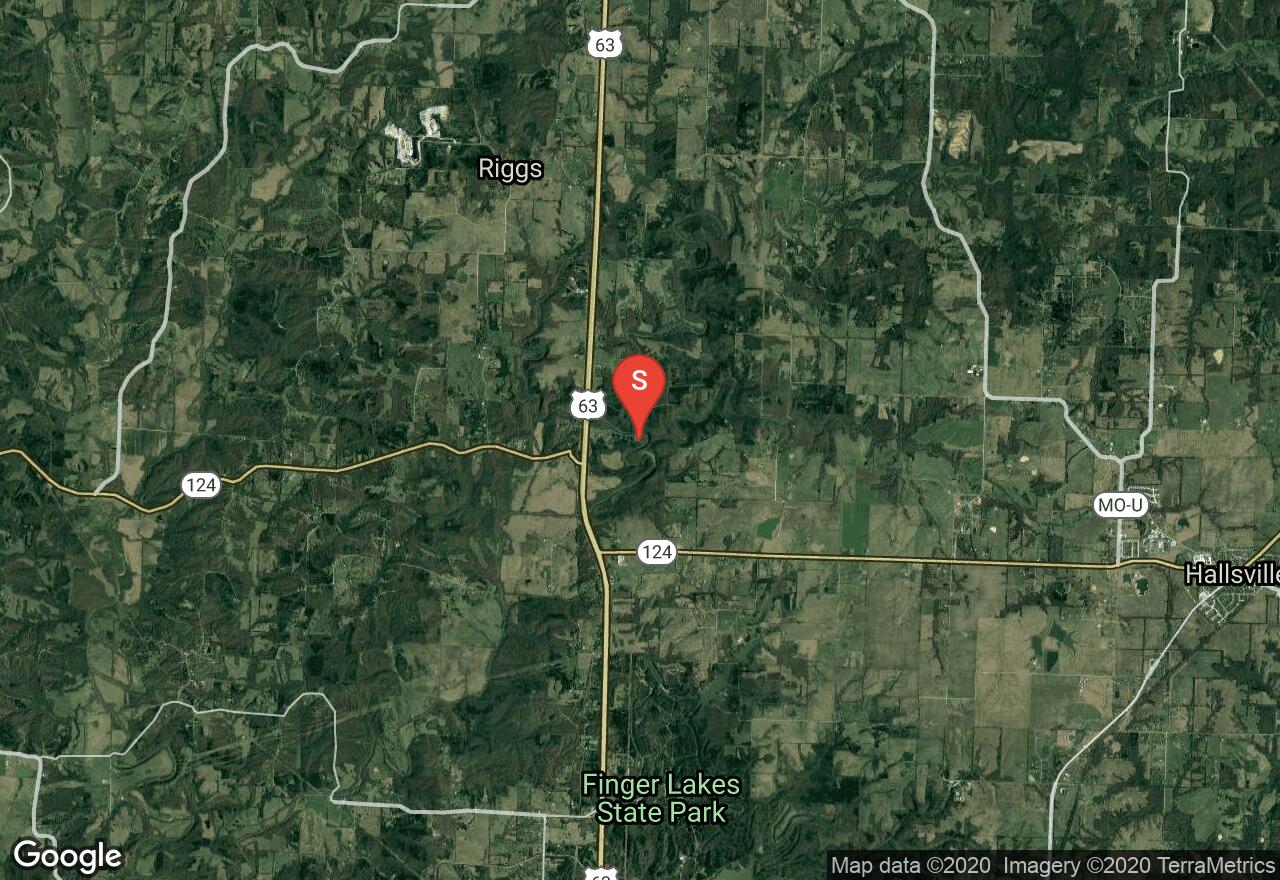
Missouri, Boone County
00 :25 hrs
0.6 mi
7.3222656 ft
Moderate
This is a great hike to view a large variety of rock formations. You will see and hike on top of rugged rock pinnacles, find cliffs, arches and a shelter bluff. You will also find tons of fossils embedded into the rock.This trail isn't recommended for young children or those afraid of heights. You will go through some narrow and steep areas while on the pinnacles so use caution. After you hit the shelter bluff, you will track back toward the wooden bridge and find a shallow spot to cross the stream. This is where you will start climbing on top of the pinnacles. Just after the last pinnacle you will be heading into the forest. This is a good place to turn back and retrace your steps to the parking lot.
See more adventures..
Explore complete list
Explore nearby adventures

