Best Climbing in Maine
Trying to find the best climbing in Maine? Bivy has great hiking, biking, paddling, climbing, skiing, riding and more, with hand-curated trail maps, as well as detailed driving directions.

Maine, Piscataquis County
17 :52 hrs
16.8 mi
1134.7008 ft
S3
Typically done as a multi-day trip, this tour from Abol Bridge to the Great Basin and Saddle Trail will test your endurance and commitment. Begin at the plowed parking area located just before Abol Bridge. From here work your way to Roaring Brook Road to the east. Follow Roaring Brook Road to the campground parking for Roaring Brook. Connect with the Chimney Pond Trail and then onto Saddle Trail. Travel up the gully and begin at the intersection of the Northwest Basin Trail at the top of the ridge. Follow your tracks back to your vehicle. If desired, there are more descent options to the north known as the Great Basin Gullies. Also,there is a camp and shelter Near Chimney Pond if you decide to stay the night before following your tracks back to your vehicle.
Maine, Piscataquis County
36 :58 hrs
33.9 mi
1273.5211 ft
S3+
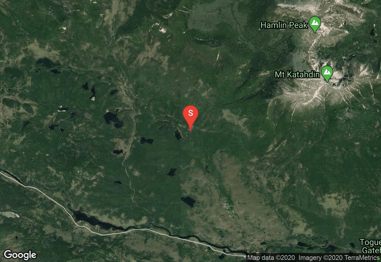
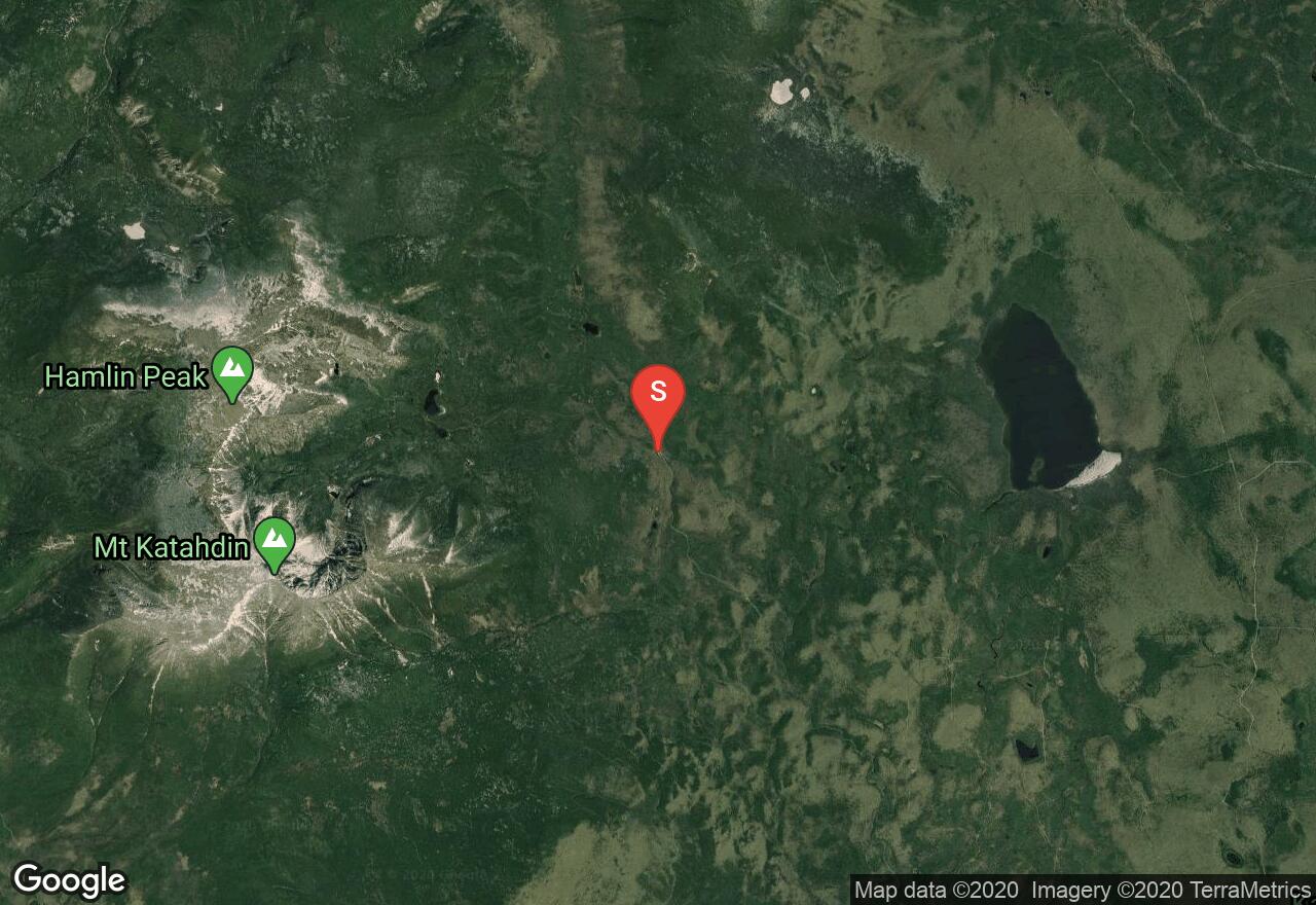
Located northwest of Chimney Pond, the Great Basin Gullies offers some of the best backcountry skiing in the area. The gullies are located on the north wall of the Great Basin and each one drops 800 to 1,000 feet with 20 to 30 feet in between the walls leaving enough room to get some turns in. Access the Great Basin Gullies via Saddle Trail or Hamlin Ridge Trail, with the latter being the easiest option (shown here). The approach from Abol Bridge to the Great Basin and up Hamlin Ridge will test your endurance. Begin at the plowed parking area located just before Abol Bridge. From here work your way to Roaring Brook Road to the east. Follow Roaring Brook Road to the campground parking. Connect with the Chimney Pond Trail and then onto Hamlin Ridge. At the bottom of Hamlin Ridge Trail, it is a 2 mile hike to the summit. As you ascend along the ridge enjoy views of both the North and South Basins. After reaching the summit, head to south and choose which gully you will be going down. From the bottom, follow the streambed on the valley floor back to Chimney Pond Trail. There is a camp and shelter Near Chimney Pond if you decide to stay the night before following your tracks back to your vehicle.
Maine, Piscataquis County
10 :14 hrs
4.6 mi
1271.2878 ft
I
Mount Katahdin is the highest mountain in Maine rising 5,270ft. Its name comes from the Penobscot Indians and the term Katahdin means “The Greatest Mountain”. There are several routes to reach the summit and the Hunt Trail is one of the most popular routes. Beginning at Katahdin Stream Campground, Hunt Trail follows the Appalachian Trail. The first few miles are easy and you will pass by the spectacular Katahdin Stream Falls. It progressively turns more difficult and involves some scrambling and exposure. Be sure to check weather and come prepared for conditions changing quickly. Warm clothing and a good pair of boots is essential. Winter ascents require ice axe and crampons.

Maine, Piscataquis County
15 :57 hrs
15.8 mi
713.7061 ft
S1+
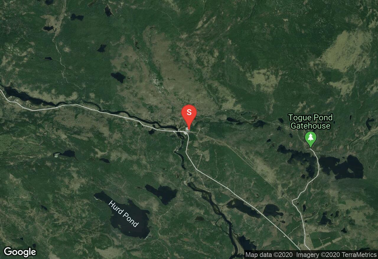
Typically done as a multi-day trip, this tour from Abol Bridge to Chimney Pond will test your endurance and commitment. Begin at the plowed parking area located just before Abol Bridge. From here work your way to Roaring Brook Road to the east. Follow Roaring Brook Road to the campground parking for Roaring Brook. Connect with the Chimney Pond Trail and travel another 3.3 miles to the pond. The trail from Roaring Brook to Chimney Pond is the most physically demanding section of the tour. The trail ascends over 1,4000 feet in only 3 miles. Make sure to plan properly for a multi-day trip and bring the proper amount of gear and supplies, but do not pack too heavy. If desired, further distance can be traveled from Chimney Pond to add to your backcountry tour, (see Baxter Peak and North Basin: Taber Gully to name a few).
Maine, Piscataquis County
05 :29 hrs
9.7 mi
996.82513 ft
S3
Taber Gully is a classic couloir that descends 1,000 feet to the valley floor within the North Basin from Chimney Pond. The trip to and from Taber Gully is a multi-day trip and can also include other tour within the area. The approach begins from Roaring Brook Campground, shown here (see the “Chimney Pond” route to gain insight on how to reach Roaring Brook). From the campground, follow the Chimney Pond Trail to reach Hamlin ridge Trail. After reaching Hamlin Ridge Trail it is a 2 mile hike to the summit. As you ascend along Hamlin Ridge enjoy views of both the North and South Basins. After reaching the summit head north to Taber Gully. The gully is wide at the top and narrows to about 15 feet near the middle before opening back up at the bottom as it spots you out into the remote North Basin. Work your way back to Chimney Pond Trail and retrace your tracks back to Roaring Brook Campground. Note: this is only a portion of a multi-day trip that must be connected with the first section “Chimney Pond” route.

Maine, Piscataquis County
06 :23 hrs
4.4 mi
1149.1233 ft
S3
This section of a multi-day backcountry ski tour includes a descent from Baxter Peak, or steep gullies within the South Basin. After reaching Chimney Pond, many skiers like to push a little further up towards Baxter Peak via Cathedral Trail (shown here), or ski across the pond and head towards the steep slopes of south basin. The leg of this multi-day trip approach begins from Roaring Brook Campground, shown here (see the “Chimney Pond” route to gain insight on how to reach Roaring Brook). From the campground, follow the Chimney Pond Trail, either to Chimney Pond itself (this will be the option if you desire to ski the steep gullies in South Basin), or connect with Cathedral Trail to reach Baxter Peak (shown here). Descend following your tracks back down Cathedral Trail and back to Roaring Brook Campground. Note: this is only a portion of a multi-day trip that must be connected with the first section “Chimney Pond” route.
Maine, Penobscot County
00 :22 hrs
0.6 mi
77.08419 ft
Various
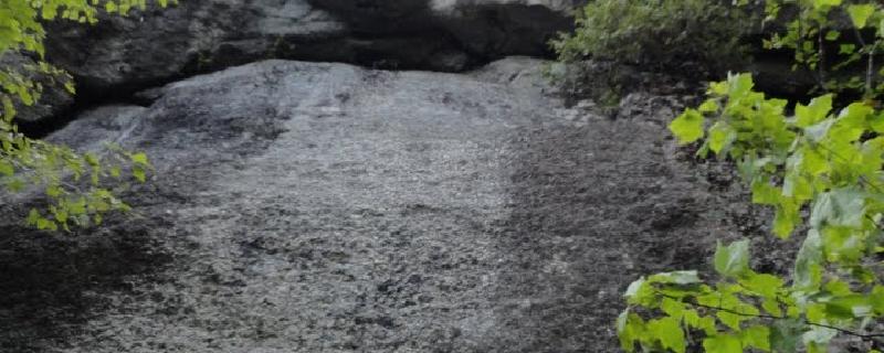
The prime climbing spot in the Bangor area, Eagle bluff sports some nice granite that unfortunately dirties quickly from lichen; so please climb here and help keep it clean. This part of the cliff offers steep slabs, bulges and layback flakes. The approach isn't terribly long and is a pleasant walk in the woods.
Maine, Oxford County
00 :48 hrs
1.1 mi
193.89291 ft
Various
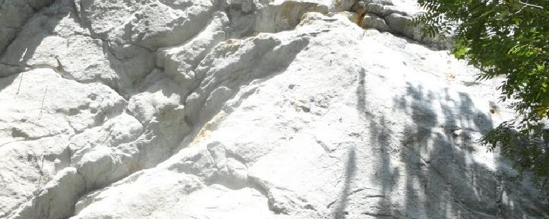
Although this is not a large formation it does have an abundance of quality climbing routes. The terrain is steep, holds are substantial and the quality of granite is good. The approach is a bit of a hike but it's pleasant and the elevation gain provides a good warmup.
Maine, Hancock County
00 :03 hrs
0.1 mi
30.60251 ft
Various
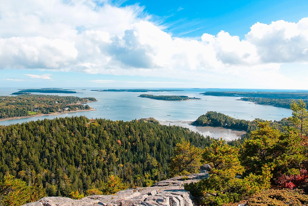
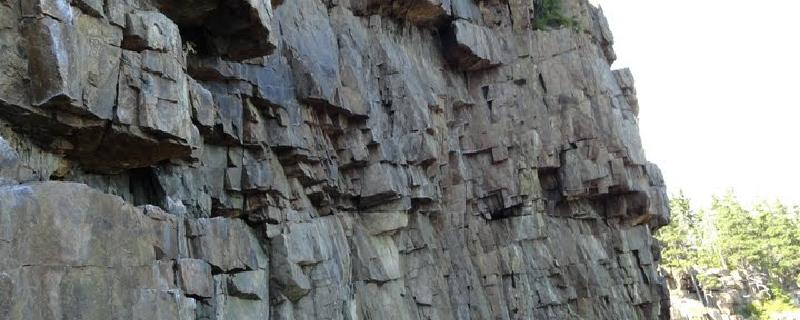
Although very domesticated you couldn't really ask for more in terms of ambiance than Otter Cliffs. You'll find no bolts at Otter and only a few routes offer gear placements but as odd as it sounds to say, you'll find the sickest easy to moderate top-ropes you've ever seen. You'll weave between throngs of tourists wearing big floppy sun hats, cameras hanging from their necks, as you walk along the short approach trail. At the top of the crag you'll have to lower or rap from gear or a few present anchors to a ledge (inundated at high-tide) just above waves, lapping against the rocks. From here haul yourself back up the well traveled, clean granite with great ocean views over your shoulder. Routes are listed from left to right from the perspective of the climber, beginning in The Gallery end of the crag (ocean view right).
Maine, Penobscot County
00 :22 hrs
0.5 mi
79.880714 ft
Various
The prime climbing spot in the Bangor area, Eagle bluff sports some nice granite that unfortunately dirties quickly from lichen; so please climb here and help keep it clean. This part of the cliff offers the steepest terrain on the formation with many horizontals leading into roofs. The approach isn't terribly long and is a pleasant walk in the woods
See more adventures..
Explore complete list
Explore nearby adventures

