Best Waterways in Maine
Trying to find the best waterways in Maine? Bivy has great hiking, biking, paddling, climbing, skiing, riding and more, with hand-curated trail maps, as well as detailed driving directions.
, Hancock County
04 :28 hrs
11.2 mi
9.577 ft
SK III
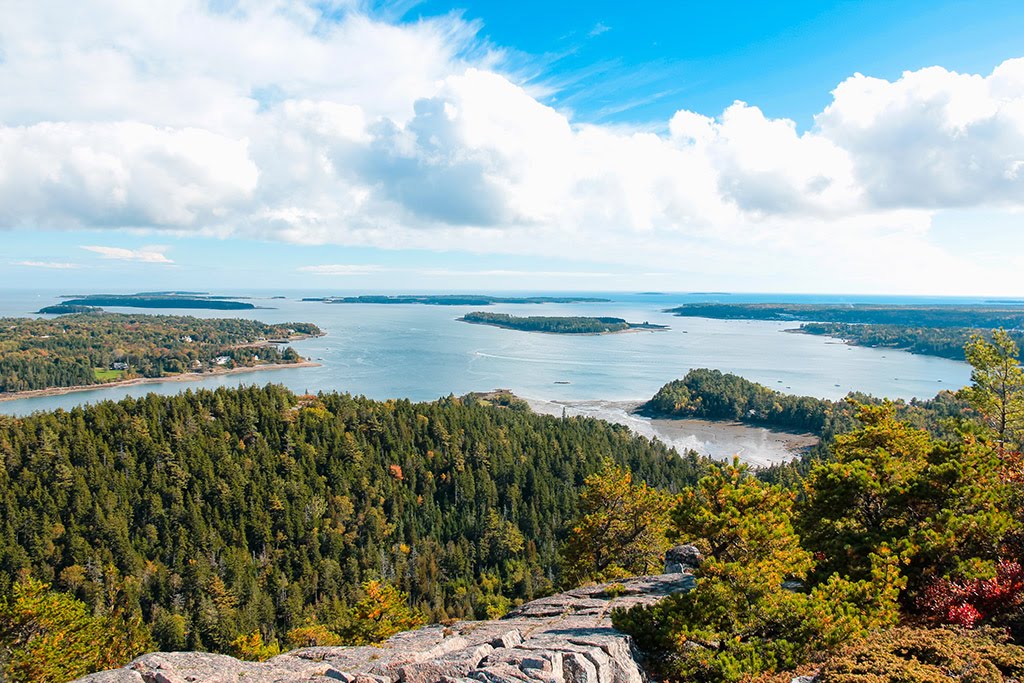
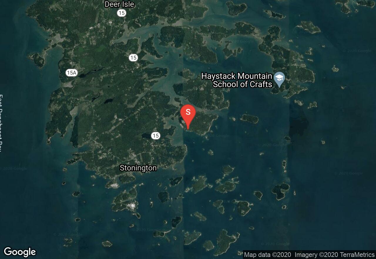
The Deer Isle Archipelago is a large group of public islands located just south of Stonington on the coast of Maine. The islands consist of rugged granite and thick forest landscape, offering some of the best scenery and paddling on the coast. The area does experience a lot of boat traffic and fog can also present a challenge. Exploring within the islands is fairly protected but take caution when crossing Merchant Row and Deer Isle Thorofare boating channels.
Maine, Hancock County
01 :45 hrs
2.2 mi
8.843936 ft
SK II
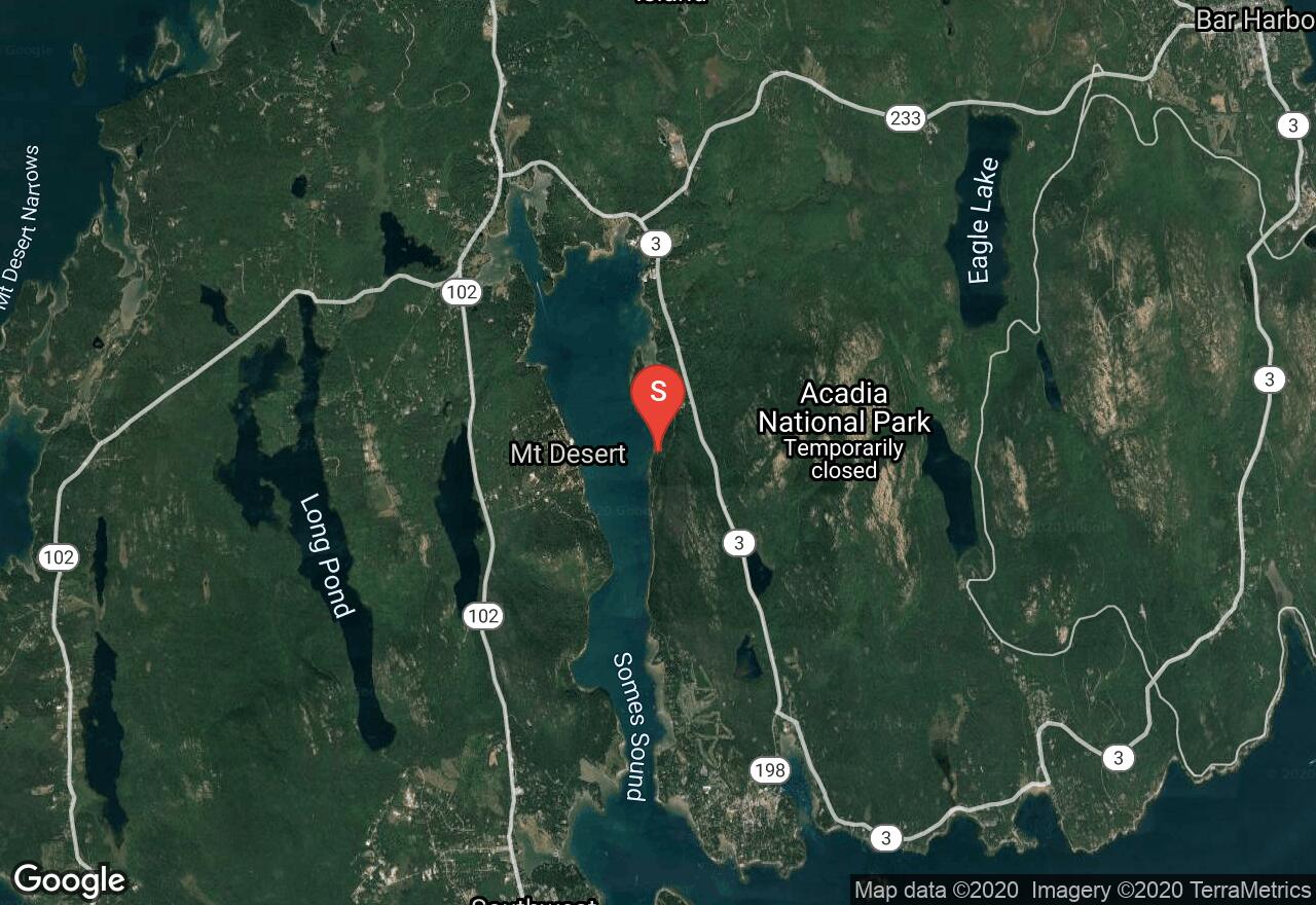
Somes Sound is located in the lower middle section of Mount Desert Island and is known for its scenic shoreline and protected waters. The deep body of water is a great place for relaxing half-day paddle trips on the coast. This trip starts from the picnic area off of Sargent Drive and follows the western shoreline of the sound south to Valley Cove. Valley Cove is a great place to pull off and picnic and hike around before returning back.
Maine, Washington County
06 :08 hrs
7.7 mi
2.7400916 ft
SK III
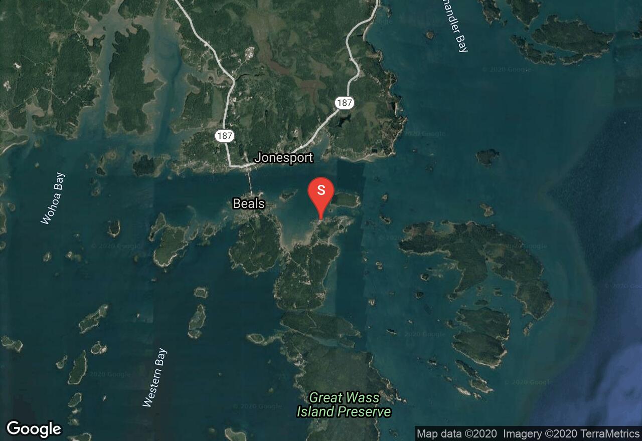
Exploring the shoreline of Great Wass Island offers an enjoyable paddle with plenty of wilderness scenery and great wildlife viewing opportunity. Great Wass Island is the largest island in the Great Wass Archipelago and offers over 1500 acres of nature preserve. The island also offers some great hiking trails. This trip starts from the launch on the north of the island and follows the eastern shoreline down to Cape Cove. The southernmost part of the island experiences a lot of fog so it is best to return the way you came before getting too far south.
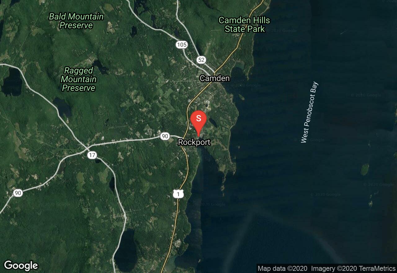
Maine, Knox County
03 :48 hrs
4.7 mi
2.47 ft
SK II
Paddling between Rockport and Camden provides visitors some of the best coastal scenery that Maine has to offer. Along the route paddlers will enjoy views of picturesque harbors, charming, villages, and beautiful blue waters out in the bay. The area is also great for viewing all types of watercraft including impressive yachts and sailboats. The harbors are also a lot of fun to visit once you have landed. The waters are fairly exposed and can be rough during windy conditions.
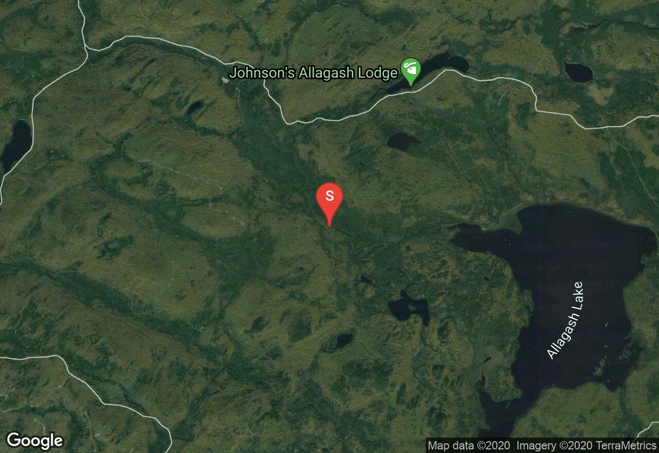
Maine, Piscataquis County
06 :20 hrs
7.9 mi
9.573822 ft
SK II
Allagash Lake is a remote and scenic lake that is part of the Allagash headwaters in northwest Maine. The lake offers some of the most secluded and picturesque paddling in the area and is a must-do if visiting the area. The large lake can be accessed from a carry-in site off Upper Allagash Stream almost 4 miles upstream. There are camping sites located on the lake for overnight trips. The lake also has some great fishing and some ice caves that are fun to explore on the northwest side. Another option to access the lake is a from a portage trail located on the south end of the lake.
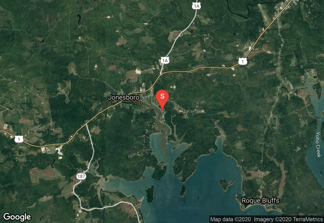
Maine, Washington County
02 :04 hrs
2.6 mi
3.3939314 ft
SK I
The trip down the Chandler River into Englishman Bay is a short and protected paddling route that travels into some of the most scenic water of coastal Maine. Paddlers can launch just southeast of Jonesboro and travel south into the bay. Be sure to paddle during the top two-thirds of the tide or getting stuck in mud could be a real possibility.
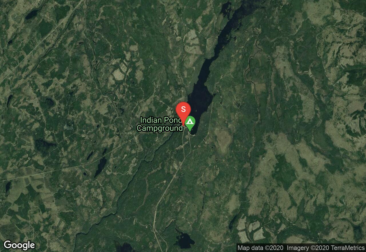
Maine, Somerset County
01 :28 hrs
3.7 mi
64.01318 ft
V
Kennebec River is a popular river for constant rapids. Dependent upon the daily water releases from Harris Dam, this section of the Kennebec River features large whitewater sections such as, Big Momma and Magic Falls. There is a small parking area by each starting and ending locations with stairs leading to the water's edge. This river route is also known to have holes that can flip rafts, so be sure to study the entire course before going. Check water levels of the river and release times from the dam ahead of time.
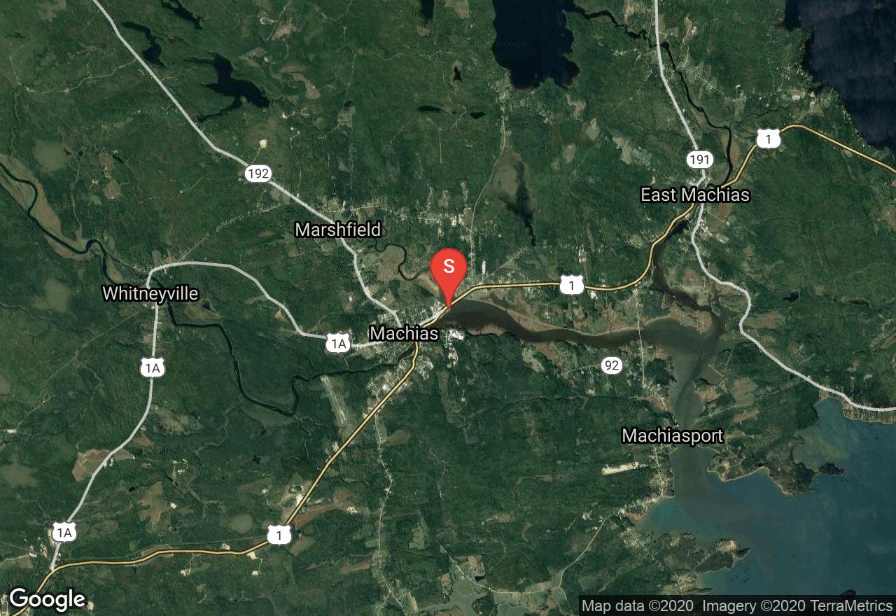
Maine, Washington County
03 :11 hrs
4 mi
2.6117795 ft
SK II
Paddling the protected waters of the Machias River offers excellent scenery and abundant wildlife viewing for paddlers. The area is especially known for great eagle watching. The river channel travels through marshes and mudflats and can be traveled regardless of tide but there is a lot more water to work with during the top half of the tide. The trip can be done as an out-and-back or as a one-way by parking a car and taking out in Machiasport.

Maine, Hancock County
02 :59 hrs
3.7 mi
8.995 ft
SK II
Somes Sound is located in the lower middle section of Mount Desert Island and is known for its scenic shoreline and protected waters. The deep body of water is a great place for relaxing half-day paddle trips on the coast near Acadia National Park. This trip starts from the picnic area off of Sargent Drive and follows the eastern shoreline of the sound up and around to Somes Harbor and back. The sound is fairly protected but rough winds can make for tough paddling and there is some boat traffic near the harbor.
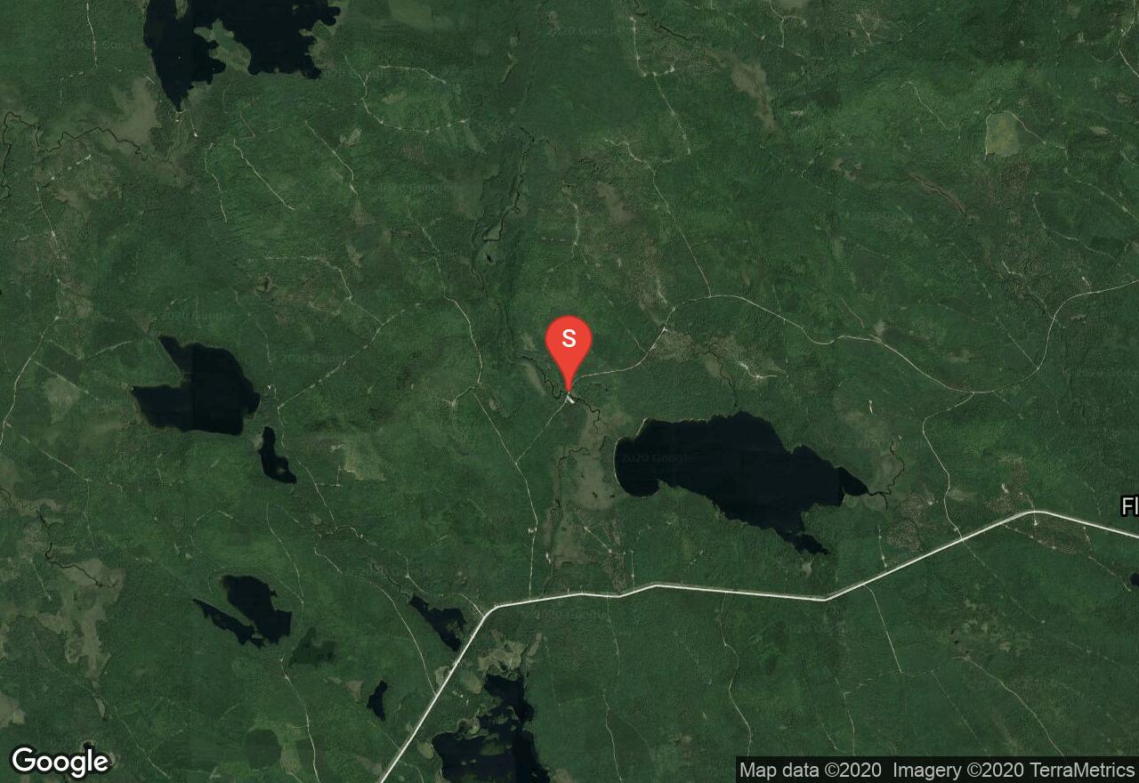
Maine, Hancock County
04 :28 hrs
10.7 mi
20.656525 ft
III
The Machias River is one of Maine's most scenic rivers and it offers some excellent paddling trips of varying distances and difficulties. The river runs through mostly wilderness terrain with excellent scenery and wildlife viewing opportunity. This trip begins on the river just downstream from 5th Machias Lake. The river between the put-in and take-out on 4th Machias Lake consists of some quickwater with multiple class II-III rapids and ledge drops that will need to be scouted. The water calms almost completely as it nears 4th Machias Lake where there is miles of shoreline to explore.
See more adventures..
Explore complete list
Explore nearby adventures

