Best Cross Country Skiing in West Virginia
Trying to find the best cross country skiing in West Virginia? Bivy has great hiking, biking, paddling, climbing, skiing, riding and more, with hand-curated trail maps, as well as detailed driving directions.
Maryland, Garrett County
01 :34 hrs
3.5 mi
29.054321 ft
Easy
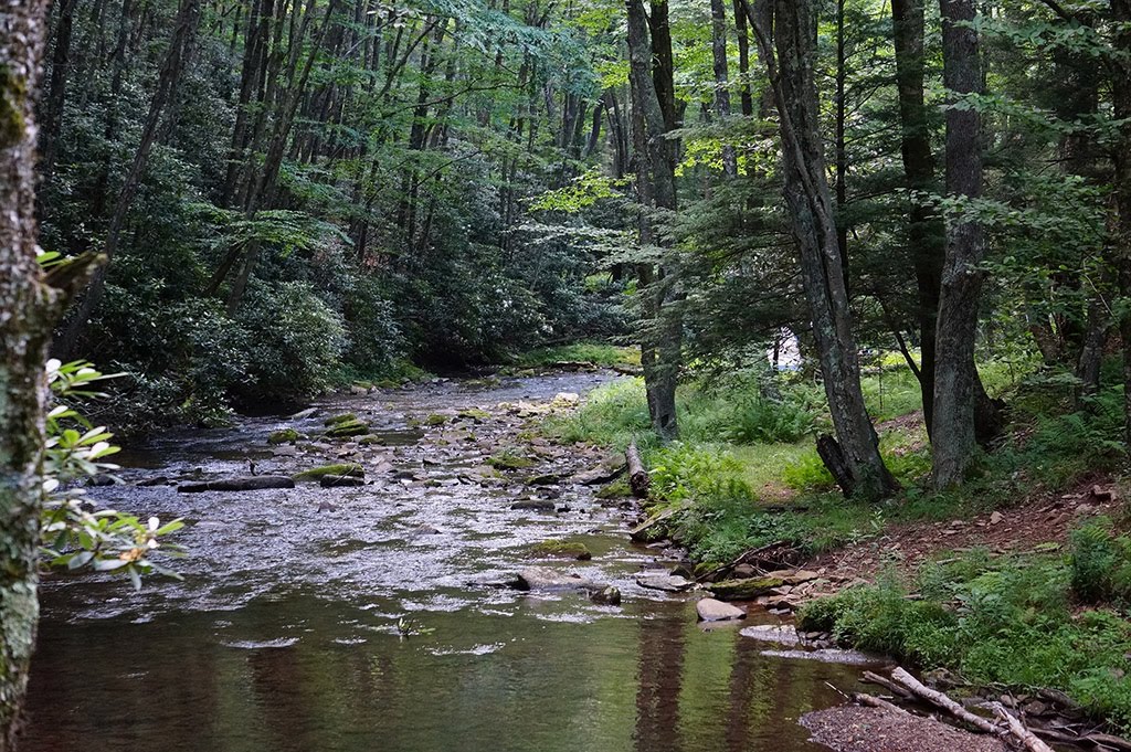
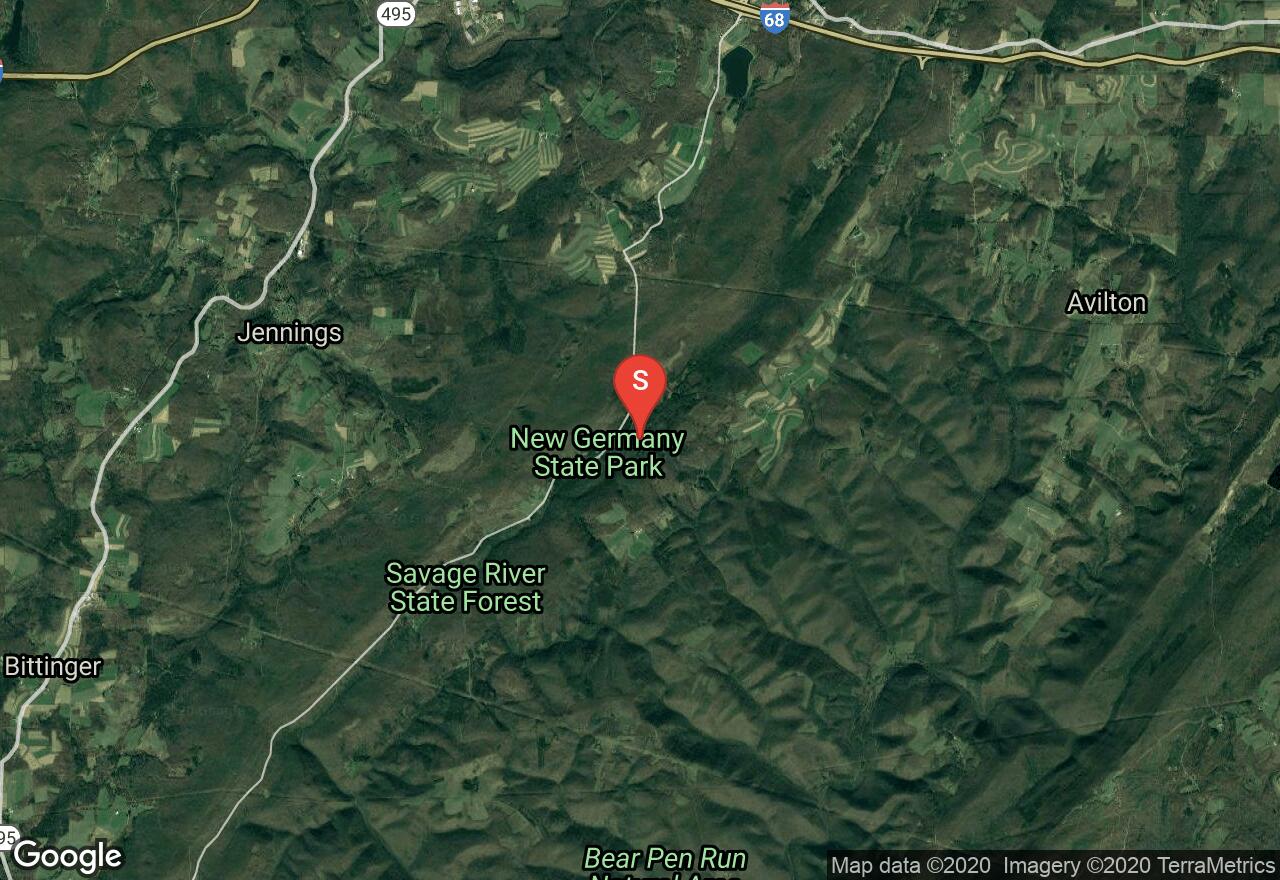
New Germany State Park’s visitors frequently call it a “best kept secret.” Located between Big Savage Mountain to the east and the eastern Continental Divide along Meadow Mountain to the west, this park contains a network of multi-use trails and a small lake. This trail leaves from New Germany Lake and heads into the deep woods through the mountains. Traveling over rolling hills, you will reach the top of two large hills, dropping into the valley in between each. There are great views and gorgeous scenery. The ski trails are groomed and trails are track-set when conditions allow. Snowshoeing is also invited but must stay to the side of ski tracks.
Maryland, Garrett County
01 :34 hrs
3.5 mi
50.76013 ft
Moderate
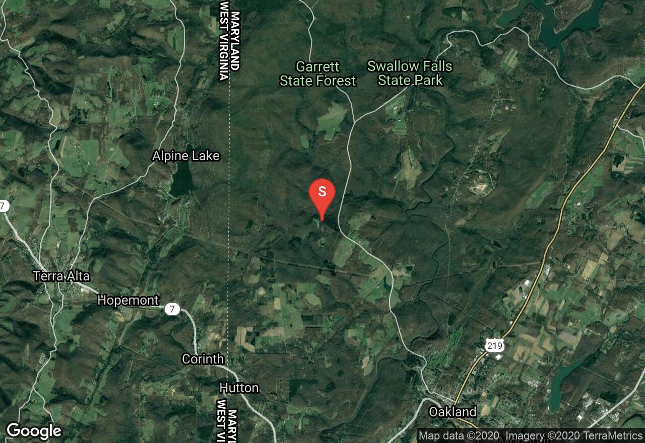
Located within Garrett State Forest, Herrington Manor State Park encompasses 365 acres and offers swimming, canoeing, kayaking, hiking, cross-country skiing, and many other outdoor recreational activities. There are cabins available for renting as well. The ski trails are groomed and trails are track-set when conditions allow. Call ahead to check on trail conditions and closures. This trail begins next to the lake and travels deep into the woods over some rolling hills with one extended incline that is very gradual and not too difficult. Most of the trails in the park are at a beginner to intermediate level. Rentals are available for both skis and snowshoes.
West Virginia, Wheeling
01 :42 hrs
8.5 mi
7.8094482 ft
Easy
The Wheeling Heritage Trails travels along the former Baltimore and Ohio Railroad. Traveling along the Ohio river the trail is relatively flat and paved. This trail passes some industrial areas and does not offer a lot of shade. This trail has sections where it travels along roads with fast moving traffic. There is a huge variety of wildlife along this trail including, deer, squirrels, chipmunks and birds. This trail is wheelchair accessible.
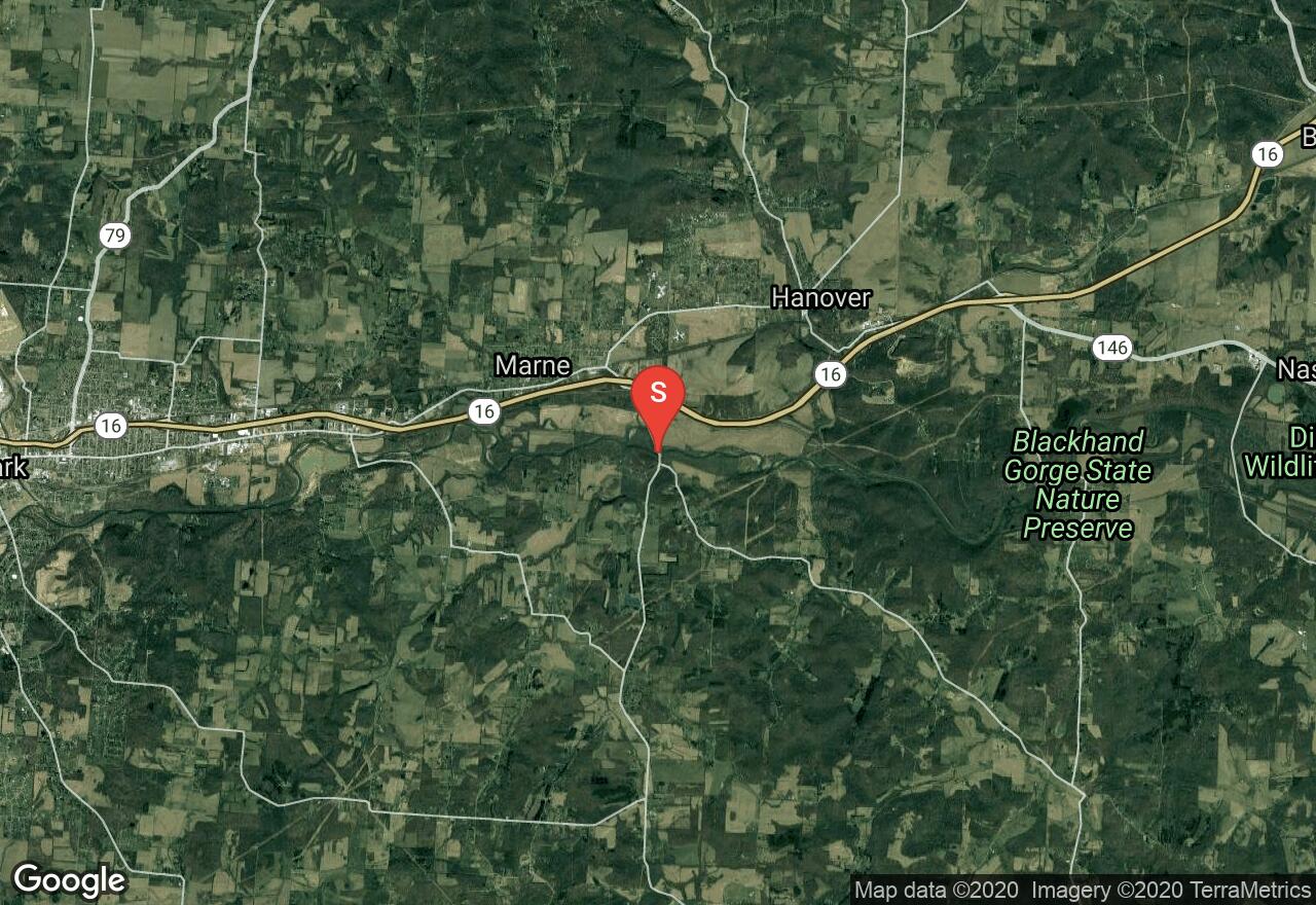
Ohio, Madison Township
00 :52 hrs
4.3 mi
6.0081635 ft
Easy
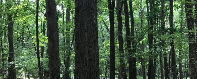
Blackhand Gorge has some of the most beautiful scenery in Ohio. The woods are thick and there is green moss and wild ferns that grow from the cliff formations. A flowing river trickles over rock ledges and rock formations. The trail is used by hikers, runners, bikers and even cross-country skiing in the winter.
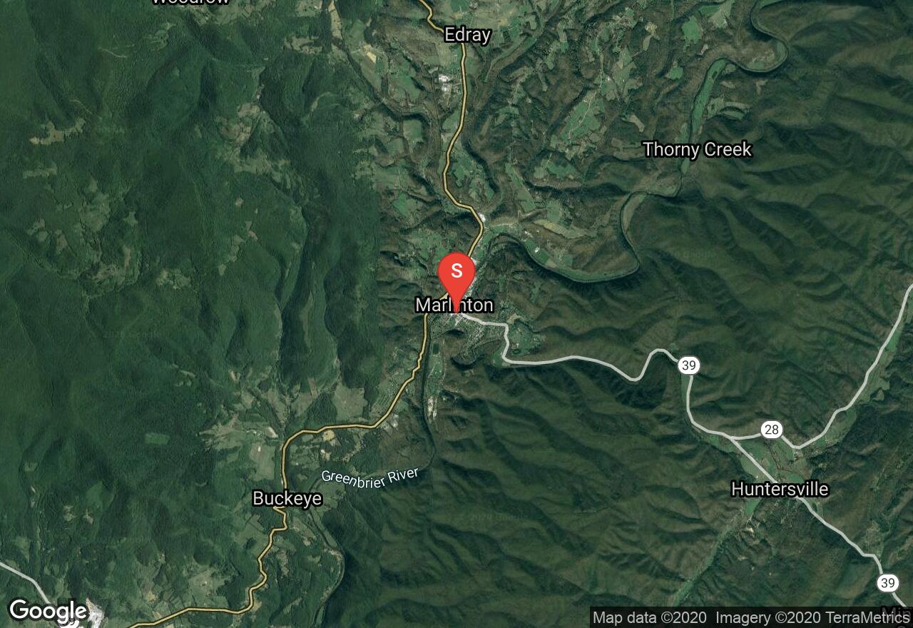
West Virginia, Pocahontas County
06 :37 hrs
24.2 mi
101.51495 ft
Moderate
The 77 mile Greenbrier River Trail operated by West Virginia State Parks, is one of America's premier rail-trails. This former railroad is now made from crushed limestone with some paved sections making it wheelchair accessible is some sections. This trail crosses 35 bridges and passes through 2 tunnels and many small towns. It travels through a forest full of sycamore and river birch as well as maple and mountain ash. During Spring through Fall there are many seasonal wildflowers including phlox, dutchman's-breeches and trillium. Throughout the trail there are many bird and wildlife encounters possibly black bears and bald eagles. There are many camping and access points along the Greenbrier River Trail, making it easy to travel any section or length of the trail. Marlinton to Cass is the most popular and scenic section with not a lot of development and travels through the 511 feet long Sharps Tunnel, built in 1899. A shuttle plan is needed for this trail.
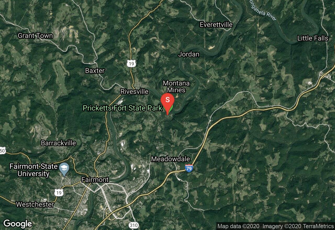
West Virginia, Marion County
10 :53 hrs
20.4 mi
37.141144 ft
Moderate
The Mon River Trail South is part of the West Virginia Rail Trail system. The trail is paved for a short distance with the remaining is compacted crushed stone. As this trail winds through a wooded river valley it offers beautiful river views with the occasional waterfalls. This former CSX rail line is relatively flat and offers plenty of shade and wildlife.
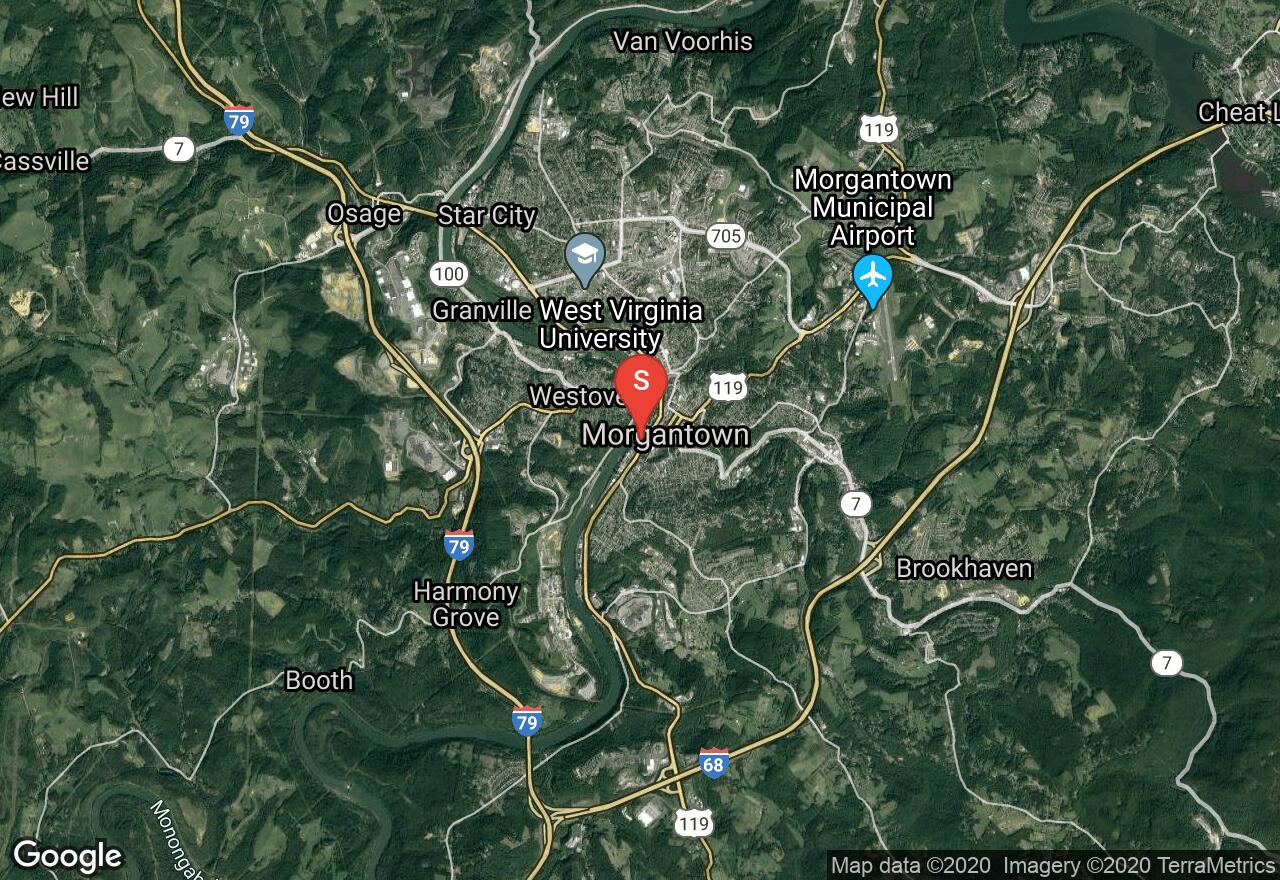
West Virginia, Morgantown
05 :21 hrs
19.1 mi
286.54688 ft
Moderate
The Deckers Creek Trail is the gem of the West Virginia Rail Trail system. It begins at Hazel Ruby Mcquain Riverfront park in Morgantown, The first 2.5 miles of the trail are paved, with the remaining is compacted crushed stone. The trail has a slight uphill grade as it travels through the Monongahela River valley passing a along Deckers Creek with a series of rapids and waterfalls. The trail also passes an abandoned row of coke ovens, remains from a large coal-mining industry which are listed as a National Historic Landmark. When the trail approaches the endpoint near Reedsville, the grade flattens and the woods give way to wetlands that feature cattails and red-winged blackbirds. This trail can be traveled in either direction and a shuttle plan is recommended.
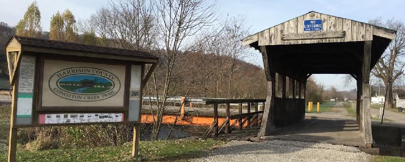
Ohio, Bowerston
02 :14 hrs
11.2 mi
18.370148 ft
Hard
The Conotton Creek Trail travels through wooded large hills with spotted farmland. The trail opened in 2000 and parallels Conotton Creek and an active railroad. It begins in Bowerston and ends in Jewett. There is good opportunity to see wildlife along the way.
Maryland, Garrett County
01 :51 hrs
4.7 mi
156.66699 ft
Hard
Deep Creek Lake State Park located in Garrett County and surrounds Deep Creek Lake, a reservoir that was created with the construction of a dam in 1923. There are trails for hiking and mountain biking as well as water sports on the reservoir. This trail takes a large loop around the park. It circles the base of the mountains and rises to the summit where several cell phone towers and a former fire tower are located. You will then descend the mountain and reach the site of an abandoned coal mine before returning.
West Virginia, Wheeling
01 :42 hrs
8.5 mi
10.35022 ft
Easy
The first part of the Wheeling Heritage Trail known as Ohio River Trail, runs from Pike Island Locks and Dam in Clearview to 48th Street in Downtown Wheeling. This old rail trail provides an urban escape and the opportunity to experience local history and modern industries. The route follows along a paved trail along the eastern bank of the Ohio River.
See more adventures..
Explore complete list
Explore nearby adventures

