Best Mountain Biking in Texas
Trying to find the best mountain biking in Texas? Bivy has great hiking, biking, paddling, climbing, skiing, riding and more, with hand-curated trail maps, as well as detailed driving directions.
New Mexico, Bernalillo County
01 :03 hrs
3.9 mi
142.65161 ft
Hard
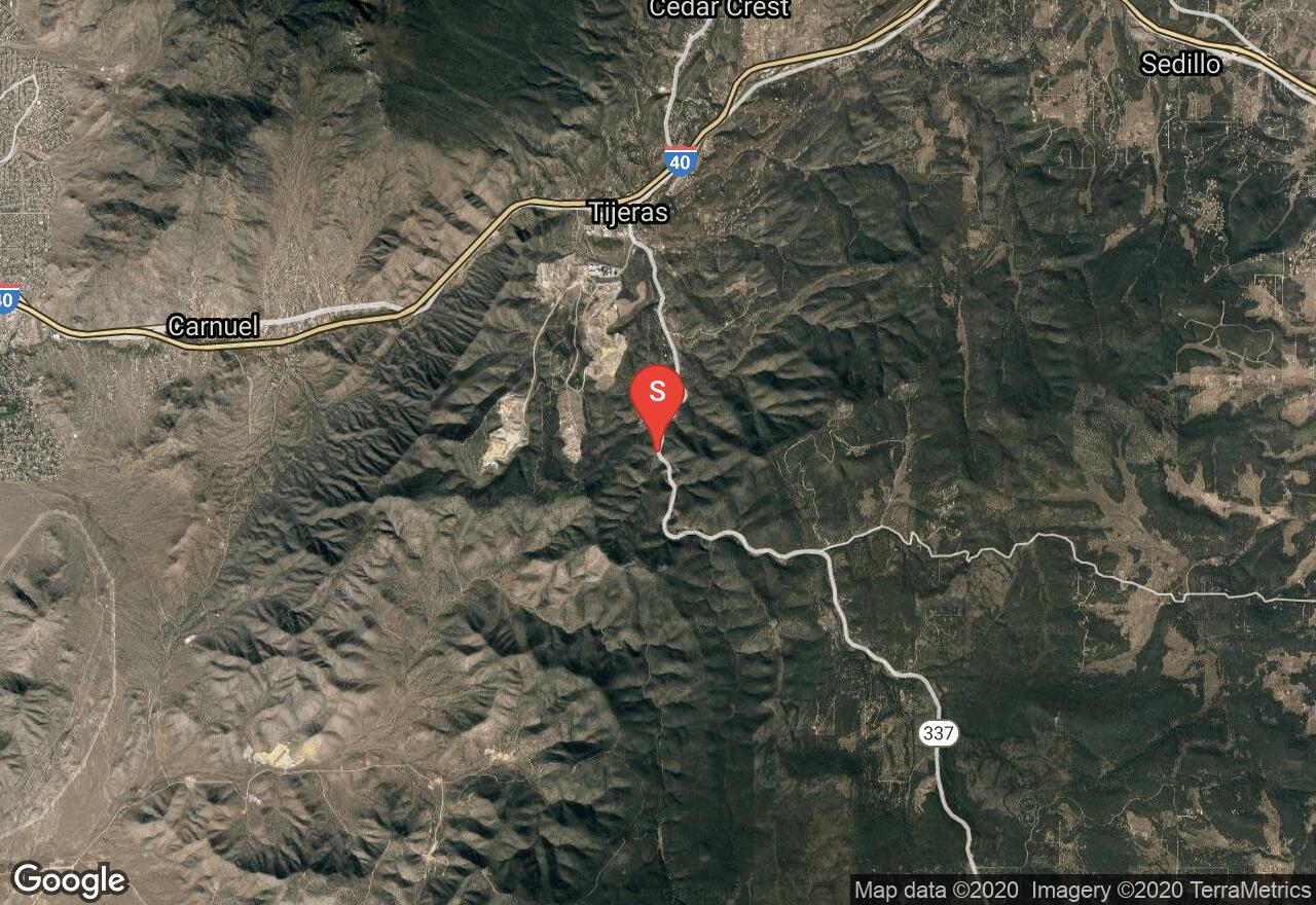
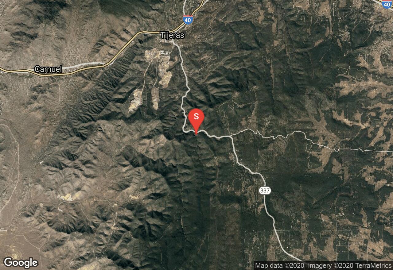
This route through Tunnel Canyon is pretty short and is great paired up with the Otero Canyon routes. Mainly singletrack, with the return portion of the loop using the highway. This singletrack climbs up the skinny canyon and provides lots of sidehill options. Once you hit the highest point, you will get some views of the Sandia Mountains. Most of the obstacles on this ride are fun and not too technical, but there are some sections of loose rock and staircases that add to the adventure.
New Mexico, Bernalillo County
02 :31 hrs
9 mi
153.85693 ft
Expert
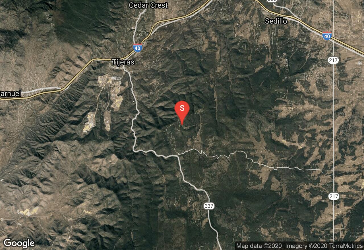
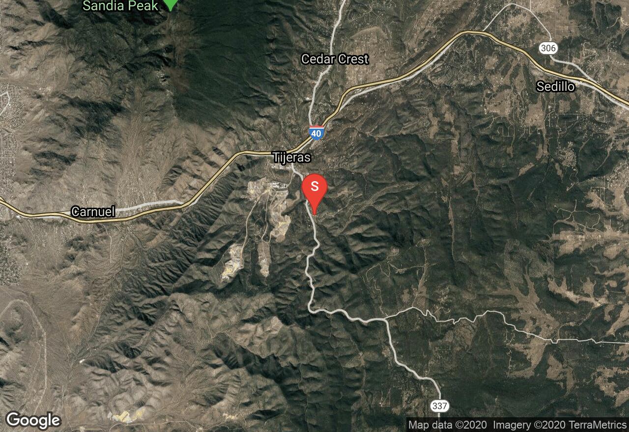
Ride on what is considered by many, the best single track around. This will take you through the foothills, around some pinon-juniper forest and through grassy meadows as well as beautiful Tablazon Canyon, with some nice views of the Sandia Mountains up top. This is a fairly level route, and most is hard packed single track, but you will find yourself amongst some tough rocky areas, so be aware. There is a large network of trails around this area, so be vigilant to stay on the track you want.
New Mexico, Taos County
06 :19 hrs
18.7 mi
1071.6143 ft
Expert
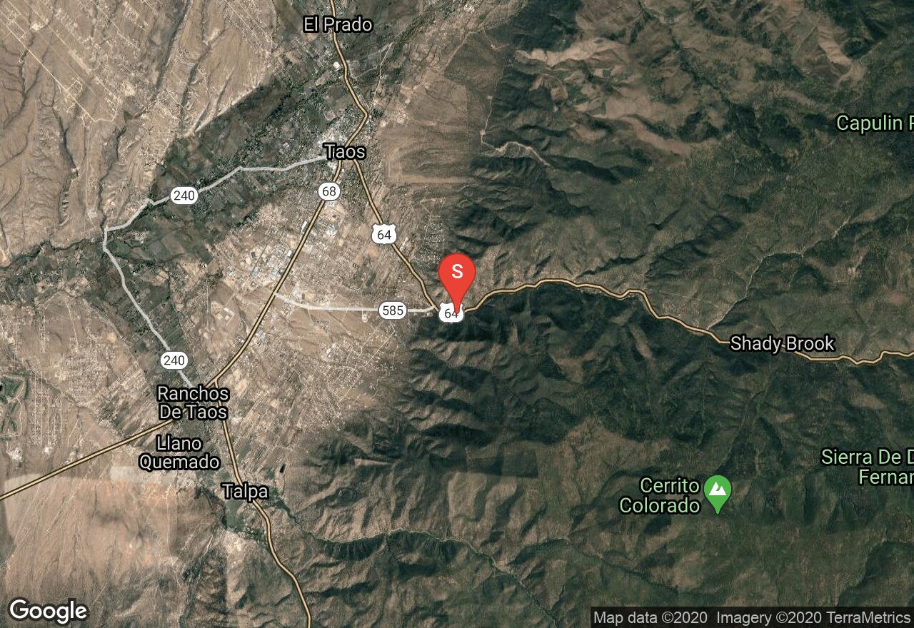
The South Boundary Trail is, by far, one of the best mountain biking trails in all of New Mexico. Famed for its epic downhill, this trail is not to be missed. The entire ride runs through beautiful mixed coniferous forest and open grassy meadows. The steepest climb will hit you within the first 2 miles, after that it is smooth sailing. You may want to stop and take a break around the 13.5 mile mark, before you hit the technical descent you've so long been hearing about. You will want to set up a shuttle for the ride, or call one of the local bike shops in Taos - many will shuttle you for a fee.
New Mexico, Santa Fe
03 :09 hrs
5.9 mi
622.57324 ft
Easy
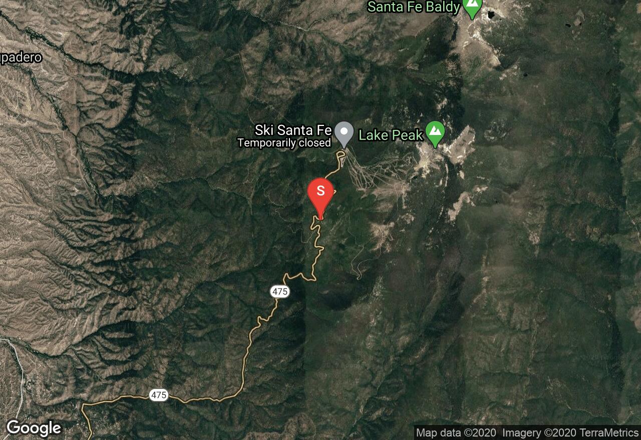
Aspen Vista Road is a service road that requires no technical skills, just a strong pair of lungs. The parking lot is located at 10,000 feet and you will be climbing the whole way up to the summit of Tesuque Peak - if you aren't acclimated to the altitude, this one will burn. Summer will bring ample wildflowers but also mid-afternoon thunderstorms, so be prepared. Fall, on the other hand, has much more stable weather and you can enjoy the changing colors of the trees. Once you reach the top, you will be rewarded with amazing views in all directions. This road will also connect you to a bunch of other single track routes at the top, so bring a map and enjoy the area.
New Mexico, Santa Fe
01 :41 hrs
9.7 mi
1005.3921 ft
Expert
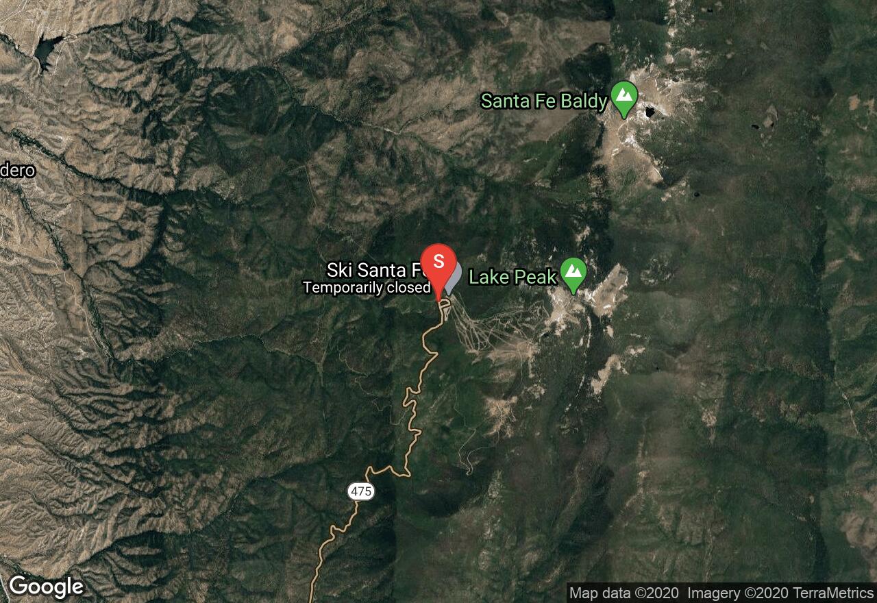
The Windsor Trail is a local downhill favorite. Some prefer to take on the grueling climb first to earn their downhill later, but most tend to set up a shuttle. Mellow Velo, one of the local bike shops, may be able to set up a shuttle for you. This is a very technical downhill, you will have multiple stream crossings (beware, they are cold!), some log bridges, loose rocks, fast single track switchbacks, berms and more! You will be riding through beautiful forest scenery, alongside a creek, and through wildflower filled meadows. When you get a chance to let go of those brakes, take a look around and enjoy. This ride is not to be missed.
New Mexico, Bernalillo County
01 :56 hrs
7 mi
193.85498 ft
Hard
Otero Canyon offers up some great single track that travels through a colorful limestone canyon with some strenuous climbing at the beginning and a rewarding, technical downhill at the end. You will mainly be travelling through pinon-juniper forest with some wetters areas down on the canyon floor. Most of the ride is on hard packed trail, but there are some loose, rocky sections that can be difficult to navigate. There are many different trail options once you get to the top, so be vigilant if you want to stick to this route. Also, be aware of federal land and no trespassing signs.
New Mexico, Bernalillo County
02 :30 hrs
9.2 mi
224.17175 ft
Hard
Some find Chamisoso Canyon to be the prettiest in the Cedro Peak area, so take a ride through it and see for yourself. This ride starts through Chamisoso Canyon and climbs up and out, before heading back down the Coyote Trail. Most of the trail is great, hard-packed single track, but there are some loose, rocky climbs and technical staircases, forcing many to get off and walk it. You will ride through some beautiful terrain and get some nice views of the Sandia Mountains while you're out.
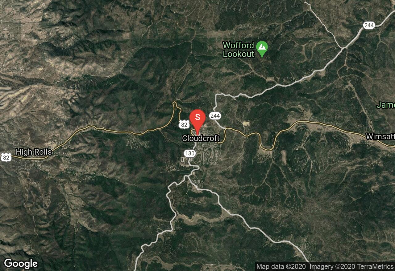
New Mexico, Cloudcroft
09 :20 hrs
17.2 mi
337.25708 ft
Hard
Take a ride along the Rim Trail near Cloudcroft, NM, considered one of the top 10 trails in the nation. This trail is an old railroad grade, no converted to a nice, single track, multi-use trail. You will get some nice views along the way, including all the way down to White Sands. Most of the trail is heavily forested, however, and parallels the Sunspot Highway - so there are plenty of places to hop on or off, depending on when you want to turn back. The terrain is rough and rocky, with some long climbs and long descents which can be rough if you are not acclimated to the elevation.

New Mexico, Taos County
01 :33 hrs
5.9 mi
323.8628 ft
Extreme
The Devisadero Trail will truly test both your lungs and your technical skills. The route starts with a very steep, extended climb, up some rocky tread along tight single track. You'll have some great views of Taos Valley and the Rio Grande gorge all the way up. Once you reach the summit of Devisadero Peak, enjoy a break on some man-made stone chairs & take in the view before you start your steep, technical descent. This trail is popular with hikers, so keep an eye out while your negotiating your way back down the trail.
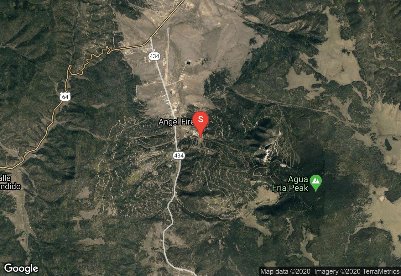
New Mexico, Angel Fire
02 :09 hrs
7.7 mi
413.2605 ft
Expert
Angel Fire Resort’s trail system is ranked in the top 10 nationally and offers miles of downhill and cross-country entertainment. The skill levels range from family friendly trails to extreme advanced riders only. You can take a ride up the Chile Express chairlift and ride back down, take any number of routes (all well marked for your skill level), or try the route depicted here. This was once a route on the Mountain States Cup Chile Challenge (which is still an annual event held at Angelfire, just different routes). Most of this ride is single track with a little bit on dirt roads. All day chairlift pass is $26.
See more adventures..
Explore complete list
Explore nearby adventures

