Best Kayaking in North Dakota
Trying to find the best kayaking in North Dakota? Bivy has great hiking, biking, paddling, climbing, skiing, riding and more, with hand-curated trail maps, as well as detailed driving directions.
North Dakota, Ransom County
02 :11 hrs
2.6 mi
1.9665222 ft
I
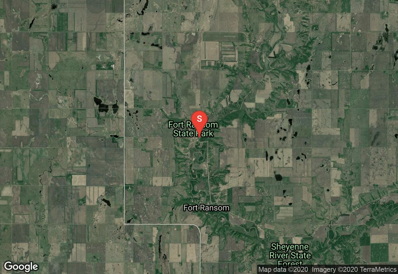
Sheyenne River is a major tributary of the Red River stretching 591 miles across North Dakota. The shoreline and terrain cuts through rolling hills, wide bottomland forests, open prairies and rich agricultural land. Fort Ransom State Park is a popular place to paddle offering river access. Many paddlers will put in and paddle upstream and float back down to the park. The park rents canoes and can provide a shuttle upstream for a fee.
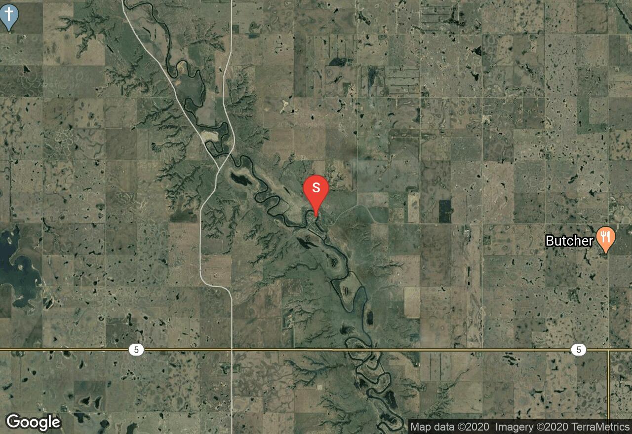
North Dakota, Barnes County
06 :13 hrs
14.7 mi
9.548248 ft
I
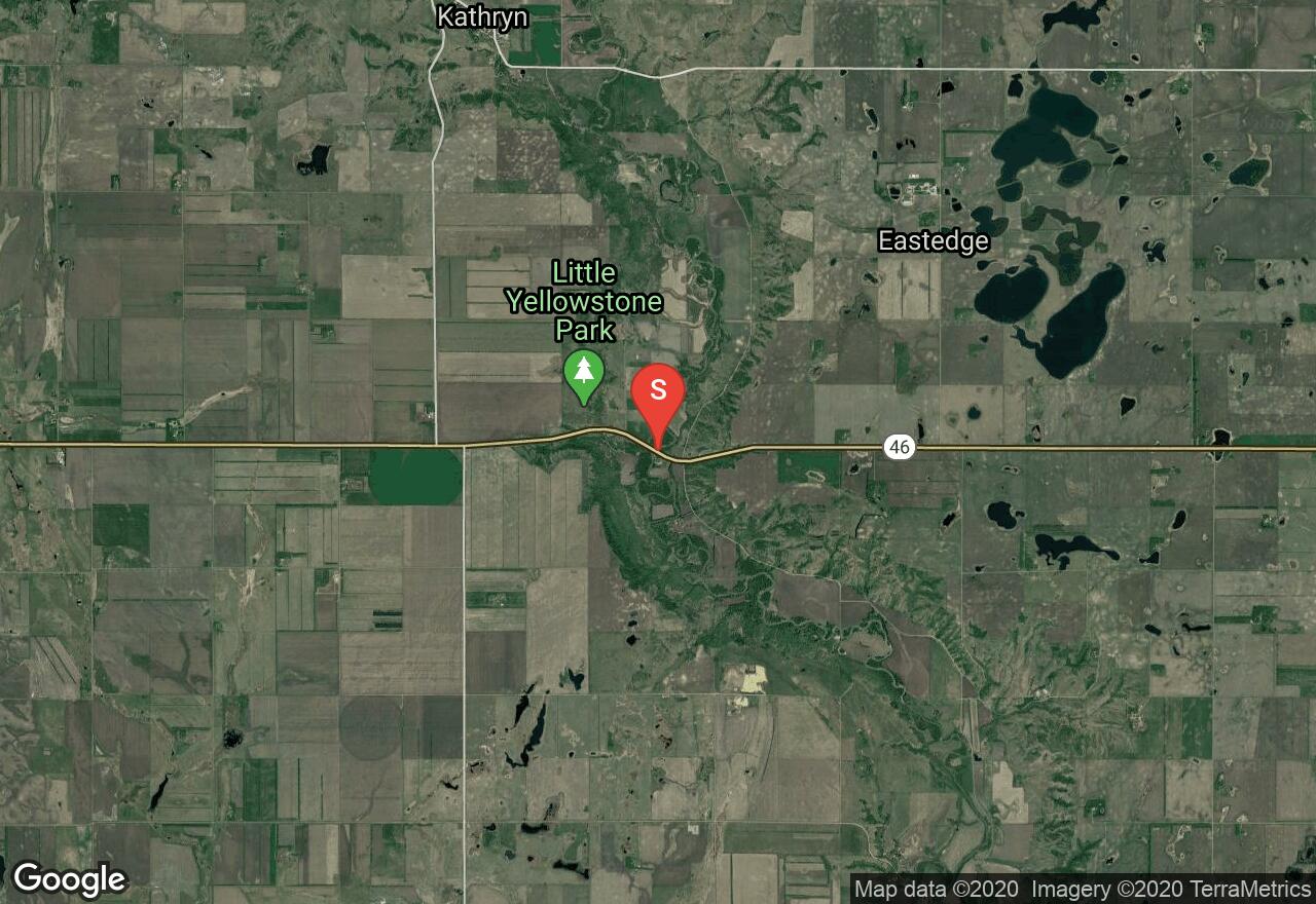
Sheyenne River is a major tributary of the Red River stretching 591 miles across North Dakota. The shoreline and terrain cuts through rolling hills, wide bottomland forests, open prairies and rich agricultural land. Fort Ransom State Park is a popular place to paddle offering river access. Put in at Little Yellowstone Park and enjoy a peaceful paddle to Fort Ransom State Park. Be aware of snags and deadfall.
North Dakota, McKenzie County
04 :03 hrs
9.5 mi
6.4727783 ft
I
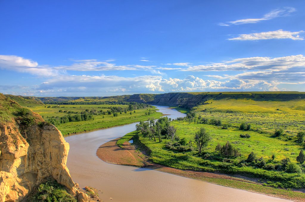
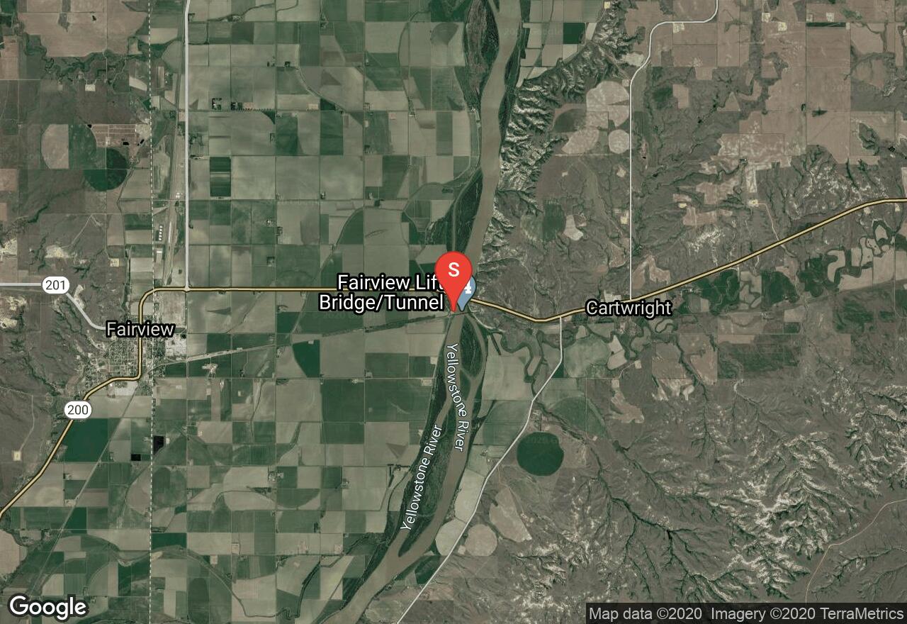
17 miles of the Yellowstone River flow through North Dakota. The shoreline is bordered by tall steep bluffs with several sandbars and is home to a variety of wildlife. The Lewis and Clark expedition crossed this path and two historic sites still remain at the confluence. This segment begins at Sundheim Park and flows to the Confluence of the Missouri River. Some hazards to be aware of are submerged trees, sandbars and possible high winds from the north.
North Dakota, Griggs County
07 :41 hrs
18.1 mi
4.5105286 ft
I
Sheyenne River is a major tributary of the Red River stretching 591 miles across North Dakota. The shoreline and terrain cuts through rolling hills, wide bottomland forests, open prairies and rich agricultural land. This section is a peaceful stretch that begins at Cooperstown Bible Camp. Watch out for snags and fallen trees that may require portage around. Takeout is in Sibley
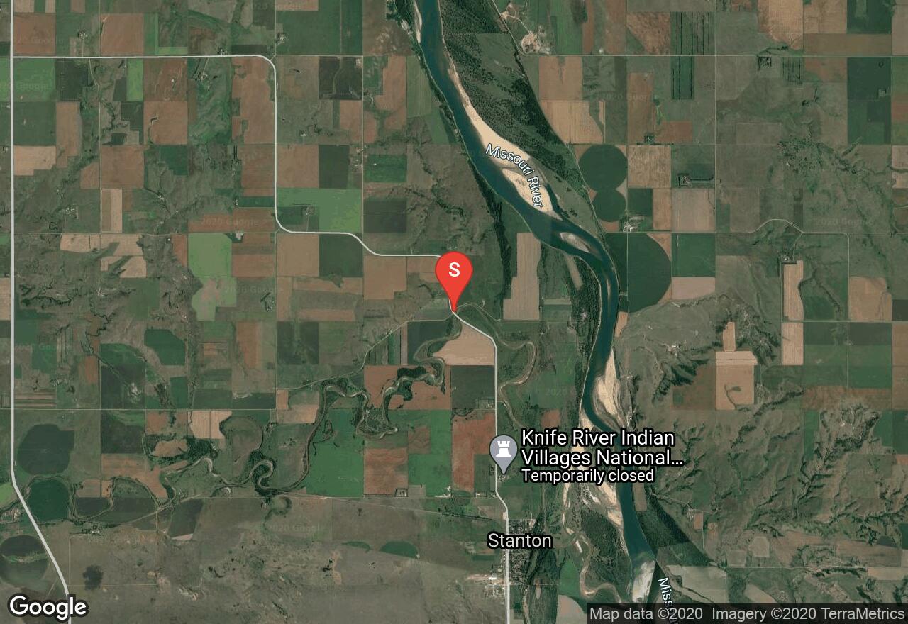
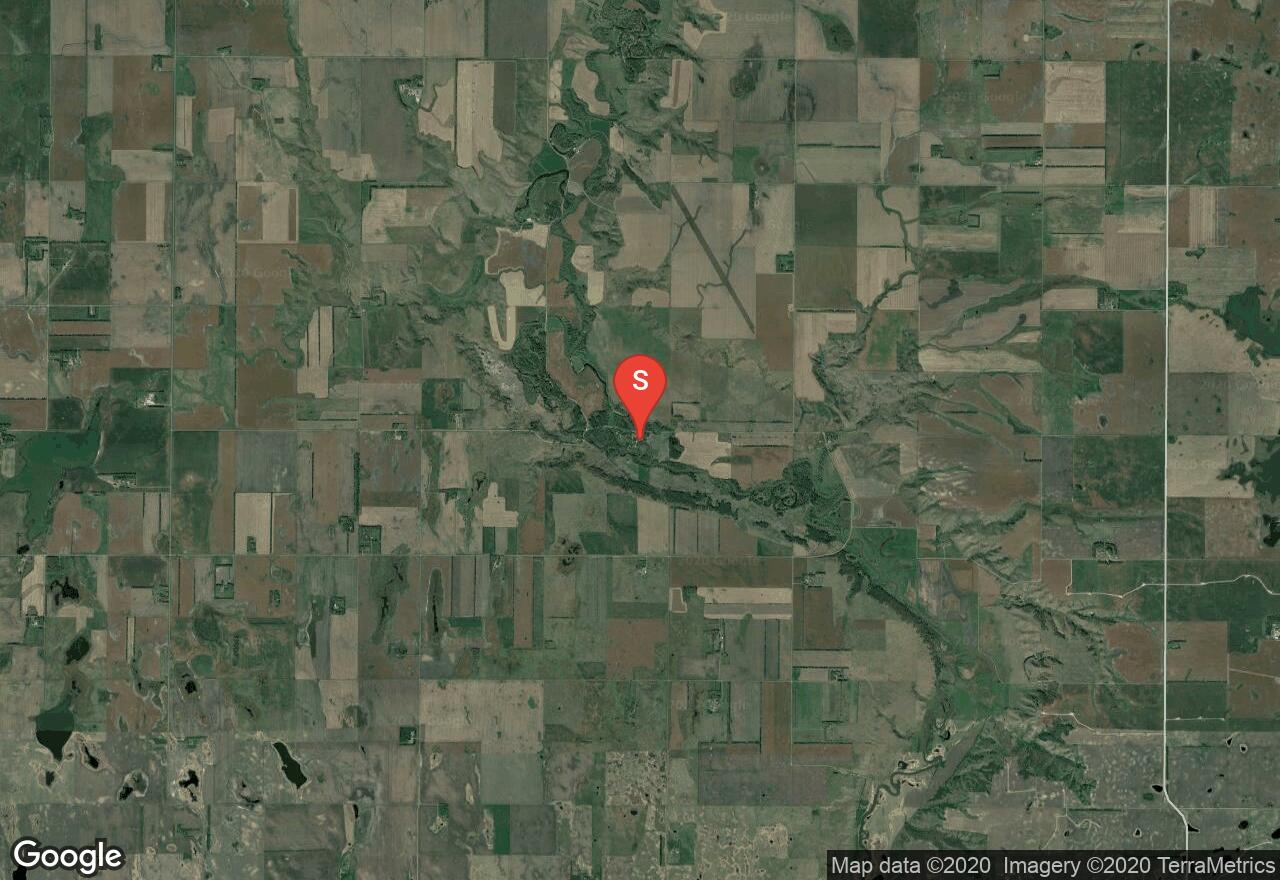
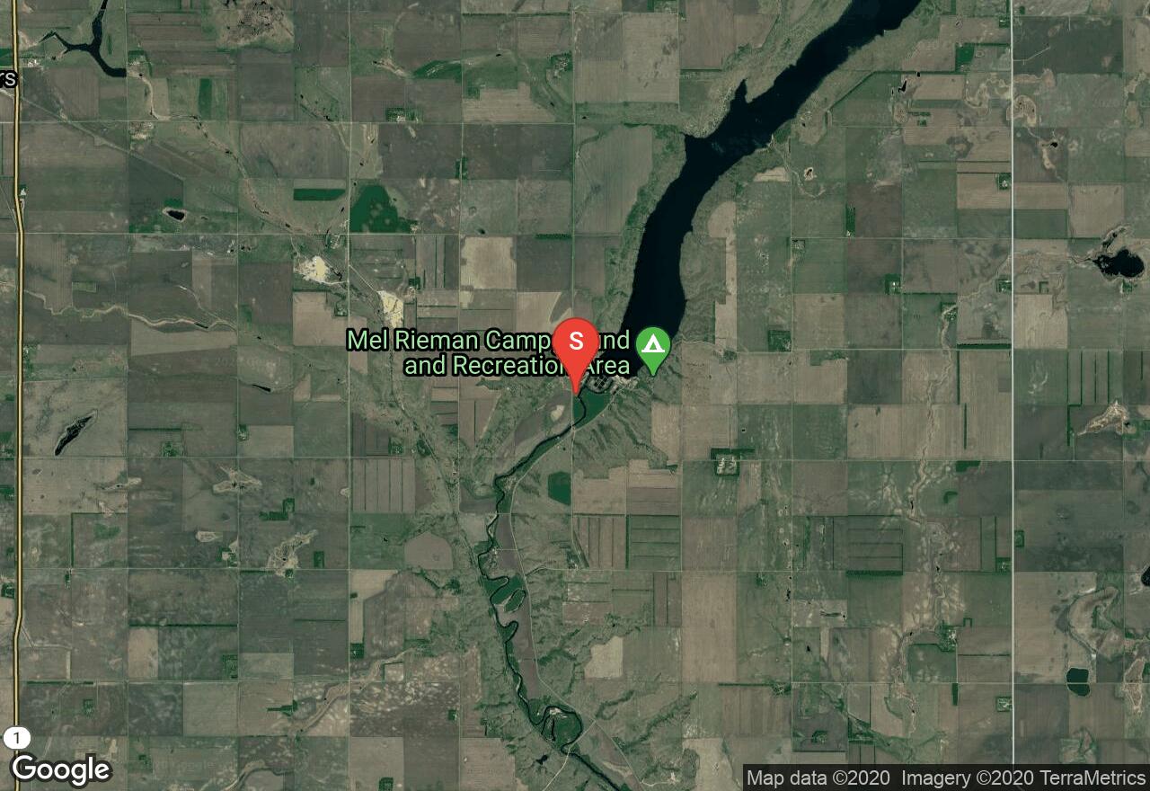
North Dakota, Mercer County
01 :38 hrs
3.9 mi
4.6768494 ft
I
The Knife River is a tributary to the Missouri River. This lower section of the river is an easy float and rich in history. The Indian Villages is a nationally recognized historic site. You will paddle through broad plains, river bluffs and riverbottom forests. Put in at Knife River Indian Villages National Historic Site and takeout at Stanton City Park.
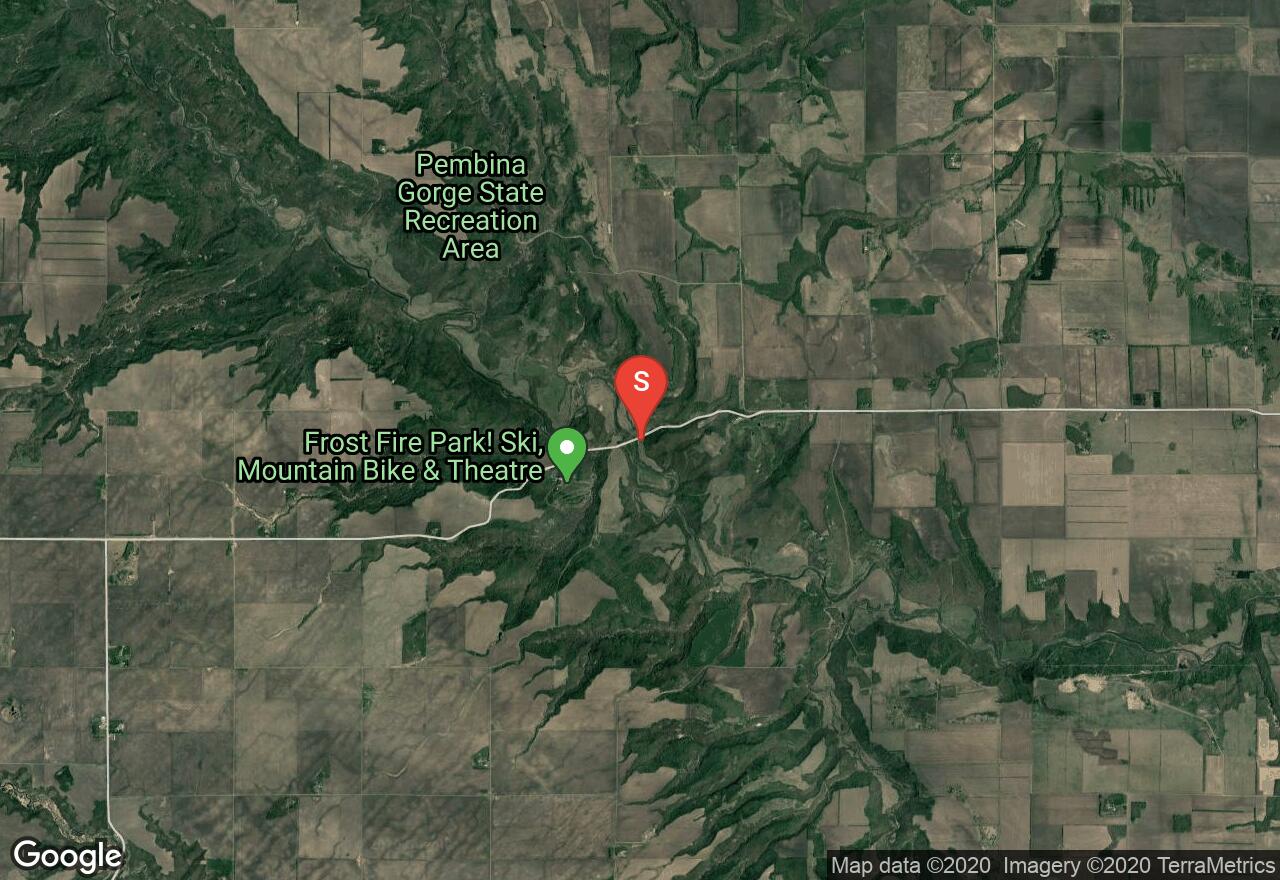
North Dakota, Cavalier County
04 :31 hrs
10.8 mi
28.601593 ft
II
The Pembina River wanders through a thick wooded forest surrounded by a scenic backdrop. The rocky bed provides North Dakota’s only white water, which is very little. This section begins at County Road 55, 6 miles west of Walhalla. Expect fast water and quick turns. Watch for downed trees and snags. Takeout is at Hwy 32 in Walhalla or further downstream at Riverside Park.
North Dakota, Renville County
04 :18 hrs
5.1 mi
0.28955078 ft
I
Souris River is located within the Upper Souris National Wildlife Refuge and is home to a variety of wildlife and birds. It is a popular and pleasant place for paddling and sightseeing. The Mouse River Trail begins at the boat ramp in Mouse River Park. This trail paddles up to the Refuge boundary where you will float/paddle back down stream to the put-in.
North Dakota, Barnes County
05 :54 hrs
13.9 mi
6.7714233 ft
I
Sheyenne River is a major tributary of the Red River stretching 591 miles across North Dakota. The shoreline and terrain cuts through rolling hills, wide bottomland forests, open prairies and rich agricultural land. This section begins at Baldhill Dam. Two rock dams must be portaged between Baldhill Dam and the Fish Hatchery. Takeout is at Chautauqua Park.
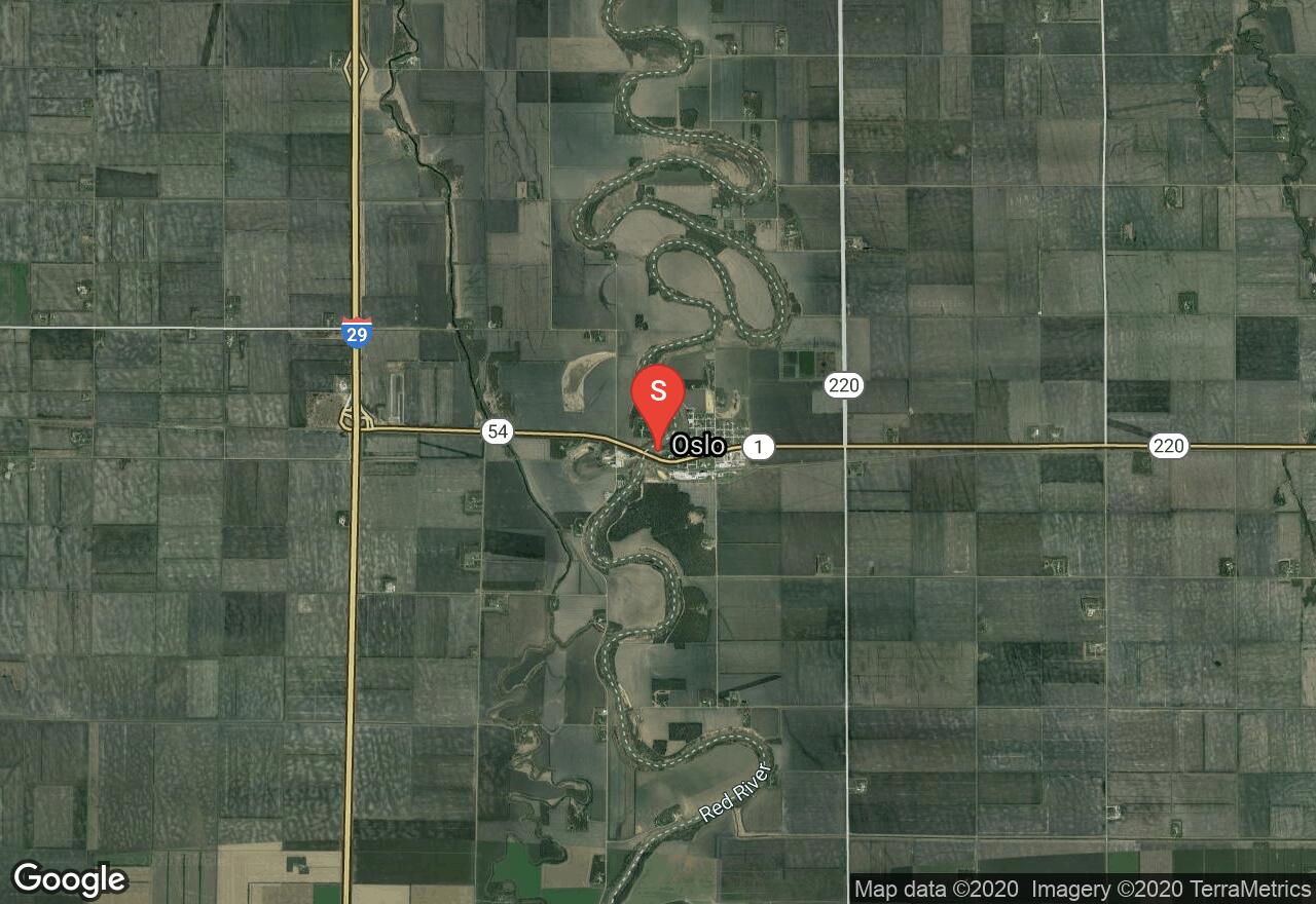
Minnesota, Oslo
10 :46 hrs
25.3 mi
8.339554 ft
I
The Red River is generally offers a slow current and an easy paddling experience, this section of the river meets this expectation. Bring the whole family for this pleasant ride through rolling rural landscapes along the northwestern border between Minnesota and North Dakota. The shores of this river are lined with aspens, birch and other tree species. Wildlife that may be seen in the area include a number of different bird species, including bald eagle.
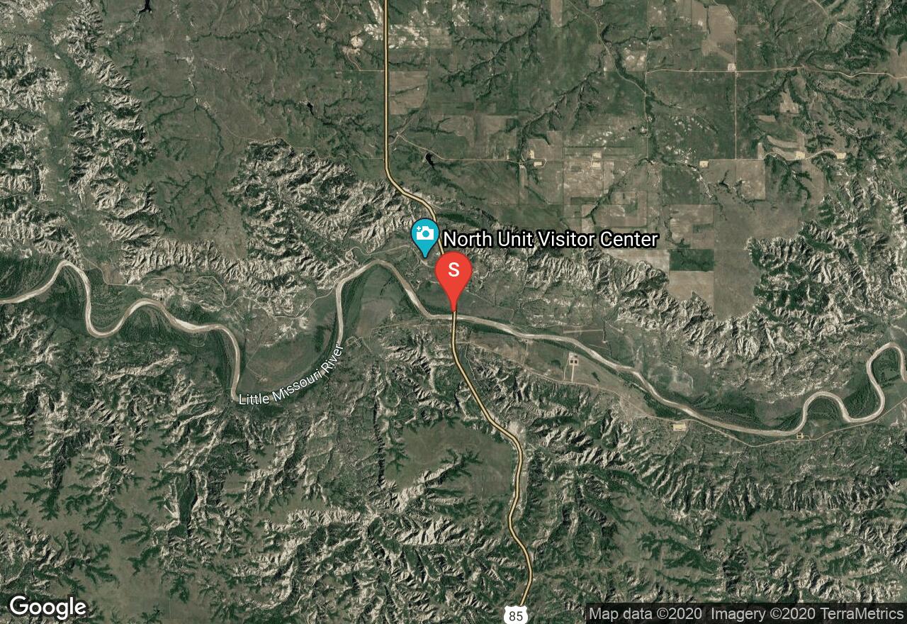
North Dakota, McKenzie County
17 :50 hrs
42.1 mi
28.092285 ft
I
The Little Missouri River flows through the badlands of North Dakota in remote terrain. May and June are the best months to float but before you float be sure to check water levels. The river level changes rapidly and a depth of at least 2.5 feet is required for enjoyable paddling. All campers must follow leave no trace principles. This section flows through Little Missouri National Grassland Park. Begin at Hwy 85 bridge and takeout at Hwy 22.
See more adventures..
Explore complete list
Explore nearby adventures

