Main.726e0f2c599ca549d020.js in District of Columbia
Trying to find the best in District of Columbia? Bivy has great hiking, biking, paddling, climbing, skiing, riding and more, with hand-curated trail maps, as well as detailed driving directions.


British Columbia, Squamish-Lillooet Regional District County
03 :10 hrs
9.4 mi
280.5188 ft
Hard
Technical run on a series of hiking and biking trails
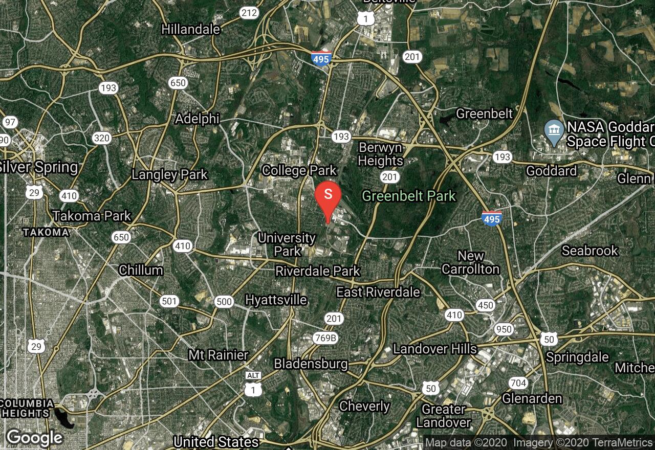
Maryland, College Park
01 :18 hrs
12 mi
112.521545 ft
Moderate
The Potomac River Basin is a massive network of more than one hundred rivers draining over nearly 15,000 square miles of land and provides about one-fifth of Chesapeake Bay’s water. This trail tours some of the creeks of the Potomac River Basin, mostly along paved bike paths through residential areas and forested parks with some short sections on connecting roads. You will parallel the Northeast and Northwest Branches of the river as well as Sligo Creek. The paths are all paved and the terrain is mainly flat with a gentle and gradual descent to the end at Forest Glen Station.
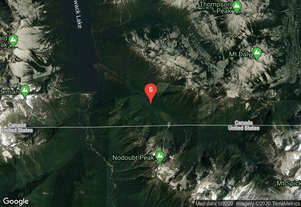
British Columbia, Fraser Valley Regional District County
17 :56 hrs
7.8 mi
1924.8516 ft
I
The Silver Lake Glacier pours off of the north face of Mt Spickard, a high and rugged peak just south of the international border, and makes for an interesting alternative ascent in place of the standard South Ridge route. While it's possible to reach the base of the glacier from Silver Lake, a much quicker approach is to follow the climber's trail to Lake Ouzel then take the large gully heading northeast toward the obvious notch northwest of the mountain. The toe of the glacier is right around the corner. The best way across the glacier normally is to make a rising traverse to the east, aiming for an 8,500 foot notch in the Northeast Ridge. There are several large crevasses on the glacier, so roping up is advised. From the high notch, follow the crest of the Northeast Ridge or venture onto the East Face where necessary to avoid steeper sections. Most of the climbing here is Class 3 but there are also several areas of Class 4, but unroped climbing is possible. For an easier return to Lake Ouzel, descend via the normal South Route along the South Ridge.
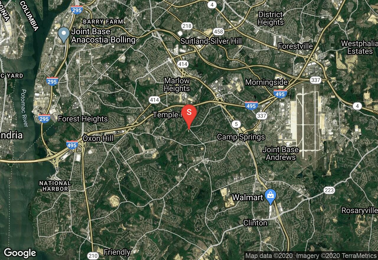
Maryland, Prince George's County
01 :28 hrs
14.7 mi
34.007 ft
Moderate
The Henson Creek Trail runs downstream from Oxon Hill through wooded parkland. The creek flows into Broad Creek and then into the Potomac River, but the trail stops short. The tour follows suburban streets to the remains of Fort Foote, a battlement built to defend the city of Washington during the Civil War. Next stop is the historic St. John’s Episcopal Church at Brad Creek, where Washington worshiped. The tour ends at Fort Washington. Along the trail, enjoy the beautiful scenery and great views of the river. One section of the trail at Fort Foote is on a dirt path, which may be walked to explore the park. The terrain is moderately hilly.
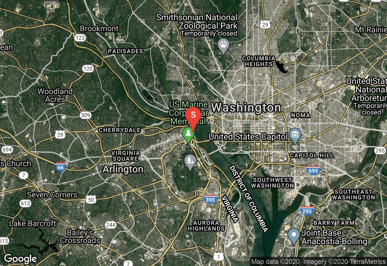
Virginia, Arlington County
00 :41 hrs
2 mi
8.697588 ft
Easy
The island is open year-round. The restrooms are closed for the winter season, usually October through April. During those months, you will find a portable toilet near the restroom. President Roosevelt was known for taking government officials and diplomats on hard hikes. Although not a very hard hike, here you can enjoy his legacy. Bird watching is great and the wildflowers are beautiful during spring and early summer. You may walk or jog through the trails. The surface is mostly flat with a boardwalk, concrete or surfaced with pea-sized gravel Canoeing or kayaking around the island is a popular activity. You may rent your craft at Georgetown or bring your own. Either way, be prepared to paddle on a busy and wide river.

British Columbia, Fraser Valley Regional District County
17 :55 hrs
7.7 mi
1931.6548 ft
I
Mt Spickard is the highest peak of the Chilliwack Group of mountains in the northernmost portion of North Cascades National Park. The best way to reach the start of climbing on the South Route, the shortest and easiest way up, is via the Depot Creek Route, which begins near Chilliwack Lake in B.C. (the road to the trailhead is full of potholes; high clearance vehicles recommended.) Be sure to obtain the necessary camping permits and border documents before beginning your journey. The route up the valley of Depot Creek follows a logging road to the border, then a rough trail past a spectacular waterfall, along the edge of a large wetland, and up a lateral moraine to silt-laden Lake Ouzel, where a camp is normally established. From the lake, follow a large gully heading northeast until a break in the right wall of the gully is reached (near 6,850 feet.) Head southeast across loose scree to a small glacier southwest of the peak. Near the top of the glacier, locate a snow finger leading to an 8,000 foot gap in the south ridge of Mt Spickard, then follow the ridge directly to the summit, venturing onto the relativley low-angle south slope at times to avoid cliffs.
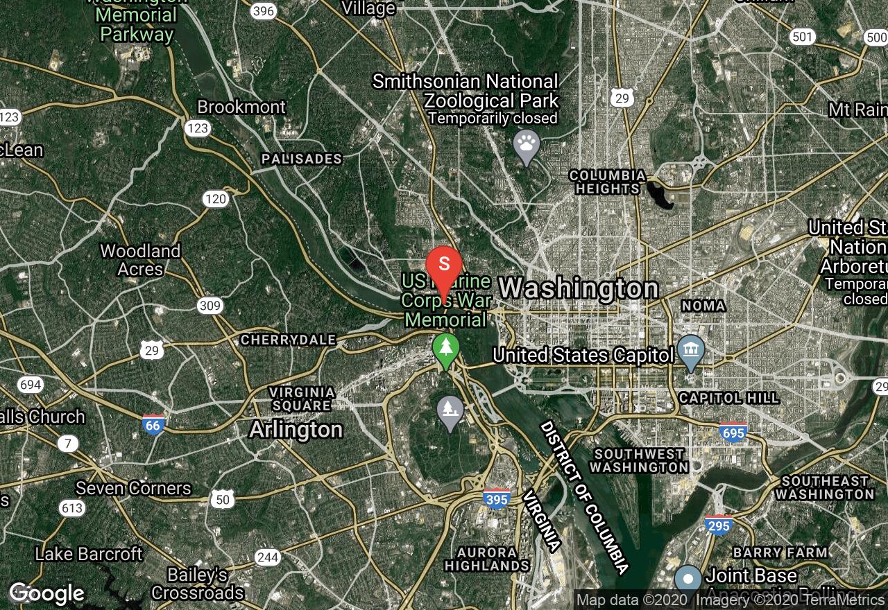
Maryland, Washington
02 :19 hrs
5.8 mi
2.798094 ft
SK I
You will have the best views of the monuments in Washington DC. A constant current is present here. The island has wonderful trails for hiking. Across the water from Roosevelt, on the east shore, you will find a 10-foot high and long concrete floodwall. If you go early, you will most likely run into at least one rowing team. They travel in straight lines, very quickly and without the ability to maneuver their boats. Stay out of the way. And keep on the lookout for the Georgetown Waterfront National Harbor Ferry.
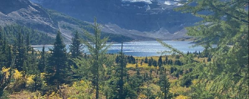
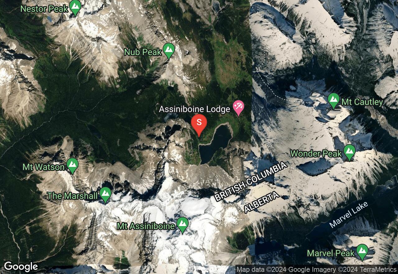
British Columbia, Regional District of East Kootenay County
04 :59 hrs
9.9 mi
411.74976 ft
Moderate
Citadel Peak to Marvel Lake
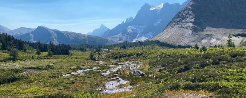
British Columbia, Regional District of East Kootenay County
04 :05 hrs
9.4 mi
723.8572 ft
Hard
Magog to Marvel Lake campground
British Columbia, Regional District of East Kootenay County
04 :37 hrs
9.1 mi
615.7012 ft
Hard
Leg 2 of Rockwall hike, starting at Helmet Falls campsite ending at Numa Falls campsite
See more adventures..
Explore complete list
Explore nearby adventures

