Mio Route
Oscoda County, Michigan
Uploaded by Bivy Team
02 :02 hrs
10.4 mi
112 ft
Unknown
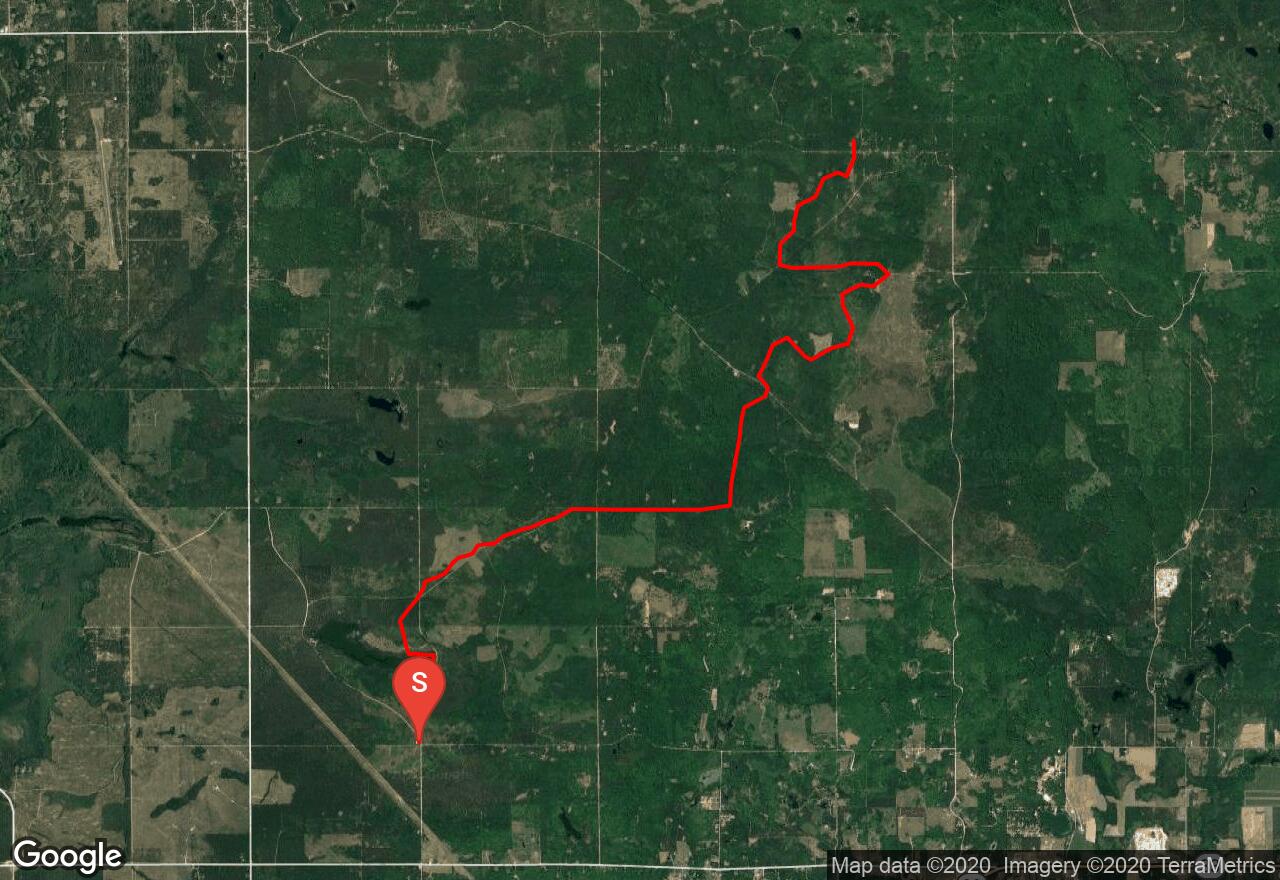
The Mio Route is located in the north central portion of Michigan's lower peninsula and offers over 10 miles of ORV trail through state forest land that can accommodate ORVs of all sizes. The trail has a moderate amount of elevation change. The route also connects to the Mio trail, Mio to Meadows Route, and The Hunt Creek Motorcycle trail providing riders with additional riding opportunities. The trails and routes are all 2-way traffic. An ORV license and trail permit are required for riding unless the unit is already licensed by the Secretary of State.
2 photos
[{"url":"https://images.bivy.com/lgMap/5315214959443968.jpg"},{"url":"https://images.bivy.com/lgTrailMap/5315214959443968.jpg"}]
Mio Route | Oscoda County, Michigan
The Mio Route is located in the north central portion of Michigan's lower peninsula and offers over 10 miles of ORV trail through state forest land that can accommodate ORVs of all sizes. The trail has a moderate amount of elevation change. The route also connects to the Mio trail, Mio to Meadows Route, and The Hunt Creek Motorcycle trail providing riders with additional riding opportunities. The trails and routes are all 2-way traffic. An ORV license and trail permit are required for riding unless the unit is already licensed by the Secretary of State.