Liberty Cap
Mariposa County, California
Uploaded by Bivy Team
02 :28 hrs
2.8 mi
1913 ft
Unknown
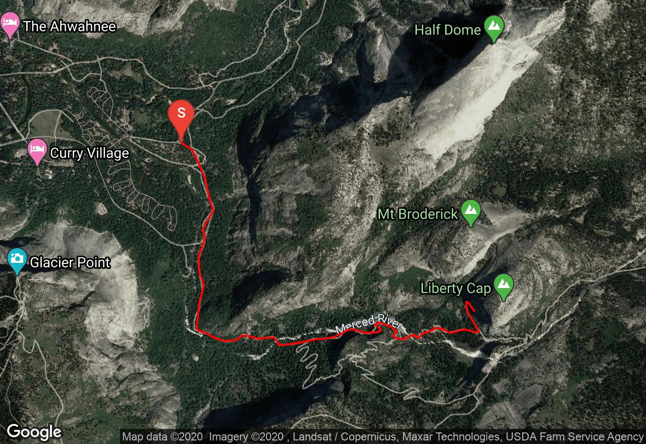
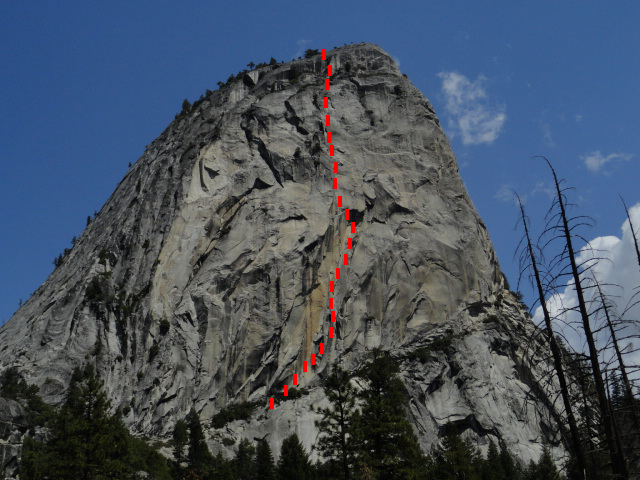
Located along the John Muir Trail between Nevada Falls and Mt. Broderick, Liberty Cap offers quality climbing on granodiorite in a iconic location. Liberty Cap is cam friendly due to the many splitter cracks that run up the face and huge corners. The classic standout route here is “Southwest Face” which ascends right up the middle of the face. Begin your approach from Happy Isles and follow the john Muir Trail for one mile before turning left onto Mist Trail. Continue to the base of Nevada Falls where the white granite step are located. Here you will see the climbers trail. Follow this as iy skirts the southwest face for a few hundred yards. Next scramble up 3rd class terrain back to the right until reaching the base of the routes.
3 photos
[{"url":"https://images.bivy.com/fullsize/Liberty-Cap-6369377897152512.jpg","author":"Bivy Team","date":"8 years and 7 months ago"},{"url":"https://images.bivy.com/lgMap/6386527970000896.jpg"},{"url":"https://images.bivy.com/lgTrailMap/6386527970000896.jpg"}]
Liberty Cap | Mariposa County, California
Located along the John Muir Trail between Nevada Falls and Mt. Broderick, Liberty Cap offers quality climbing on granodiorite in a iconic location. Liberty Cap is cam friendly due to the many splitter cracks that run up the face and huge corners. The classic standout route here is “Southwest Face” which ascends right up the middle of the face. Begin your approach from Happy Isles and follow the john Muir Trail for one mile before turning left onto Mist Trail. Continue to the base of Nevada Falls where the white granite step are located. Here you will see the climbers trail. Follow this as iy skirts the southwest face for a few hundred yards. Next scramble up 3rd class terrain back to the right until reaching the base of the routes.